The weekend was cleared, weather was looking favorable after a small system moved through the area and the car was loaded with all the necessary bike gear. I opted to go solo on this
Scott Morris inspired ride. You see, he kept posting pics of his bike atop Mt. Elbert. That's Colorado's highest peak at 14,433' and open to bikes. He sent me the track and told tales of new trail construction on the lower portion. Did I mention the leaves around Twin Lakes was be near peak color?
I hit the road directly from work arriving at my gravel pit campground outside of Durango sometime after midnight. The next morning I stopped for breakfast & coffee at Durango Joe's and found a message from the
Red Rock Chica, RRC, re: my planned ride near Engineer Mtn. We couldn't quite match up our schedules to meet up for a ride. She warned me about the amount of rain that fell in Durango the day before and I should skip my planned ride and go check out the RATS (Ridgway Area Trail System) a bit farther up the road in, you guessed it, Ridgway.
 |
| Molas Pass overlook. Amazing, but I didn't want to see snow up there!! What would Elbert look like? |
 |
| Windshield view near Silverton. |
 |
| US550 is a 'must drive' kind of roadway. Here near Ouray. |
The RATS trailhead is right off US550 with a nice trailhead map and tool stand. I didn't want to spend too much time here as I was scheduled to meet my friend, Rachel, up in Gunnison later for a tour of Hartman Rocks. I figured an hour and a half would get me a good feel for the place here. Trailforks app loaded, off I went.
Ride 1: RATS
 |
| Looking good from the parking lot. |
 |
| I'd like to see more trailheads eqipped with these. |
 |
| Every junction I came to had these pedestal maps and 'you are here'. |
 |
| The early climbing was well graded switchbacks leading up to this. More fast trail. |
 |
| Contoured hillside riding led to a fork in the road. Which way to go? |
 |
| I chose wisely and rode the other direction. I concur, the trail was super fun!! |
 |
| RIdgway Reservoir. |
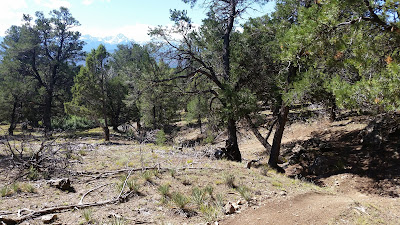 |
| Swooping dirt in/out of this drainage. |
 |
| 'Most fun this direction?' Ok, Speedy Gonzales it is. |
 |
| The San Juan Mountains are simply breathtaking...in more ways than one!! |
 |
| Back down the way I came up. So fun!! |
I kept to my time goal, but wish I had more to spend here. These trails are incredibly fun. If you're looking for technical challenge, this isn't the place. I though it had a Phil's World feel to it, but with more climbing. Not a bad thing. I'll be making it a point to stop here whenever I pass through the area.
Flyover
Route:
Ride 2: Hartman Rocks
I made it over to Gunnison a couple hours later and met up with Rachel, my tour guide for the day. Rachel started riding a few years ago when she lived in AZ, yet our paths never crossed even though we have a ton of common friends. Her boyfriend,
Jefe, of ultra long distance fame, couldn't join us for the ride as he was wrenching at the shop. It was still great to finally meet the legend in the flesh though. Cool dude.
 |
| Trailhead is fairly obvious. |
We started with a nice warmup riding to the trails from the shop. That was a wise choice since the first trail went up. The trails here reminded me a bit of Brown's Ranch back home. Decomposed granite surface with cool rock formations all around, but more climbing and techy bits.
 |
| After the initial climb, the views opened up. |
 |
| Coming off the Ridge, fun rock challenges throughout. |
 |
| Mesas and outcroppings abound. |
 |
| Huge sweeping turns too!! |
 |
| Rachel winding through the rocks. |
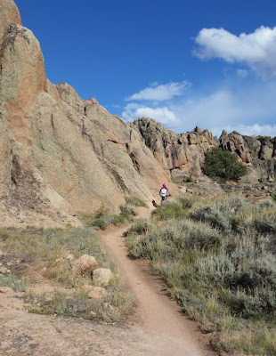 |
| Trail could have been named Bluffhugger. |
 |
| Love this kind of terrain. |
 |
| Ripping down Becks towards a grin inducing down Collarbone to finish things off. |
We actually finished up on time!! Thanks so much for the tour Rachel, it was great riding with you. See you two down in the desert this fall.
 |
| Post ride replenishment. |
Flyover
Route:
I left Gunnison around sunset and made my way over to Twin Lakes where I found a convenient pullout for the night. It was a starry night under the Milky Way. Amazing.
Ride 3: Mt. Elbert
I woke around daybreak. It was 43º and I was surrounded by dark ominous looking clouds. What happened to the clear skies?? I slowly got moving, ate breakfast and readied my gear. Then it began to lightly rain...then some hail. Of course it did. I'll admit at that moment, I wasn't really super motivated to climb a 14,000 foot peak. I thought about bailing down to Salida for the day. I came to my senses quickly, this was the sole reason I was here. To summit Mt. Elbert on my bike. If the weather turned nasty, I could always turn around. From my vantage point at camp the summit was clear of snow, it appeared the San Juan storm never made it here.
 |
| Camp view. |
 |
| Hmmm, skies looking unstable. |
 |
| Starting to rise above Twin Lakes. |
 |
| Clouds beginning to break up?? |
 |
| Nice grade to get the blood pumping. |
 |
| There's a trail in there somewhere. |
 |
| Back on the CT...under sunny skies?? Believe it. |
 |
| Newer rerouted tread on S. Elbert Trail. |
The weather had stabilized, temps were cool and the trail angled skyward. I was able to ride most of the lower stuff, but coming from roughly 1200' above sea level the pitches above 10,000' had me walking more than I wanted.
 |
| Trees beginning to thin out. |
 |
| Twin Lakes basks in autumn glory. |
 |
| HAB in full effect. I just need to get up there. ^^^ |
 |
| What's this? More bikers joining the party!! |
 |
| Leadville, CO sits at 10,200'...it's way down there. |
 |
| There were a few steep pushes. Some hikers were turning around due to high winds. |
 |
| The other bikers, mostly from Denver, slowly leaving me in the dust. |
 |
| Look closely along the ridge. there are a ton of hikers coming up the N. Elbert trail. |
I was somewhere around 13,000' and that was my last picture as my phone got too cold and locked up on me. Noooo!! I was bummed that I'd miss a few more photo ops on the way up, but I really wanted a summit shot.
I'm also a bit of a GPS track geek and that meant my Strava app wouldn't be recording any longer. I was also using my Garmin Edge705, but moments after my camera seized, I received the dreaded 'low battery' warning on the GPS unit. Crap. It was about this time when I realized I left my cache battery & phone cable back in the car. I also mixed up my USB cables at home and didn't have a means to charge the GPS anyway.
I kept trudging up the mountain, stopping often to catch my breath and chat with hikers. Most of them were amazed that a few of us had our bikes up here.
I picked my way up the final series of switchbacks as the other riders began their descent. I topped out a few minutes later and waited my turn at the top with the sign and hoped I could somehow snap one picture.
The small handheld wooden sign read: 14,439', I thought the official summit was 14,433'?? I've also seen 14,440' online. Strange. I asked a hiker to take my picture, but of course my phone wouldn't cooperate. He then offered to email me a pic from his phone. Cool!! I got it later that night and did a small photoshop edit on the elevation!!
 |
| Me. Elbert summit!! 14,433'. |
I didn't hang around long at the top as the winds were howling around 30mph and I couldn't really feel my fingers in the upper 30 degree temps. A few hikers applauded my tenacity for bringing my bike up there. I was ready to finally use it to my advantage...after some downhill HAB.
I walked through the upper switchbacks quickly then began a steady dose of riding and rapid heating of my brake system. I was cruising along and came to a steeper pitch. The trail was in good condition, but as I began this particular decline, my brakes were no longer keeping me in control!! I was gaining momentum!! Gah!! I had to ride off trail and use the side slope to come to a halt. Crazy. I figured I should just walk the few steep pitches going forward.
Before long I was down back in the trees enjoying all the trail I hiked up a few hours earlier. I was now back on the CT and made a different loop to get back to the car. This section of trail was opposite direction from the race back in July and wow!! It rode like a dream. Mostly downhill, smooth trail under a canopy of gold. I had to try my camera again. It worked!!
 |
| During the CTR I arrived here at night. |
 |
| My camera locked up here during the CTR & I missed this sign. |
 |
| I'm starting to think the CT is pretty good. |
 |
| It may not hate me after all. |
 |
| Sensory overload. |
 |
| The day turned out beautifully after the auspicious beginning. |
 |
| If I had more time a lap around Twin Lakes would've been in order. |
 |
| All done and it's still early!! |
 |
| Mt. Elbert is the peak on the far right, the big treeless dome. |
I guess I'll have to travel to Nepal if I want to ride higher trails. Not a bad idea. At any rate, I'm glad I did this ride before the snow started to fly.
Flyover
Route:
Ride 4: Arkansas Hills
I arrived to a star lit trailhead and settled in for the night. It was a bit chilly the next morning and I poked around until the sun rays illuminated the surrounding rock outcroppings. I was taking in what I missed during my nighttime arrival. I didn't have much of a plan for this ride, only to sample the area in about an hour or so. I loaded up the Trailforks app and headed out.
I quickly found out that not all the trails are on the app because some of them are hiking only. This wasn't a big deal, but it was a bit confusing at the start as the trails spider-webbed all over the place it seemed.
 |
| Situated north of Del Norte, CO. |
 |
| Nice singletrack that reminded me of northern Arizona. |
 |
| My confidence was a bit shaken after some rugged hike-a-bike and slow going. |
 |
| Order restored as I swore I had time-warped to Gooseberry Mesa. |
 |
| I almost rolled this, good thing I didn't as a sure OTB would've resulted. Next time, send it!! |
 |
| It ended up being a fun loop, albeit short. I'll be back to ride some more. |
 |
| Singletrack dumps out near the trailhead I was parked at. |
I didn't have enough time to get over to the other side of the canyon where it seemed more possibilities lie. Next time.
Flyover
Route:
Ride 6: Alien Run
I was making good time as I entered New Mexico and figured I had time for another quick spin. Once again I consulted the Trailforks app to see what was in the area. I found a few places, all but one had the right mileage (around 10) over intermediate trails. The place was called Alien Run. The name alone caught my attention, sounded cool, right? The trailhead was less than 10 minutes off my route home.
There were a few cars in the parking lot and I asked a local which direction was preferred. I was informed this was a one-way trail system. Cool. The entrance & exits were signed and only a few feet apart.
 |
| Enter here. |
 |
| Fast dirt skirts the edge of a slickroack playground. |
 |
| Alien Run has flashes of Moab & Phil's World. |
 |
| Rocks mark the main line. Some paint dots too. |
 |
| Great use of the natural terrain. |
 |
| The slickrock drops off exposing magnificent views to the south. |
 |
| The Black Hole has a few tough technical moves in this short loop. |
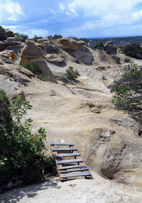 |
| Some of the woodwork was showing its age. |
 |
| Tricky spot to thread the needle. |
 |
| Dreaming of the next adventure. |
 |
| Outer Limits adds on another 6-7 miles. Not enough time on this visit. |
 |
| The San Juan Mtns. are visible far off to the north. |
 |
| The back half of the loop trended downhill and started smooth, but lined with river rock. |
 |
| Iron horse pumping away. |
 |
| A light rain began to fall as I ripped through the final miles. |
 |
| Home stretch. |
Alien Run was an absolute hoot. I'd love to spend a little more time there playing on the slickrock and adding the Outer Limits loop. Check it out on your way to/from Durango if you don't go through Cortez.
Flyover
Route:
On my way out, I learned, like many AZ drivers, my wiper blades were shot. I picked up a fresh pair for a clear drive home. I actually arrived home at a reasonable hour putting the wraps on a fine ride weekend. Six in three over two, that's six rides in three days over two states. Now, back to work.


