El Camino del Diablo, aka The Devil's Highway, is a mostly sandy 130 mile route between Yuma and Ajo, AZ (It extends south into Mexico to the town of Caborca). The route is rich in history dating back hundreds of years to the Spanish Conquistadors quest for gold. In more recent times this route was used by the gold rush seekers of 1849 in their quest to strike it rich in California. Today the area is more known for illegal border crossings and drug smuggling operations.
 |
| Historical Marker near the Yuma terminus. Photo courtesy of Waymarking.com |
A few weeks ago the thought entered my mind while riding relatively easily through some sand on the
Binary Bicycles Chuparosa I have been using. I thought the Diablo route would be doable, but I wanted a touring partner for this one. My buddy, Mark, came to mind instantly. A couple years ago he moved north to Prescott and has been settling in with his family. He had done a few long distance fatbike rides in the past so I knew as long as his schedule meshed he'd be game. We agreed on a mid-March weekend and hoped the weather would cooperate. It did. Dare I say perfectly??
George outfitted the Chuparosa with mechanical shifting and 3.0 Teravail Coronado sand specific tires front and rear, added a couple of cages to the fork & another cage for a 1 litre bottle on the downtube. Water is scarce on this route. Mark and I decided we should each begin with around 9L of fluids.
I loaded everything up and put the bike & backpack on the scale at work: Bike - 55lbs, pack - 26lbs. Quick math tells me that's 81lbs of two-wheeled radness.
We met down in Ajo at the
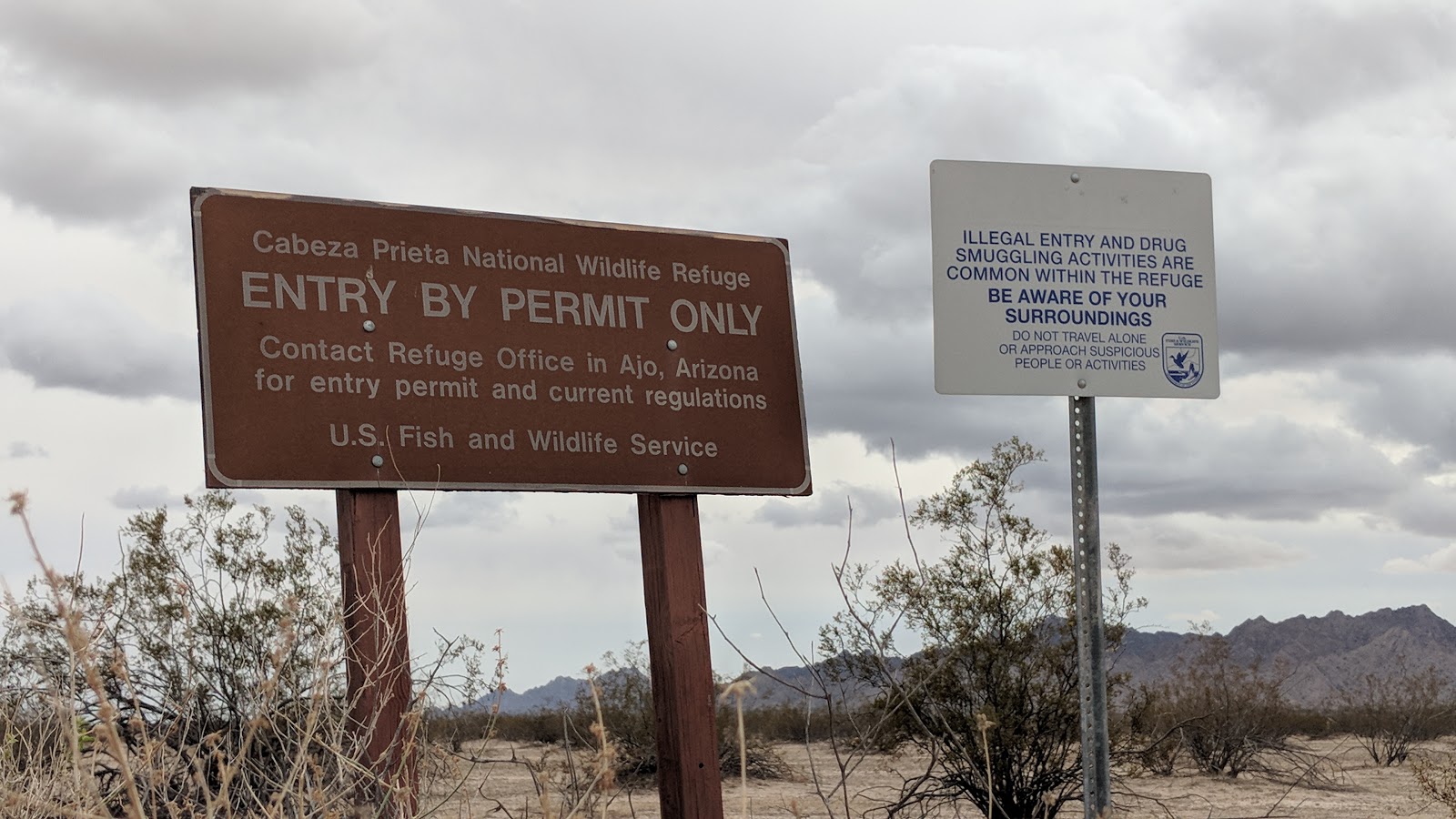
Cabeza Prieta NWR Visitor center where we obtained our permits for the refuge and crossing of the Barry M. Goldwater Air Force Range. Both are free and you need to contact the military base (phone number is on the permit) to let them know of your presence and to verify that no military exercises are planned. We were able to leave my car there for a few days and made the drive over to my buddy, Tanner's, house in Yuma. He was kind enough to let us park Mark's truck there while we rode east and pointed us to a local taco stand for lunch. Perfect way to kick off this adventure.
 |
| Tanner showing us the local eats. |
 |
| Some of the sketchiest riding of the entire route!! |
 |
| Manicured yards & RV's on one side, vast open desert on the other. |
 |
| After a few miles our tires finally meet Diablo dirt...err, sand as we dive into the Yuma Desert. |
 |
| Mark dropping some air pressure in the fatties. |
 |
| Before we knew it, Yuma was a distant memory. |
We passed through some scraggly looking desert, something that reminded us of Friday night party goers. There were lots of turnouts & tire tracks everywhere. There were a few short small hills and overall the road was rocky in nature.
 |
| The dark hues of the Gila Mountains were a nice contrast to the tan sand. |
 |
| Fortuna Mine. |
 |
| Sweet!!! A company store, time for snacks... |
 |
| ...or not. Sometimes it's hard to imagine a bustling lifestyle in these surroundings. |
 |
| These signs were everywhere!! Not a place to go wandering off-road. A not so gentle reminder of what we were riding through. |
 |
| Shadows casting long as the day wore on. We were still headed mostly south along the Gila Mountains. |
 |
| Yes he is. |
We didn't leave Tanner's house until sometime after 3p. We had about 4 hours of daylight to get away from civilization. My original goal was to knock out at least 13 miles, but Mark thought we could make it to the next 'high' point near mile 25. The 13 mile mark came and went, so we pushed on while still taking the time to soak up the sights.
 |
| This was one of the deep sandy areas, we both walked a bit here. Thankfully, it didn't last too long. |
 |
| Creosote bushes & Ocotillo were about the only thing out here, other than rocks & sand of course. |
 |
| A little more HAB as we closed in on the 25 mile mark near the end of the mountains ahead. |
 |
| We had pleasant temperatures, upper 60's, yet the landscape still 'felt' hot. |
I ended up a bit ahead of Mark for a while. He was trying to get his riding legs under him, he hadn't been riding in a few months or bikepacking in years!! He later told me he was kinda bonking and hoped he could hang on for the ride. Mark is one tough hombre, I didn't have any doubt he'd rally the troops.
 |
| While not every turn was signed, there were plenty along the route. |
Sunset came and just as it began to get dark we found a site to call home for the night. We ended up camping not too far from a rescue beacon. These are towers with a blue light that flashes every 30 seconds or so and has a red emergency call button. We were far enough away so the light wasn't noticeable.
Way off to the south we could barely see headlights from traffic on Mexican Federal Highway 2, a paved road that roughly parallels the border on the other side. The glow of Yuma was also visible over the horizon while a billion stars hung above. It was so great to finally be out on El Camino del Diablo.
 |
| Camp #1 just off the road near the end of Vopoki Ridge. |
 |
| We could see an ordnance lying nearby from camp. |
 |
| More ordnance fragments by the side of the road. |
 |
| Approaching our second mountain range, the Tinajas Altas or High Tanks, named after the naturally formed pools. First we must cross the Davis Plain. |
 |
| We saw plenty of these survey markers along the way. |
 |
| The markers dating back over 50 years. |
 |
| We were searching for this sign, never did see it. Found out online that it's located on the spur route to Wellton. Photo courtesy of Azlro.org |
 |
| The split for Cipriano Pass was a bit odd as it had all these poles tied together with cables. It did make the intersection blatantly obvious. |
 |
| Not sure what was going on here. |
 |
| One of the many tire dragging sleds we saw. The Border Patrol drags the tire sled over the road to wipe the tracks clean, then documents the time. It makes the footprints easier to spot. |
 |
| The Davis Plain gives way to the Tinajas Altas Mtns. |
 |
| We'd cut through the range via Tinajas Altas Pass, go figure. |
 |
| Emergency tower and Zombie sighting!! |
 |
| The tall wooden post next to the sign was another route marker and corresponded to Air Force Range map we were given in Ajo. |
 |
| Perfectly carved mini-mine. |
 |
| Vegetation began to thicken as the mountains closed in on us through the pass. |
 |
| Spotted a small arch near the end of the pass. |
More often than naught we couldn't really tell where the climbs ended. The terrain was so gentle out there, we'd be pedaling along at 8-9 mph, then all of a sudden we'd be pedaling at 10-11 mph. I guess we're on the downhill now?!?
 |
| The harsh rugged beauty of the Tinajas Altas Mtns. |
 |
| The waterway forming the pools can be followed down from the saddle just right of center. |
 |
| We found water in the lowest pool. I'm glad we didn't need any, it was very stagnant. |
We opted to not climb up to the higher pools. The terrain was very rugged and steep. I can see how many travelers perished here when the found the lower pool empty and too exhausted to make the climb up. We were finding out just how brutal the conditions may have been for those early pioneers. It's an unforgiving land out there.
 |
| We found a huge shade tree near the pools for a lunch break and like the heat and lack of water out here, the vegetation is also out the wreak havoc on unsuspecting passersby. |
 |
| We really lucked out with the cloud cover and temps hovering around 70º. |
 |
| Brittlebush or octopus?? The roots casting a wide net in search of water. |
 |
| Beginning a long gradual descent into the Lechuguilla Desert. |
 |
| The miles ticked by quickly here. |
We were roughly 24 hours into our journey and finally saw our first vehicle and it wasn't Border Patrol!! A white pickup drove by as we exchanged waves, five minutes later we saw our first BP Agent who thought we were nuts for riding to Ajo. He mentioned that we'd be seeing a bunch of them along the way and told us to flag any of them down if we needed assistance. He also mentioned that the Cabeza Prieta Ranger was a few miles ahead and would probably ask for our permits. No big deal, except Mark realized he left his in the truck back in Yuma!! Gah!
 |
| Entering the Cabeza Prieta NWR and signing the ledger & dropping a form off documenting our passage. |
 |
| Cabeza Prieta is Spanish for dark or dirty head and refers to the namesake granite peak with a dark lava cap in the western part of the refuge. |
 |
| You are here. Far west end on the diagonal line just above the border. |
 |
| Looking back at the entrance to the Barry M. Goldwater Air Force Range. |
 |
| Huge climb...as in long miles. |
 |
| For the next 35 miles or so we'd be three miles or less to the border. |
 |
| Mark's fatbike against a lunar landscape. |
 |
| The dark cinder cone of Tordillo Mtn. is a stark contrast to the Cabeza Prieta Mtns. |
 |
| An occasional route marker. |
 |
| Intersection marker. |
 |
| A very American survey marker. |
 |
| Our long straightaway coming to a close at the east end of the Lechuguilla Desert. Tule Mtns. on the right. |
Eventually we came across the Cabeza Prieta Ranger and he did ask to see our permits. I handed mine over and Mark came clean when asked for his. The ranger paused a bit, then asked for Mark's driver's license and all was good. We were thankful for a drama-free encounter.
 |
| For the most part, the Diablo was very rideable. So far the sand wasn't an issue for our setups. |
 |
| Cholla & Ocotillo are thriving on this hillside. |
 |
| It wasn't all sand, fast gravel section here. |
 |
| Tule Well water stop. |
 |
| Weathered sign. |
 |
| Hmmm, we had to check that out. |
 |
| Boy Scout tribute from 1941. |
 |
| Quite the collage. |
 |
| Tule Well from the monument. |
 |
| Empty land to the NE. |
 |
| This structure was renovated back in 1989, yet maintains a feel from the pioneer days. |
 |
| Tule Well water had a mineral and/or slight salty taste. Not bad, so we both grabbed a few litres as backup. I opted to drink my water I started with, hoping Papago Well would provide cleaner tasting water. |
 |
| Tule Well was downright civilized. Picnic tables, BBQ's, fire pits and of course water. This is an official camping area within the Cabeza Prieta NWR. |
 |
| 31 miles to Papago Well & 40 to Organ Pipe National Monument. |
 |
| We finally got to see the tire contraption at work, wiping the slate clean. |
 |
| First tracks on a pristine sand road. |
 |
| The desert slowly transforms with greenery. |
 |
| The advantage of tame dirt roads is you can really take in the surroundings as you ride through. |
 |
| It was a little surprising to us how flat the route was considering how many mountain ranges it passes through. |
 |
| Mark drawing on a blank canvas. |
 |
| Here, the road is cut deep through the Pinta Sands. |
 |
| These signs marked the 50' easement of the Diablo. |
 |
| No footprints here. |
 |
| No tire dragging through the Pinacate Lava Flow. |
 |
| Quite possibly the tallest Ocotillo we've ever seen. HUGE!! |
 |
| We thought we would make it through the Pinacate before sunset, but we also wanted to set up camp in daylight. |
 |
| We lucked out and found a swath of smooth ground behind some bushes within the 50' easement. |
We set up camp, ate dinner and watched the stars come alive. Shortly after dark we saw a set of headlights approaching from the west. Must be a BP Agent. Sure was, and the side spotlight was illuminated. We were curious to find out if they'd see us. The truck drove by and our home for the night remained dark. That would be the only vehicle to pass through the lava flow all night. It was a quiet evening. We were camping approximately 1 1/2 miles from the border and Mexico Hwy. 2 was roughly 4 miles away. We could faintly hear the hum of tires and barely see the headlights on the horizon. Civilization seemed a million miles away. We loved it.
 |
| All quiet on the border. |
 |
| Perfect campsite for night #2. |
 |
| Las Playas. This area is known for potential impassable sections when wet. |
 |
| The moondust was exceptionally smooth, soft & quiet on our tires. |
 |
| Had to get one riding selfie in. |
 |
| Looking south into Mexico. |
 |
| Gradual climb to O'Neill Pass. |
 |
| The grave of Dave O'Neill, a late 19th century traveler who, according to reports, may possibly be the only person the perish along the El Camino del Diablo via drowning. Legend had it that he got drunk and passed out, face down, in a stock tank and drowned. Today passersby leave trinkets at his grave. We left a few pennies for good luck. RIP. |
 |
| Leaving O'Neill Pass we approach Camp Grip, a border patrol headquarters of sorts. |
 |
| This section of the route is know for very silty sand and the these metal planks were placed on the road. We learned that the planks have been removed, as of three weeks prior, and replaced with crushed gravel. We wondered how deep the gravel would be and its effect on our bikes. |
 |
| Camp Grip in the southern Mohawk Valley. |
 |
| A nice stretch of hardpack jeep road. |
 |
| Papago Well. |
Mark had definitely found his legs by now and he steadily stayed a bit in front of me most of the final miles. We joked about how he felt on the first day and he was thankful there wasn't more climbing!!
 |
| Another big tank full of refreshing water. This time the water tasted great, so we both dumped out our Tule Well water and loaded up for the remainder of the ride. |
 |
| Inscription on the Papago Well slab. |
 |
| Traversing by the Antelope Hills. |
We encountered the gravel sections where the metal grates had been pulled and the riding was fine. I think we were both a little disappointed to not experience the metal roadway, but at the same time happy we didn't have to push our bikes through inches of pea gravel.
 |
| First the giant Ocotillo, now a 50' Saguaro?!? Look at the size of this thing!! Amazing. (I'm 6'2" for reference) |
 |
| A few rather large Saguaros nearby along Chinaman Flat. |
 |
| Blue flag in the desert?? That means water. |
I don't want to get all political here, but we wondered what the conditions must be like on the other side to make a person or family attempt a border crossing over these lands. As far as we could see, nothing but hostile terrain, searing heat most of the year and water, few and far between. Yet, here we were, two guys out for a 2+ day bike ride across the same landscape...for fun. Neither one of us could comprehend a crossing on foot or what would drive someone to go to such extreme levels for a chance of a better life.
 |
| What is this?? Hard packed dirt? Yes. Mark swore it smelled a bit like vinegar. This section looked like it had recently rained, but it had not. It did have a twinge of vinegar, hence the dubbed name: Vinegar Highway. |
The road was packed so hard it was like riding on pavement. Mark offered a challenge: let's see if we can make these things go 20 mph. We were off!! Cranking away...16...17...18......19.........20!! Oof. That's a lot of tire & gear to get moving. Mark wanted more and went for 25. I watched. He made it to 23+, but couldn't convince himself to push harder.
 |
| End of the line for the Cabeza Prieta NWR. |
 |
| In a nutshell. It's staggering to think how long this route has been traveled. |
 |
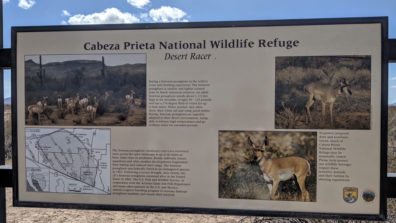
| We didn't see much wildlife, couple of lizards, a rabbit, two chipmunks and one garter snake I rode over. |
 |
| Years ago, K and I had visited Organ Pipe National Monument via car. We drove one of the southern dirt road loops and it was choked with Organ Pipe Cactus. This time around we were at the less traveled NW corner of the park. |
 |
| Constant reminders to stay alert. |
 |
| History lesson of the area. |
 |
| Entering Growler Valley & Organ Pipe Nat'l Monument. |
 |
| Another BP compound. |
 |
| It's that simple. Push button, get water...and a ride back to Mexico. (Not pictured) |
 |
| This junction, about 14 miles north of the border, runs south towards Mexico to join the southern dirt road loop in Organ Pipe Nat'l Monument. |
 |
| Entering a lush Growler Wash. |
 |
| Looking up Growler Wash, no, we didn't have to ride up the wash. |
 |
| It wasn't much of an incline, but the saddle on the far right is Growler Pass, one of the few high points we could actually see as we approached it. |
 |
| First Organ Pipe Cactus sighting!! |
 |
| A few more Organ Pipe Cacti. |
 |
| A very dry Bates Well. |
 |
| It was hard to fathom a functioning ranch property out here, but obviously the Gray family succeeded for many years. |
 |
| Relaxing in the shade of the Gray residence. |
 |
| Time standing still. |
 |
| The property had three windmills and a couple large holding pens along with a few structures. |
 |
| We only took pictures of the insides. |
 |
| I love the texture of this barn. |
 |
| Resourceful fence building. |
 |
| An old pull-tab Pepsi can. |
 |
| Meat hanging hook?? |
 |
| Bidding farewell to the Bates Ranch. |
 |
| Valley of the Ajo opens up as we crest Growler Pass. |
 |
| A long gradual climb leads to the final high point of the ride and our camp #3 search. |
Our goal was to find a place to camp just far enough away from SR85 so we wouldn't hear or see it, but only leave a handful of miles to reach my car in Ajo. As luck would have it, we found a nice 2-track off the main road right at the top of the climb. We rode back a few hundred feet and found a nice clearing.
 |
| This may make a fine campsite for our final night out. |
We were about to set up camp when the wind picked up a bit. Mark began looking around a bit more and found a small wash a few feet away. It was down in a gulley about 7-8' deep, but had just enough flat sand to pitch the tent. It looked perfect!!
 |
| Not a bad view and protected from the wind. |
 |
| Different view. |
We settled in, ate dinner and once again watched the stars fill the sky. We watched a few BP Agents drive by on the main road, but sometime around 8p or so a white pickup truck came up the main road and stopped near the 2-track split. We killed our headlamps as we didn't want to be bothered even though we were camped legally on BLM land. The truck then came up the 2-track and stopped right where we were going to setup camp originally. Then the engine was shut off and we could hear a couple of guys mumble something, couldn't tell if it was in English or Spanish. Next thing we heard were bird calls or audible signs to someone. I doubt anyone was hunting quail after 8p.
Let's just say it was a tense few minutes trying to figure out what was going on. We both sat in silence staring over the embankment. We couldn't really see anything other than the top of the truck and the torso of the guys as they walked around. The calls went on for about 30 seconds or so. Then one of the guys broke out a flashlight and scanned the area. It swept in front of me in a flash, slightly obstructed by a nearby Palo Verde tree, but he swept it back towards me and I felt the light beam stall on me for what seemed like a few seconds. In actuality it couldn't have been more than a half second. Barely ten seconds later the fellas were getting in their truck. Did they see me? The truck started up, then backed into the flat area before heading back down the 2-track. As soon as it fell silent Mark and I slowly walked up the embankment to see the taillights heading back towards Ajo.
This entire scenario lasted about 5 minutes, but it seemed much longer. Not sure what exactly was going on. Did they see us and get spooked off? Were they signaling someone else in the area that all was not clear? Who knows, but we were thankful they drove off without incident.
Believe it or not, we both nodded off to sleep shortly thereafter.
 |
| Locomotive Rock from the 2-track at camp. |
 |
| Tire tracks from the night before. |
 |
| Tailing piles from the New Cornelia Mine in Ajo. |
 |
| Decaying homestead. |
 |
| A lone tree finds life in the tailings. |
 |
| Glad to be in town and off the shoulderless SR85. |
 |
| The loaded Binary Bicycles Chuparosa with 3.0 Teravail Coronado tires gets an A+ on this ride. |
 |
| Marks Surly Mukluk performed up to task as well. |
 |
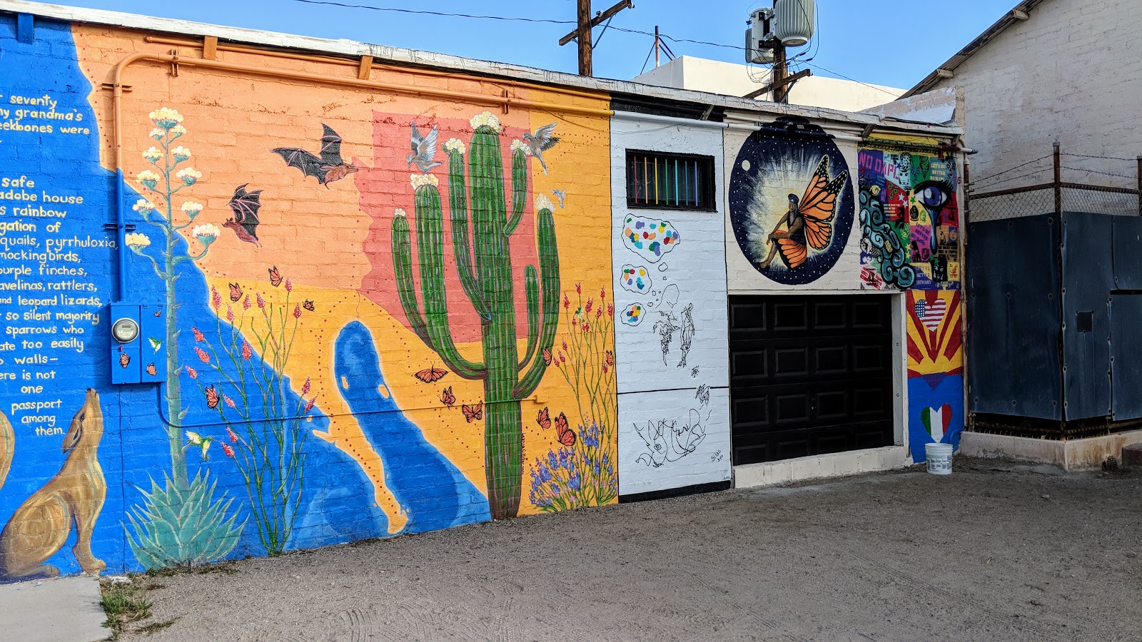
| Ajo is loaded with murals, here's a sampling from our ride into town. |
 |
| Bike Ajo & beyond!!! |
 |
| Immaculate Conception Catholic Church. |
 |
| Finished!! |
We only rode about 7 miles on Sunday morning to wrap things up. This was a good thing since we still had to drive back to Yuma to retrieve Mark's truck. Thanks again, Tanner, for letting us park at your place. My car was exactly how I left it. I changed into some clean clothes, Mark disassembled his bike (tires are too wide for my rack) and then we grabbed a quick bite at Circle K before hitting the road.
In Yuma, we grabbed a couple of celebratory brews, then hit up the Mexican fare where I bought the pre-ride burritos. Mark hit the road and I started back home on I-8. I did want to drive out to the spur road in Wellton in hopes of finding the large red El Camino sign. I drove south on the sandy road for a mile or two, but didn't see it. I figured I shouldn't press my luck being solo in my car, so I turned around and stopped for a date shake at
Naked Dates. That was a darn good shake!!
 |
| I did manage to locate this sign at the beginning of the Diablo spur route. |
We both had such an amazing time out on the El Camino del Diablo, we didn't really want it to end quite yet. I would love to revisit it and spend more time exploring some of the side trips along the way. I'll have to ride the spur roads to Wellton & Tacna for sure. I filled in a huge part of my Arizona mental Atlas (Thanks Eszter for that phrase!) that many people never get to see. It's rare in this day & age to be somewhere and hardly see any signs of civilization for over a hundred miles.
It was so good to share this ride with Mark. He's a great ride partner and fellow jokester, never a dull moment!!
A special shout out to George and his Binary Bicycles Chuparosa. Thank you so much for letting me ride such a capable steed for this journey. It performed flawlessly, so much so that we often forgot we were riding in sand.
Ride notes:
- Bring a fatbike. Leave your skinny tires at home. Nothing less than 3.0's and those better be sand specific tires.
- This is NOT a summer ride. Water is scarce. Winter & late autumn, early springtime only.
- Permits are required for both the Cabeza Prieta NWR & Goldwater Air Force Range. They're FREE, just plan ahead and check the hours of operation for the offices. We obtained both at the Ajo visitor center for the NWR. There's also a number you must call, located on the permit, to the military base to let them know of your presence. It would be a smart move to make sure no bombing exercises are planned.
- As far as we could tell, water was reliable at both Tule & Papago Wells. That's it. Plan accordingly.
- Follow a GPS track. Most of the route is signed, but there were a few instances where we could've easily gone the wrong way without a track to follow.
- Be aware of your surroundings.
Adios Amigos!!
Route:


