February 25, 2022

Hawes: Traveling Salesman 2.0

 The Traveling Salesman was set to make another round through the Hawes trail system. The weather was perfect for this type of outing, all systems GO. My buddy, Mike, had sent a text a couple days prior asking if I had ride plans for Friday. Of course!! I told him of my plan: ride every trail at hawes plus the few new additions on the east side of Usery Pass Rd. He was game.

Mike did the dirty work of dropping two gallons of water on the opposite side of the network as this was going to take a full day to complete.

The big question or problem to solve was the routing. How do you ride every trail without doubling up constantly with all the potential loops, etc. It was a daunting task at first. I knew I wanted to get as many of the most difficult trails done early. With that in mind, our starting/finishing location was set. We'd stage from the Park-n-Ride lot under the Loop202 freeway. Using a GPS for this type of navigation is confusing at best since you're just following a line, but with so many intersections, you'd get tripped up and miss something. So, break out the old skool paper map, then color code the sections in the order we'd ride. I tried to keep the routing so we'd ride the preferred direction of the trail, no way we're going UP Sunset Ridge!!

Here's what I came up with:

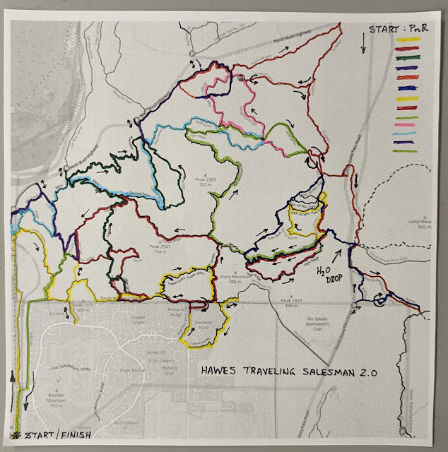
Start in the lower left & follow the color legend top down in the upper right.
As you can see there are a few short out-n-back segments and some tiny looping bits to cover it all. I had been asked a few times what the mileage would be and the elevation gain. I opted to go in blind as I thought knowing those details may derail us mentally. I had a guess though: 70 miles & about 10.000' of gain. That was largely based off my Traveling Salesman 1.0 route I did a few years ago before all the new Hawes Trail Alliance, HTA, trails were built.

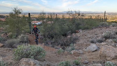
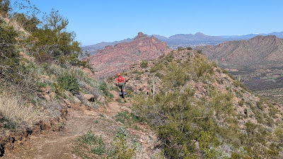
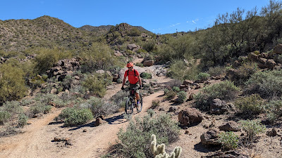
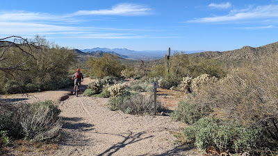
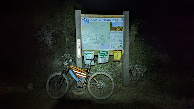
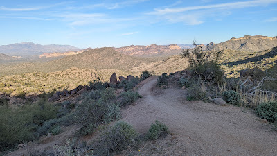
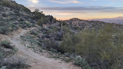
We met around 5a and were rolling by 5:20a. It was rather breezy and cold for us desert dwellers hovering in the upper 30's and my resistance (Read: stubbornness) to ride only in fingerless gloves wasn't doing me any favors. We were barely two miles in by the giant Hawes trail map sign and I couldn't feel my fingers. That uncomfortable burning sensation set in while I paced about.
Trying to regain feeling in my hands here.

Our first of a few out-n-backs, OnB, during the ride.

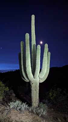
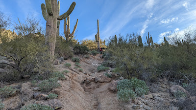
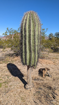
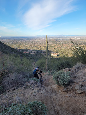
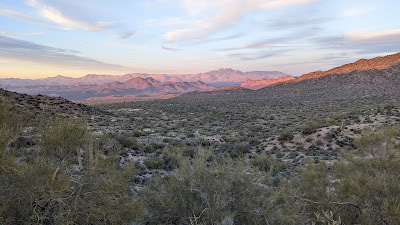
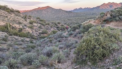
Daybreak by this picture perfect Saguaro.

We made our first audible of the day as we reached Lower Gidro. There was a short section of the Hawes trail we'd need to do an OnB on, but I had us doing it a bit later in the ride. I thought it would be wise to just do it now so when we finish the tough Microwave Tower & Upper Hawes trails, we could simply head over the mountain. It only took a couple of minutes, then we could move on to Lower Gidro.
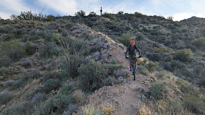
Methodically making our way UP Lower Gidro. Photo by Mike.

There was a fair amount of hike-a-bike, but I eventually crested the top. Photo by Mike.

I can't say I'd recommend climbing Lower Gidro, I actually think Cactus Garden is easier. Hmmm. It did make for a fun rip down Cactus Garden where we crossed paths with fellow HTA'er, Kirby. He's also the mastermind behind the Sunset Ridge trail. I assumed he was getting in a quick spin before work at Hawes House Bike Shop. (Formerly Two Wheel Jones)
We did a short loop utilizing the new trail that bypasses a steep, rutted mess on the old alignment.

Mike going full enduro mode on the hike-a-bike up the Microwave Tower trail.

Early morning view at the top sure didn't suck.

The southeast view from the helipad. PeakFinder app.

Who doesn't love downhill hike-a-bike?? Photo by Mike.

We actually rode a fair bit going down, even on our hardtails.

Audible No. 2. We skipped a short loop beyond this sign as it appears no one really uses it and it's technically outside of the trail system.

We made the grunt up Cactus Garden and across to the start of Sunset Ridge. Perfect place for a mid-morning snack. So far we had been averaging about 3.3 mph!! Killing it.

View to the north and some snow!! PeakFinder app.

Looking west. Incredibly clear day. PeakFinder app.

One of the tame sections of Sunset Ridge. This was Mike's first time down, my second.

Really cool boulder squeeze area.

Overlooking Granite Reef Dam. Where's Waldo??

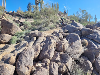
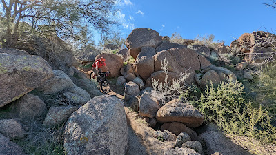
Approaching a field of boulders. Photo by Mike.

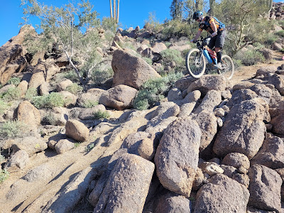
Cool shot, but in full disclosure I stalled out here. Balked. Photo by Mike.

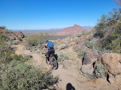
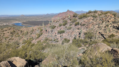
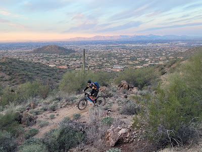
Fantastic views of Red Mountain all the way down. Photo by Mike.

It's a Saguaro-on-a-Stick!! Must be getting close to lunch...

We had gone up Magic Mountain early in the morning, now we get to descend it!!
We zigzagged through a bunch of the upper legacy Hawes trails before making our way to Mine trail. The plan was to leave a few of the frontside trails for the end of the day, don't ride all of them now to avoid doubling up later.

One of the mines on Mine trail.

Snowy Four Peaks.
We reached the top of Big Sister around 12:30p, perfect place for a lunch break. There were a few riders milling about and doing the Sister's Laps. After we ate, we gave 'er a rip then made our way to the easier perimeter trails.

The dirt serpent along Bush Lite West.
We reached the bottom of Scorpion which signaled the beginning of a long gradual climb to Pass Mtn. We'd throw in a quick OnB on Stinger Alley so we wouldn't have to do it later. Then continued up Scorpion to Maricopa Madness after making a short loop and OnB to nab all the miles. Then up the Maricopa Trail to the new Rattler trail.

Mike takes off down Rattler.

Our closest vantage point to Pass Mtn.

Knocking out a short sand loop connection out to Usery Pass Rd. before heading down Bull Run.
During this quick loopy loop we crossed paths with a couple of hikers on three occasions within 5 minutes. By the third crossing they were giving us puzzled looks. We told them what we were up to and they laughed and wished us luck.

It was now getting to be late in the afternoon and we still had three climbs up L'Alpe D'huez to hit Iron Goat, High Ridge & Red Mtn. Rush. We also had our water cache to attend. It was perfect timing too as we were both now running low.  We used up both gallons, packed out the empty jugs and crushed some quick calories.

We both cleaned the first climb up Alpe, but it was a grind after nearly 12 hours.

Mike hits the Spine feature on Iron Goat.
It took us a bit longer to get down Iron Goat than normal. Why? Well, there are three optional lines, we hit them all then backtracked up the mountain so we didn't skip anything!! And, we're dumb & stubborn like that.

The top of NRA #1, aka: Pure Ovaries. Such a fun trail, steep, but not too bad, plus jump options.

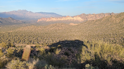
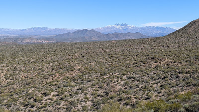
We've been at it so long today most of the snow on Four Peaks had melted!! Ha!

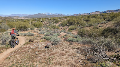
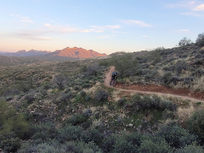
Mike is hard to spot, but he's climbing up Cactus Nectar here.

Golden hour taking hold.

Coming in hot on Cactus Nectar. Photo by Mike.

Yowza!! What a view to the west from the top of Cactus Nectar.
In hindsight, we should've simply done an OnB on Cactus Nectar, but I thought the heatmap showed a few rider tracks on NRA #4 and we had seen a faint trail earlier before riding Pure O.

See? There IS a trail going straight, that's Cactus Nectar up higher on the right.
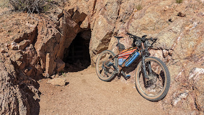
The trail disappeared shortly after the first few turns and was severely rutted. I guess the ride wasn't going to be complete without some desert bushwhacking. Check that box too. Somewhere in here my Garmin zeroed out all my data. Dang it. I knew it was saved, but I was kind of using it as cues. I rebooted the device and it was fine the rest of the ride. Maybe it's on its last legs, it is an old Edge705.

Daylight was fading fast as we climbed Lance's Trail back towards Alpe. We still needed to bag High Ridge before heading off the top of the mountain down Red Mtn. Rush, but as we approached the bottom of Alpe, I had a revelation. It's going to be dark enough that we'll need lights, we've already climbed Alpe, so why not just go UP High Ridge and be done with it? High Ridge is primarily a downhill trail, but at this time of day/evening, traffic is virtually nonexistent, plus, we'd see lights coming down well in advance. I proposed the idea to Mike when we reached the High Ridge exit and his face lit up, YES!! We got our lights setup and began up. The lower portion is rideable and isn't until the mid-section of the trail where things really kick up. Cue the hike-a-bike. We did see a light going up Alpe across the valley and wondered if the rider would be coming our way.

We topped out on the steep stuff and rode the upper portion. We did cross paths with the other rider, Dustin, who happened to know me and has been wanting to get out on a ride. He was heading back down to his car, but asked if he could tag along down Red Mtn. Rush. Sure, why not.

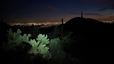
City lights as darkness settles in.

Our third rider: Dustin.

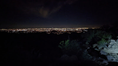
Big city views from the top of Red Mtn. Rush.
Mike and I were feeling it as our GPS's were now showing over 10,000' of gain. We took it a bit easy going down Rush, but it was still a blast. We still had to knock out High Noon, Wild Horse and the Stinger Loop while on this side of the mountain. The riding was fairly quick and Dustin split off when we reached the east end of High Noon.

We then climbed up Twisted Sister for another lap down Mine trail for the final few trails on the front side of the mountain. The end was beginning to seem near as we approached 70 miles on the day. We had a couple more short OnB's to knock out then a few fun loops on Ridge & Mo Ridge.

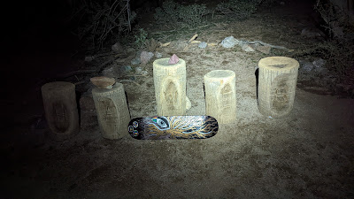
The HAWES stumps. Now we can beeline outta here!!
We both rejoiced a bit when our tires reached Fenceline trail as that was the final unique trail of the ride. It was quickly approaching midnight and I had thought for hours we'd get in before 12a. We reached the vehicles as 12:01a!! Total elapsed time of 18h 40m!! Stoopid fun!!

Strava link.
The reason for the difference in elevation gain is when my GPS zeroed out the data, it created two separate gpx tracks for the ride. I like having my rides in one complete file, so I had to manually merge the two which screwed up the auto-sync feature from Garmin Connect to Strava. The 11,359' was pulled directly off the GPS, while the 9,576' was calculated from Strava and is always low. *I learned a couple weeks later if I had saved my merged track as a .tcx file, it will still auto-sync to Strava from Garmin Connect unlike a .gpx file when doing a manual upload. I guess I'm a bit of a data geek when it comes to this stuff, but I find it interesting.

Anyway, Mike and I kicked back in the parking lot eating pickles, chips and toasting a cold one. I'm glad he remembered to bring camping chairs!! 

I'm really glad Mike ended up joining me on this ride, it kept things fun all day especially as the day wore on. We both agreed we were glad we had no idea what the final mileage or climbing data was, that too kept our interest as things wound down.

Where will the Traveling Salesman end up next?? Hmmmm.

Route on Garmin Connect:

February 20, 2022

Bikepacking 101: 96 Ranch - AZT

 I've been very fortunate over the years to have met and call friends some amazing people in the mountain biking community. I've done some incredible bikepacking rides over those years as well and plan to do more. We have a great online community of riders too, the Hawesaholics page on Facebook is constantly full of stoke, so much so, a child group was formed for all the lady shredders out there, HBRO, Hawes Babes Ride On. Cool, huh?

A couple months ago Heidi, one of the key contributors in HBRO, reached out to me about doing a bikepacking Q&A for a group of ladies interested in getting started in bikepacking. I was more than happy to share what I've learned over the years. The holidays delayed things a bit, but a few weeks ago we did the Q&A and had a great time going over the ins & outs of camping out with your bike. At the end of the talk I mentioned to the group I had scouted a good overnight loop that would make a great introduction to bikepacking. I set it up as a Bikepacking 101 ride, giving the HBRO group first dibs at attending, capping the ride at 12 riders.

It filled quickly with 10 HBRO members, plus Nik, a friend of one of the riders. We set up an event page where we could ask questions, post pictures of our setups and solve any issues during preparation. I tried to only be involved when necessary as I wanted the group to really think about their setups and not simply try to copy what I was doing as each person's style & preferences are different.

Our route was down east of Florence out in the backcountry using a bunch of gravel roads and a good slice of Arizona Trail, AZT, along the Boulders & beginnings of the Ripsey segment. Most of the climbing was gradual, but fairly long and on the first day. The total distance was about 66 miles with 40 being done the first day. Gotta get 'em tired for their night at camp!! We'd camp at the Freeman Rd. trailhead along the AZT and I drove out early to stash 6 gallons of water for the group.

Our planned route.

I scheduled a 10a meetup at our staging area and figured we'd be riding by 10:30a at the latest giving us all plenty of time to reach camp in daylight.

Making final adjustments. Photo by Kara.

Saturday morning came and the riders began to arrive and get set up. I got a pic of everyone once they were ready to roll:

Heidi's setup.

Beverly, aka the Bevinator!! She helped me scout the route a few weeks earlier.

Yoko's setup foregoing the seatbag in favor of side storage.

Kona, aka Ko, and her rig.

Kara and her brand new rear rack.

Nik riding one of the three gravel bikes, he had the widest tires of the three.

Dannie's setup. She showed up in spite of not knowing anyone, kudos!!

Tami on her Cross AZ gravel setup.

Marguerite rounding out the gravel crew.

The pup wanted to go too!! Photo by Heidi.

I tried to make sure no one felt rushed while getting their setups dialed in. No need to forget something in the car. Meanwhile we got word that our final rider got caught in Renaissance Festival traffic and was running late...then she missed the Florence-Kelvin turnoff.

Can you feel the anticipation??

Victoria's setup. Her rear rack came apart while loading, luckily one of the OHV guys had some wrenches handy and we got her situated, but time was ticking.

The trailhead/staging area was hopping as it's a popular area for the OHV crowd.
We finally rolled out of the staging area a bit after 11:30!! Much later than I hoped. Lesson learned, next time there needs to be a drop dead departure time. I still thought we'd have enough daylight to reach camp.

Our route started with a quick mile of pavement down into a wash where we'd turn on Barkersville Rd. It's a well graded dirt road and steadily climbs for the 8 or so miles we were on it. It's not steep, but if you're not used to a heavy loaded bike, it'll wear on ya.

Marguerite cruising along.

Bev isn't enjoying this at all!!

Victoria, I learned, had only begun mountain biking two months prior to this.

Dannie & Yoko on Barkersville Rd.

Well, if it isn't Jennifer Hanson out on a training ride for the Alaska Iditarod race!! As of this writing, she's about halfway through the 350 mile route!! Go Jen!! Go Jason!! You can follow them here: Trackleaders: ITI350

Group selfie!! Photo by Nik.

Bike corral. Photo by Tami.

I was hanging with the back of the pack making sure everyone was good. It was clear Victoria's pacing wasn't going to make camp in daylight. She was riding well, just a very slow pace. I gave her the option of cutting out the miles to 96 Ranch so she could take a more direct path to camp. She agreed and stayed on Barkersville Rd. out to Freeman Rd, while I caught up to the others on their way towards 96 Ranch.
Ahh, shade at 96 Ranch. Photo by Kara.

The group reunited for a quick lunch break at 96 Ranch.

Getting ready to head out after the break.

Dannie nears the top of a short climb.

Ko in hot pursuit.

Yoko starts the long downhill to our next turn.

I told the group this was the adventure portion of the route. A lesser traveled dirt road connecting 96 Ranch Rd. to Freeman Rd.

A wee bit o sand. Not ideal for the gravel bikes, but they powered through!!
A few of the riders, Tami, Nik, Heidi & Bev took off ahead through here, Kara followed suit after we realized Ko had a small slice in her tire. It was holding air, just oozing sealant a bit.

We eventually made our way out to Freeman Rd. I kept telling everyone, once we hit Freeman, it's 15 miles to camp....mostly uphill. :) I was now riding with Dannie, who was beginning to labor due to some knee issues. We reached the first mile marker on Freeman and I told her I had good news. It's only 13 miles to camp, not 15!! Soon after that I got a bit ahead of her and when I stopped I couldn't see her behind me. I waited a few minutes, then rode back down to see what was up. She was off walking her bike, knees were really bothering her and she couldn't pedal. We assessed the situation and her option was to reach Barkersville Rd. up ahead where it was almost all downhill back to the car. There were some folks camping nearby and they had a pickup truck and offered to drive her to Barkersville Rd. She was clearly upset about not being able to finish, but sometimes your body doesn't cooperate. It's happened to me plenty of times. I needed to ride on to catch the others as light was waning. I found out later at camp, that Dannie had taken a spill earlier in the day which probably was the cause of the knee pain. She ended up going to the ER that night to find she had a small tear in her MCL. Ugh. Heal up, Dannie and come back for another go, you were clearly enjoying yourself out there.

It took a few miles, but I caught up to the three riding at the back of the pack as the sun dipped low on the horizon.

Almost done with the steady climbing...

Sunset glow near Barkersville Rd.
We still had about 5 miles to go as darkness fell. The others, Marguerite, Ko & Yoko had lights, but some were buried in their gear. I rode slightly behind Marguerite flooding the road with my dynamo K-Lite setup. She was really feeling the long day, her bags were rubbing the rear tire so I took one of her bags and strapped it to my handlebars. We took short breaks at a few mile markers in a row. After we crossed Willow Springs Rd. there were a few downhills mixed in and we covered ground more efficiently. The girls made it up the final climbs and we rolled into camp a bit after 7p.

I found out a buddy was camped in the trailhead as he prepared to tackle the Antelope Peak Challenge route the following day. I caught up with him before finding a place to call home for the night.

Last rays of light from camp. Photo by Kara.

Everyone was gathered around the stone bench under the shade canopy making it a large dinner table. It worked perfectly for this. It look like everyone had brought freeze-dried meals, which are fine, but I had leftover pizza that I knew would hit the spot...along with a can of Yuengling beer I carried all day. Yep, perfect. I finished off the meal with my leftover piece of chocolate cake I bought during our Stagecoach bikepacking ride the weekend earlier. The girls couldn't believe I brought dessert!!
Starry night at camp. Photo by Heidi.

As things were winding down, I heard Marguerite talking to her husband and arranging for a pick-up the next morning. I didn't say anything, but wanted to see how she felt in the morning.

I think I was the only one cowboy camping, it was a bit chilly but nothing too bad and I got a few hours of good sleep.

We had plenty of water for everyone to top off for the ride out.

Packing up camp.
As we gathered around for breakfast I was asked a few times how today's ride compared to the previous day. It definitely trended downhill, only a few hills here and there. Marguerite made the call back to her husband to tell him she was going to finish the ride. I was so glad to hear that as I knew she would regret it if she hadn't.

Victoria, who rode the shortcut to camp, was adamant about not riding her bike. Well, what's your plan? She thought she could get an uber to come get her. Nope. I knew she shouldn't take the singletrack and directed her back the way she came. Going backwards on route meant Barkersville Rd. would be practically entirely downhill and that was over half the mileage. She finally came around and agreed to that plan. She texted a few hours later letting us know she made it back safely. She needs to get more mileage and general bike handling under her belt before taking on a ride like this in the future. 

Gathering around the dining room.

Nik had to take off a bit early as he had a wedding to attend.

Freeman Rd. kiosk. Photo by Heidi.

AZT Register. Photo by Heidi.

Ready to roll out!! Photo by Kara.

I think we left camp around 8:30a or so and not a 1/2 mile later our adventure for the day began. Ko's tire was getting low, so Heidi and Ko stopped to put air in it, then the valve stem sheered off. Busted. We were all a bit dumbfounded as I can't recall seeing one break off like that. I asked if either of them had a spare and was met with that 'oh shit' look. I dug into my repair kit an pulled one out. We put it in, but after wasting a few CO2 cartridges, the tire wouldn't seat. Pull out the valve stem and in goes the tube. A few minutes later Ko was back in business.

I think Kara likes the AZT!!

Bev powering up the mini-bitches. Photo by Kara.

Yoko is about to lose a bottle!! Photo by Kara.

Marguerite glad she kept riding. Photo by Kara.

The rest of the group had continued on as we played catch up. Then Heidi's seatbag began rubbing her rear tire. We stopped to readjust the bag, but it began rubbing again. She noticed her dropper post had slid down a bit. A short test ride confirmed it was the dropper causing the issue. This was a good time to mention the part from Wolf Tooth Components, a valais, it clamps to the dropper for the seatbag straps to go around to keep the dropper from getting scored. It also doubles as a clamp to prevent the dropper from dropping in the event of a failure!! My buddy, Igor, had a similar issue recently and he used a stick to keep the seat fully extended. I figured we could find one suitable out here. Took two tries but we found a good one and I cut it to size using Ko's utility knife.

Heidi stoked to have her seat fully extended without the bag rubbing!! MacGyver would've been proud.

Finally, we were back on our way. Reaching the famous self-closing gate.

Elephant Butte Rock!!

Ko with the elephant's backside.

The Boulders segment was riding great.

My lone riding pic. Photo by Heidi.

Kara posing on the boulders.

Magnificent sky!! Photo by Kara.

Great view of the Gila River Canyons. Photo by Kara.

We reached the powerline segment and I originally had us taking Cougar Hill, but figured it would be wise to bypass that bit today. As we rounded a corner, there was quite the commotion up on the road. My first thought was somebody had either a bike mechanical or the off-road crew had an issue with a vehicle.

It was the owners of Old Time Pizza in Kearny out for a spin!!
I found out afterwards that Yoko's chain had dropped and they were having issues getting it resolved. The offroaders were quick to jump in and lend a hand and by the time we arrived everything was good to go!! How cool is that? They are huge supporters of the Arizona Trail and will deliver pizza to Kelvin along the AZT!! Awesome, huh? If you're ever in Kearny, stop in. They handed all of us cold bottles of water and took our trash too. Thank you!!

Tami riding strong on the gravel bike.

Ko topping out on the climb.

Heidi was all smiles and we're over halfway through day 2!!

Yoko digging in!!

Heidi just found out we were finished with the powerline section!! Photo by Kara.

Kara and Tami on one of the newer bits of the Ripsey segment.

I really like the addition of these metal AZT signs.

The remaining crew at the biggest gate along the entire AZT!! (Bev had rode on ahead)

Only a couple more miles of jeep road until the Florence-Kelvin Hwy.

Distant Pinal Peak. Photo by Bev.

It's all downhill from here...mostly. :) Photo by Kara.

The final zigzags out to the Florence-Kelvin Hwy on Red Cloud Rd. Photo by Kara.

A second riding pic!! Photo by Kara.

Florence-Kelvin Hwy, after this short rise it was about 7 miles of fast, mostly trending downhill riding back to the cars.

Kara taking a moment with the boulders and finish line in sight!!

That's a wrap!! Carried a few empty gallons from the Freeman Rd. cache.
Route:


I'm beyond proud of everyone who came out and redefined their personal limits of what they thought they could do. I hope everyone learned a ton of valuable tidbits, not just from me, but each other as we all do things differently. That's one of the cool things about group bikepacking rides. I'd love to keep the Bikepacking 101 series going, perhaps with a shorter ride. I'd love to see everyone out on the next adventure.