Why would anyone ride UP Montana Mtn on the
Arizona Trail? Good question, but I have an answer. In spite of the perceived hike-a-bike, HAB, that lie ahead on those upper 2 1/2 miles, I am determined to ride as much of the bike legal AZT that is feasible during this year's
AZTR750. I figure if I'm going to do it in April, I might as well see how brutal it's going to be.
I opted to sleep in a bit on Friday and didn't start pedaling north out of Picketpost TH until 10:30a. There were plenty of other trail users milling about, a large group of equestrians were heading south along with a few hikers. I didn't expect to see much, if any, trail users going north.
Of course barely a half mile into the ride I came up on another group of equestrians riding northbound. I crossed under US60 and then Queen Creek making my way to Hewitt Station rd where the rest of the AZTR750 riders will turn left. More than likely my tires will turn right and head to Superior for a burrito before heading up the trail.
 |
| The 3 B's of the AZT: Bones, Barbed Wire & Bikes. |
As I approached Hewitt Station rd, I noticed a fresh set of tire tracks in the dirt. How old were they? Couldn't have been more than a day old since they weren't trampled by hoof prints. The more I looked at them the more I became convinced the rider wasn't too far ahead.
The trail began a gentle ascent after crossing some railroad tracks and the rubble began to appear. Initially it wasn't a show stopper, but soon the pitch increased along with the number of baseball sized rocks. Time for a bit of HAB.
 |
| Beautiful morning to be out of the trail. |
 |
| A few of these greeted me early on, only a couple minutes here & there. |
I think I was cresting the second ridgeline when I noticed some hikers up ahead...and someone pushing their bike! I found the owner of those tire tracks. Five minutes later I caught up to him, out for a day ride. I motored on as the trail was getting pretty good, even mixed in some fun downhill.
 |
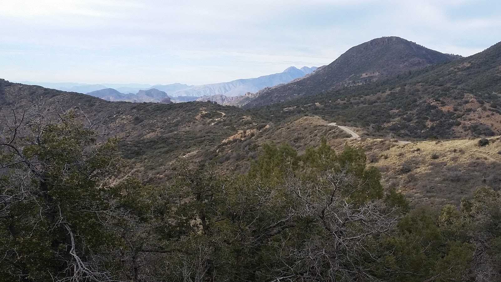
| Montana Mtn doesn't tower above anything, I think it's the rounded peak on the far left horizon. |
 |
| Plenty of green in Whitford Canyon. |
As soon as I dropped into Whitford Canyon I saw something I had never seen there before: flowing water!! It was a welcome change to the typically bone dry canyon. The water mostly stayed above ground as it made its way towards Queen Creek.
A large group of day hikers were just ahead finishing off their trek as I rode by. I reached the first crossing of FR650 without too much trouble. So far the ride was going well. I wasn't so sure how the next segment would ride as I recall most of it being downhill gong southbound. I'm glad my memory wasn't correct, this section was a blast to ride. Desert wildflowers even made an appearance!!
 |
| A splash of gold already on the hillside at this elevation?!? It's going to be a fantastic wildflower year. |
 |
| Well contoured trail leading towards the larger mountains. |
 |
| Your typical Arizona jeep road. |
A short downhill led me to the second crossing of FR650 at the Reavis Canyon TH. There were only a couple of miles left before the big push up Montana Mtn.
 |
| Reavis Canyon TH. |
 |
| Proof! Water!! |
 |
| Spotted some trail flagging for a future re-route near a severely washed out section of trail. |
There were two portions of the trail that were completely obliterated from last season's monsoon. At least it was only the portions that dipped into the wash, but it was a little difficult to see where the trail picked up again. That's one reason I always ride with a GPS with a loaded track when possible. You simply never know what type of conditions you may encounter on these remote outings.
The GPS now read 13.3 miles, time to get my HAB on. The lower flanks of Montana Mtn are narrow, steep & loose, but not to bad to walk. The elevation gain comes rapidly as you peer back down the canyon.
 |
| Typical photo, doesn't really convey the steepness. |
 |
| Starting to rise out of Reavis Canyon. |
 |
| Higher up, the trail surface has less rubble to navigate. |
 |
| The Voodoo was getting tired, so we took a break. |
 |
| Freshly manicured switchbacks all the way up. Should be real nice to ride down these. |
 |
| There it is!! The gate just below the saddle signifying the end of the climb. |
 |
| I love the views up here, so much to take in. |
As I neared the top I could hear OHV's up on the ridgeline, it almost sounded like they would be coming down the trail!! I spotted them traversing eastward on FR650 as it wraps around the north side of Montana Mtn.
The GPS was now showing 15.8 miles, 1 1/2 hours in, I crested the saddle. Of the 2 1/2 miles of climbing I think I rode about 0.4 miles. It's a stout climb for sure, but I'd just as soon get in over with in one push in April. Climbing up on the forest roads isn't exactly a cake walk and even though the AZT trends downhill going south, it's still makes you work. Instead I'll enjoy 16 downhill miles on FR172.
On the north side of the saddle were patches of snow even though it was 60º outside. This vantage point provides you with views of Pinal Peak, Mt. Lemmon, Picketpost Mtn, Superstition Mtns and some of Four Peaks. It's quite incredible.
 |
| I don't often find snow so close to home. |
 |
| Part of the Four Peaks behind FR650. |
The downhill began on FR650 as it continues north as the AZT to Roger's Trough TH. FR172 splits off about a half mile from Roger's Trough, but I opted to take the detour to the trailhead for a snack. There was plenty of running water crossing the road along with slushy sections!! Snowpack was melting fast, but sure made things interesting.
 |
| Popular trailhead for day hikers. |
 |
| I may have a pic of my Voodoo next to every one of these along the trail. |
 |
| End of the line for bikes. |
The only concern I had riding down FR172 was whether or not my brakes would combust. The road isn't super steep, but speed comes easily and there are a handful of tight turns. I tried taking in the views all the way down, pausing a few times to snap some pics.
 |
| The ruggedness of the Superstition Mtns. guards its famed gold stash. |
 |
| Layers & layers of foothills. |
 |
| Thick stand of Saguaros. |
 |
| Such an amazing place to ride. |
 |
| Towering cliffs and cacti around every corner. |
 |
| Exiting the canyon. |
The entire ride down I only saw one vehicle, a truck that I caught and passed. I could see a wall of dust waiting for me as I approached Hewitt Station rd. The OHV crew was tearing it up, but they were headed the other direction and the dust settled quickly.
It was now late afternoon as Picketpost came back into sight. A few miles of graded dirt led me back to the first couple of AZT miles from the morning. Sure was a fine way to wind down the ride.
 |
| Finish line in sight. |
It took me about 6 hours to complete the portion I'll ride in April. How long will it take then? Who knows, but hopefully not too much longer. 7 hours? 8?? We'll see.