I was messing around in
Topofusion one evening looking for a possible dirt route that would loop the northernmost two passages of the
Arizona Trail. I was finding some forest roads here and there, but nothing was jumping out at me. I noticed
Scott had added a new map layer into the software titled '
Juicy Trails', hmmm, what's this? I applied the layer and began to pan around the region. Low and behold I spotted a trail running northwest from House Rock Valley rd called the Navajo Trail. A little search on the interwebs made this trail very intriguing. I drafted a figure 8 route starting at Stateline campground on the AZ/UT border, heading south on House Rock Valley rd to the Navajo Trail, then a series of forest roads to Jacob Lake where we'd spend the night and re-supply. The following day would be mostly downhill and shorter on all singletrack of the AZT back to Stateline CG.
I needed a date and some willing participants for an exploratory type ride that most certainly had a fair amount of hike-a-bike (HAB). A few of my riding friends were interested, but had reservations re: Navajo Trail. In step Michelle and Tim; after a bit of convincing that the pace would be slow with plenty of photo opportunities!!
We all met at Tim's on Friday afternoon and piled two bikes on the roof and my bike on the back, then all the gear for bikepacking plus 3 adults into......a mini cooper! Yeah, it was a clown car like no other. I assumed my position in the remnants of the back seat, but surprisingly had plenty of room. The tricky part was getting in/out of the seat!!
 |
| Ideal transportation for a bikepacking weekend! |
We hit the road around 4pm and slowly made our way free of the urban gridlock. A quick dinner stop in Flagstaff and we were in rural northern AZ in no time.
By all accounts House Rock Valley rd was easily traveled by any car, reports warned of death mud if wet. Conditions were dry as a bone and the road was well maintained sans a few sections of washboards. There were at least 4 wash crossings where ruts were visible from vehicles getting bogged down during wet times. The mini was flawless, but a couple miles from Stateline we heard some clanking on the roof!! Uh oh. The washboarding had jiggled the roof-rack loose and a couple bolts fell out! At least we stopped quickly enough to retrieve all the parts and made it to Stateline sometime around 11pm.
It was a chilly night down in the low 30's, but not too bad. The sun took a while to rise due to the high canyon walls. Tim & Michelle started to freak out when they thought it was already almost 9am!! We were practically on the UT border, which happens to be 1 hour ahead of AZ, when we confirmed it was just after 8am. We still took our time, packing up, eating breakfast and finding Michelle's rear axle had worked its way loose from the washboarded road. Luckily I always remove my drive-side pedal for my bike rack and had my cone wrench on hand, coupled with a leatherman, it was an easy fix. We finally started riding south around 10am, not the preferred time, but we weren't shooting for a break of dawn getaway either.
The first 14 miles were spent on House Rock Valley rd enjoying the views we missed on our arrival.
 |
| Getting underway onto House Rock Valley rd. |
 |
| A few undulating climbs to start. |
 |
| Great day to be out on a bike. |
 |
| Red rocks littered the first half of the road ride. |
 |
| Soon the wide open plains appeared. |
 |
| A trail for another adventure?? |
 |
| One last climb before our turnoff. |
 |
| A nice two mile descent to the Navajo trailhead. |
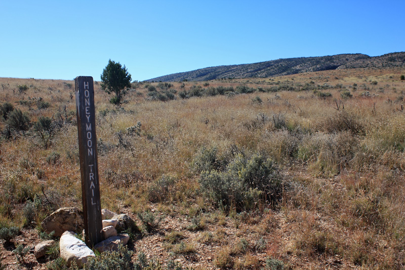
We pulled into an open area marked by a brown hiker sign and rode up to a gate with an old weathered sign that read 'Navajo Trail No. 19' This is the place. Michelle was leery of what lie ahead, I was ready to push my bike up the mountain and start riding while Tim may have wondered what exactly he got himself into.
When I put this route together I initially used satellite imagery to draw in the Navajo Trail as I could easily see it on the map. The problem was when I switched to the Juicy Trails map layer the route was shifted quite considerably. Not knowing the true trail conditions this was an issue, which one was going to most closely represent what was actually there? I used the Juicy Trails website to check on some known trails in the Phoenix area and from what I could tell the tracks were spot on. So, I went back and moved my satellite route over to the Juicy Trails alignment. Looking back now, this was key to our successful ride.
Immediately on the other side of the gate the trail was barely visible, but we could see it across the field we had to navigate. Straight ahead! We started climbing and I was down in granny gear soon enough. The trail quickly spiked skyward and became quite chunky, time for HAB.
 |
| What would the next 12 miles bring? |
 |
| Easy to follow in spots, non-existent in others. |
 |
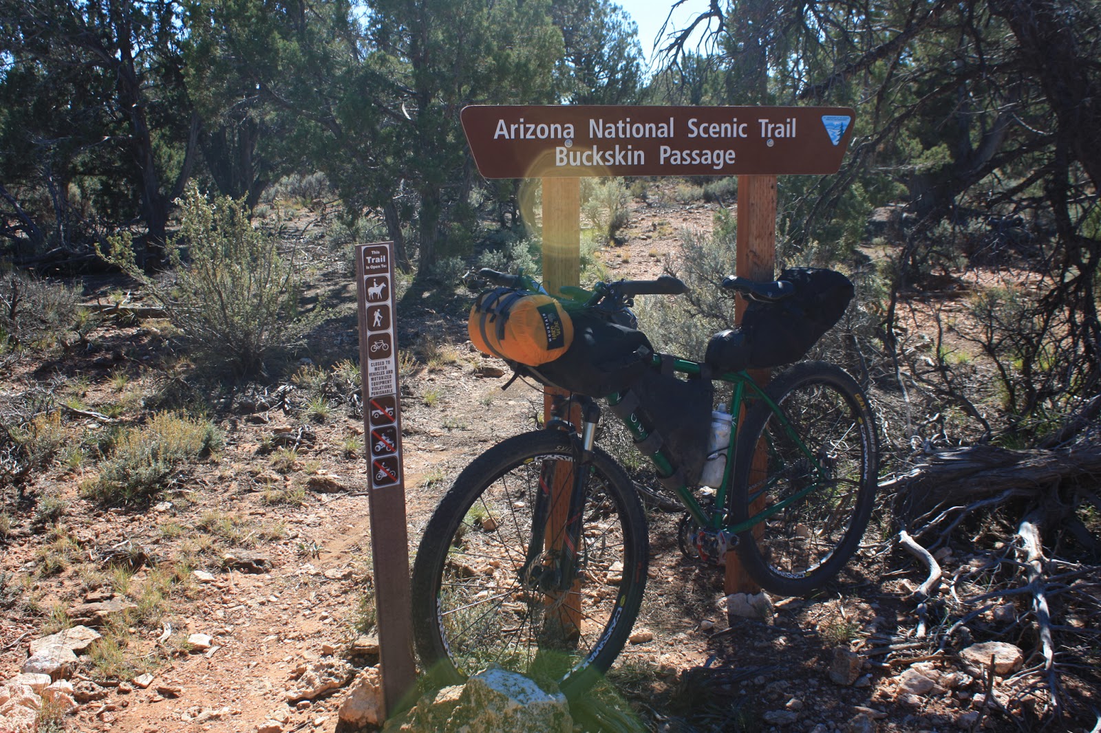
| Kaibab Plateau Tr is the Arizona Trail or Trail No. 101. |
 |
| One final push before the walking begins. |
 |
| These small signs were few and far between, but helpful along the way. |
 |
| Up, up, up. |
 |
| You are here. |
 |
| With each footstep up the mountainside the views became more impressive. |
 |
| Tim working it around a switchback. |
 |
| See, it wasn't ALL HAB!! (This helmetless section was only 50 feet long!) |
 |
| Vermilion Cliffs towering over House Rock Valley rd. |
 |
| Looks like a house shaped rock on the horizon. |
 |
| Some sections made you pause until a cairn was sighted. |
 |
| Far below, the trailhead stands out. |
 |
| The big push finally comes to an end. |
We took a short break at the top then started pedaling once more. We had now gained the plateau and were riding in the trees on a nice wide singletrack corridor.
 |
| Most of the trail was easy to follow, but we'd hit at least 4 spots where nothing was visible on the ground. A GPS with a loaded track is mandatory for the Navajo Trail. |
 |
| Some surprising sections of singletrack. |
 |
| A few miles in we were treated to our first views of Zion Nat'l Park. |
 |
| A steep downhill into Summit Valley and the AZT crossing. |
 |
| Lunch break at the AZT crossing. |
 |
| This was a really nice sign...in the middle of nowhere, a few hundred yards west from the AZT on FR248. |
 |
| FR795 deadends at the Navajo Trait tank, then this begins, more great singletrack!! |
 |
| A few splashes of color could still be found. |
 |
| Closer to Zion, we ready for our final steep descent. |
 |
| You'd be all smiles too standing here. |
 |
| We HAB'd down a steep scree slope from that ridge, then resumed a fast trail to here. The end of the Navajo Trail. |
The Navajo Trail dumped us out onto FR248D, a nondescript road on the open shrub filled plains. The sun was dropping fast and we still had 20 miles to go until Jacob Lake. It was now 4:30p, we knew we'd be riding into the night, but could we still make the Inn before the grill closed at 8p??
 |
| We initially thought we descended the scar on the ridge, little did we know, we were about to climb it. |
 |
| FR248D. |
 |
| Making the turn eastward. |
 |
| A lone tree basks in the cool golden hour light. |
 |
| Nothing but fence posts for miles. |
We started our gradual climb back up to the plateau, the scarred switchback inching closer until it was clear we'd be climbing it. The sun was now just above the horizon, a little past 5:30p, that left 2 1/2 hours to make it to the Inn for dinner. Michelle was starting to slow, this was going to be her longest ride to date....on a fully loaded bike....at elevation, but she was plugging along. I took the opportunity to get myself ready for some night riding at the switchback while I waited for them to meet up.
 |
| FR248D barely visible below the setting rays. |
 |
| On the push up to the plateau. |
 |
| Not a bad grade, at least the HAB was done for the day. |
We regrouped just as the sun dipped below the horizon. We decided it would be best to send me along to get to the Jacob Lake Inn before the grill closed. We also slightly modified the route over the last 5 miles for a more direct route & a little less climbing. I gave Michelle & Tim my paper map of the area, wished them luck and continued on in hopes of snagging some good eats.
One small item of note: my handpump had stopped working earlier in the day and my rear tire was being suspect. I did have a CO2 cartridge, but really hoped I could make it to the Inn without issue.
I really enjoy riding at night. On the forest roads lights can be on low and you settle into a rhythm, often peering into the darkness around you, perhaps on the lookout for another set of eyeballs.
On this night I rode into a most unexpected sight. It was at the junction of FR248D & FR248A, there was a small gap in the trees to the east with an almost burnt orange glow a full moon was rising! It was fantastic, the darkest orange moon I'd ever witnessed. There was no way I could capture the image without a tripod, so I just stopped for a minute and burned it into my memory bank. Moments like that make you very thankful for the ability and opportunity to be outside enjoying nature.
A few miles down the road my front end suddenly became very squishy. Drat. I had to resort to my CO2. I had an idea, I needed a little air in the rear tire as well, so I set the valves to the ready position, hit the front tire with 2/3rds of the cartridge, backed it off, then hit the rear tire with the remainder. Bam!! Fully inflated I was back to mashing in no time.
I kept checking the time 6:30p, 7p, 7:20p, then I came to FR248. Cool. A few miles later I was on the paved US89A, it was 7:30p. After a deceiving 1 1/2 miles of pavement I arrived at the Inn and asked if the grill was still going. Yes it was and until 9p!! The manager on duty was kind enough to put my bike in the office while I ate. Eat I did. I woofed down a tasty club sandwich, fountain cokes, hot chocolate and cherry pie ala mode!
It was now 8:30p and still no sign of Michelle & Tim. By 8:50p I put in an order for them, then checked to see if there were any available rooms for the night. I figured Michelle was really feeling it and probably wouldn't mind skipping a night of cold camping. For the record, I didn't mind either as the temps were forecast to dip into the upper 20's. I grabbed my bike and the food order, went outside just as they were rolling into the parking lot!! Perfect. We quickly agreed on the room, checked in, showered, and were asleep around 11p. **Yes, we carried all our bikepacking gear for nothing!! A training ride perhaps?**
Day 2: AZT 42-43
 |
| The only services for miles. |
 |
| AZT trailhead, near where we were supposed to camp. |
 |
| We saw one Kaibab squirrel running up a tree. |
 |
| One of the easier gates to open/close. |
 |
| Really fun piece of trail through a gully. |
 |
| The AZT is also signed as Trail No. 101 |
 |
| Crossing our tracks at the Navajo Trail junction. |
 |
| AZT / Navajo Trail intersection. |
Passage 42 started off with two very short HAB's over loose terrain, after that it was mile upon mile of cruisin' singletrack through the forest. From Jacob Lake to Stateline the elevation profile was very favorable. I'd venture a guess that only 2 of the 30 miles were uphill, the rest was either level or angling downhill.
 |
| Our first sighting of the red rocks near Stateline & Navajo Mtn. |
 |
| We crossed 5 drainages before the long descent into Stateline. |
 |
| Tim diggin' in. |
 |
| Almost 70 miles in and still smiling!! |
We started a long gradual descent crisscrossing a wash on a soft red powder-sand surface. I must've been doing 15-17 mph when my front tire gave away and I washed out coming to an abrupt halt in the dirt. Only a small cut on my knee, a few prickly pear spines in my leg, but at least the bike was fine, back to the trail!!
The last couple of miles are a hoot, dropping some 1500' down the mountainside into Stateline. The switchbacks are not sharp, rather large arcing curves. Be sure your brakes are good to go on this one.
 |
| Another fun section through a canyon. |
 |
| Getting close now. |
 |
| It was tough to keep your eyes on the trail here. |
 |
| Another great ride about to wrap up. |
 |
| A look back on the final descent. |
 |
| Go ride some today. |
 |
| End of the line. |
 |
| Back where we started. Photo by Michelle. |
We finished up around 3:30p, a bit too late for a side trip over to Wire Pass trailhead for a quick hike into a sandstone slot canyon. We loaded up the clown car for the 6 hour drive home and were treated to more incredible views while the sun set over the high desert. I'll definitely be back to ride this loop again, it far exceeded my expectations. As always, it's extra fun to do a ride like this in good company, thanks to Michelle & Tim for joining in on the fun.
 |
| It really is called Stateline for a reason. |
 |
| Heading into Utah you get this sign. |
 |
| On the border. |
 |
| Heading back into Arizona you get this sign. |
 |
| Saw a few wild horses on our way out on House Rock Valley rd. |
 |
| Cool rustic barn on the open plains. |
 |
| Such a beautiful place, try and catch it near sunrise or sunset!! |
 |
| Clown car filled to capacity. |
 |
| Fiery cliffs near Marble Canyon. |
 |
| The Colorado River slices a chasm through the region just south of Lee's Ferry. |
 |
| Our route & elevation profile. |


GPX of the route can be found here: http://www.242mediagroup.com/gpx/
ReplyDelete2 files are needed: AZT42-43_Loop & AZT42-43_POI