It's a good idea to have options when planning a bikepacking route or in this case a car camping outing. It's relatively rare for us desert dwellers to alter plans due to weather, but we typically have great riding weather so there's no need to be out in undesirable conditions.
Our initial plan was to car camp at Freeman Rd and do a slightly modified loop of the old
AES APC115 course, adding in a few extra miles of
AZT through Oracle State Park. The forecast called for overnight temps in the upper 20's, so we scratched the camping plan & opted for a single day
Gila River Ramblesque route. I merged a few gpx tracks I had along with some of Scott's for sections I had yet to put tires on.
This route was shaping up to be a really sweet single day loop, hitting all the 'must-see' attractions along the way: AZT, Artesian Well, Gila River, Coke Ovens, Area 52 and Ripsey!! This is gonna be awesome!!
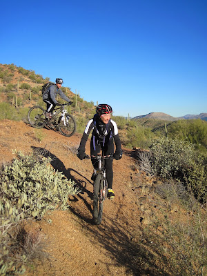
Six other regular nutjobs joined in on the fun and as we rolled out of the Kelvin trailhead it was 27º!! Brrrr. Yeah, we're spoiled. Barely 30 minutes later the layers began to come off as the day slowly warmed up & we hit the first climb of the route.
 |
| Randy had the right idea for the cold. Photo by Jeff. |
 |
| Nancy & Derek on the AZT between the trailhead & motor bridge. Photo by Jeff. |
 |
| About to rejoin the singletrack. Photo by Jeff. |
 |
| The top of the first climb marks the completion of the AZT back in Dec '11. |
 |
| Jeff enjoying the contoured downhill. |
We continued west along the Gila River on the AZT for about 6 miles, roughly 1/2 way to where the trail turns sharply up & north. We were now in a large wash and would ride north a couple of miles until we reached a turn-off where, as Scott said, 'we may have some Hike-a-bike'.(HAB) Our next stop would be the Artesian Well and none of us had been there before.
 |
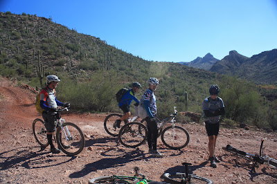
| A quick re-group at the wash junction. |
 |
| Cairns & Carsonite mark the way for the AZT. |
 |
| The wash was sandy, duh, but rideable. Photo by Jeff. |
We made it to where our line on the GPS turned left....and UP. Ahhh,
there's the HAB we've been waiting for. I learned a few years ago, if Scott says there
may be HAB, there
WILL be HAB. Start pushing.
 |
| Here's proof. It was a little steep!! Photo by Jeff. |
The HAB topped out next to a towering cliff, there were signs of camping spots strewn about, but we had yet to see another person. The raw beauty of this area is breathtaking, the views out here are hard earned.
 |
| Top of the first HAB. Photo by Jeff. |
The jeep road became ride worthy as we snaked to the west, then it dropped down sharply, as most of these jeep roads do, into another wash.
 |
| Looks rideable from here, right? |
 |
| You could say our terrain is rocky. Photo by Jeff. |
 |
| Entering Walnut Canyon. Photo by Jeff. |
The rubbly descent ended and we started the next brutal ascent, but my GPS beeped: off course. Hmmm, we didn't see another turnoff, no trail, no jeep road, just a thick swath of bushes down in the wash. We getting close to the Artesian Well, but the jeep road we were on would take us away from its known location. This piece of track we were following was cut from Scott's Gila network, it has to be right?!?! (*After the ride, we would learn that we should have bushwacked up the wash for a bit) We continued on the jeep road dragging our bikes to the top and away from the Well.
 |
| A second towering cliff at the top of the second HAB. Photo by Jeff. |
We were all a bit disappointed by our inability to locate the Artesian Well especially after pushing up those two wicked HAB's. It was the sole purpose for leaving the AZT!! At least we all appreciated to remoteness, wonderful views and different perspective of the surrounding canyons.
Our next mission was to make our way back to the Gila River, fording it, then break for lunch.
 |
| Continuing west along the jeep road corridor. |
 |
| Back at the AZT & Red Mtn Mine Rd. |
 |
| AZT singletrack climbing up into Martinez Canyon. |
We arrived at the river to find it flowing much greater than a month earlier when it was only ankle deep. We debated a bit on where to cross, the banks were not the easiest for footing and we couldn't tell how deep the water was. I offered to be the guinea pig and shed my socks/shoes. The riverbed was covered in 6" of silt making things slippery, but underneath the silt was a solid base. The water at its deepest was mid-thigh, but freezing cold!!! It took about 5 seconds for my toes to go numb. I made my way about 1/2 way across, where the water level was only mid-calf deep, the others were convinced to make the plunge. One by one we waded across, no water casualties only an interesting wardrobe decision by Derek!!
 |
| Nancy posing for a picture. |
 |
| Ray trying to find good footing. |
 |
| Caroline at the deep spot of the crossing. |
 |
| The rocky riverbed digging into my feet, ouch! Photo by Jeff. |
 |
| Derek exposing his thighs to the light of day for the first time ever!! Photo by Jeff. |
Time for lunch, filter some water and clean feet. It was getting a bit late after our slow going through the jeep roads so we opted to skip the out-n-back to Area 52 as we'd want more time to really explore that gem. We weren't sure we'd have time to do the Ripsey portion of the loop either since not everyone had lights & Caroline forgot her helmet back at my house!! We decided to ride back to the Florence-Kelvin Hwy, check the time and make a final decision on what to do.
 |
| Caroline under a rare desert tree tunnel. Photo by Jeff. |
 |
| First, we stopped to view the Coke Ovens above Cochran. |
 |
| Beautiful setting. |
We were back on dirt roads climbing gradually the entire way. A few miles in we reached a pitch in the road that just left me in the dust. Legs felt heavy after lunch and I watched as everyone else slowly pulled away. Soon I was riding by my lonesome trying to enjoy the surroundings, but each incline dealt a tiring blow. By the time I settled into the constant pedaling I was about a mile from the F-K Hwy.
 |
| The long winding dirt roads near Cochran. Photo by Jeff. |
 |
| A nice view back to the Gila River Canyons. Photo by Jeff. |
I caught up to the group and it had already been decided that Ripsey would be skipped on this day. I felt bad for Derek & Randy as they have yet to experience that ride, so next time we'll head directly there!! We took the fast track back to the trailhead bombing down the 4+ mile decline of the F-K Hwy.
No Artesian Well, No Area 52, No Ripsey, but still a great ride?? Sure was. If anything this ride will help me plan other rides in the area with a better idea for time management. It's all about being out there anyway.
Thanks to Ray, Randy, Jeff, Nancy, Caroline & Derek for coming out. A special thanks to Jeff for taking a ton of great pics when I didn't feel like digging into my pack for the DSLR!! Check out
Jeff's take on this ride too.


No comments:
Post a Comment