I'm running out of rideable sections of the
AZT. At last check I had completed over 600 miles of trail. A while ago I decided to complete the whole thing. That means hiking into the Wilderness areas. Now that I'm off the bike until who-knows-when, might as well start knocking out a few sections.
Passage 1: Huachuca Mtns. was an obvious choice. The
AZTR300/750 was kicking off and I'd be down at the junction of passages 1 & 2 anyway. Then I got a text from Josh asking if I had plans for that weekend. We bounced a few texts back and forth and came up with a plan for race day. Josh & Holly would get dropped off at Montezuma Pass by me, hiking northbound back to their car. I would wait at the pass for Mark & Mike - they were dropping
Josiah off at the border for the 750. We'd leave my car there and drive back to Parker Canyon Lake to watch the
start of the 300 then begin hiking southbound.
 |
| Fantastic trailhead. This would be our finish. |
 |
| Josh & Holly ready for a short out-n-back to the border before climbing up to Miller Peak. |
One way or another it all worked out!! We started our trek south about 9:30a. I was using my new Salomon Speedcross 3 shoes, the ones I purposefully bought for the Grand Canyon portage of the 750. They felt great in the week+ I had been wearing them at work, but I really wanted to check their trail worthiness. Hat tip to Jason for turning me on to these.
*EDIT: They are fantastic!!*
This hike served another purpose, it was also a scouting trip for next year's 750. Sunnyside Canyon is one of the bonus sections I plan on riding. The current route bypasses it because of the Miller Peak Wilderness and the routing of Sunnyside Canyon. It's almost an out-n-back ride, rejoining the track barely 1000' feet farther down the dirt road.
We immediately dropped into Scotia Canyon, this is currently the first mile of AZT the 750 riders experience.
 |
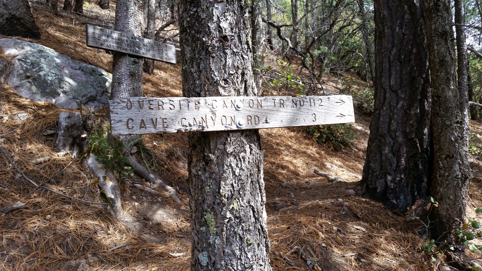
| Great sign! |
 |
| Mark heading up Sunnyside Canyon. |
 |
| Sunnyside rd. |
 |
| A short distance past Sunnyside rd the Wilderness begins and with it BEARS!! |
 |
| The AZT doubles as local area trails through the Huachucas. |
Our short term destination was the Crest trail, also known as the Arizona Trail. The first few miles were on mellow grade, but soon the trail would angle towards the sky and the calves would begin to work.
Near the Wilderness boundary we encountered our first thru-hiker. Mike had already left Mark & I in the dust, so it was fun to hear the hikers relay messages down the trail to us. This first fella had a determined pace and great demeanor, it was one of those short meetings where both of us said almost in unison 'He'll make it to Utah, no problem'. We weren't nearly as confident with the next thru-hiker. An older guy, 60-ish, out alone, asking us if this was the AZT? The trail was a bit camouflaged, but not impossible to see. We asked him when he started his trek north, assuming it was before dawn or the previous afternoon. When he told us he was on day 3 and already considering turning around we both had serious doubts not only for him to reach Utah, but Patagonia!! Gotta have a good headspace going to complete any long haul.
 |
| The AZT crisscrosses this spring fed runoff for a few miles. |
 |
| Crystal clear pools too. |
 |
| Most of the trail was on sweet singletrack. |
The trail soon kicked up and away from the idyllic water flow. My calves were getting a solid workout going up the steep pitch. As we approached the bevy of switchbacks I began to feel a twinge in my left IT band. Uh oh. We were barely 6 miles into a 18+ mile hike and now
this?!? I was becoming all too familiar with this pain while hiking, it first crept up on me during our
Highline hike. Mark began to pull away from me as I slowed things down. It didn't really help as my right kneecap started to become sore. I was becoming more concerned about how I was going to handle the final 5 miles of the hike - all downhill.
 |
| Rest my knees, snap a pic. Parker Canyon Lake is to the left of the center hill. |
I took a few breathers on the way up and finally met up with Mark after topping out. Snack time. It was a much needed break for me as the last 1/2 mile almost broke my will to continue. I was looking forward to more undulating terrain, hoping my knees would rebound. They did for a while.
 |
| Junction with the Crest trail. |
Shortly after reaching the Crest trail we crossed paths with Holly & Josh. They were making great progress and also did the side trek up to Miller Peak. Mark and I got going and we decided it would be best for him to continue on ahead of me. He had thoughts of bagging Miller Peak too, so he'd leave a trekking pole across the trail for me. I'd move it aside giving him notice that I had past through, otherwise he'd wait for me. We figured Mike was long gone and we wouldn't see him until the end.
 |
| Ridgeline views near 8000'. |
 |
| Same spot, stitched together. |
 |
| Many sections like this had me daydreaming about having my bike. |
 |
| False summit, not Miller Peak. |
 |
| No bear sightings on this day. |
 |
| I was surprised to see so many other trails in the area. |
 |
| Signage was well marked throughout the hike. |
The Crest trail (AZT) was in fantastic shape all the way across the ridge. My knees were on & off and I was apprehensive about the upcoming prolonged downhill. A few of the step-ups on the trail gave me reason for concern as my IT band would shoot a stinging pain through my leg. In places where the trail leveled out I was fine, but it was slow going through these few miles.
 |
| Yet another trail leading down the mountain. |
 |
| Again, the junctions were well marked. |
 |
| 2.3 miles to the downhill. |
 |
| Miller Peak above Bathtub spring. |
 |
| Time for a much needed break. |
 |
| Aptly named Bathtub spring, practically on the trail. |
It was now mid to late afternoon and I was hopeful I could make it to Montezuma Pass by nightfall. I downed some grub and a Mountain Dew, then continued on. The ensuing trail was fairly mellow and the next mile or two went by at a much faster clip. I was actually feeling a strong second wind. My renewed energy really lifted my spirits and I was able to enjoy the terrain instead of worry about what lie ahead.
 |
| Miller Peak (9466') sits only a couple miles north of the Mexican border. |
 |
| Spur trail winding down towards Sierra Vista. |
 |
| Immigrant camp? This high up and right on the trail?? |
 |
| Wasn't sure if the Huachucas had aspens, apparently they do! |
 |
| This was the only signpost not properly marked. No indication of the Miller Peak spur trail here. It's directly behind the sign leading away from the large boulders. Plenty of signs counting down the mileage to this location though. |
The Miller Peak trail signaled the start of the final 4 mile plunge to Montezuma Pass. I was really hoping for a mild pitch. The trail obliged...the entire way!! The only question I had was if I could make it before dark.
 |
| The AZT continues its free-fall along the spine of the Huachucas. |
 |
| A few switchbacks to get things going. |
 |
| More shaded primo trail. |
 |
| Another spur trail! |
 |
| I rounded a corner to find a wide open view and Mark & Mike on the trail up ahead! |
 |
| I told the guys to make a push for the border while I took it easy snapping pics. |
 |
| Bob Thompson peak and the switchbacked access to the Morgan Mine. |
 |
| Burn area recovery. |
 |
| Exiting the Miller Peak Wilderness. |
 |
| The finish line, Montezuma Pass TH. |
 |
| Sealed mine shaft. |
 |
| The international border cuts a dark line through the grasslands. |
 |
| Golden glow of waning sunlight. |
 |
| I only needed my headlamp for one final shot at the trailhead when my flash wouldn't fire. |
 |
| Made it!! Not a moment too soon. |
I tried to stay loose while I waited for the guys to finish their out-n-back to the border. It was slow moving around the parking lot as my legs began to tighten up a bit. I downed some recovery fuel, snacks & changed into my sleeping gear. My phone was about to die, so I used what little battery life remained to check on the
progress of the AZT riders.
The guys soon arrived and we began our drive back to Parker Canyon Lake to pickup Mark's truck. Then we made the slow crawl to Sonoita and finally Tucson. I scanned the hillsides along Rte 83 looking for LEDs, but didn't spot a single one.
We made a quick stop at QT for some chocolate milk when I realized how fatigued I really was. I could barely get out of the car!! It was then time for the rugged slog up Redington road. My Juke isn't a 4x4, it almost needed to be, but we made it back to where the AZT crosses the road and set up camp. BBQ grilling commenced at 1:30a while we watched Kurt's LED get closer to camp. After chatting with him for a bit we finally crashed out for the night, another tough day in the books.
 |
| Near our campsite. |
It's time for me to start planning other AZT Wilderness hikes so I can officially claim the entire trail complete. I'm down to about 200 miles left, most of that is off limits to bikes. Should be a load of fun!!


No comments:
Post a Comment