Nothing. Nada. Zip. Zilch. Zero. Ahh, but wait this route only goes through Nothing, there has to be something out there, right? My buddy Robert thought so and he concocted a route NW of Wickenburg out to Alamo Lake, then up to Kaiser Hot Spring and over to the oddball placename of Nothing. Well, I added that side detour when I saw how close the route went to Nothing, can't skip that prime photo opportunity!!
Mike was also game and we all had most of the weekend free since this was going to be the annual Queen's Ransom bikepack, but I decided to cancel it this year due to COVID - it's supposed to be a very social ride and just didn't feel right in the current circumstances.
Anyway, I had to work until 2p on Friday so I had to play catchup with the fellas. They found a good staging area off Alamo Rd. where we could leave our vehicles for a few days practically on route. I grabbed a few burritos on my drive north and arrived sometime around 4:30p. As I was getting ready, I realized I left my helmet light at home. Drat. We weren't really planning on much night riding, only THIS night!! I also wasn't running my dynamo setup, it's on another bike not the Binary Bicycles SSP I was riding. I did have my old MagicShine light and it had tested out fine, so I figured I was good to go. Oh, and it was a full moon tonight.
We got going a little before 5p with the goal of riding out near Alamo Lake some 30+ miles into the route and almost all downhill on the elevation profile.
 |
| Joshua tree!! A huge one too. |
A few miles before I arrived the Joshua trees began to appear. I knew they were in the area and thought we would ride through some on day 3. It was a nice surprise to see them scattered about where we staged the vehicles. Much to our delight the first couple hours had plenty of Joshua trees to gawk at.
 |
| Mike had his priorities in order, packing a couple of brews for the ride. *Robert & I each had tequila* Photo by Mike. |
 |
| Joshua trees dot the landscape as we get into the fast groove. |
 |
| Each one has its own style. |
 |
| The early elevation profile seemed like a long downhill glide, but in reality it was almost flat, yet very easy pedaling. Photo by Robert. |
 |
| Robert dwarfed by this Joshua tree. |
 |
| Smith Peak would dominate our view the first hour. PeakFinder app. |
 |
| Robert glides towards the setting fireball. |
 |
| It took two tries, but self-timer shots using a piece of Cholla wood isn't easy!! Ha! |
 |
| Officially crossing into western Arizona. |
 |
| Full moon, aka Snow moon, rising over an indigo sky. |
 |
| The moon was incredibly bright, the dirt road wide, smooth and fast. No lights needed. |
We had seen there was a bar & grill on route, but after a Google search their hours were listed as closing at 5pm on Friday. We knew we wouldn't make it to the
Wayside Oasis by 5p, so we planned to carry our first nights dinner. We also wanted to check the place out for future reference. As we approached some of the first lights we had seen in a while, a couple of OHV Razrs turned into the area. It's also an RV park and as we pulled in we saw a neon 'open' sign illuminated in the window. We took a peek inside and sure enough there were people sitting at the bar. Beer me.
 |
| Large patio area for our dinner feast. |
We grabbed a round of beers and asked if the kitchen was still open, the chalkboard outside listed closing time as 7p, not 5p. It was now 7:15. The bartender checked with the cook and he said we could order food if we liked. All we wanted were fries & tots. Easy. First stop was a win, cold beers, deep fried nuggets and burritos!!
 |
| Lots of friendly boney critters scattered about. Photo by Mike. |
We still had about an hour or so of riding under the moonlight to reach our camping location somewhere near Alamo Lake. We didn't have a specific site planned out, just wanted to be close to water for the morning. We were all surprised how fast our eyes readjusted to the moonlight after leaving the Oasis. It almost felt like daylight, so rad. It was really the first time any of us had done substantial riding under pure moonlight and this was the perfect road for it.
 |
| Farther down the line we spotted this chimney across the way. |
Not sure what used to be here, but as we were leaving I was the last to leave the site and thought I had followed the others tracks back to the road. Nope. I entered a small dip and realized quickly there was a concrete ledge staring down my front tire. I tried to pull up, but it was too late, all my weight was forward when the tire met concrete. I immediately felt the rear wheel lift, going OTB!! It was a slo-mo affair, I reached back and grabbed the rear wheel so it would smack me in the head as I tumbled to the ground. It was rather comical. No injury, bike was fine, roll on.
A few miles later we exited the main road for a side spur that twisted a bit more through the brush. We spooked a group of wild burros and soon found a campsite for the night. I was so glad to have my replacement mattress pad, but for some reason I woke around 2a and had a difficult time falling back to sleep. Perhaps it was the occasional heehawing of the burros or the grunting of cattle, who knows, but I just lied there trying to get some winks.
 |
| I took this shot from my sleeping bag at 2a, no filter, only the moonlight with my Pixel 3a phone. Cool, eh? |
 |
| Rise & shine, Mike was up early catching the setting moon & rising sun. |
 |
| Not gonna lie, it was tough to get moving before the sun rays hit us. It was chilly!! |
 |
| View of Alamo Lake from camp. |
 |
| Artillery Peak would be a focal point of the first half of the day. Part of the Artillery Mountains. |
 |
| This semi-steep downhill greeted us from camp & we all decided it was best to ride it during daylight instead of moonlight!! The smooth portion of the ride ended here. |
 |
| We were now on the lookout for a natural arch I spotted on the topo map. |
 |
| I thought I found it tucked under the curving red rock, but the shadows played tricks on my eyes. No arch here. |
 |
| It was around the corner, more of a hole in the rock, but still cool. Mike & I scrambled up to the top for a closer look. |
 |
| Walking out to the arch. Photo by Mike. |
 |
| Made it!! Photo by Robert. |
 |
| Robert is the tiny black dot in the middle of the hole!! |
 |
| Lava rock arch. |
 |
| You can almost picture the molten rock oozing from the Earth's crust. |
 |
| A lone wolf chunk of quartz. Photo by Mike. |
 |
| Green trees, must be near water!! |
 |
| I found some nice game trail singletrack next to our dirt road. Had to ride it!! Photo by Robert. |
 |
| Mike & I doing the more traditional pose. Photo by Robert. |
 |
| Robert is stoked to see the Santa Maria River flowing!! |
 |
| Solar lighting in a Saguaro?? Must be a hopping night spot. |
 |
| The Big Sandy River merges here at our crossing as we enter Mojave County. Mike shredding the downhill. |
 |
| Cutting through the river tangles. |
 |
| Just shallow enough to ride through without getting completely soaked. |
 |
| We'd follow the river bank west for a mile or so, sometimes riding... |
 |
| ...sometimes pushing through sand. |
 |
| Based on lake levels online, we weren't sure how far up this valley Alamo Lake extended. Turns out, it was easy to get by with lake levels at 1190' |
 |
| Mike found a great access point to filter water. |
 |
| Found this magic bus as we began to ride away from Alamo Lake. |
 |
| Stop sign mechanism at the rear of the bus. |
 |
| Into the Wild?? |
 |
| How long has it been here? |
 |
| Mining foundation nearby. |
 |
| Group of 8 moto-bikepackers!! |
 |
| Climbing into the red hills. |
 |
| Alamo Lake becomes more visible as we climb. |
 |
| It was turning into another glorious day to be out in the backcountry. Photo by Robert. |
 |
| Near the American Mine. |
 |
| Mike takes on the mining hill climb challenge while I look on. Photo by Robert. |
 |
| We could imagine the conveyor belts bringing the ore to the surface here. |
 |
| Descending with a lake view. |
 |
| Abandoned mine with a wooden door?? Near Burro Wash. |
 |
| Zigzagging through a small canyon connection. |
 |
| Remote house looked like a room addition was added every couple of years. |
 |
| Outdoor workshop. |
 |
| Last glimpse of Alamo Lake. |
 |
| The terrain was constantly changing colors, mining remnants were everywhere. |
 |
| Continuing our climb north. |
 |
| Posing for a potential peak name change!! Photo by Robert. |
 |
| Artillery Peak comes into full view. Stunning. |
 |
| We found not one, but two more arches. This was by far the better of the two. Dogbone Arch?? |
 |
| The riding surface was sublime. |
 |
| Mike approves. |
 |
| I had recently learned of the Arizona Peace Trail and wouldn't you know we ended up on a short stretch of it. This wide, rideable wash gently climbed for 6 miles or so. |
 |
| Steer clear of the Cholla gauntlet!! Photo by Mike. |
 |
| Cholla forest!! |
 |
| Has to be one of the more dreaded desert cacti. |
 |
| Mike wisely chooses the far side of the road, away from the Cholla balls!! |
 |
| We gained enough elevation that Joshua trees began to emerge again. Never realized they cohabitated with Saguaro, Ocotillo, Cholla and Yucca. |
 |
| We followed the border of the Arrastra Mountain Wilderness for miles. |
 |
| That's a biggun'. |
 |
| For a mostly sandy road, it was packed nicely & rode well. Photo by Robert. |
 |
| Rest break. |
 |
| Robert nearing the top of the grade. |
 |
| Over the top on red dirt. |
 |
| Eagle Point Well was bone dry. |
 |
| Mini Joshua tree. |
 |
| We peeled off the Peace Trail onto a more obscure jeep road, still skirting the Wilderness boundary. Photo by Mike. |
 |
| I think we were all enjoying the more intimate riding through here, felt more remote. Photo by Robert. |
 |
| We were really digging the Sonoran Desert chock full of Joshua trees, such a cool sight. |
 |
| Another beautiful desert pic. Photo by Mike. |
 |
| This area reminded me of the Black Hills north of Oracle. |
 |
| Mike dropping in to what we dubbed as Joshua tree Canyon. It was a real highlight of the day. |
 |
| We tried planting one at our house years ago, but it got fried after 3 years or so. Elevation was too low. |
 |
| Goldbug Mine. |
 |
| Huge descent down to the Big Sandy River, seen straight ahead. We'd be aiming for the dirt road to the left of the river. |
 |
| Cutting through the Artillery Mountains |
 |
| Robert towers over Arrastra Canyon. |
 |
| Fun, rowdy downhill, but watch the rocks & ruts!! |
 |
| The downhill mellows to a fast cruise. Photo by Mike. |
We flattened out for a bit then our track went straight, but no road or path anywhere. We poked around a bit, but couldn't see an obvious way through. We knew we could keep descending the wash to the Big Sandy River, then follow it to rejoin our route, but we kept looking for a connection. I rode up the wash a bit, but didn't see anything promising in the direction we needed to go. Mike climbed a short hill to give a look an also came back without a clear route through.
 |
| Descending a rideable wash. |
 |
| The Big Sandy River didn't look promising to follow. |
 |
| We backtracked to this camping area in hopes there was a better path through. |
 |
| There may have been some scratchy bushwhacking here!! |
 |
| It did open up and allow for better travel. |
 |
| We filtered water, then continued on, mostly riding down the middle of the river!! Perfect!! |
 |
| Gaging station along the Big Sandy. |
 |
| We exited the Big Sandy up Rupley Wash towards Signal. |
 |
| Back on route at Signal Rd. (Signal: Est. 1877 Pop. 0) |
 |
| Signs of life in Signal. Photo by Mike. |
 |
| Signal Rd. was wide, groomed and fast for miles. |
 |
| 'Merica!! The wind had picked up considerably, but really wasn't a factor. |
 |
| Somewhere in here my legs began to get heavy, the climbing became a struggle and more hike-a-bike than I would've liked. I was jealous of Mike & Roberts spinny low end!! |
 |
| Looks like some locals up ahead. |
 |
| There were something like 20 burros roaming around, checking us out. |
 |
| Technology in the desert. We'd be looking down on this the next morning. |
 |
| The miles were dragging on, how close to Kaiser Warm Spring were we? I had no idea, but I was ready for a soak. So we decided to add an extra powerline climb when we missed an obscure turn. |
 |
| Sun setting on a long day. |
 |
| Nearing US93, we have to be close now, right? |
 |
| We mercifully reached the beginning of the out-n-back to the spring. |
 |
| No danger tonight, all quiet. |
I fell behind the other two, rounded a corner and saw a bit of water flowing across the road. My first thought was: Drat, the spring is a dud. I stopped, then looked left. Ahh, there it is, I said. There was a guy in the spring and he said 'what's there?' He didn't realize I missed seeing the spring, it blended in well with the fading light. Robert and Mike blew right by it!! We went back and set up camp, then grabbed some snacks & drinks for a long soak in the spring. It was large enough to hole 8+ people comfortably and the fella chilling there didn't mind us crashing his solo Kindle time.
The spring hovers around 90º and is fed by a single round hole pumping warm water out of the cliff side. We watched the moon shadows develop on the canyon walls, casting long shadows of Saguaros. The wind had picked up and after an hour the debate began about making a run for camp without freezing our asses off. Mike went first and began gathering wood for a campfire.
 |
| Great call!! Felt great to sit around on this breezy, cool evening. |
I got ready to settle in for the night only to find my mattress pad completely flat. Hmmm, maybe I didn't close the valve correctly. I reinflated it and not 20 minutes later it was flat again. Good grief. I tried again in hopes I could fall asleep quickly, it sort of worked, but I woke again around 2am on flat ground. At least we were camped in a deep sandy wash.
 |
| Another night shot at 2am. |
 |
| My home for the night, complete with flat mattress pad. At least it was sandy. |
 |
| Morning view of the warm spring. We'd walk down around the bend where a flowing Burro Creek could easily be filtered. |
 |
| Kaiser Warm Spring, aka Hobo Oasis. Photo by Robert. |
 |
| Warm spring source: perfect hole in the rock. |
 |
| Burro Creek. |
 |
| A beach!! And a cave in the canyon wall. |
 |
| Towering monolith. |
 |
| The north facing slopes were covered in moss. |
 |
| Could make for a decent swimhole. |
 |
| Robert taking in the canyon views. |
 |
| Sunlight begins to poke through as we head out of Warm Spring Canyon. |
 |
| Out-n-back complete, we had to connect over to the US93 underpass via washes. |
 |
| It wasn't all walking. |
 |
| Mike pushes up to the parking area under US93. There were 3 hikers already making their trek to the spring as we were heading out. |
 |
| The morning was losing its chill, shed layers, apply sunscreen. Photo by Mike. |
 |
| Mike taking a break while Robert and I pushed up the chunk. |
 |
| First extended climb of the day quickly got us high above US93. |
 |
| We rode in on the distant dirt road the day prior, the tiny white dot is the satellite dish from the site. |
 |
| Great pano of the first climb of the day. Warm Spring Canyon is the dark canyon to the right of US93. Photo by Mike. |
 |
| Life finds a way to thrive. Nothing but volcanic rock here. Photo by Mike. |
 |
| Nearing an area known as Hells Half Acre. We could see why. |
 |
| Steep, rugged downhill, then a steep hike-a-bike up that 4x4 incline. |
 |
| Fractured Earth. |
 |
| Mike rolling the steep & loose. |
 |
| It was a rowdy descent to get to this overlook. |
 |
| I bet that's a cool waterfall during a downpour. |
 |
| Best to play it safe out here. |
 |
| This was the most rugged, steep terrain of the entire ride. At least it was short. |
 |
| More desert dumping. |
 |
| Looking back what we came down. |
 |
| Mike's ready to ride after the hike-a-bike. Photo by Robert. |
 |
| Oooh, look!! The rowdy continues!! |
 |
| We almost cleaned it all, but this last section was a bit dicey. |
 |
| Suddenly, I felt like we wormholed to Gallup, NM. |
 |
| Cool rock formations around every turn out here. |
 |
| Time to open it up on a long downhill. |
 |
| Mike and I ready for launch!! Photo by Robert. |
I got ahead of the fellas, unbeknownst to me Robert took a bit of a tumble on the descent. Thankfully, he still bounces ok. Only a bit banged up, but all was good. While I waited, I spotted another well manicured game trail. Let's see where this goes...
 |
| Looked inviting off the road. |
 |
| 100 yards in, I found this fella. Back to the road to meet the guys. |
 |
| Proof of singletrack riding!! Photo by Mike. |
 |
| As far as powerline corridors go, this was about as nice as they get. |
 |
| Robert, no worse for wear, sticks the steep descent into the wash. Watch out for the sharp, sandy hard left turn at the end!! |
 |
| A shiny spinning windmill approaches. |
The winds had picked up considerably, but really didn't faze us as they were mostly tailwinds or slight crosswinds in the hilly terrain. |
| The windmill was pumping ground water to a nearby tank that was overflowing. |
 |
| This wasn't on our cue sheet, but we weren't about to turn down good water and topped off. |
 |
| I think we were invading this local's watering hole. |
 |
| When I see clay in the name, I instantly am reminded of death mud. None of that nonsense today. |
 |
| Into the hills we go...or stay as we never really left. |
 |
| Nearing the Bagdad Mine, a monstrous open pit copper mine. |
 |
| Another long winding downhill. |
 |
| Weeeee!!! Photo by Mike. |
 |
| Six Mile Crossing of Burro Creek below the Bagdad Mine. |
 |
| Beginning the long gradual climb to Nothing. |
 |
| It started in Suicide Wash up this canyon. |
 |
| The surface turned more crushed granite and was a bit easier to pedal as we flirted with the Yavapai & Mojave County lines while crossing Manuel & Bonanza Washes. |
 |
| This road had a very Brown's Ranch feel to it. Photo by Mike. |
 |
| Checking out the peak names at the top of the climb. |
 |
| Robert crests the summit, snack time!! |
 |
| The high tension powerlines from earlier make a return appearance, must be getting close to US93 again. |
 |
| There IS something in Nothing, a cellphone tower!! |
 |
| And some graffiti on the lone dilapidated structure. |
 |
| Nothing, AZ there have been hints of revitalization over the years, but Nothing has remained just that. |
 |
| Sad to see it in such disrepair. I'm fairly certain we stopped here for drinks on a drive to Vegas many years ago. |
 |
| It makes for a cool photo though. |
 |
| Is Nothing fading to black? Time will tell. |
 |
| A short rise greeted us leaving Nothing. |
 |
| Lots of boulder piles in this region. |
 |
| Another long downhill takes flight. |
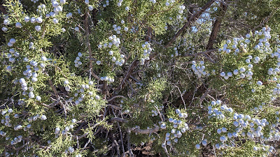 |
| Massive amounts of bright white Juniper berries. |
 |
| Two more miles of twisting dirt road. |
 |
| We joined SR97 for a short burst of speed, which was nice since it didn't have a shoulder to ride on. |
 |
| We peeled off on the less traveled dirt road before reaching US93. |
 |
| Believe it or not, but there was more good powerline riding!! Who would've thought? |
 |
| Another steep loose descent, Bridle Wash running alongside US93. |
It was getting late, we looked at our route going down Bridle Wash, it looked rideable from a distance, but then it curved back and we saw the insanely steep 4x4 road we'd have to hike-a-bike up. Nah. It's our route, we were all in agreement: hop the US93 barrier and sail down the paved shoulder. We'd rejoin our track about two or three miles later. It really was a no-brainer.
 |
| This was the easy way out after navigating over a short barbed wire fence. |
 |
| I'm sure we caught the attention of some drivers. |
 |
| Ticking off fast miles now. |
 |
| Back on route...almost. One more gate to hop. It may have been locked, but no signage saying 'Keep Out' or 'No Trespassing'. Onward. |
 |
| So this is where they keep those median crash barriers!! |
 |
| Back on the Santa Maria River, finding a way through to our next dirt road. |
 |
| Nope, not this way. |
 |
| Keep following the river. |
 |
| Found it!! A chunked up sideslope, but made short work getting out of the river valley. |
 |
| High above the Santa Maria River. |
 |
| The rubble gives way to a nice jeep road. |
 |
| Remnants of the Big Stick Mine. |
 |
| The last climb of the ride would follow along Black Canyon Wash. |
 |
| Look who's back? Joshua trees!! |
 |
| The late afternoon light was dazzling. |
 |
| Joshua trees getting more abundant. |
 |
| Have I mentioned how awesome it was to ride among Joshua trees? Well, it was. |
 |
| Tres Alamos on the far left, part of the Black Mountains. |
 |
| Don't be fooled, the spines of the Joshua tree are very sharp, similar to Agave. Don't get stabbed!! |
 |
| Climbing towards the saddle up ahead. |
 |
| Back in the sand!! Only for a short bit as we found the road continuing on the far left hill. |
 |
| What a specimen. |
 |
| Starting to top out. |
 |
| It was a very pleasant gradual climb the entire way, only that one short bit of sand. Photo by Robert. |
 |
| One more powerline road to bring us home. Looking like a nighttime finish. |
 |
| Last rays of day ignite the distant mountain. |
 |
| Powerlines following the curvature of the Earth. Yes, Earth is round. |
 |
| Nice to have access granted here. Photo by Mike. |
 |
| Swaying in the night. |
 |
| No moonlight finish tonight, break out the lights. |
We rolled back to the vehicles around 8:10p, it was getting chilly!! Had to break out the puffy jacket for the final miles of powerline riding.
Robert broke out the chili Fritos and brews were toasted. What an awesome ride. I think it far exceeded all our expectations. Cool terrain, great riding, lots of sights to see, wildlife and a bit of luck. Such a great crew to do this with.
The route posted in the Strava link is what we rode, but if you want a gpx track, use the RidewithGPS link to get an updated track without the bushwhacking down near the Big Sandy River.
Route:
Route flyover via Ayvri.com (Pan, zoom, control playback speed and see ride stats in the upper right. Fast forward through the camp locations.)
RidewithGPS Edited Route:


No comments:
Post a Comment