The Traveling Salesman was set to make another round through the Hawes trail system. The weather was perfect for this type of outing, all systems GO. My buddy, Mike, had sent a text a couple days prior asking if I had ride plans for Friday. Of course!! I told him of my plan: ride every trail at hawes plus the few new additions on the east side of Usery Pass Rd. He was game.
Mike did the dirty work of dropping two gallons of water on the opposite side of the network as this was going to take a full day to complete.
The big question or problem to solve was the routing. How do you ride every trail without doubling up constantly with all the potential loops, etc. It was a daunting task at first. I knew I wanted to get as many of the most difficult trails done early. With that in mind, our starting/finishing location was set. We'd stage from the Park-n-Ride lot under the Loop202 freeway. Using a GPS for this type of navigation is confusing at best since you're just following a line, but with so many intersections, you'd get tripped up and miss something. So, break out the old skool paper map, then color code the sections in the order we'd ride. I tried to keep the routing so we'd ride the preferred direction of the trail, no way we're going UP Sunset Ridge!!
Here's what I came up with:
 |
| Start in the lower left & follow the color legend top down in the upper right. |
As you can see there are a few short out-n-back segments and some tiny looping bits to cover it all. I had been asked a few times what the mileage would be and the elevation gain. I opted to go in blind as I thought knowing those details may derail us mentally. I had a guess though: 70 miles & about 10.000' of gain. That was largely based off my
Traveling Salesman 1.0 route I did a few years ago before all the new
Hawes Trail Alliance, HTA, trails were built.
We met around 5a and were rolling by 5:20a. It was rather breezy and cold for us desert dwellers hovering in the upper 30's and my resistance (Read: stubbornness) to ride only in fingerless gloves wasn't doing me any favors. We were barely two miles in by the giant Hawes trail map sign and I couldn't feel my fingers. That uncomfortable burning sensation set in while I paced about.
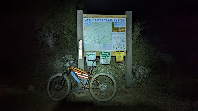 |
| Trying to regain feeling in my hands here. |
 |
| Our first of a few out-n-backs, OnB, during the ride. |
 |
| Daybreak by this picture perfect Saguaro. |
We made our first audible of the day as we reached Lower Gidro. There was a short section of the Hawes trail we'd need to do an OnB on, but I had us doing it a bit later in the ride. I thought it would be wise to just do it now so when we finish the tough Microwave Tower & Upper Hawes trails, we could simply head over the mountain. It only took a couple of minutes, then we could move on to Lower Gidro.
 |
| Methodically making our way UP Lower Gidro. Photo by Mike. |
 |
| There was a fair amount of hike-a-bike, but I eventually crested the top. Photo by Mike. |
 |
| Who doesn't love downhill hike-a-bike?? Photo by Mike. |
 |
| Approaching a field of boulders. Photo by Mike. |
 |
| Cool shot, but in full disclosure I stalled out here. Balked. Photo by Mike. |
 |
| Fantastic views of Red Mountain all the way down. Photo by Mike. |
It was now getting to be late in the afternoon and we still had three climbs up L'Alpe D'huez to hit Iron Goat, High Ridge & Red Mtn. Rush. We also had our water cache to attend. It was perfect timing too as we were both now running low. We used up both gallons, packed out the empty jugs and crushed some quick calories.
 |
| We both cleaned the first climb up Alpe, but it was a grind after nearly 12 hours. |
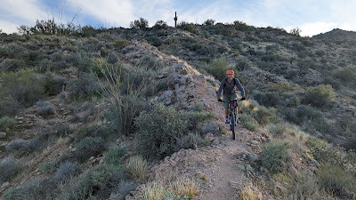 |
| Mike hits the Spine feature on Iron Goat. |
It took us a bit longer to get down Iron Goat than normal. Why? Well, there are three optional lines, we hit them all then backtracked up the mountain so we didn't skip anything!! And, we're dumb & stubborn like that.
 |
| The top of NRA #1, aka: Pure Ovaries. Such a fun trail, steep, but not too bad, plus jump options. |
 |
| We've been at it so long today most of the snow on Four Peaks had melted!! Ha! |
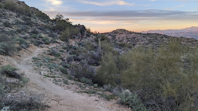 |
| Mike is hard to spot, but he's climbing up Cactus Nectar here. |
 |
| Golden hour taking hold. |
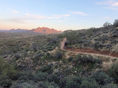 |
| Coming in hot on Cactus Nectar. Photo by Mike. |
 |
| Yowza!! What a view to the west from the top of Cactus Nectar. |
In hindsight, we should've simply done an OnB on Cactus Nectar, but I thought the heatmap showed a few rider tracks on NRA #4 and we had seen a faint trail earlier before riding Pure O.
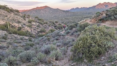 |
| See? There IS a trail going straight, that's Cactus Nectar up higher on the right. |
The trail disappeared shortly after the first few turns and was severely rutted. I guess the ride wasn't going to be complete without some desert bushwhacking. Check that box too. Somewhere in here my Garmin zeroed out all my data. Dang it. I knew it was saved, but I was kind of using it as cues. I rebooted the device and it was fine the rest of the ride. Maybe it's on its last legs, it is an old Edge705.
Daylight was fading fast as we climbed Lance's Trail back towards Alpe. We still needed to bag High Ridge before heading off the top of the mountain down Red Mtn. Rush, but as we approached the bottom of Alpe, I had a revelation. It's going to be dark enough that we'll need lights, we've already climbed Alpe, so why not just go UP High Ridge and be done with it? High Ridge is primarily a downhill trail, but at this time of day/evening, traffic is virtually nonexistent, plus, we'd see lights coming down well in advance. I proposed the idea to Mike when we reached the High Ridge exit and his face lit up, YES!! We got our lights setup and began up. The lower portion is rideable and isn't until the mid-section of the trail where things really kick up. Cue the hike-a-bike. We did see a light going up Alpe across the valley and wondered if the rider would be coming our way.
We topped out on the steep stuff and rode the upper portion. We did cross paths with the other rider, Dustin, who happened to know me and has been wanting to get out on a ride. He was heading back down to his car, but asked if he could tag along down Red Mtn. Rush. Sure, why not.
 |
| City lights as darkness settles in. |
 |
| Our third rider: Dustin. |
 |
| Big city views from the top of Red Mtn. Rush. |
Mike and I were feeling it as our GPS's were now showing over 10,000' of gain. We took it a bit easy going down Rush, but it was still a blast. We still had to knock out High Noon, Wild Horse and the Stinger Loop while on this side of the mountain. The riding was fairly quick and Dustin split off when we reached the east end of High Noon.
We then climbed up Twisted Sister for another lap down Mine trail for the final few trails on the front side of the mountain. The end was beginning to seem near as we approached 70 miles on the day. We had a couple more short OnB's to knock out then a few fun loops on Ridge & Mo Ridge.
 |
| The HAWES stumps. Now we can beeline outta here!! |
We both rejoiced a bit when our tires reached Fenceline trail as that was the final unique trail of the ride. It was quickly approaching midnight and I had thought for hours we'd get in before 12a. We reached the vehicles as 12:01a!! Total elapsed time of 18h 40m!! Stoopid fun!!
The reason for the difference in elevation gain is when my GPS zeroed out the data, it created two separate gpx tracks for the ride. I like having my rides in one complete file, so I had to manually merge the two which screwed up the auto-sync feature from Garmin Connect to Strava. The 11,359' was pulled directly off the GPS, while the 9,576' was calculated from Strava and is always low. *I learned a couple weeks later if I had saved my merged track as a .tcx file, it will still auto-sync to Strava from Garmin Connect unlike a .gpx file when doing a manual upload. I guess I'm a bit of a data geek when it comes to this stuff, but I find it interesting.
Anyway, Mike and I kicked back in the parking lot eating pickles, chips and toasting a cold one. I'm glad he remembered to bring camping chairs!!
I'm really glad Mike ended up joining me on this ride, it kept things fun all day especially as the day wore on. We both agreed we were glad we had no idea what the final mileage or climbing data was, that too kept our interest as things wound down.
Where will the Traveling Salesman end up next?? Hmmmm.
Route on Garmin Connect:








loco for sure! nice!
ReplyDelete