Thanks to Pinal County's Parks & Recreation Department, Gold Canyon has a new playground: Peralta Regional Park. It opened in early January and was advertising 8 miles of trail open to mountain bikes. I was curious to see how close the park & trails would be to the existing trails in Gold Canyon. One way to find out.
I had a Bikepacking 101 ride planned for later that day, but figured I had enough time to head over to Gold Canyon and ride all the new trails and connections before 1p. The only information I had about the trails was the online trail map, shown below, but it didn't have difficulty ratings or elevation data. I was essentially just winging it.
 |
| The goal was to ride all the trails & connections, not including the park roads. A Traveling Salesman route. |
 |
| Can't miss the park entrance. |
I staged off Peralta Rd. near the park entrance and rode in. I found the first trailhead sign, with a simple 'trail' designation. I would later find that's how all the trails were signed, so having a park map or
Trailforks is almost necessary. I immediately came to my first split, which way to go? Not knowing the layout it was a 50/50 gamble if I'd chosen correctly. I went left going clockwise around the Oro Vista Loop.
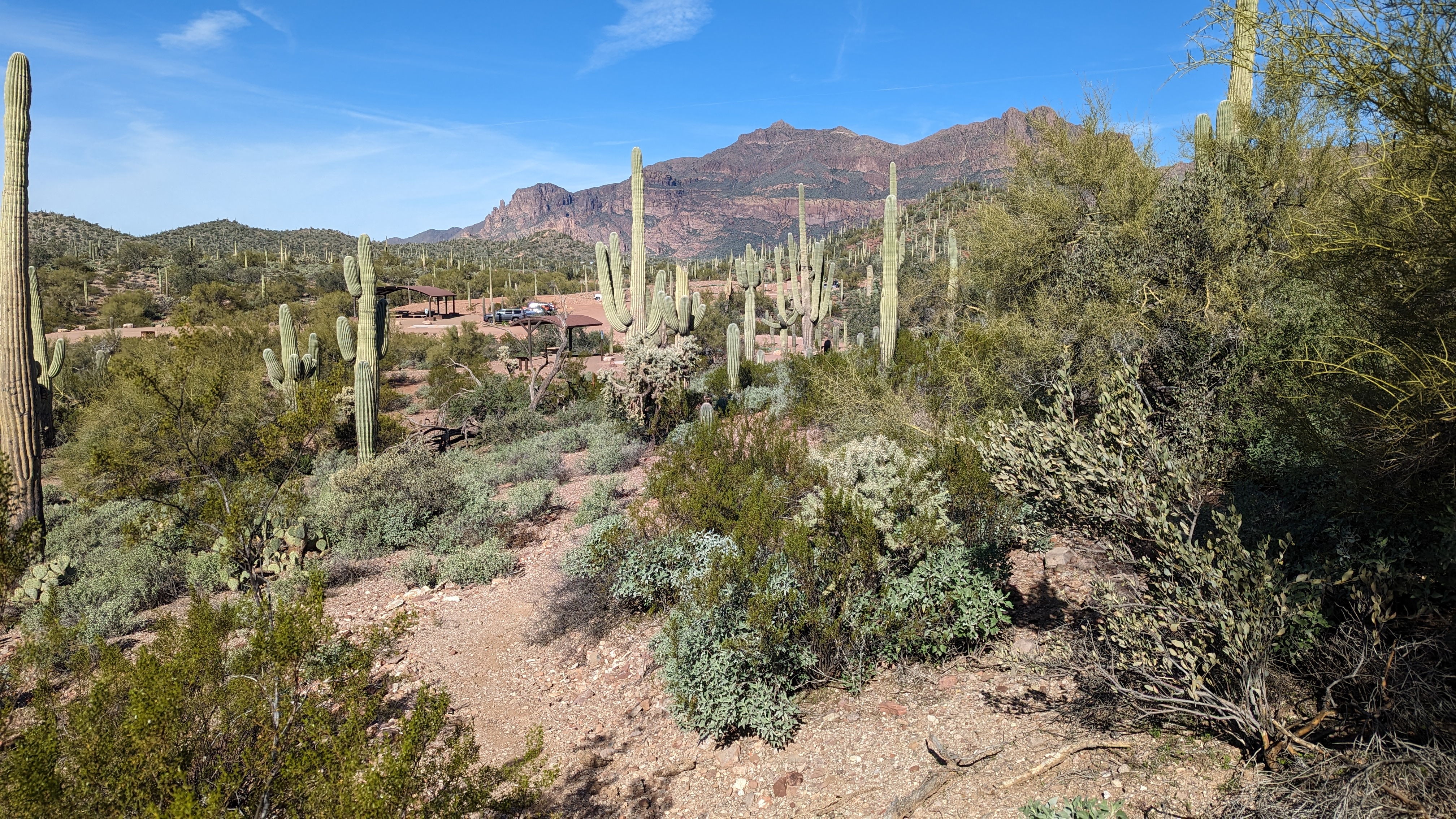
 |
| Rounding the corner a magnificent view of the Superstition Mtns. unfolds. |
 |
| Then the trail really kicks up. Oof. |
It was about this point when I wondered if I should've gone the other way!! In hindsight, yes. The steep section had some exposure, but wasn't too long. It's probably a fun descent.
 |
| Coming down the opposite side of the hill, I spotted a tiny Saguaro. |
 |
| There's a singletrack connection from the Oro Vista Loop to the Stargazing node. It leads here, a cool spot to stare at the heavens. A mellow gravel path leads out to the parking area. |
I made my way back to finish the Oro Vista Loop and then bisect it along the Wanderer Trail. It began with a steep, switchbacking climb but I was able to ride it out. The ensuing ridgeline was fantastic with panoramic views of the Superstition Mtns. I was having too much fun to stop for photos.
The connecting trail over to Saguaro Loop was steep and already showing signs of erosion. Not sure how it's going to hold up after a few big storms. Saguaro Loop had a bit of hike-a-bike to gain initial elevation, but was then very rideable going clockwise.
 |
| Saguaro Loop Trail. |
 |
| Two mines right off the trail, this fenced off one was slightly below the trail grade. The other was above. |
 |
| Making my way to the center of the park. |
 |
| Nice, flat interpretive trail. |
 |
| Finishing up the Serenity Loop. A mostly beginner loop with a couple short steeper bits in/out of washes. The distant knob would be the destination of the North Star Trail. |
 |
| Some water hanging around on the Desperado Loop, the main perimeter trail. |
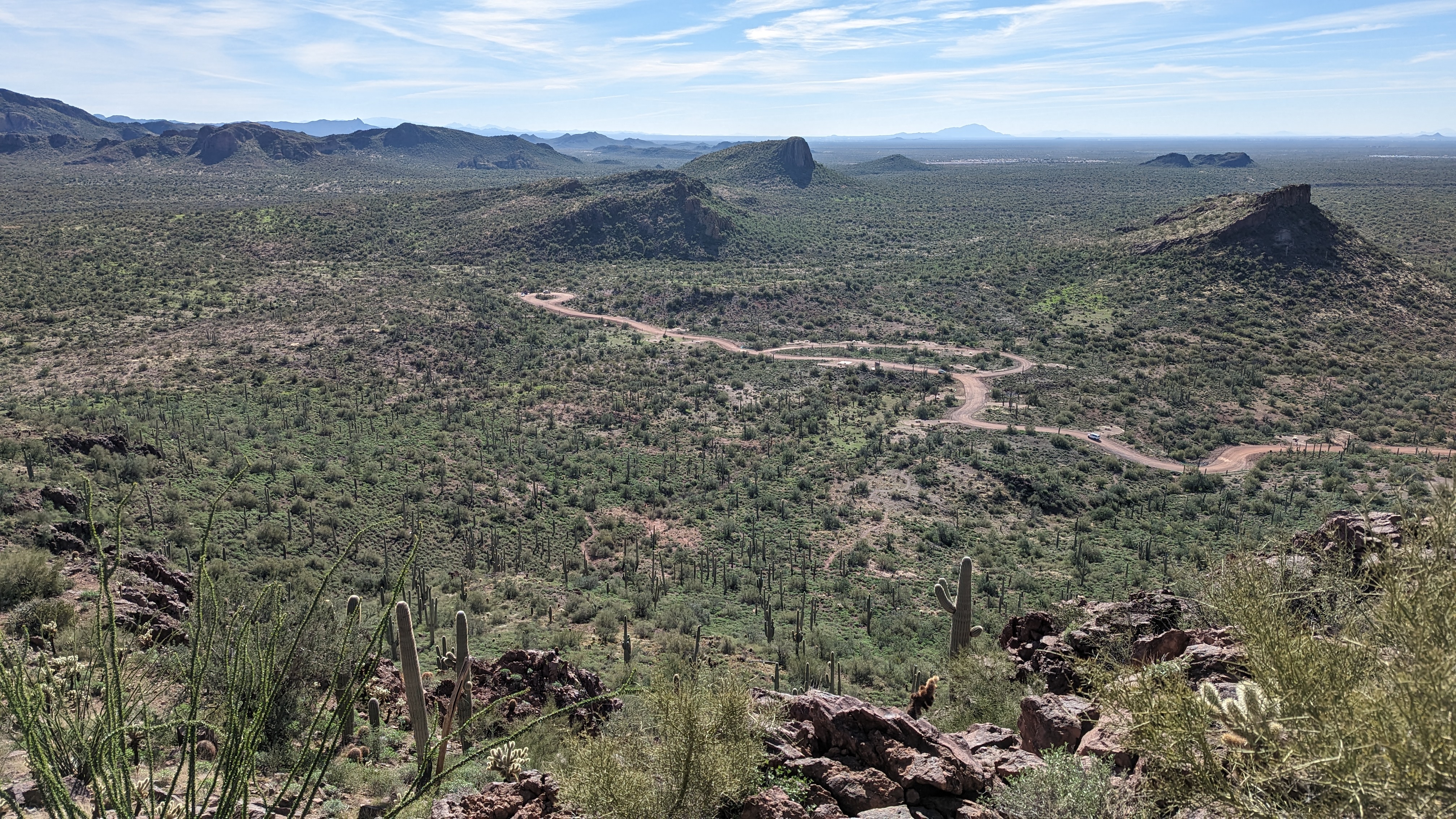
I stopped to chat with a trail runner. He gave me enough intel on the North Star Trail to know I should leave the bike behind when things got steep. Sure enough, the beginning of the trail was nice, but it was obvious when I needed to ditch the two wheels. I hiked, scrambled up to the overlook which provided a sweeping view of the entire park and beyond.
 |
| This trail gained elevation rapidly!! San Tan Mtns. in the distance on the left, Estrella Mtns. on the right. |
 |
| Looking more south. You can barely see Mt. Lemmon here, slightly left, faded dome on the horizon. |
 |
| Lush Ocotillo up top, carsonite marking the end of trail viewpoint. |
 |
| Close-up knob view. |
 |
| A little hard to see, but it's a rock throne to take in the views. |
 |
| Far east side of the Desperado Trail. |
On the south end of Desperado Trail, I did one loop using the camping access trails. They look like a great place to spend the night. I did a final out-n-back on the last camping trail, running into the Pinal County Open Space Director, Kent Taylor. I had met him a few years ago at an open space presentation. When I told him I was finishing up riding all the trails, he laughed and said 'tough trails, huh?' Yep. This is Pinal County, not Maricopa County Regional Park trails.
They were fun, but he was right, you definitely worked for the miles. The trails are generally rocky, not smooth flowy trails. That's not to say they don't have any flow, but you work for it. There were a couple of technical areas on both Saguaro Loop & Desperado Trail. Erosion is going to be an issue here methinks. It was already showing in a few areas. Hopefully it gets addressed before severe ruts take over.
As far as connectivity goes, the park entrance is very close to the east end of the Gold Canyon trail network, Outer Limits & Don't Fence Me In in particular. So it would be easy to add a Peralta Regional Park loop to a Gold Canyon spin.
It's a very scenic area and worth checking out. If rocky riding isn't your thing, consider a hike or a camp out. I know I'll be camping here in the future.
The Traveling Salesman did finish the route, but a little behind schedule and had to hurry to the Bikepacking 101 ride!!
Route:


No comments:
Post a Comment