Ever since
Chad and I tried a bikepacking loop up on the Mogollon Rim a few years ago, I've been wanting to give it another go. Recently, there's been a
bunch of trail work completed, most notably on the Highline trail. I had also become more familiar with the other trails in the area and put together what I hoped to be a stellar route.
A couple months ago I was down
riding Mt. Lemmon and got to talking with Shannon & Wendi about doing some bikepacking for their upcoming runs at the AZT300. We all cleared our schedules and made a mad dash for the pines before the calendar flipped to November.
I received a last minute tip about the Pine Canyon trail not being completely ready for primetime use. We were also starting our ride late on Friday afternoon and I opted to gain the rim in the shortest distance possible: Donahue trail. This would cut the Pine Canyon variation short by almost half, down to 4 miles and give us a chance to check out the newly minted Highline re-route eastbound from the Pine trailhead.
I arrived early after loading up on Alfonso's Mexican food in Payson, running into a buddy, Ken, who was also up in rim country for the weekend. Over at the Pine TH a local rider was getting set to hit the trails and came over to see what I was up to. I revealed our plans and he mentioned another new trail cutting over to the AZT or perhaps it is the AZT after a re-route? Either way, I wanted to check it out.
 |
| Tres amigos with three different setups: Wendi on a SS rigid, my hardtail & Shannon's full squish rig. |
I was finishing my setup when the girls arrived. A few tweaks to Wendi's brake levers and we were ready to go. Our goal for this afternoon/evening was to simply attain the rim, get the hard part out of the way. I think it was sometime around 4:30p when we left the Pine TH.
 |
| Warm glow of the enchanted forest. Photo by Shannon. |
 |
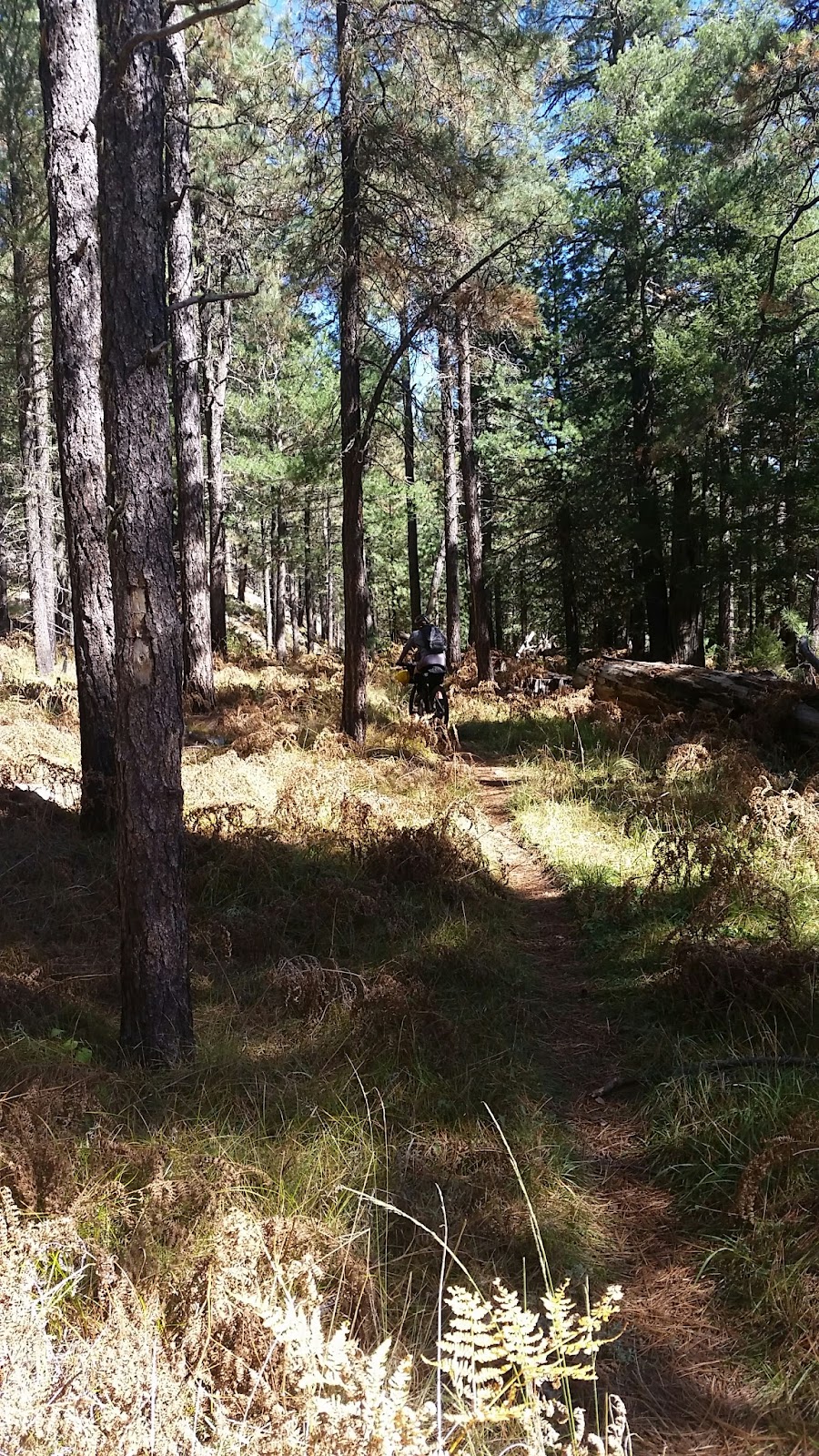
| We rode in from the right, the old Highline alignment is behind the downed log. Photo by Shannon. |
Right away the newly cut trail was fantastic as it switchbacked away from the parking lot to a flowy bit of singletrack. We quickly rejoined the old alignment through some trees.
 |
| Soft dirt on the new Highline reroute. |
 |
| Sunset came abruptly, but sure put on a show. |
 |
| We arrived at the Donahue trail as the light began to fade. Looks like things are about to get interesting!! |
I knew going in that the Donahue trail would be a HAB grunt up the rim. We didn't mind since it allowed us to crest the rim in less than 2 miles. What we didn't know was how steep some sections would be, the boulder hopping, 2-person bike lifts, bushwacking and general difficulty in route finding would be. Dare I say it is Mingus Mtn's little brother? Yeah, it was kinda like that. But we still had fun lugging our gear up the rim,. We managed to find a section or two that was rideable as well!!
 |
| HAB by moonlight. Photo by Wendi. |
 |
| Shannon utilizing her bushwacking skillz to get back on route after I wandered into a dead end. |
Soon enough the grade eased up and we were all riding!! The sight of a sign signaling Milk Ranch Point rd was met with exuberance. All we had to do now was figure out where we wanted to camp. A couple miles down the road we found a nice clearing loaded with pine needles...and pine cones. At least those are easy to move. It was around 8p and our big day was done, all 6 miles of it...and over 2k of climbing.
 |
| I lugged a variety of beverages, but figured this was the obvious choice to celebrate our HAB adventure. |
I was trying my bivy setup for the second time, but I really wanted to see how it handled in the colder weather. I also had my sleeping bag liner out for its inaugural use. I didn't sleep great, but not horrible either, mostly dozing on/off all night. I was mostly comfortable, but for some reason my feet were cold all night even with my
Goosefeet Gear booties. My hands or feet always seem to be cold.
We were all slow to get going the next morning. It was chilly and none of us slept all that well. I munched on a breakfast burrito while I debated whether or not to get up & get moving. I eventually finished breakfast and got going. We had to mess with Wendi's front gear strap routing for a bit to make all the cables happy, but we worked it out and got rolling.
 |
| Beautiful crisp autumn morning. Photo by Shannon. |
 |
| Milk Ranch rd campsite. |
We passed a large gathering of hunters receiving the morning briefing along Milk Ranch rd. A few miles later we arrived at the junction of FR300, the Rim rd. This is by far my favorite forest road in the state. Undulating terrain on well maintained dirt skirting the rim's edge most of the way.
 |
| Wendi arrives at FR300. |
 |
| Our first overlook stop. |
 |
| Short break at Kehl Campground. |
Our only real 'goal' for the day was to reach the general store at Woods Canyon Lake before closing, which according to their facebook page was 6pm through Oct. 31st. Shouldn't be an issue since most of the day was spent pedaling fast forest roads.
 |
| Another fantastic overlook, this is one of my favorites. |
 |
| This was Shannon & Wendi's first time riding in rim country, I think they're diggin' it. |
 |
| I see routing potential!! Photo by Shannon. |
 |
| We may have different ways to get here, but we're all enjoying the great outdoors. |
 |
| One of these days I'm going to attempt to follow the Gen. Crook trail as close as possible. It roughly parallels FR300. |
 |
| Rolling into the burn area. |
 |
| Interesting landscape of downed trees, yet a few survived. |
We met up with the Arizona Trail where it crests the rim. There are a series of trails here known as the Cabin Loops, linking a few historic cabins from the early 1900's. The first trail, Fred Haught, doubles as the AZT for 3 miles following a drainage that often has a little water in it.
 |
| We're a little over halfway up that sign. Photo by Shannon. |
 |
| General Springs cabin. |
 |
| Pro-switchback form! |
 |
| Lots of water along the Fred Haught trail. |
 |
| The ferns may have been dead & gone, but the forest singletrack was sublime. |
 |
| We're almost to our lunch break Wendi, I promise!! Photo by Wendi. |
 |
| Because everyone likes bikes leaning on signs pics. |
 |
| Pinchot cabin = lunch! |
 |
| Shannon taking on the rock bridge at Aspen Spring. |
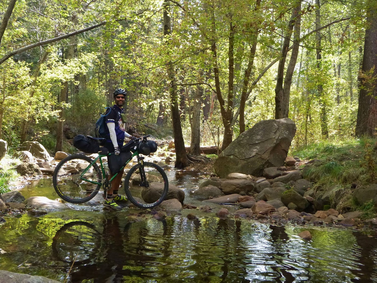
We topped off our bottles at Aspen Spring, but not after I found out my Sawyer squeeze bag had a huge hole in it just below the nozzle. That made things a bit more entertaining, but clean water was obtained. The girls took off up Houston Brothers trail while I packed things up at the spring. I was beginning to get a bit concerned about making the general store before 6p. It was a bit after 2p when I got rolling up Houston Brothers.
 |
| Not just a grassy meadow, but the trail goes to the right of the two trees at center. Look closely! |
We topped out on FR139A then down to FR139. I decided to skip the Barbershop trail due to time constraints as there are a couple of HAB sections, but otherwise it is a good trail. Soon we rejoined FR300 down on the rim, it was now 3p. We made a group decision that Shannon and I would ride ahead and try to reach the general store before closing. We had 3 hours to cover 30 miles of forest roads, could we do it? We were going to give it our best shot.
Of course we were almost immediately greeted with a couple of slow uphills. The road leveled and we took off.
 |
| We had to stop for one photo op along the way! |
We were now making really good time and I was beginning to like our chances. I still wanted to ride through the Carr Lake trails along with the General Crook trail. I knew they were fast and actually straight-lined our route more. Unfortunately in my haste after a bacon refueling I blew right by the turnoff continuing along FR300.
 |
| A gentle reminder that it does get cold up here. Photo by Wendi. |
 |
| Phenomenal views in rim country. |
The last several miles into Woods Canyon Lake went by incredibly fast as the road was either level or downhill. We knew we'd make the 6pm closing time now. We zoomed along the paved bike path down to the lake's edge, a few people were milling about and a bunch of cars were still in the lot. I rounded a pile of cut lumber in the entryway and stopped in disbelief. CLOSED. Apparently the fall hours change from 7a-6p to 8a-5:30p after Labor Day. It was 5:45p. We were crushed. It sure would have been nice to know ahead of time, but nothing was posted on their facebook page and their website was not functioning.
 |
| Noooo!! |
A few others showed up as well expecting the store to be open. Shannon and I put our disappointment aside and rode back up the hill to fill up on water. It was beginning to get dark and we needed to track Wendi down. As luck would have it, she overshot the turnoff and was on her way back just as we left the water station. Regrouped and topped off with water we needed to make camp on top of the rim once again so we could hit the store in the morning.
 |
| Gotta have choices when bikepacking. |
We found a nice spot off the paved path where dinner and beverages went down without a fight. It was going to be another chilly night, so we opted to sacrifice a little comfort in lieu of warmth. Yes, you can fit 3 people in a 2 person tent fairly easily with a good laugh!! I think we all slept a bit better than the previous night.
 |
| Fresh off a store run. |
The next morning was chilly, but not too bad. We headed back down to the store shortly after opening to load up for the days ride which would end up being almost 70 miles. A short spin on the General Crook trail brought us to the Military Sinkhole trail. This would be our drop off point to descend the rim. I was holding out a bit of hope that some work had been done since my last ride down. It wasn't. The trail was chunky most of the way, but not too bad. The only snafu was a broken spoke on Wendi's front wheel.
 |
| Ready to shred?? |
 |
| Dropping in. |
 |
| Lots of loose chunk, some bigger, some smaller. |
 |
| Wendi nearing the Two Sixty TH. |
I was a curious to see how my loaded rig was going to handle the upcoming sections of the Highline trail. I was feeling really good, weather was perfect and we had hero dirt to ride on.
I noticed right away that a little more trailwork had been done since my last ride a month earlier. The Highline is shaping up real nice now.
 |
| Every so often a view opens up. |
 |
| To quote Wendi, 'I can HAB for days'. |
 |
| Found a few splashes of color in a side canyon. |
 |
| The final approach after a wicked fun 2 mile descent. |
 |
| Crossing Christopher Creek. Photo by Wendi. |
 |
| First leg of the Highline complete. On to the Derrick trail split. |
The trail climbs a bevy of switchbacks leading out of See Canyon. I cleaned all of them except No. 3!! The loaded bike handles great on the tight turns. I've also been trying out an oval granny ring that my buddy, Josiah, made. That too has been really nice, I think it's a keeper.
 |
| Someone was glad to have the switchback section over with. |
 |
| Shannon's new nickname: Quads of Power!! |
 |
| Having fun yet? |
 |
| Probably my favorite shot from the weekend. |
 |
| Are we in Sedona? |
 |
| Layers upon layers of mountains. |
We had been making pretty good time so far, but I had a feeling we weren't going to make it up to Horton Spring before needing to eat lunch. This ended up working out really well, as I didn't realize there was a nice picnic/camping area down at the Horton TH. The upper half of Derrick trail was still really bumpy & loaded with rocks, but the lower section was great.
 |
| Final bit of the Derrick trail. |
 |
| Almost lunchtime!! |
 |
| Great place for a break, plus drinking water & restrooms are available. |
 |
| Horton Spring: 3.2 miles, not 4. This is important because it's all uphill!! |
After lunch I knew we had a bit of a grind to get up to Horton Spring. The first couple of miles are nice, then things get a bit steeper and rockier. I paid thanks to a local trailworker who was out clearing a section as I climbed away. Eventually, the trail won out and I was in HAB mode until the junction with the Highline. The girls followed suit a few minutes later.
 |
| The sign was a bit more accurate up here & the Highline over to Tonto Creek is really fun. |
 |
| Because everyone gets a HAB pic!! |
 |
| Horton Spring is quite a sight. |
We made quick work through the next section of Highline over to Tonto Creek by the fish hatchery. It was now late afternoon and we knew it would be a finish in the dark. At least the remaining 29 miles were on graded dirt road. My legs were still feeling great and I hoped we could at least knock out the 10 miles leading to the Control rd. before darkness fell.
 |
| Trail? What trail? |
 |
| End of the singletrack. |
We set a steady pace on the dirt roads, regrouped at the top of climbs and generally banged out the miles. Somehow I got ahead of the girls on the final downhill to the Control rd. I made it there just as it was getting dark, so I threw on my helmet light & got ready for the colder temps. They too had stopped a little farther up the road to change over. Darkness fell as we began the final 19 miles back to Pine.
 |
| Junction of Roberts Mesa & Control rds. Mile marker 19 visible on the left. |
 |
| Waning rays of light. |
The Control rd. rides really well, but there are a steady diet of uphills to remind your legs why they're there. It was funny to watch Wendi spin away on the SS at the bottom of a climb, then pop off into a brisk HAB to the crest of a climb. I wasn't riding much faster than she was walking!!
We kept at it and a few hours later arrived back at the Pine TH to our waiting cars. We did it! Our finish was a bit later than we would have liked, but that's how it goes sometimes. Overall, I was really pleased with how the route flowed. Next time I'll stick with the Barbershop & Carr Lake trails and hopefully a new more bike friendly trail will be around to gain the rim.
 |
| Shannon had the flash advantage, Wendi & I just look dopey. Photo by Shannon. |
Great route, great weather & great friends. That's what these little adventures are all about. Thanks for making the extra long drive north, perhaps a route down south is in order??
More pics:
Our route: