Is this the next ice skating tour? Newest drink at the local watering hole? Nah, it's the annual fund raiser for the
Arizona Trail held on the AZT southeast of Tucson, only this year the starting temps for the ride were somewhere around 22º! Brrrr. It's not that it doesn't get cold in AZ, it does. There's even downhill skiing here. We typically don't have to deal with frigid temps like that in the land of the cacti.
I knew I'd get a good opportunity to try out my new winter riding gloves, aka the lobster mitts. Seron had to pull the plug due to knee issues, so I made the trip south solo. I actually arrived early enough to park in lot #1 - shocker. The shuttle buses filled up and we were off to the drop point down on Box Canyon Rd. It would be a 39 mile point-to-point ride on some sweet AZT, at least when it's dry!!
 |
| Patches of snow at the start. |
Thankfully the sun was shining & the wind calm. There's about a mile of dirt road before the AZT turnoff, then the undulating climbing begins. People gathered their bikes quickly and took off, almost race-like, we were all eager to climb to get warm!
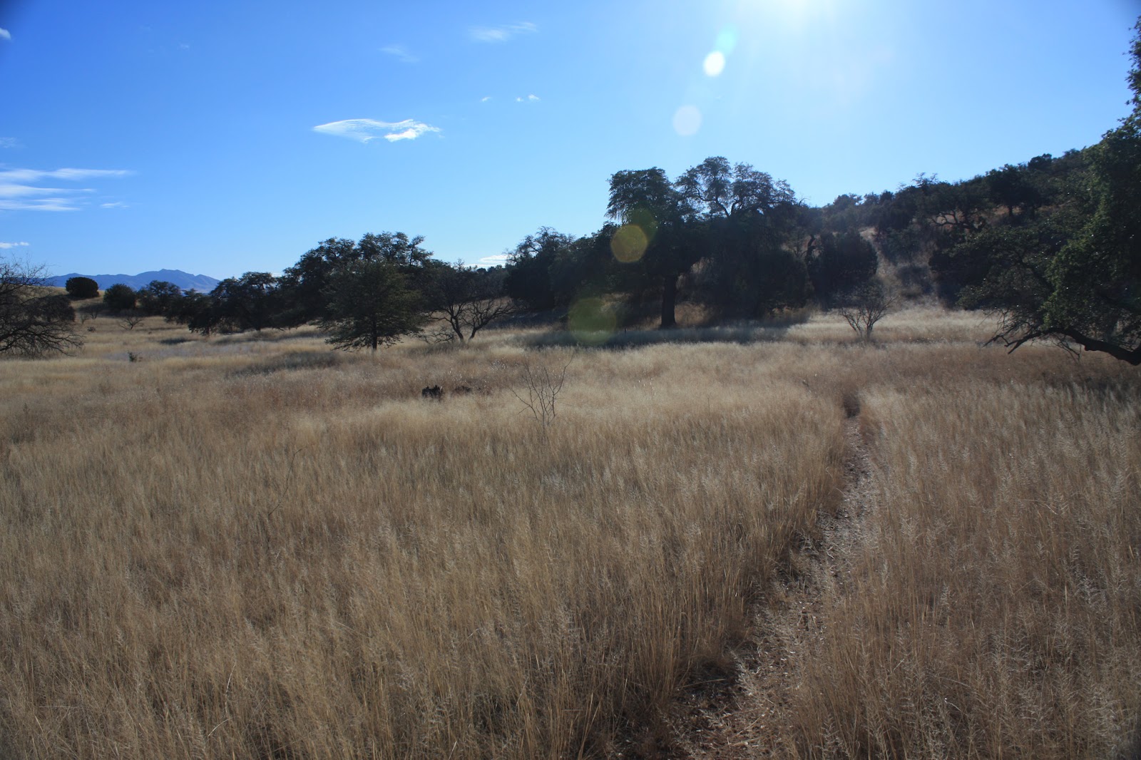
I had plenty of layers on, felt comfortable, all was good. The trail through this part of AZ is truly stunning.
 |
| One of two spots where I stopped for the sole purpose of taking a picture. |
 |
| Cutting through the grassland. |
Almost all of the north facing slopes in the shade had snow, albeit very thin, but it kept you aware. Last year Chris and I struggled through this section on the AZT300, I kept having flashbacks to the miserable riding conditions and all the hills I had to hike-a-bike. Thankfully, I was cruising along actually passing a few people here and there. One of the longer tougher climbs I was able to clean except for one quick stop to catch my breath.
 |
| The longest stretch of snowy trail on the day. |
The Santa Rita foothills give way to fast flowy singletrack near the 14 mile mark. From there it was a mad dash with another rider from Colorado to the aid station. I tried to keep up with her, but those CO lungs kept pulling away. I met up with her at a gate with a few miles remaining to the aid stop and started off ahead of her. I know she could have passed me just before reaching Sahuarita Rd, but we arrived for the mini-pizzas together.
 |
| One of the best parts of the day! Thanks SDMB! |
Hey, it's Jeff & Nancy hanging out at the aid station. Jeff gave me the impetus I needed: slam a beer, grab a mini-pizza and a few snacks before heading back out. I wouldn't see those two again until the end. I left the aid station solo, the CO rider split a few minutes before me & I figured I wouldn't catch her.
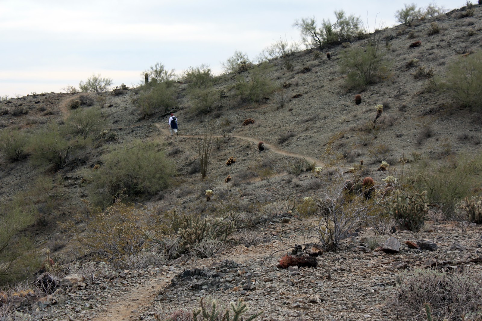
The trail down to I-10 is a hoot, followed by a nice piece overlooking a gorge. There's one sharp turn there I overshoot every time!! I was sure to take the high road at Three Bridges then back onto some twisting singletrack. Soon I starting seeing riders from the 10am shuttle and on one of the techy bits I caught up with Michelle, Tracy and Kathleen. I hung around at a goofy gate that was all knotted up with wire, helping a few riders get their bikes over when the CO rider came up from behind surprised to see me ahead of her!! 'Hey, how'd you get
there??', she asked. I returned the same question followed by a 'you must have gone down under Three Bridges, huh?' Sure enough. She was gone after that until the finish.
I heard a few of the 10am shuttlers mumbling about how they were not prepared for this kind of ride as they were HAB'ing up a short climb. The AZT will do that to people. I was cruising along, rose out of the saddle and my left quad just locked. Whoa, did that smart. I had to wait a minute or two before I could unclip, then just stood there for about 10 minutes waiting for it to release. I at least snapped a few pics.
 |
| Cramp pic #1. |
 |
| Cramp pic #2 with Mt. Lemmon in the background. |
Finally back riding, I only had about 4 miles to go and I was shooting for a sub 5:30 time, but that delay would cost me. The trail entered the land of the saguaro, flattened out and became really fast. I could see the cars at the parking area, but by the time I rolled in my time was 5:33 a little over a half-hour faster than last year. Funny thing is, my moving time from last year was faster, but this year I stopped a lot less.
 |
| J-Bake, Donna & Krista are trying to keep warm during the post-ride festivities. |
Another year, another successful
AZT Jamboree. If you find yourself in AZ in mid-January look this event up, I promise it won't be this cold next time!! A special thanks to
Chad &
Scott for helping to make this a reality.