The work schedule was altered slightly to allow for a four day weekend in Moab, UT to hopefully meet up with my ScampLife friends,
Scott &
Eszter. They've been known to hang out in slickrock country the past few fall seasons. But, as the dates grew near, Scott was lured to northern AZ for an AZT bikepack. I can't argue with that. My plans were still set on riding the rocks of Moab and I was able to lightly coax my buddy, Sam, into tagging along. It would be his first time there.
Last October was really my first time getting a full taste of what the area had to offer and now I'm thinking this should be an annual pilgrimage.
Sam and I left the traffic behind on Thursday afternoon and eventually rolled into Moab to secure a camp location some time after 1am local. The dispersed camping area north of town was fairly packed in, but we managed to find just enough room for my car, at least for a short night of sleep.
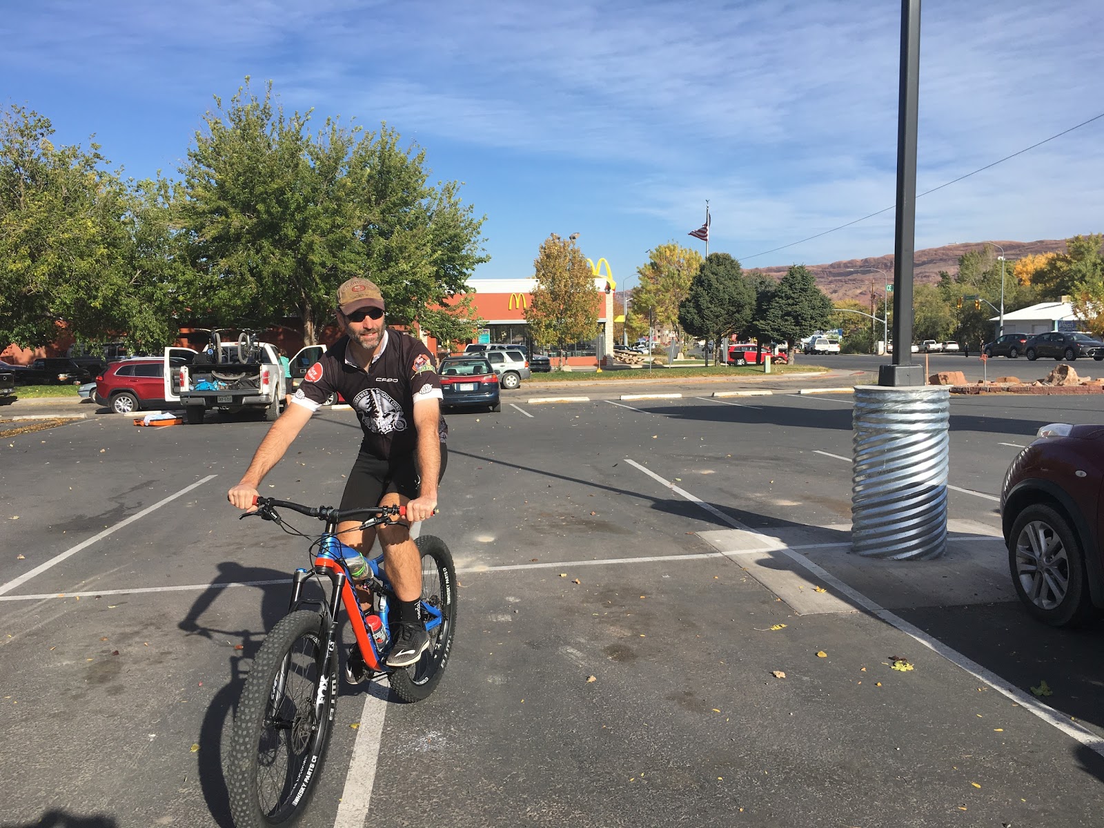
We took our time the next moring before heading over to pick up my rental bike at
Chile Pepper Bikes. This year I'd be playing on a Salsa Pony Rustler with 3.0 tires. Something completely different than what I'm used to. The forecast for Friday was wind, the 20+ mph variety. I figured a good bet would be to start with an all-time Moab classic: Slickrock Bike trail. I had never ridden the entire loop and it had been 18 years since I last put tires on any of it. The wind did stir up some desert dust and my nose wouldn't stop running all day, such a PITA.
 |
| The rental sled for 4 days. Photo by Sam. (SG) |
 |
| It felt good to be back in this parking lot after all these years. |
 |
| Sam getting his first taste of premium grade A slickrock. |
 |
| For the most part, white dots mark the mountain bike route & black rubber indicates the 4x4 path. |
 |
| Grinding the big rig up a steep grade. The weight was very noticeable to me, somewhere around 8-9 lbs heavier than my Ti hardtail. SG |
 |
| Bombs away!! |
 |
| There were a few pitches that were a bit too hectic. Here, some random rider assumes the position. SG |
 |
| Soaking up the scene. SG |
 |
| It seems like most of the trails in Moab lead to a sheer cliff. Slickrock is no exception. |
 |
| A couple of riders framed by the La Sal Mtns. |
 |
| If it says STOP, you better listen. |
We took a short break at the overlook, marveling at the surrounding area and views of the Colorado River. On our way back to the main loop there was a short, but steep roller just beyond the junction. Sam hit it flawlessly. We were only a few miles into our first ride of the weekend and perhaps I was still trying to find my comfort zone on the Pony. I may have forgotten to drop the seat and as soon as I began rolling I could tell my weight was too far forward. I think I compounded the issue by staying on the brakes too long. As I neared the bottom I fixated on a small lump of slickrock directly in my line of travel. This was the fatal flaw. I knew if I hit it, I'd go over the bars. When my front wheel got close I attempted to lift it over the hump, but with my weight forward and the extra front end mass of the bike nothing happened. Well, something happened. I went over the bars...more like the bars simply fell out of my hands. I recall seeing the solid rock of terra firma rapidly approaching my face. Somehow I was spared a full faceplant into the slickrock. My elbows hit first, then the bike landed on me. Oof. WTH.
I was a bit stunned as I lay under the Pony kissing the rock. A quick system check and I came out unscathed for the most part. Some small cuts / scrapes on my elbows & knees...and a cracked sub-layer on my GPS!! Gah! And a busted GPS mount. Darn it. While i checked over the bike, my elbows began to throb and tighten up. Ruh-roh. I began pacing to ease the discomfort, but it wasn't doing much. I was afraid I'd have to head back to the car. I kept pacing and 15 minutes later the throbbing subsided and I felt fine. It was a close call and I promised to not leave my elbow pads in the car for the next ride!!
 |
| Sam in power mode. |
 |
| Slickrock switchbacks. SG |
 |
| Parked on a wave of rock. SG |
 |
| Do these tires make my butt look big? SG |
 |
| Another Colorado River viewpoint. |
 |
| There were a few pools & pockets of water along the way. |
 |
| One thing about the Slickrock trail, you're either going up or going down. No flat riding here. |
 |
| Moto playground too. |
 |
| The trail is well marked all the way. |
 |
| Sam grinding out one final push. |
 |
| Back to the sea of humanity at the trailhead. |
Flyover
Route:
The wind wasn't much of an issue, too many dips kept things mostly sheltered. It turned out to be a really nice day for a ride. We were ready for lunch and I had spotted a local gem on the way to the trailhead: Milt's!!
 |
| Excellent choice!! |
After Milt's we went on a hunt for a replacement for my busted GPS mount. It took three stops, but we tracked one down. The afternoon was growing long, but I was ready for another ride. I think Sam was a bit apprehensive at the notion, but he agreed to head out.
The wind was still kicking and I thought another good ride would be the now famous HyMasa / Capt. Ahab loop. Wind shouldn't be an issue there. It wasn't.
The trailhead was bustling, but most of the riders had wrapped up their rides and were leaving.
 |
| Obligatory sign pic. |
 |
| Surrounded by giants. |
 |
| A short break from the climbing on HyMasa. |
 |
| Late rays overlooking the Colorado River from Capt. Ahab. |
 |
| Blue dots mark the way on Ahab. |
 |
| A brief show of sunlight. SG |
Flyover
Route:
Route:
We grabbed some lunch while there, then made our way over to Navajo Rocks for an afternoon spin.
 |
| Look!! More slickrock!! |
 |
| Pony crawler. SG |
 |
| A few riders make their way across a fun, off-camber bit of trail. |
 |
| UT313 cutting a line through the desert. |
 |
| These dudes know how to pack!! |
Flyover
Route:
 |
| We wrapped up the ride, enjoyed a cold one while watching the rocks morph into a fiery display. |
We rolled into town only to find out the showers we were going to use closed earlier today than y'day!! Dammit. There were still employees hanging out and one fella pointed us towards Canyonlands Campground, behind Texaco on the south end of town. Come to find out, they have untimed public showers available until 9pm!! Score.
We got cleaned up and found ourselves at the most unusual Mexican restaurant, El Charro Loco. The place was jam packed, almost to the point of a fire hazard. People were standing all around, but we kept hearing how great the food was. It appeared there were maybe 5 employees handling the 25 tables or so, and the chekcout, and perhaps cooking too, who knows. It took almost 30 minutes just to get our name on the sign in list!! We were minutes from bailing, but finally got seated. From that moment on, it was mostly normal service and yes, the food was amazing!! I'd definitely go back, just maybe not of a Saturday night!!
 |
| Early rise on Sunday for our 8am shuttle run down The Whole Enchilada. |
We had seen a dusting of snow up on the La Sals in the days prior, but assumed we'd still be getting dropped at Burro Pass. We ended up starting at the Hazard Co. trailhead due to reports of ice on the road & trail. That was ok as I wanted to add in the longer Jimmy Keen singletrack section anyway.
 |
| A bit of the white stuff up high. |
 |
| The ride gets the blood pumping early with a climb out of the trailhead. |
 |
| Hazard Co. gives you a small taste of the aspens. |
 |
| Things open up and the downhill begins. Rocky, flow trail style. |
 |
| We took turns caving some arcs. |
 |
| Lean into it!! SG |
 |
| This year, I stopped a couple times on my way down to give my hands a break. We opted to skip the Kokopelli fire road in favor of singletrack. |
 |
| The Jimmy Keen singletrack section was pure XC fun. |
 |
| I'm guessing this yurt is available for rent. |
 |
| The trail had good flow overall and a couple of nicely graded climbs. |
 |
| Sam bobbing & weaving through the cattle. |
 |
| Snack break as we rejoined the Whole Enchilada route. SG |
 |
| From alpine to desert in a few hours. |
 |
| Token Castle Valley & bike shot. |
 |
| One of the many features on the Upper Porcupine Singletrack, UPS. |
 |
| Freeride play time. |
 |
| Tucking for the steep roller. |
 |
| Postcard shot. |
 |
| Such a fun trail, plenty of rock features to keep your attention. |
 |
| We watched one fella ride down the Snotch, all others walked down. |
 |
| I wanted to see how gnarly the Notch was, so we went that direction. |
 |
| We saw a couple guys start down, then balk. We opted to walk down as well. |
 |
| Way above my pay grade. |
 |
| The Notch also requires a 90º right-hand turn to exit. |
 |
| I kept the fat tires on terra firma. SG. |
 |
| Sam landing a ledge drop. |
 |
| A long series of undulating jeep roads eventually bring you to the Porcupine Rim singletrack. |
 |
| Another old school legendary Moab trail. |
 |
| My perch for the next photo... SG |
 |
| Colorado River opens up below. |
 |
| There were a few tricky spots along the way, but the finish line is now in sight. |
 |
| 6800' of descending led us here. |
Flyover
Route:
We knocked out the final few flat miles back into town and made a beeline for Moab Brewery. Another stop at Canyonlands Campground to grab a shower and we were actually back out to our camp location before dark for a change.
 |
| Not a bad place to watch the stars come out. |
Our final day was upon us. We opted to keep it close by and relatively simple. The Klonzo trails were in the same area we were camped so it was an obvious choice. We plotted a quick route that incorporated the Sovereign trail, a popular one I had heard about.
 |
| Ride #6 on day 4 gets underway. |
 |
| It was nice to climb on a few miles of smooth XC type of trail. |
 |
| Even the slickrock areas were fairly smooth. |
 |
| Signage in the Klonzo system was superb. SG |
 |
| Sam drops into Gravitron, Moab's version of K-trail in Gold Canyon. |
We exited Gravitron to wrap around to Sovereign trail, but I think we both would've been content to stay on Gravitron. We made a short, but steep, wrong turn up a loose jeep road before realizing our mistake. Bonus climbing!!
 |
| Sea green hues dominate this feature. |
 |
| We made it to the trail, it was anything but easy. SG |
 |
| We weren't expecting this level of HAB. |
 |
| Topping out on the HAB. SG |
 |
| From here, it was mostly downhill on mixed slickrock & dirt trail. SG |
 |
| Not drone footage. The trail cut back under a cliff edge for near vertical viewing. |
 |
| A couple fun miles back to the car. |
We passed a few riders who were climbing up our exit route. I'm glad we rode Sovereign in the direction we chose. Overall, it was decent, but next time I'd just stay on the Klonzo trails.
Route:
I dropped off the bike, then we grabbed some quesadillas from a food truck downtown before hitting the road.
 |
| Mexican Hat rock is a popular sight along the way. |
Another Moab trip successfully in the books. Thanks for coming along, Sam. It was great to ride and hang out for a few days. Perhaps I'll try again in the spring to track down Scott & Eszter. It's easy to see why they keep coming back.


