The Queen's Ransom bikepacking route turned 10 this year. It's actually the 11th year, but it was cancelled in 2021 due to some sickness floating around. Being the 10th Edition I wanted to do something special for those who came out.
I reached out to one of my best friends and super talented graphic designers, Shannon. I had an idea for a 10 year logo and she perfected my vision.
Adding the stars was a nice touch!!
As you can see below, it pulls a few key elements from the main logo, which she also designed a few years ago:
This colorful one looks so good as a patch.
I also wanted the base logo as a grayscale 10th edition, so we came up with this tweak:
This is quite fitting since a lot of riders arrive at camp in the dark!!
The logos were set for the stickers and I sent off the round 10th Edition logo for a one-time patch run from Stadri Emblems.
Fantastic detail on a 2 1/2" patch.
I then reached out to Jeff at Okluma to see if he'd do a Ti stem cap run. He agreed with the timeframe I was working with and knocked it out of the park.
The detail is amazing. This immediately went on my bike.
I uploaded the images to my Zazzle account to have pint glasses made for whoever wanted one. I bought one right away to check the quality out and I've yet to be disappointed with anything purchased there. It's such a great way to get some unique one-off design things made for a really affordable price.
The final offering would take a little more coordination. Hand crafted pottery coffee mugs. I reached out to Katie Anderson of Hello Fern Creations in Leadville, CO. Seems a bit random, no? Not so fast. Katie is the first woman to finish the AZT800!! She did an ITT in the spring of 2021. Rad, huh? Yep.
Based on her production time we devised a plan to give her a head start on making the mugs as I could tell they were going to be popular. She made a stamp from Shannon's logo, added some ride stats and went to work making slightly different sizes and colors.
I was blown away when they arrived.
I had a tough choice for myself!!
Which color do I want?? I finally opted for red.
I couldn't wait to hand all this stuff out to the riders. Stoke was high as registration opened. The ride filled in about 10 minutes. I had a handful of folks on a wait-list, but wanted to see just how many I'd end up with. If it wasn't too crazy, I'd let everyone in. After a few days of no more registrants, the count was at 39. I made the call to let everyone join, knowing the camp locations may be a little tight, but they do have room to spread out a bit if needed.
The weeks leading up to the ride saw our area get pounded with a couple of strong winter storms dumping rain across the desert and feet of snow in the high country along with damaging wind. I was so thankful we weren't out riding on a few of those days. It would have been absolutely brutal conditions.
The 10-day forecast began to come into view. Another small system was slated to move through the area on Wednesday before the depart. That's right about perfect as it cleans out the air, tamps down the dust and possibly provides us with more water sources in typically dry areas. In hindsight, we sure didn't have to worry about that!!
There's been a sickness floating around and it wasn't all COVID. I had quite a few folks become under the weather or hadn't fully recovered from whatever ailment they had. The day before the ride it looked more like the 2022 edition, just under 30 riders.
My wife and I offered up our house this year for anyone coming in from afar to spend the night before or after the ride. It really helps with logistics and storing bike boxes. Now that the route is publicly available on Bikepacking.com, more folks from out of state & country are attending, which is super cool. I had eight people take me up on the offer. Joe, Dave & Sean were first to arrive on Thursday and we scooted over to the BruCo Taproom for lunch. As the others trickled in, we planned to head over to the Creekside Taco Shack for a pre-ride meet & greet of sorts. Thomas, from Switzerland, joined us after convincing us he was going over to Circle K to grab a bit of unleaded gasoline for his stove. It worked just fine BTW. Ben, from Show Low, AZ and Ronald, a local from Gilbert and Adam, who drove in from Louisiana, rounded out the taco crew. Emily & Brie from SoCal met us at the house a bit later.
Loaded bikes and garage.
We actually crashed out at a reasonable hour in anticipation of the big day ahead.
Day 1: Queen Creek to Gold Canyon
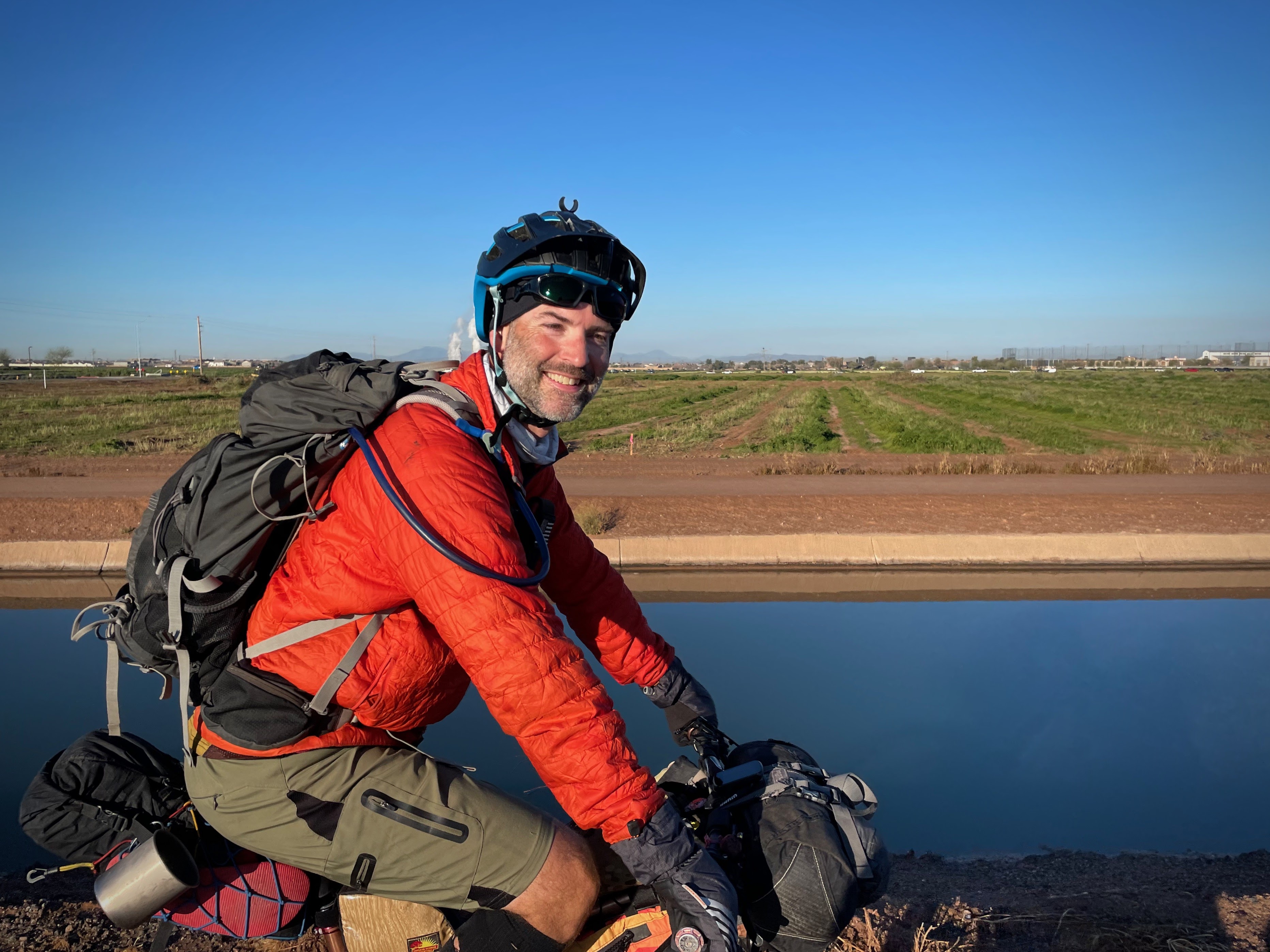
Riders began arriving shortly after 6a for the 7a depart. I was very happy to see a few get dropped off and others carpool. It helps keep the HOA off my back and the surrounding neighbors happy. As with a large group there's always something to do last minute as I felt I was scrambling a bit as 7a approached. We were only a few minutes behind schedule for the group pic.
26 ready to roll out!! *One fella is almost hidden on the far left and thanks to Stephen, a day rider taking the photo.
Large turnout from the ladies this year!! Plus two more who joined for part of the ride. The Town Bicycle did a great Q&A with a few of them.
We rolled out from the house around 7:15 weaving through some pathways out to a busy Queen Creek Rd. during rush hour. We quickly made our way into the Power Ranch greenbelt and were almost simultaneously yelled at by some older guy. Get off my lawn!! Hope our 30 second interaction with him didn't ruin his entire weekend.
I had Jeff stop the group so I could ride ahead and get an overhead photo as the group rode under Germann Rd. It worked out well:
Jeff leads them out.
Long string of riders!!
Party at the back.
Bikepacker silhouettes. Photo by Ben.
Almost as soon as we reached the canals the mud began. It wasn't horrible, but you had to pay attention to avoid the bad stuff. It just felt a bit slow overall, definitely could've been worse. Since I had stopped for the overhead photo, I had drifted to the back of the pack of riders. The first few miles of canal require you to switch from side to side to avoid fences, etc. Since I wasn't leading, a bunch of riders missed the switch to the east side after Ray Rd. and were forced to retreat while we waved as we rode by.
Riders on the correct side of the canal!! Photo by Justin.
I was taking no chances with cold hands as it was hovering in the upper 30's at the start . Photo by Ben.
Making it through one of the tricky sections along the canal. Not sure why there's not a gate. Photo by Ben.
Justin & Adam on the long canal segment as we head north.
First stop. Good for a quick snack and to shed some layers as we're about 20 miles into the day. Photo by Carrie.
Anna getting some skills practice in at Desert Trails Park.
Roll call!! Last year I decided to get everyone's photo with their bike here, it turned out well, so here's another round:
Chase. (From Flagstaff and the current AZT800 women's record holder!!)
Brie. (Yep, SoCal. She also finished both the Stagecoach 400 & Tour Divide last year!!)
Carrie. (SoCal!! Also met her at the AZTR start last year.)
Greg.
We did a quick lap around the bike park, then a bit more pavement before finally reaching the trails at Hawes. It was shaping up to be a really nice day outside and the trails seemed to have dried out a bit since the Wednesday storm.
Cool canopy of Mesquite trees along the Fenceline trail as we enter Hawes proper.
David popping through the tunnel.
We only had a few miles until our next stop, John & Jennifer's garage of goodness. They've been hosting QR riders for a few years now and while it's a fantastic stop, I have to warn people to not get sucked into the downtime!! It's a long first day.
It's a bike gathering.
So many choices. Photo by Carrie.
Take a load off...
...dance around a bit!!
The gracious hosts: Jennifer & John. Thank you!!
Let's ride some trails!! Emily droping in to Magic Mountain.
Dave, ready for some Hawes action. Photo by Joe.
We rounded a corner and found a few guys messing with Sean's tire. He gashed it pretty good. The guys did their best, but in the end opted to head to the nearest bike shop for a new tire and rejoin the route farther down the line.
Justin's a pro at this, so he jumped right in. Photo by Mike.
Getting it done. Photo by Mike.
The guys were well on their way to getting the tire fixed enough, so we rolled on. There's a tricky corner right afterwards, I rolled the drop fine, but as I turned into the hard right, I clipped my handlebars on a large boulder. I went OTB, bouncing off the top of my head down a narrow chute on the trail. Kelly was right behind me and saw my legs go flying!! Thankfully, I only had a couple of minor scrapes, everything else was a-ok.
I tumbled pretty good, even made it around the corner!! Photo by Kelly.
Hawes trail signage. Photo by Carrie.
Back on my bike, we made our way over to Secret trail and like clockwork, I began to feel the effects of the hilly terrain at Hawes. It always takes me a while to adjust to the loaded bike. Toss in some good early climbs and I'm whooped. I always remind myself, it'll get easier, just keep moving. I caught up to a resting Chase at the high point of Secret. Then we blasted off through the rollercoaster downhill, so much fun!!
Chase ripping through this section.
The poppies were opening up in the sunlight.
Is Shelly ever not smiling?? A: No. Photo by Carrie.
Tanya looks pretty stoked on the short hike-a-bike. Photo by Carrie.
That is one ginormous Saguaro. Photo by Carrie.
Thomas takes flight on Twisted Sister trail.
Four Peaks shrouded in snow from Wednesday's storm.
Classic 'Wish you were here' capture from Hawes. Red Mountain, Saguaro & singletrack.
Kelly heading out on Wild Horse trail.
Dave nearing the end of the Hawes section. Photo by Joe.
Oh no!! More tire woes. This time it's Ronald putting in a tire plug. Photo by Carrie.
Bumped into a longtime friend, Sharon, on the Usery trails. We met back in 2013 during the AZT300 when she used to live in Alaska. We leapfrogged a few times that year, both finishing.
Sharon also knew the ladies from SoCal!! Photo by Carrie.
Emily rides by Pass Mtn. and it's infamous rock band.
The dreaded Cholla. Don't get too close. Photo by Ben.
Cool Tonto Nat'l Forest sign.
Visual flight rules apply: <Phoenix that way.
Joe & Dave weaving through the Usery trails. Photo by Sean.
Adam taking a break in Usery Mtn. Park. Photo by Mike.
SoCal crew cruising towards the snowy Superstition Mtns. Photo by Carrie.
The miles go by quickly at Usery Mtn. Park. A short bit of pavement leads to a trailhead where the following trail connects over to the Goldfield Mtns. The Goldlink trail has its good sections and it's hike-a-bike sections. It's work, but the views are fantastic and it's the only true singletrack trail connecting to the Goldfield Mtns.
Unfortunately for me, my left quad decided today was the day it was going to cramp intermittently. Great. I could feel it coming on, so I soft pedaled for a bit, took a few short breaks and hoped it wouldn't lock up. So far so good. I felt I had been hydrating well and keeping up on calories, but every once in a while the cramps strike. I downed some SaltStick capsules and hoped for the best.
Making my way up the first climb on Goldlink trail.
Jeff & Nancy begin the freshly re-routed downhill on Goldlink, which is now 100% rideable!! Photo by Mike.
One of the new banked switchbacks.
New tread on the left, old crap on the right.
Some interesting buildings here and that house on the left sure gets the views!! This area begins the second, tougher climb on the Goldlink trail.
I was settling into the second climb when the quad cramp hit me again. This time stopping me in my tracks for a few minutes. Dang it!! So frustrating. It's a long tough day when everything is going well. I figured these delays would pretty much guarantee a nighttime arrival to camp 1.
Nancy & Jeff cresting the climb. Photo by Mike.
Jeff is very happy to be done with that climb. Photo by Mike.
Superstition Mtns. panorama. So cool to see the snow lingering around, it typically doesn't last this long. Photo by Danny.
Chase reaches the top. Photo by Mike.
Adam joins the party too. Photo by Mike.
A little while after everyone else passed through, I made it up as well.
Some neat rock formations as the route enters the Goldfield Mtns.
I saw a rider approaching, it was Adam. He asked if I had seen a cell phone on the ground. Nope. He had taken a spill a ways back and was certain that's where he dropped it. Too bad it meant he had to go back up & over the previous climb to look for it. I told him to focus on finding it, then shortcut the route a bit due to time. I did receive a text from him a bit later saying he found the phone!! Thank goodness. He ended up riding the Goldlink trail three times!! I also don't think he skipped any of the route as we saw his tracker barely halfway through the Jacob Crosscut trail in darkness!! Yikes, that's tough enough during the day.
New outdoor Sunday service area?? Saw some folks gathering for a wedding there as I rode by.
Some sandy singletrack before reaching the dirt roads in the Goldfield Mtns. Photo by Thomas.
Late afternoon in the Goldfields is simply magnificent.
I continued to battle quad cramps all through the Goldfield Mtns. I was able to pedal, but had to really lay off any big bursts of power. Just keep moving.
Lichen everywhere out here.
Superstition Mtns. getting a bit closer.
Yes it is. Always. Photo by Mike.
I had to add this sand trap bypass to an overrun squatter camp. At least it's fairly short.
The Apache Trail, AZ88, crossing. Photo by Mike.
Wormhole to a Sedona Vortex??
Kelly on the dirt sidewalk before the Jacob Crosscut trail. Photo by Justin.
Let the fun begin!! Photo by Mike.
Deer in the desert!! Neat. Photo by Mike.
The first couple of miles start out innocently enough.
To the snow!! Ok, maybe not. Photo by Carrie.
Someone is excited to ride the Jacob Crosscut trail!! Photo by Carrie.
The trail tightens as you leave the confines of Lost Dutchman State Park.
I was finally settling into a good pace again, the quad had finally settled down. Just in time for the technical gauntlet of the Jacob Crosscut trail.
Nancy getting into the chunkier area. Photo by Jeff.
Looks like Ben is smiling to me. Photo by Jeff.
I somehow caught up to Mike, only because he was messing with his pedal and shifting. The pedal was a concern. He tried contacting some mobile bike services, but with no luck. I had a few friends who live in Gold Canyon, I'd reach out to Roy when we got a bit closer as he lived right next to the shopping center.
Somewhere in this section of trail, Kelly spotted a couple of Bighorn Sheep!! What a cool sighting, I was bummed we didn't see any.
Silly Mtn. and the Gold Canyon shopping center straight ahead. Let's go bounce off some rocks first. Photo by Mike.
Mike riding into a golden hour postcard under the Flat Iron.
My turn for the postcard. Photo by Mike.
Mike making quick work of this climb.
That wooden sign marks the beginning of a half mile of downhill babyhead surfing. Photo by Justin.
Total chunderfest!!
I mentioned to Mike that I was never so happy to reach a shitty descent!!
The rocks are shifting my handlebar load!! Photo by Mike.
I was ready to get to the shopping center in Gold Canyon. I wanted to grab a quick bite to eat knowing that Kris and Duane would have tacos & beer waiting for the group at camp 1. Is this luxury bikepacking??
The sunset view made up for the crappy descent.
Done with Jacob Crosscut and the rocks...for now.
Fun, fast horse trails in some Apache Junction open space. Photo by Thomas. (Notice how high the sun is here, Thomas was quite a bit ahead of most of us)
Typical Sonoran Desert sunset. Photo by Thomas.
Mike and I reached the shopping center around 7:30p in the dark. There were a bunch of other riders still milling about, some getting ready for shopping, others grabbing a bite to eat. I opted for a quick 6" Subway tuna sandwich to get me to camp.
I reached out to Roy to see if he could assist Mike with his pedal, it had fallen off once so far. Roy was home and came over to the shopping center. He and Mike headed back to his house to see what could be done.
Mike's shiny pedal bushing. Photo by Mike.
Mike & Roy. The pedal was fixed, Roy earned some quality trail karma for his efforts and Mike rides on!!
Final stretch into camp 1. Photo by Danny.
I left the shopping center with Joe, Dave & Sean after they rejoined the route, getting Sean a new tire after his tire slice back at Hawes. The night was cooling down, but of course there was a bit of road climbing through the neighborhood which generated some sweat. I was trying to avoid shedding layers, but the jacket had to come off.
We slowly made our way up Cougar trail, a few dismounts on the steep wash crossings kept us on our toes. I rounded one particular corner a bit too tight, clipping a Cholla cactus with my left forearm. The small Cholla arm broke off as it stuck into my arm. OUCH!! Son-of-a.... Man, that sucker was embedded good. It took a really solid pull to get it off my arm. I could hear the spines rip out of my skin. Rookie mistake on these trails. I think this was where Kara caught up to us as we rode the final couple of miles to camp 1.
We arrived after 9p to a campfire and coolers full of tacos, burritos and more!! Cold beer too. Kris and Duane really hooked up the crew. Thanks, gents!! While we ate and finally relaxed after the 74 mile day, we watched the final few riders trickle in. I think Adam was the final rider to camp since he didn't cut much, if any, of the route short when he went back to locate his phone. I saw his tracker pinging about halfway through the Jacob Crosscut trail well after sunset. Talk about a tough night ride. Kudos for getting it done!!
Day 1 stats: 74.7 miles, 5277' gained.
Day 2: Gold Canyon to AZT Rain Collector
Dawn broke to a cold desert morning, upper 30's and everything was soaking wet. To quote Justin, 'My stuff has 7 gallons of dew on it!' Sounds about right. I wasn't expecting that this morning, but perhaps I should have since it had rained only a couple days prior.
Camp 1 overview.
Rise & shine, ladies!! Photo by Carrie.
Time to start packing the wet gear. Photo by Thomas.
It didn't take long for everyone to get moving. Photo by Ben.
Duane and Adam with Duane's slick setup. Thanks again to him & Kris for the tacos & beer.
Beverly joined the group at Gold Canyon and camp 1. Photo by Bev.
Bev, Anna & Kara head out early. Both Anna & Kara pulled a pro-move on day 1 since Anna lives in Gold Canyon, they decided to ride to Anna's house, then add their bikepacking gear. Smart!!
The Saguaros give it away, but it hardly looks like the desert this year!! Photo by Justin.
Kara ready for another big day. Photo by Kara.
Early rays on the Lost Goldmine trail.
Mike rolls the high line at Micro Moab.
My turn to ride some rocks. Photo by Mike.
Brie on Micro Moab.
Mike on one of the tricky rock rolls on Phantom trail.
One of the final fun rollers on Phantom trail. Photo by Mike.
Shelly on gate duty. Photo by Carrie.
Mike and I exited the Gold Canyon trails out to Peralta Rd. where we found Jeff & Nancy. Jeff was sitting by the side of the road, throwing in the towel. It's very unlike him, he's done the ride before and was really looking forward to it this year. But he had been traveling and I think it caught up with him. He just wasn't feeling it. He opted to ride all the way home to Fountain Hills instead. *I later found out he didn't get home until 5:30p and the next day said he felt sick. Bleh. Probably a really good decision to stop riding when he did. Next time, Jeffro!!
Peralta Rd. flowing deep from Peralta Canyon.
I was surprised to see water here on Goldrush Rd. It would be the theme of the day, seeing water in places it's always been dry.
Anna after 1 of 5 crossings of the runoff from Barkley Basin. Photo by Kara.
Brie clears the wide crossing as well. Photo by Kara.
I caught back up to Mike on the flats as his shifting was getting wonky. He messed with it for a bit, rode a bit, a busted chain ended up being the culprit, quick link to the rescue.
One day earlier and this would've sucked. Dry enough today. Whew!!
A rare smooth 2-track under powerlines. Believe it.
Even during dry years, there always seems to be a huge mud puddle here!!
Pavement into Queen Valley, first time I've ever seen snow from here.
Whitlow Canyon Wash as it joins Queen Creek.
The retirement oasis of Queen Valley.
It's a mountain biking gathering!!
I was pleasantly surprised to find the restaurant, El Guapo Burro Cantina, open!! I ordered some delicious green chile chicken flautas. Livin' large.
Brie, Bev, Kara & Anna ready for the next section.
My touring pace isn't much different than my race pace. Photo by Mike.
This is the other food option in Queen Valley that isn't the convenience store. Photo by Carrie.
It has plenty of room to spread out as well, plus some extra fancy public restrooms. Photo by Carrie.
And apparently it was a dance-off too!! Photo by Carrie.
Angie making fast friends with the locals. Photo by Carrie.
Chase & Thomas on their way to Superior. Photo by Justin.
The pavement soon gives way to a graded dirt road, Hewitt Station Rd, and it's often very popular with target shooters and 4x4's. Today was no different, lots of folks out enjoying a beautiful Saturday. I dub this section Gunsmoke Alley...#pewpew.
Crossing Queen Creek. The first of two crossings here.
The creek was running more like a river. The second crossing was waist deep on me. I opted to change socks so I could keep my knee high compression socks dry for camp. This was the deepest I've ever seen Queen Creek, it was impressive.
Angie watches as Shelly is about to sink into Queen Creek!! Photo by Carrie.
Now beyond the gunfire, Justin & Chase tackle FS172. Photo by Thomas.
Joe & Dave on the rolling hills. Photo by Sean.
Hewitt Station Rd. is closed to through traffic, so we take the scenic route along FS172 & 252. Photo by Joe.
FS252 doubles as Hewitt Canyon Wash. I couldn't believe what I was seeing, again, never have seen water here before!!
Anna & Brie make their way across. Robles Butte juts skyward. Photo by Kara.
The volume of water was impressive.
I made the same mistake, trying to sneak by the deep thick mud only to get scratched and poked by catclaw. Of course I then saw an easier way around after getting through!! Photo by Carrie.
There were a few more smaller water crossings along FS252, again a first time for me.
Picketpost Mtn. comes into view!! Superior is getting close.
Back on Hewitt Station Rd. Look, more water!! This was runoff from Potts Canyon.
I caught up to Kara & Brie for a bit. Photo by Brie.
Lunch is in sight!!
Circle K + sunshine = a good recipe to dry out our camping gear. Photo by Emily.
A bunch of us had gathered, eating lunch, buying supplies for the next day+ of the ride, etc. One of the guys asked if we had finished all the water crossings for the day as I had been warning everyone that Arnett Creek had at least 7 crossings and was expected to be running high. The look on their faces was priceless when I informed them we hadn't even reached Arnett Creek yet!!
It was already getting late in the afternoon so I fully prepared for another nighttime arrival at camp. Hopefully a bit earlier than last night.
Barely 100' behind the Circle K was a good crossing of Queen Creek. How we didn't see or hear it while sitting outside still amazes me. Kara hops right in.
Everyone else takes their turn!! Photo by Brie.
Even the roads were under water, let's cross again!! Photo by Kara.
The Legends of Superior Trail, L.O.S.T., passes through a thick grove of Mesquite trees.
On our way back towards Picketpost Mtn. on the L.O.S.T. Photo by Thomas.
Our final crossing of Queen Creek, not yet to Arnett Creek, in slight bushwhacking mode.
Danny & Chase drop into Arnett Canyon. Photo by Thomas.
Joe, Sean & Dave snake their way down a semi-muddy trail?? Yep.
Joe & Sean rolling through the canyon.
I've seen puddles here before, but never flowing water.
Ben, turn right!! Photo by Joe.
Arnett Canyon is simply stunning, so are Justin's leopard print bags from Dispersed Bikepacking. Photo by Justin.
Plenty of water crossings as expected. Photo by Justin.
The creek wasn't as deep as I thought it may be. Photo by Justin.
Choose your line wisely!!
What a cool place to ride.
Everyone gets to ride through the final, 9th, crossing of Arnett Creek!!
Emily.
Joe.
Dave.
Sean.
Ben.
Emily & Joe on a fast, smooth bit of trail. Photo by Ben.
Tanya digging in. Photo by Carrie.
Photos like this make me sad. These ladies drove all the way here from SoCal and can't unwind, relax or have fun. So uptight. Mountain biking isn't so serious all the time, sheesh. Photo by Carrie.
Chase makes the final climb before joining the Arizona Trail, AZT. Photo by Thomas.
Golden Hour begins to take hold as we leave Arnett Canyon behind.
Picketpost Mtn. peeks over the hill as we meet the AZT.
From here it's 12 miles to camp 2 at the ATA rain collector, trending uphill. It was about 5p when we reached the AZT. I was hoping to get at least halfway there before breaking out the lights.
The trail contours around a few hills on the west side of Picketpost Mtn.
Picketpost Mtn. is spectacular in the late afternoon sun. Chase getting a front row seat. Photo by Thomas.
Even Alamo Canyon was flowing!!
I was riding around one of the right-hand contours, the trail kicks up for about 15 feet, in a short straight smooth burst. I can't tell you how many times I've ridden this, never any issue. Today, I reached the top, stalled, put my right foot down to reset....and nada. No ground to be found. Ruh-roh. I quickly glanced down to the right and saw a steep embankment and the rocky wash quite a ways down. I couldn't halt the momentum as I jumped off the bike. Somehow, I didn't tumble, just slid, feet first on my bum over rocks and thanfully no cactus!! I must've slid for a good 15 or more feet off the trail. Only a bit of road rash on my right hamstring. *and a baseball sized bruise a few days later!!
Where the slide stopped.
It was a bit of a struggle to get the bike upright without sliding back down. Bike was fine, keep pedaling.
AZT Gnome, I could've used some good luck a few minutes ago!! Photo by Mike.
I was settling back into my ride when I saw a rider walking towards me. It was Anna. She was clearly hobbling and not able to put much force on her leg. She was certain she tore something as she had a similar injury a few years ago. There was a hiker with her making sure she made it out to the trailhead. I felt terrible for her. I wanted her to experience this ride in its fullest, especially the AZT along the Gila River that I had to skip when the two of us were out here a couple months ago. Now she was staring a lengthy recovery in the face. Dammit. She said it wasn't even a crash, just an awkward foot placement and a dreaded 'pop'. Heal up, Anna, I can't wait to ride with you again.
The light was about perfect as we crested a climb around a sweeping corner.
Sean coming through.
Hard to not smile here, right, Ben?
Emily catches up at the next saddle.
A near full moon rises over Picketpost. Photo by Kara.
Since when is there a waterfall & swimhole along the AZT?? Photo by Mike.
A couple miles later I found Bev with her camp setup off the side of the trail. She opted to make camp early since she was walking more than she would've liked. It's a tough ride to get here from Gold Canyon on a loaded bike. She decided to head back to Picketpost the next morning.
I think one of those lights are mine!! Photo by Emily.
Two miles to go!! Photo by Joe.
Snow?? In March? On the AZT, here?? Yep.
Sunset over Martinez Canyon from camp 2. Photo by Thomas.
A few of us arrived at camp around 8:30p. No hikers camping out this year and it wasn't windy!! We set up camp as we saw a few lights peek over the previous climb. It was fun watching them dance down the trail. It took about 20 minutes or so for the rider to appear. We saw the lights of the SoCal ladies, but when they didn't arrive, we figured they stopped a bit early.
Day 2 stats: 54 miles and 5300' of gain.
Day 3: AZT Rain Collector to Area 52
Much to everyone's delight, our gear was dry in the morning!! It was chilly, but not freezing like last year. It felt like it was going to be a great day. I was excited to see the wildflowers down by the Gila River, how good would they be?
Camp 2 overview. What a spot!!
My friend, Kathleen, joined us at camp 2 for her first overnight ride!! She even made her own bags, how cool is that? She was riding an out-n-back from Picketpost, which is not an easy first bikepacking trip. Thanks for coming out, Kathleen.
Carrie & Tanya ready for day 3!!
Not many places are better than first light in Martinez Canyon. Photo by Sean.
Full stock pond.
Every seep in the canyon was flowing.
Assume the position!!
Ben, Brie & Kara leading the way.
Dave & Sean on the canyon wall. Photo by Joe.
Brie, locked in.
This place will humble you quick.
Emily & I reached the traverse before the big downhill to the Gila River.
Justin soaking it in.
Kara earning those turns!!
And this is where Sean realized, 'I'm not in Boise, ID anymore'. Photo by Joe.
The Gila saddle, the official start of a 7 mile, 2000' descent.
Mt. Lemmon on the horizon, Ben carving trail in the foreground.
This is why we ride here. Photo by Thomas.
Weeeeee!!!!
Just another lame bike pic.
Early morning glow on the Gila descent. Photo by Justin.
Everything covered in green and the flowers were beginning to open up.
The middle few miles of the descent are a dream. Fast, flowing singletrack through this stunning landscape will make anyone's jaw drop. I also love that you have to earn it to get here. No easy ways here. At the bottom of this section, there's a famous Saguaro, the Two Thumbs up guy!! I often stop for a pic & today was no different....until it was.
Two Thumbs up Saguaro. Photo by Mike. His was better than mine!!
From what I remember, I stopped for the photo, got off my bike for the shot, then took a step back and caught my heel on my bike. I lost my balance backwards - of course - and toppled into a very large sprawled out Prickly Pear cactus - the type that also has the very fine cactus spines. Emily was on hand to witness my elegance and when I couldn't use my hands to assist me getting upright because of all the spines on the ground, she pulled me up with ease being a former powerlifter!!
My left palm was covered in spines, my left forearm too...and shoulder area. Bless Emily's heart, she instantly busted out her tweezers and went to work for about 20 minutes. I managed to peel off my glove, now destined for a trash can.
This was now the third day in a row I've done something stupid on this ride. Recap: Day 1 - bounced off my head in Hawes and collected a Cholla on my left arm in Gold Canyon. Day 2 - Fell off the AZT and now Day 3 - toppled into a Prickly Pear while taking a photo. Good grief. I was beginning to dread Day 4!!
That glove is going in the garbage.
My pack took a little bit of the brunt for me.
Kara cruises past Dale's Butte.
Justin's bike in the perfect desert camouflage. Photo by Justin.
A little farther away, this shot shows the steep jeep road descent from where Justin's photo was taken. Photo by Thomas.
Nearing the river valley, the poppies were getting thick!!
The end of the singletrack descent, but not quite the bottom. One more steep jeep road to ride down.
Gila River running high. Photo by Mike.
About 100' after reaching the bottom of the descent, you cross the low point of the entire AZT at 1646'.
Brie heading out along the Gila River.
Man down!! Saw a few of these, so sad.
Nice overlook of the Gila River. While the AZT follows the river for 16 miles, it isn't easily accessible.
The peaks & buttes of the White Canyon Wilderness.
Justin cruising on some sweet singletrack. Photo by Thomas.
Fairyduster adding some light reds to the landscape. Photo by Justin.
Wall St. of the Sonoran Desert.
The trail was fast & flat down by the river.
Back into the hills we go!!
This fella was a bit challenging to get over. Photo by Justin.
Top of the World!! Photo by Ben.
The train trestle sighting means one thing: Dale's Demoralizer is coming!! (That's the final climb before reaching Kelvin)
Tight, lush singletrack before the climb.
Someone took a detour. Photo by Mike.
And a souvenir?? Photo by Mike.
Near the top of Dale's Demoralizer lies the AZT brass cap, where the trail was officially completed back on December 16, 2011.
The train trestle is waaaay down there, now you know how the climb got its name.
During a strong wildflower year, the poppies are often thick on the final approach to Kelvin.
Glamour shot.
A very high Mineral Creek.
I caught up to Joe, Sean & Dave at Mineral Creek and it appeared they were filtering water. I asked if they were and fingers pointed to Dave. You may want to dump that out, I informed Dave. Mineral Creek flows directly out of the Ray Mine, an active open pit copper mine. Plus, there's a public water spigot at the ADOT yard barely a quarter mile from here.
The gang's all here!! Re-stock on water & calories for the final push to the SAG stop.
The final two miles of AZT are work. There are two tough climbs with the second one a bit longer and steeper than the first. I wanted to see how far I could get before having to walk. I cleaned the first climb, which has a few tricky switchbacks and made it over halfway up the second before tapping out.
Sean riding strong on the climbs, tops out on the second climb surrounded by poppies.
On to the graded Florence-Kelvin section. A short up to start, then a fast downhill and a 4 1/4 mile grind up the main climb to the SAG stop.
Looking back down the main climb, the Ray Mine in the background.
Ben nearing the top on his singlespeed!! Go Ben!!
Massive thank you to these two: Jennifer & Jason Hanson for filling in last minute on the SAG stop shenanigans.
Most of the group enjoying the resupply.
I took my phone off airplane mode to check in back home and saw I had a couple of texts. One was from Adam who said he was done at Kelvin after losing his eyeglasses. Another was from Tanya who said she had a medical, but didn't go into detail. She was nearing Kelvin and I asked Jason if he'd be willing to drive down there to check on them. He didn't hesitate. Adam was able to arrange a pick-up, and Jason brought Tanya up to the SAG stop, her Achilles was massively inflamed.
Ouch!! It's not supposed to look like that!!
We found out from Tanya that she essentially rode the entire Picketpost to Kelvin section with it like that. Tough as nails. That's also why they didn't reach camp 2 with the group. Both she and Adam were bummed about not finishing the full route, but I told them they saw all the best stuff!!
It was getting near time to head off to camp 3. We were still waiting on a few arrivals and half the group took off to reach camp in daylight.
It's only 13 miles to camp 3, about 12 of those miles are downhill. Photo by Sean.
Stunning views of the Gila River Canyons as we cruise the dirt roads. Photo by Thomas.
Just another average Arizona sunset. Photo by Sean.
Thomas snapping a sunset photo. Photo by Sean.
Our group riding the same section about 30 minutes later.
Sean rides into the sunset. South & North Buttes straight ahead, with Area 52 to the left of South Butte, camp 3. Photo by Thomas.
South Butte nears, Area 52 straight ahead. Photo by Justin.
Starry sky tonight.
Not too long after dark the final riders arrived. Everyone who was still riding was here and accounted for.
Nice to hang around the campfire with everyone.
Bedtime stories with Shelly. Photo by Carrie.
Day 3 stats: 44 miles and 4100' of gain.
Day 4: Area 52 to Finish
Daybreak over camp 3.
Mike seems quite happy day 4 is fast & flat-ish.
Thomas doesn't need a morning coffee to get going!!
First rays on South Butte as Mike & I leave camp.
It's a bit rugged to start, but it helps warm you up.
A little hike-a-bike for breakfast. Photo by Carrie.
Shelly looks excited to get this done. Photo by Carrie.
Chase negotiates a nasty mud puddle while Dave looks on. Photo by Emily.
In a parallel universe, here's the same shot from the other side!! Photo by Thomas.
Mike taking a moment to 'smell the roses' or something to that effect. Photo by Ben.
A couple of smooth miles next to the Casa Grande Canal.
Dave breaking out his aero form. Photo by Justin.
Joe hangin' loose. Photo by Justin.
I think Thomas was dancing all the way from camp!! Photo by Justin.
In Florence, some opted for the comforts of the Florence Cafe. Photo by Thomas.
While a lot of us simply binged on calories. Photo by Sean.
The SR79 bridge over the Gila River is being widened, so we stayed on the roadway to avoid construction activities below.
Poston Butte.
Ben recreating a photo from years ago.
Chase not flipping off the camera!! Photo by Ben.
I'm looking forward to the celebratory brew coming up. Photo by Ben.
Long, flat miles next to the Hunt Hwy.
We caught up to Kara before reaching San Tan Park.
Shelly & Angie make a new friend. Photo by Carrie.
So cute!! Photo by Carrie.
Danny passes by as we near San Tan Park.
Quick snack break at the trailhead before the final miles of singletrack.
The final hurdle of the route is flat, but filled with deep sand for about a mile. Photo by Carrie.
Brie seems to be enjoying it!! :)
Yes!! Done with the wash. Photo by Carrie.
Now I know what Thomas had been doing all day, practicing his Shaka Cactus pose!! Photo by Thomas.
Yeehaw!! Another QR coming to a close. Photo by Brie.
Kara powering on. Photo by Ben.
First glimpse of the Phoenix area. Some of the named peaks. PeakFinder app.
Brie on the final descent on Dynamite Trail.
We lucked out as the Dynamite Trail was scheduled to be closed for a week for maintenance.
Cowboy crossing. Photo by Carrie.
One final strip of dirt to ride.
Thomas getting a head start on drying his gear as he had another few weeks to plan for.
The unofficial end of the line. Thanks to Old Ellsworth Brewing Co. for allowing us to reserve the patio area. Nice to cheer in the riders as they showed up.
Time to hand out some QR swag. Stickers, patches & Ti stem caps.
We had a great time at the brewery sharing stories, etc. I was also glad to see a few of the riders who couldn't finish the route show up. Tanya was walking around a bit better, Adam had a spare set of prescription safety glasses so he could see to drive home and Anna showed up on crutches, likely tear in her knee. Sucks so bad.
On the Queen Creek Wash path heading home.
It's nice to have this recreation path next to our neighborhood.
Everyone was back at the house packing up. I had to remind everyone to go inside to grab either their pint glass or coffee mug!! They were both quite popular and turned out great.
As things quieted down, Dave, Joe & Sean were packing their bikes into boxes to leave at my place until morning. They were staying nearby. The next morning their UberXL arrived and it was a bit of a challenge to get three bike boxes and three humans in the van!!
Sean, how small can you go?
In the end, they all fit!! Adios, fellas, hope to ride with you all again sometime.
Would you look at that?? They clean up nicely!! Haha. Photo by Carrie.
Before the ride, Kelly gave me this 3D route profile as a gift. How cool is that? Thank you!!
What can I say about this year's ride? The weather cooperated just in time. The water on route was absolutely incredible as were the wildflowers. Once again, the group of riders were outstanding. So much positive energy and good vibes. It was so nice to meet a bunch of new friends and get reacquainted with old ones. Thanks to each and every one of you for making this ride as fun and special as it was.
Special thanks again to: John & Jennifer for opening their garage with plenty of treats, Roy for saving Mike's ride, Kris & Duane for the tacos & beer at camp 1, Jason & Jennifer for filling in last minute with the SAG stop and for picking up a hurting rider, Scott for getting the route up on Trackleaders, Shannon for the graphic design, Jeff for the stem caps, Katie for the mugs and last but not least, my wife, Kara (not the rider), for putting up with all this nonsense and opening our home to others.
Next year, 2024, look for a 5 day group ride. I'm still dialing in where the camp locations will be. The dates will be Thursday, February 29th (Yep, it's a leap year) to Monday, March 4th. Registration will open one month prior, January 29th at 8a. Look for a sign-up link on the QR Instagram page (@queens_ransom_bikepack) and the Facebook group page.
This elevation graphic is available as a poster at Redbubble. Note: poster has the standard B&W logo, not the 10th Ed. logo.
Route:
There have been a couple of recent YouTube videos featuring the Queen's Ransom and both are very well done and great for anyone wondering what the route is like.
If anyone wants one of those beautiful coffee mugs, reach out to Katie at Hello Fern Creations and she'll work directly with you. NOTE: email is best. helloferncreations@gmail.com


.jpg)


.jpg)


