I've known the
Red Rock Chica (RRC) for about 3 1/2 years now. Ever since that first summer we've talked about riding some high country Colorado singletrack, but never pulled it off for one reason or another. This summer was winding down and once again we chatted about riding the
Colorado Trail, CT, before it was too late. She was out of town when K and I rolled through on our
massive roadtrip in August. I was able to get in a
very cool ride with
Scott &
EZ on that pass, but the RRC & I had other plans for adventure.
Fast forward a month or so and we found a small window of opportunity. It simply required me driving 8 hours north for a long weekend of riding. Worth it? No question. We only had one full day to share the trails, but I had plenty of other ride options to fill in the weekend.
I bolted from work Thursday afternoon and found a camping spot between Durango & Silverton sometime around 1:30a locally.
 |
| I wanted to beat the early season snows & see some fall color. Winning on both accounts. |
I felt surprisingly refreshed for arriving so late and sleeping in my car. I met up with the RRC near Silverton and we eagerly awaited our shuttle for the morning. We waited some more, then decided to just start pedaling up Stony Pass. It's not like we don't like to climb, it was more about saving time and getting to the goods!!
 |
| Frosty bicycle art. |
We were only a little into our ride when our shuttle arrived!! A cozy side-by-side to wrangle us up the mountain. I snuggled into the back seat...sideways...wrapped around RRC's bike while I clutched my bike precariously balanced on the small bed of the side-by-side. I had tied my jacket around the frame to help keep it centered as we bounced along the dirt road.
 |
| We safely arrived at our dropoff point. |
 |
| RRC celebrating a successful timer shot!! Thanks for the lift Rusty. Photo by RRC. |
The sun was shining, the air cool but pleasant and I could breathe...at least for the moment. Time to ride!! Our dropoff location was on the only flattish portion of the Stony Pass climb, perhaps it lulled me into a false sense of what was in store.
We carved around the first uphill turn in the road and I watched as the RRC kept on chugging, dropping me like a bad habit. This, of course, after she swore to me how 'out of shape' she was!!
Please. I began my on/off/on/off relationship with the Voodoo, i.e. HAB-a-plenty for this guy.
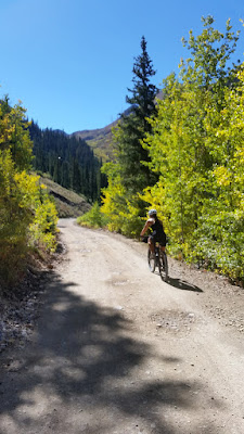 |
| Easy pedaling to start. |
 |
| Assuming the position on the first pitch. Photo by RRC. |
 |
| Oof. Where's RRC? Gone. |
 |
| I fell a bit behind on this lung buster. Photo by RRC. |
 |
| Over the top we go!! Down a short bit to the CT. |
I was promised more photo ops on the return trip in exchange for leaving the four-wheeled crowd behind as soon as possible. The RRC was ready for some high alpine singletrack, as was I.
My hopes had been to make it out to the CT high point, somewhere around 13,200'. But that would probably be done the next day if all went well today. I was already at my highest ride point ever and we did have some climbing to do. How high we'd end up was still in question.
 |
| Here we go, Colorado Trail. |
 |
| Pure singletrack bliss. Photo by RRC. |
 |
| There was plenty of HAB too, oof. That girl can't be stopped!! |
 |
| Maggie Gulch is another alternate back to the valley below. |
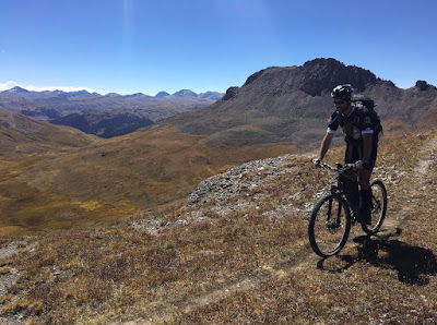 |
| Above treeline really gives the sense of 'Top of the World' Photo by RRC. |
 |
| We could easily see the next push coming. |
 |
| Sure was fun getting there!! Photo by RRC. |
 |
| She was so excited to show off the local mountains, it was great hearing all about the different options available and places she's been. |
 |
| More hoot'n & hollerin' ensued. |
 |
| Next year I'll get to see this section a little more green! Photo by RRC. |
 |
| Such a fantastic place to melt your cares away. |
 |
| There she goes again. My lungs/legs begging for mercy. None given, just the way I like it!! |
 |
| I finally caught up at the saddle. 12,918', my new high point for the Voodoo. |
We were ready to turn around as she wanted to take a different route back towards town. One that was a little unknown, but she knew I'd be game. I wanted to take a peek over the next saddle, but she knows me too well, 'Then you'll see another ridge and want to go towards that!' Perhaps. :)
We decided this would be a great spot for a self-timer selfie of sorts, but the camera needed to be kinda far away to show the expansive landscape. I was fairly cooked, so I opted to take a seat by the large cairn. I asked if she thought she could make it over to the spot in under the 10 seconds allotted. She does like to run on occasion!! What transpired next has to be one of the funniest candid moments caught on film.
The cell phone was positioned just right, she hit the shutter and took about 2-3 steps, over talus, in stiff mountain biking shoes, clipping a rock in the process and faceplanting in the alpine tundra! Before either of us could react, I heard the shutter...click...click.
First things first, she was fine. She even tumbled like a pro, keeping her arms in to protect her wrists!! She may have been a little embarrassed, but we both had a good laugh. Even moreso when we saw what was captured by the camera after the ride.
 |
| The moment of impact!! |
 |
| Her look of 'WTF'?? And my offering of support! ;) |
 |
| Let's skip the timer and do it like the cool kids. |
Back on the bikes we made our way over to the trail split and headed down the Pole Creek drainage. The trail started off fine, but there were a few unmarked junctions and we soon found ourselves on a barren hillside. We could see the trail down below and rejoined it after some freelancing down the slope.
 |
| Peeling off the CT. |
 |
| A quick snack break to take in the views. |
 |
| Keep that bike dry!! |
 |
| It's pretty tough to take a bad photo up here. |
 |
| A few bushwhacking moments led to more fine singletrack. Photo by RRC. |
 |
| I was supposed to be snacking, but couldn't resist the short hike to this overlook. |
 |
| The clouds began to build as the afternoon wore on and the singletrack morphed to 2-track near the runout. |
 |
| The trail dumped onto this forest road, where's RRC?? |
I got a little behind the RRC on the final couple of miles out to the dirt road, one too many pics perhaps. I thought we'd meet up at the road, but she was no where to be seen and I wasn't sure which way to go!! My phone wouldn't load any maps for some reason, but just as I was about to go left, I spotted her up the road on the right!! What threw me off was I knew we had to climb back up to Stony Pass, but the right was downhill. The downhill was short lived as it crossed Pole Creek near the confluence with the Rio Grande headwaters.
As I made my way up the road I lost eye contact with her, figured we'd just meet up back in town. I was getting hungry and opted for a traditional burrito break.
 |
| Burrito in one hand, camera in the other. |
 |
| Cool splash of color on the way up. |
 |
| My legs/lungs were feeling it, I walked a ton. Chatted with a few motorists along the way, one even passed along the message that the RRC would be in town upon my arrival!! *Found out later she was on a time crunch for work* |
 |
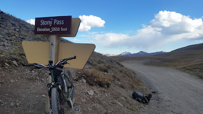
| Stony Pass up ahead. |
The clouds kept building and growing darker by the minute. I was really hoping I could finish the ride before anything rolled in. I had left my rain jacket in the car!!
Eventually, I made the pass and took a the photos I was promised earlier in the day.
 |
| Two incredible trails. |
 |
| A dusting of snow to the east. |
 |
| Get to know these logos: Continental Divide Trail & Colorado Trail. |
 |
| I was more than ready for some downhill, but I started to feel an altitude triggered headache coming on. Bleh. |
 |
| The other direction. |
 |
| It's all downhill from here!! |
Unfortunately I wasn't fully able to enjoy the downhill as my head began to pound. The road was bumpy enough that I had to really take it easy. I needed oxygen!! The lower I went, the better I felt. I'm just glad this happened at the final downhill and not much earlier in the ride. It does give me a bit of a concern for next year's
Colorado Trail Race. This particular section stays above 12,000' for roughly 30 miles. Not a place I want to experience altitude sickness.
Stony Pass Flyover
 |
| Ahh, trees = oxygen!! |
 |
| Looking towards Silverton, ride complete. |
 |
| Golden Hour beauty as I drove into Silverton. |
 |
| Tons of mining history in these parts. |
 |
| The last remaining tram link in the San Juan's used for hauling ore almost 100 years ago. |
 |
| Here's a clue you might be in ski country. The bindings actually worked!! Release the beer!! |
The RRC met up with me as I finished off my post ride pizza. It was now dark and I needed to find a place to make camp. There was a nice area up by Little Molas Lake that was perfect. I decided to keep things simple and slept in the car again.
I decided I should probably keep things a bit lower in elevation on day 2 after my humbling lung buster the day before. Of course I came prepared for just that scenario and Scott had given me a good loop to do over by Engineer Mtn. just south of Silverton.
I woke to dew dripping off the inside of my windshield and a bit of ice on the outside. Temps were hovering around 34º as the sun began to shine through the trees. I drove down US550 to the Lime Creek turnout and parked there.
I was directly across the road from Cascade Creek, my starting point, or so I thought. I began pedaling up the forest road and noticed my track going farther down US550?? I didn't feel like any road riding, I'll almost always opt for trail over road, so I kept going. I was using the
Trailforks app at this point and everything lined up, I mean, what could go wrong?
 |
| The trail split and forded Cascade Creek, I opted to head back and see if the upper crossing had a bridge. |
 |
| So far so good, super singletrack. |
 |
| Cascading waterfalls into Cascade Creek? What a coincidence. |
 |
| Cool meadow riding, too bad I had missed my turn to get here! I did get to ride through twice though!! I did end up fording the creek at the upper crossing before my slog up Graysill. |
 |
| Perhaps I should've stayed on the meadow trail. While this section wasn't overly steep, the rocks made the riding tough and the trail did kick up in a big way. Theme the HAB music. |
 |
| 0.9 miles. 100% HAB up Graysill trail. Oof. Singing 'I Love HAB!' |
Maybe I should've followed Scott's track from the start. I would have been on Cascade Divide rd, CR579 for most, if not all, of the climb. I was now happy to be pedaling on a bike friendly grade up to the CT.
 |
| The San Juan's are simply stunning. |
 |
| Looking back down into the Cascade Creek drainage. |
 |
| Linked up with the CT. |
 |
| Crystal clear. |
 |
| Once again, I'm truly amazed at the places I get to ride. |
 |
| Scree field!! |
A few minutes after riding across the scree field I finally saw another rider. He was taking a break sitting up on a boulder and shouted 'freeskier!!' as I rode by. What? Freeskier is my
forum handle on mtbr. I asked who it was, and it was Joe from Flagstaff, aka Rockman!! Such a small world. We had never met, only chatted online for a few years and this is where we run into each other? Too funny. He was up on the CT riding with a couple on vacation from the UK, another fella I've chatted with online.
 |
| freeskier46, rockman & zinger-uk in CO. |
We hung out for a bit and Joe gave me some good advice on the next portion of my route. I had been debating whether or not to stay on the CT or follow the track onto White's Creek. Joe confirmed White's Creek was the way to go, they had just come up that way. Route settled, I pedaled on.
 |
| Leaving the CT for White's Creek. |
 |
| A little bit of climbing to start. |
 |
| Then the trail opened up to wonderfully contoured hillside riding. |
 |
| Look closely to follow the ribbon of dirt all the way around the shoulder of the mountain. |
 |
| Engineer Mtn. becomes the dominant feature. |
 |
| I was closing in on 3 riders for a few miles. |
 |
| Engine Creek overlook. |
I caught up to the three riders and one guy remarked how my front suspension was less than his buddy's. My forks had been slowly leaking air and I had bottomed out a few times already. Time for a shot of air to finish out the ride.
We got to talking at the overlook and they were from Albuquerque. The topic of discussion led to the Colorado Trail Race and came to find out I am friends with one of their riding buds, Barry. What were the odds of running into these guys?
 |
| Engineer Mtn gettin' close. |
 |
| Three ABQ guys on the CT. |
 |
| One more climb to go... |
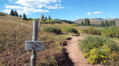 |
| Another option for a point-to-point ride. |
 |
| View to the north. |
 |
| Striated cliff band on Engineer. |
 |
| Did someone say downhill for the next 5+ miles?? |
 |
| To the east, big mountains loom. |
 |
| Blazin' fast buffed out singletrack on the way down. |
 |
| US550 winds its way up to Coal Bank Pass. |
 |
| Secret singletrack entrance. |
 |
| Pockets of golden aspens. |
 |
| At the bottom, my forks survived another one!! |
A short downhill roll along US550 brought me back to my car just as Joe and the UK duo were finishing up their ride. They couldn't believe I went UP Graysill, said it was ultra gnarly coming down!!
Cascade Creek Flyover
I headed back to Silverton for a burger, then returned to Lime Creek rd to crash out for the night.
 |
| Molas Lake. |
 |
| Dropping into Silverton and the Animas River. |
 |
| Cool mountain town, two main roads cut through, one paved, one dirt. |
I had very ambitious plans on Sunday for my return drive to Phoenix. Could I squeeze in three rides, drive 8 hours AND be home before midnight? I was going to try!!
First up was Twin Buttes in Durango after a solid breakfast at Bread. I had mapped out a 10 mile figure 8 through the trails. My planned route had me coming into the system from the west end instead of directly out of the trailhead. This ended up costing me my ride. The trail paralleling the highway wasn't much of a trail to begin with, then it dumped into a construction zone for a new community. I was still on route, but soon dead-ended at an overgrown cliff. I backtracked to the parking lot, 35 minutes wasted and called the ride off. I figured I'd just make up for it over at Phil's World in Cortez.
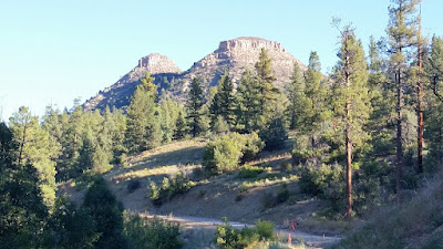 |
| I did manage one picture of Twin Buttes. |
It didn't take long to get to Phil's World and the parking area was already bustling with activity. When I
passed through in August I only had one hour to play on the pump track style trails. I wanted more on this day.
 |
| This was my third time riding here and I can't wait to go back for more. |
 |
| Sleeping Ute Mtn. in the background. |
 |
| It's nothing more than fast swoopy singletrack mixed in with shelved slickrock. |
 |
| Zooom!! |
 |
| Just enough techy bits to keep things interesting. |
 |
| I was plenty warmed up for a couple of laps through Ribcage. So fun. |
 |
| Breaking off on 2 More. |
 |
| My first time on Trust Loop. |
 |
| Hippy House was also a first and really fun. |
I wrapped up my Phil's World spin almost on time, then grabbed some lunch in Cortez before pointing the car south towards Gallup, NM. I had been eyeballing the Enchanted Forest loop for some time, but each of the last few times through the area I couldn't make it happen. I was looking at a 4pm ride start time and getting home later than I had hoped, perhaps I should just keep driving....right. Enchanted Forest here I come.
Phil's World Flyover
 |
| Only 25 minutes from Gallup, the pavement ends and trails await. |
 |
| Short fenceline rip to get things going. |
 |
| Plenty of options for more riding. |
 |
| Cool little bit of slickrock in this side canyon. |
 |
| A few miles of gradual climbing finally topped out and it was time to fly!! |
 |
| Shadows growing long as my weekend adventure wound down. |
 |
| Love the biking logo! |
I stuck with the Enchanted Forest race loop which was right at 13 miles. Even with the pictures I kept it under 1 1/2 hours. It reminded me of Flagstaff a lot, just less rocks overall. Very fast riding for the most part. Seems to be a great system of trails up there.
Enchanted Forest Flyover
I touched base with K after I filled up in Gallup. Since it was now evening I didn't have to fight traffic getting back to the Valley. I did come across a rather impressive prescribed burn up on the Mogollon Rim just outside of Payson.
 |
| Signage indicated it was 'under control'. |
I pulled into my driveway around 11pm and somehow made it to work the next day at 5am. It was an awesome getaway to the CO high country that was totally worth all the driving. If I don't have the vacation time in the future, this is definitely something I'd do again in a heartbeat. I'm kind of a sucker for jam packed roadtrips!!
Full photo album


