The Santa Rita Mountains are located south of Tucson, east of I-19 and west of SR83. There's been a local ride, RATS - Ride Around The Santa Ritas, that I've been wanting to do. It jumped higher on the must-ride list with the completion of the Casa Blanca Canyons section of the Arizona Trail. The Sky Island Odyssey East Loop also goes around the Santa Ritas, but it's a much bigger loop.
Scott was still in Tucson and we figured it was time to finally do a bikepacking ride together. It's strange, since we both bikepack a fair amount, but have never actually been on one together. We've car camped and done plenty of day rides all over the place, but never a proper bikepack. Time to change that. Scott invited Lenny to join in the fun.
We met off Madera Canyon rd. and planned to ride the loop over two days going counter-clockwise. From camp we could see the famed Elephant Head rock on the northwest side of the Santa Ritas. There's a trail by the same name that runs below it and I had heard stories of horrendous catclaw and rugged riding, but it was a cult classic trail for those long-time Tucson area riders. Heck, the original AZT300 used the Elephant Head trail before the AZT was completed on the east side of the range.
 |
| The adventure began early as Scott thought we could shortcut to the road climb. First, we had to navigate through a series of gates. |
 |
| We topped out of a wash and found some cattle approved singletrack!! |
 |
| A couple of miles of steady grinding on pavement were up next. |
 |
| Elephant Head peak poking over the mountain slope. |
 |
| A snowy Mt. Wrightson from Madera Canyon trailhead. |
 |
| Short, scenic connector trail to a dirt road. |
 |
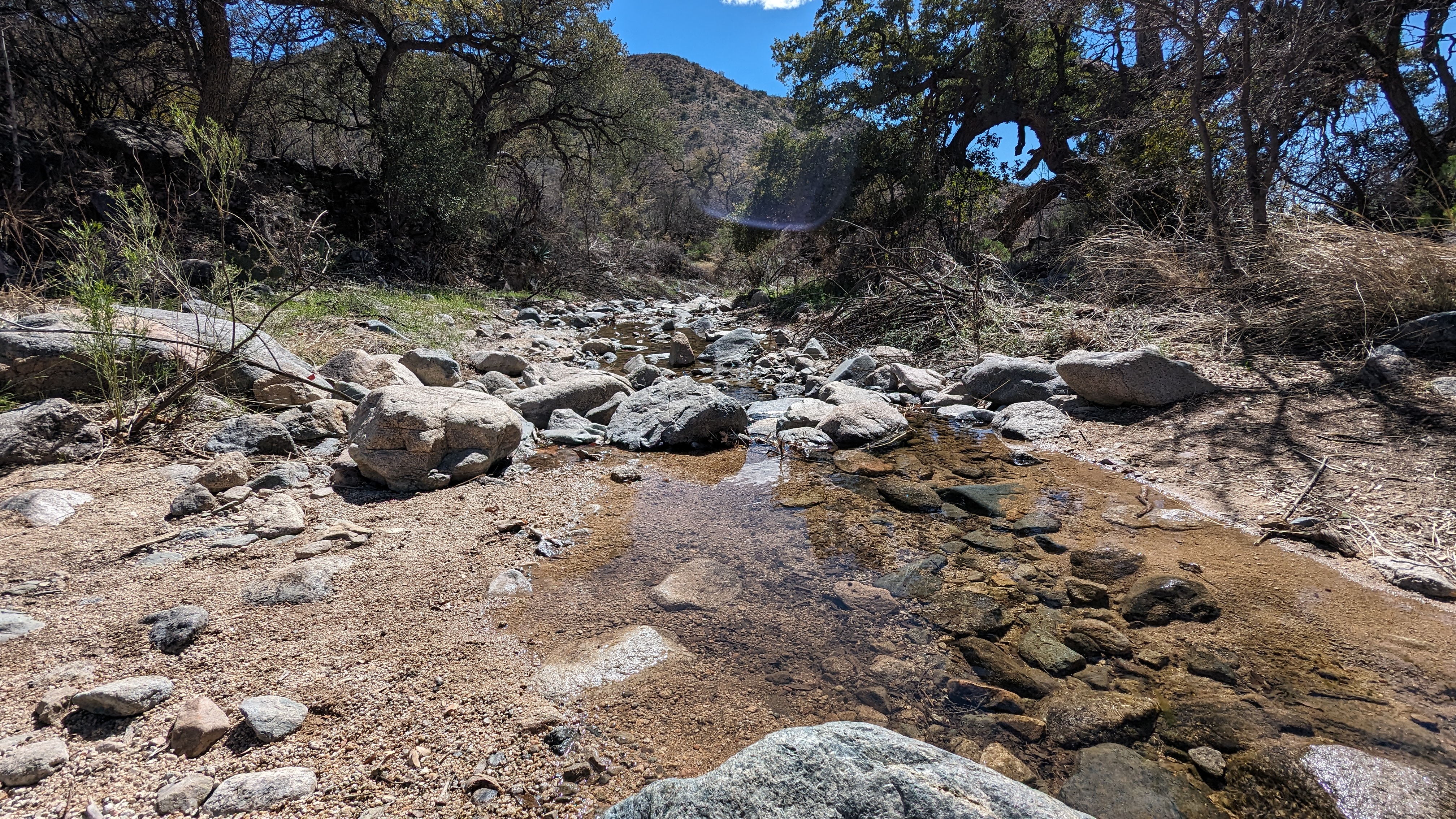
| Plenty of water with the snow run-off. |
 |
| Looks like some new signage. Scott had heard reports of trail work, we'll see... |
 |
| Lenny takes off with Green Valley below. |
 |
| So far, so good. No scratches and fun trail. |
 |
| There were enough rocks to keep you engaged and the riding was fantastic. |
 |
| Some buff singletrack too!! |
 |
| Elephant Head getting closer. |
 |
| Spiral Ocotillo?? |
 |
| Scott cleans this short technical challenge. |
 |
| Then the wildflowers exploded!! Yeehaw!! |
 |
| Poppies were everywhere. |
 |
| We weren't expecting to see such a lush wildflower show. |
 |
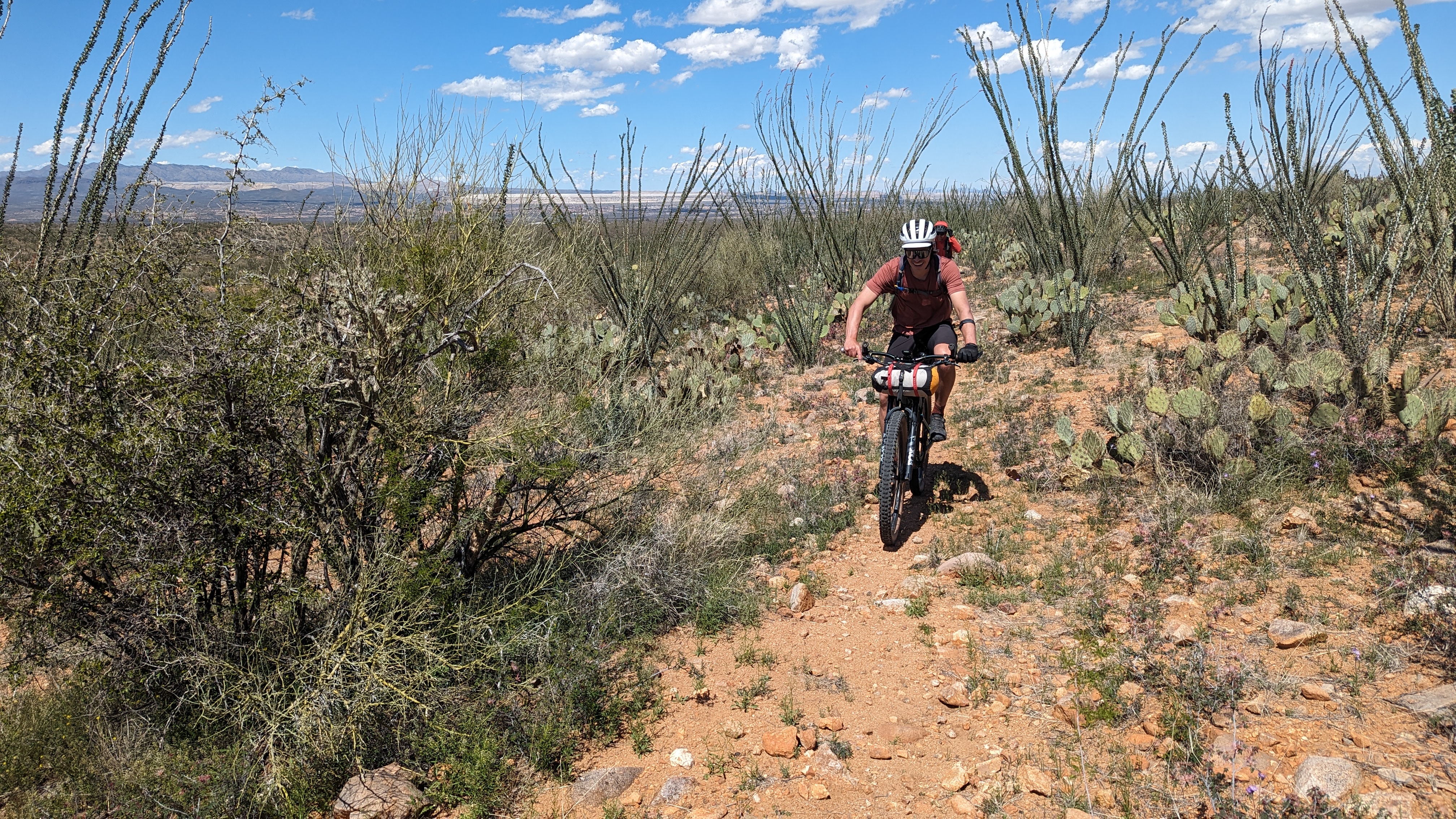
| Ocotillo forest. |
 |
| The landscape was jaw dropping. |
 |
| Lenny cruises through the Ocotillo. |
 |
| Good place for a bike pose. |
We reached the end of the singletrack, all of us stoked on the radness of the trail in its current condition. We made it all the way through with nary a scratch, someone's been out there trimming. Last month I barely got scratched on Painter Boy trail, now this. What's next, no hike-a-bike on the AZT?? :)
 |
| Water source, if needed, just off FS4073. |
 |
| The terrain began to swallow us up. |
I was beginning to drag a bit, falling behind Scott & Lenny. In short, I was getting worked and the real climbing hadn't begun yet. I had finally shook the crud that had me bogged down for the past month+, but regaining lost fitness is another beast all on its own.
 |
| The other side of Elephant Head. |
 |
| The two-track kicked up and became more rugged. Hike-a-bike time for this guy. |
 |
| We were now in the thick of the Santa Ritas and the two-track would morph back to singletrack. |
 |
| Some cool history from the area. |
 |
| Back on singletrack, the climbing continues. |
 |
| It was somewhere along this stretch where I knew I didn't have the fitness needed to do the loop. |
I was bummed, but also knew it was the correct decision. I was really struggling with the added bikepacking weight on a demanding route. Plus, I really didn't want to hold the guys up too much. I know they wouldn't mind, but I also knew I wouldn't enjoy the route as much as I should.
I made the executive decision to backtrack a little ways, hop the fence and beeline to the trail. Ask for forgiveness and hope for permission if it came to that. It was quiet out there and I really didn't expect to see anyone, but you never know. Let's make this as quick as possible, mmmkay??
 |
| I was able to get over the barbed wire unscathed and made fast progress through the open desert. |
 |
| Another fence hop led me to this double-track. |
 |
| A couple of unlocked gates surrounded this watering hole and I was through the private property in short order. A bit relieved too. |
I try my best to not put myself in those types of situations, but it does happen on rare occasion. Needless to say, do NOT use this route. I won't be posting it anyway.
 |
| I rejoined the Elephant Head trail during golden hour at the small cattle guard. |
 |
| Elephant Head. |
 |
| Ahh, water in the desert. |
 |
| It really is a great trail, would be a good out-n-back ride too. |
 |
| Ginormous Ocotillo out here. |
 |
| I was really hoping to be off the singletrack before nightfall. Almost there... |
 |
| Made it!! Green Valley lights up. |
I forgot how much of a downhill it was to reach the trailhead in the morning, I was now grinding up the dirt road towards the Madera Canyon trailhead. I finally reached the car around 7:45p and had a text from Scott. They had made camp, but confirmed I probably made the right decision to turn around as it was a tough ride to get there. I think I ended up with 10 more miles than they did, but they had almost 2000' more gain. I ended up with a 40 mile ride and 4200' gain.
I highly recommend checking this trail out, maybe take loppers just in case?? As mentioned, do it as an out-n-back or the full RATS ride or loop it by going down through Green Valley. Here's the
Elephant Head Trailforks page.
I guess Scott and I still need to get out on a bikepacking ride sometime.