Nancy's email came in asking if I wanted to join Jeff & her on a mellow bikepacking ride the following weekend. Day one of the Coconino 250 was lobbed out, but I didn't want to do that since I planned to ride the route in the upcoming weeks. One of my Flagstaff buddy's was just up in the Moab, UT area and had ridden the White Rim. That's been on my ride bucket list for years, but permits can be an issue and I never seem to plan far enough ahead to get one.
Then I did a little digging. I had been under the impression that the entire 100 mile loop was inside Canyonlands National Park, that's not the case. Roughly, the northern 20 miles are on BLM lands. I figured we could ride the park portion of the route in a day, which only requires a free day-use pass available online 48 hours prior to arriving. Jeff & Nancy were game and we opted to rent a truck so we could carpool. We asked Joe if he wanted to tag along and he was more than willing. We then decided to tack on an extra day so we could shuttle the Whole Enchilada route after I found out Jeff had never done the whole thing!! As it would turn out, most of our riding was new terrain for the others, I was the only one who had ridden the Whole Enchilada route.
 |
Let's go!!! Photo by Stefan.
|
I'm not one to talk in the third person, but this warrants an exception as the weekend was about to get rolling. In true Schilling fashion, the adventure began a full day before we headed north. I swear, I can't make this shit up. On Wednesday afternoon I received a courtesy call from Hertz informing me that my pre-paid reservation for the following night was unable to be fulfilled. Say whaa?? They offered to put me in a car, but that wasn't going to haul four bikes & gear. I was also set to get the truck from our smaller regional airport, Gateway, since it's only 2 miles from my house. No way I was changing the reservation to Sky Harbor, completely defeated the purpose!! Ugh. So, a couple of phone calls later, I had all my money back. So much for Plan A.
Joe stepped up and offered to drive since he had a means to carry four bikes, we just weren't sure about all our gear. He lives on route, so we all decided to see if we could fit. Somehow, after some Tetris skills were relived, it all worked. Cool. Now we didn't have to rush home to drop off the rental truck, maybe this was meant to be.
Nancy was able to snag a couple of last minute cancellations for camping too. One was in Arches National Park at the Devil's Garden Campground and the other was at Dead Horse Point State Park. Things were looking up!!
We hit the road early on Friday and made quick work getting to Flagstaff. Time for challenge No. 2. Joe has dual exhausts on his Volvo and made some baffles to deflect the heat, but after multiple rearrangements of my bike & Nancy's to get them to fit snugly, the baffle on the left wasn't quite lined up. The result? A melted carbon rim. Gah!!! Nancy's wheel was toast.
 |
| Carbon and exhaust heat don't mix. |
Joe felt terrible about it and to Nancy's credit, she stayed calm as we pondered our options. We were headed to the mountain biking mecca, so our chances of getting a replacement were good. A few phone calls later and we had a wheel on standby.
 |
Church rock and the La Sal Mtns. along US191.
|
 |
| Wilson Arch along US191. |
 |
Guess what this attraction is?
|
We arrived in Moab around 4p and stopped by the bike shop. We went next door to the Moab Brewery for a late lunch while Nancy's bike was getting setup. Things were looking up once again.
As the day grew long, we made our way north of town to Arches NP. There was enough light out for a short hike to Delicate Arch. I had only seen it from afar and was thrilled to get the chance for an up close encounter.
 |
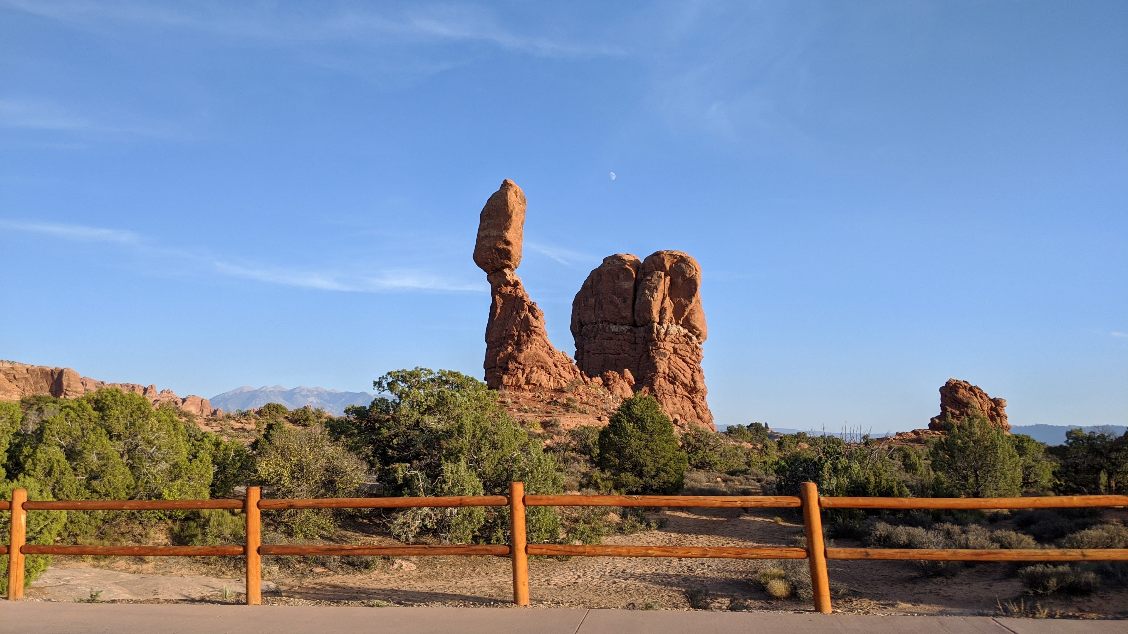
Balanced Rock on our way through the park.
|
 |
The 'trail' to Delicate Arch is about to get steep on a slab of slickrock.
|
 |
Round a corner and BOOM!! There it is.
|
 |
We had just enough light to enjoy it.
|
 |
A view through the backside of the arch.
|
 |
Isn't Nature cool??
|
 |
Looking straight up.
|
 |
One last view before making our way down.
|
 |
Rock waves frozen in time.
|
We made it back to the car as darkness fell. Unfortunately that meant we ran out of daylight for hiking around our campsite at Devil's Garden. Gotta put that high on the list for next time. The moonlight gave us a hint of how beautiful the campground was and we did get to see it on our way out the next morning.
 |
This was shot using my Night Sight setting on a Google Pixel 3a under moonlight.
|
 |
Essentially the same shot the next morning for comparison.
|
 |
Devil's Garden.
|
We made our way over Canyonlands NP the next morning, stopping for gas in Moab. Note: US191 is currently under construction on the north end of town, quite the cluster, so time your travels accordingly for the foreseeable future. Traffic was backed up to Arches NP the evening prior coming into town. Crazy. Thankfully, no traffic for us in the morning.
We had a park pass for entry, but no one was manning the entry both at Canyonlands, so we made quick work getting to our parking spot at the Shafer Trail overlook. We were directed here by park staff via email when inquiring about leaving a vehicle overnight.
 |
Jeff covered & ready for a warm day. Photo by Nancy.
|
 |
Joe repping the Early Bird racing team. Photo by Jeff.
|
 |
Nancy making a few last minute adjustments, but with a brand new rear wheel!! Photo by Jeff.
|
 |
A little haze at the start, but otherwise a killer view from the parking lot.
|
 |
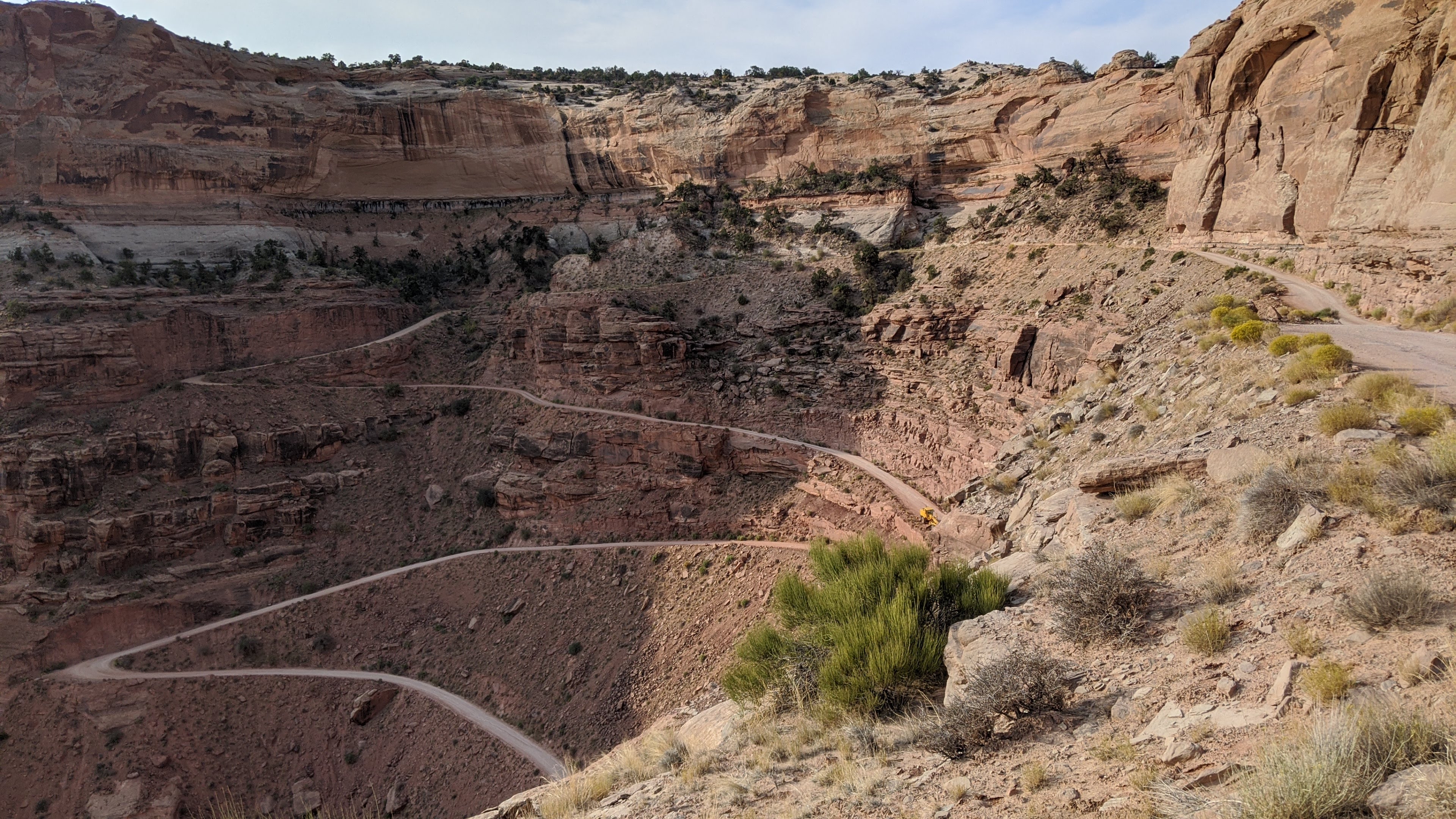
Checking out the Shafer Trail from the overlook.
|
 |
Ooooh. This is gonna be good, let's get rolling already!!
|
We pushed off sometime before 9a, a bit later than we wanted, but that's how the morning unfolded. Nothing else to do today except pedal and pedal we did.
 |
A short spin back up the paved park road brought us to the route. Let the dirt begin.
|
 |
Some general warnings and admin stuff. We had our day-use passes in hand, good to go.
|
 |
Buckle up, cowboy.
|
 |
| It didn't take long for the jaw dropping views to reveal themselves...like 2 minutes!! |
 |
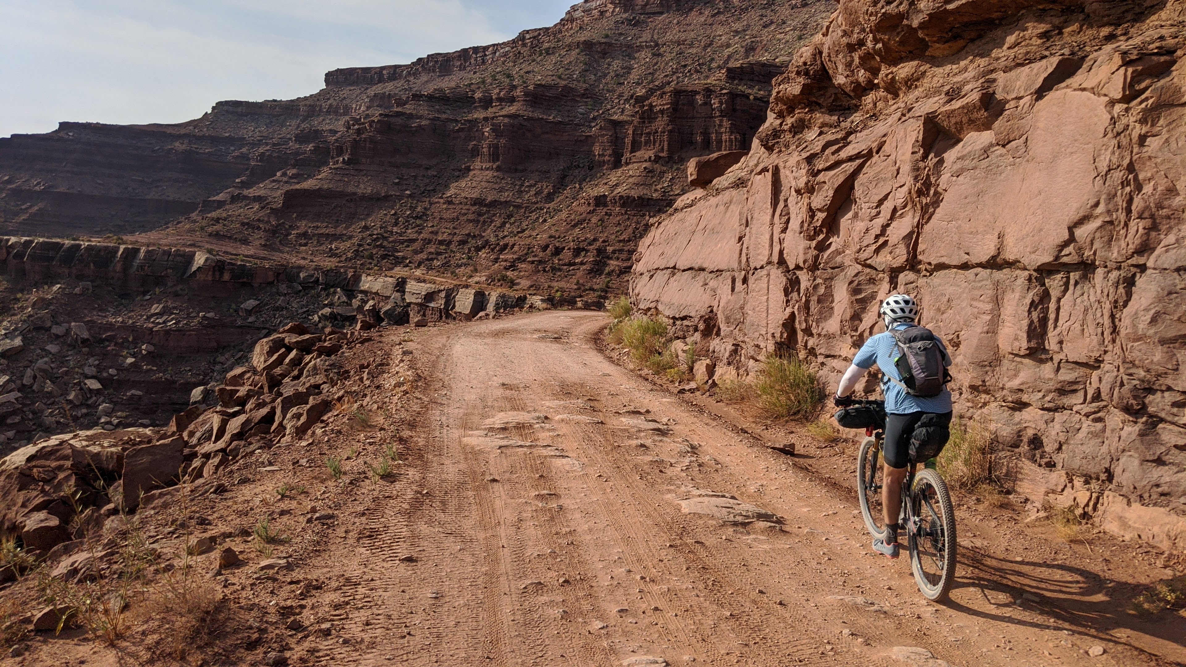
Slightly downhill perfect benchcut roadbed. Photo by Jeff.
|
 |
Yeah, we get to ride down there!!
|
 |
So this must be what it's like to ride into the Grand Canyon...if there was a road.
|
 |
Approaching the famous or infamous Shafer Trail switchbacks.
|
 |
| Jeff & Joe rounding an early bend. |
 |
| Nancy, the size of an ant, gets a head start down. |
 |
Practically looking straight down!!
|
 |
The grade isn't too steep, but you do get moving quickly as the turns open up.
|
 |
Jeff blasting off.
|
 |
The Shafer Trail ends here and the White Rim officially begins.
|
 |
The crew, now one giant ledge lower, but still high enough, roll onto the White Rim.
|
 |
| What a magical place this is. |
 |
The next few miles were mostly flat, easy pedaling contouring the rim's edge.
|
 |
Nancy approves!! Photo by Jeff.
|
 |
A brief glimpse of the Colorado River here.
|
 |
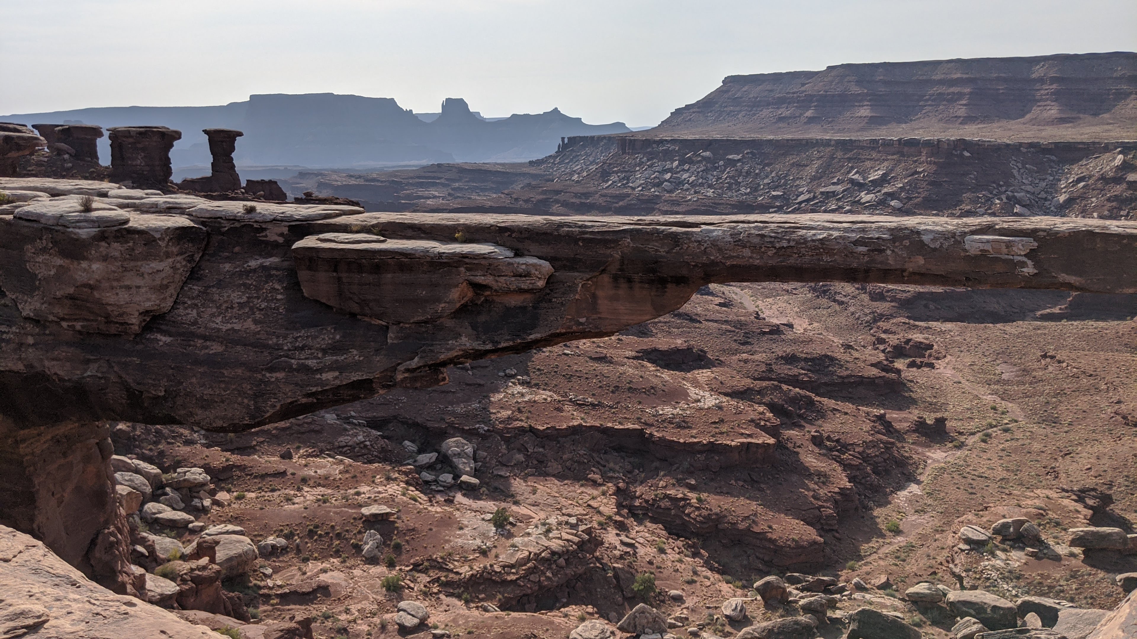
A roadside attraction near the 10 mile mark: Mussleman Arch.
|
 |
It blended in so well, it was almost difficult to see in spite of it's vast reach.
|
 |
A Natural Bridge is formed by water eroding the rock whereas an Arch is formed by weathering, but not flowing water.
|
 |
More wide open terrain.
|
 |
It's a jigsaw puzzle of rock.
|
We were cruising along and noticed an upcoming blip in the elevation profile. We knew there were two notable climbs along the White Rim, Murphy Hogback & Hardscrabble, but I had forgotten exactly where they were along the route.
 |
Grinding my way up the first blip. Photo by Jeff.
|
Both Jeff and I agreed, 'That wasn't so bad'. Little did we know at the time, this tiny blip was exactly that. It was neither of the aforementioned climbs.
 |
Jeff disappears into a postcard.
|
 |
Here, the white of the White Rim becomes a bit more pronounced.
|
 |
One of the official campgrounds along the White Rim, Airport Mesa & Airport Tower. Pit toilet and a view. An overnight backcountry permit is required to stay in any of the official campgrounds inside Canyonlands NP. Reservations open 4 months in advance, so plan ahead!!
|
The temperature continued to rise as the morning morphed into afternoon. I was beginning to feel a bit sluggish and fell off the back of the group. Calories were becoming increasingly difficult to consume, my water was warm, bit I did have plenty. I began the ride with 5L + 2 bottles + 32oz Gatorade + Root beer. I'm sure the extra weight wasn't helping matters, but I kept pedaling.
 |
The route cuts away from the rim's edge for a bit.
|
 |
Rock formations approaching.
|
 |
Jeff carves some slickrock below the Big Tilt & Monster Tower.
|
 |
No guardrails here. Photo by Jeff.
|
 |
One of the many side canyons you can get right next to.
|
 |
For a few miles, you forget all about the rim's edge.
|
 |
Rearview mirror expanse.
|
 |
Putting the white in White Rim.
|
 |
Seems like a great spot for a snack break.
|
I hadn't seen the others in over an hour, I was slogging at best searching for an energy boost. The break at the above overlook helped lift my spirits, I needed it as we weren't even at the halfway point!!
 |
Each side canyon had its own flavor. The small drainage here made me wonder how cool this must be during a downpour...at least to look at, not to ride or drive!!
|
Throughout the day we saw small group after small group of other mountain bikers going the opposite direction. I'm guessing most were part of a tour group or simply out for a spin from camp. As I neared the split to White Crack CG I yo-yo'd a couple of support vehicles. We didn't see too many motor vehicles on the day, definitely more mountain bikers than anything.
We began the lower undulations of the Murphy Hogback climb, some steep stuff, but really short. Then it leveled out and we thought we may be done with the climb. Wrong. I looked up at the abutment ahead and saw a very steep sidecut, aww crap, I think we have to go up THAT.
 |
Yes, we did. Look closely, you'll see Jeff & Nancy in full hike-a-bike mode.
|
There were a couple of motos getting ready to tackle the hill as I began my push. I let them go by and watched the dust fly, it was deep and loose on this gradient. Trailforks was showing 17%!! It was a bit of a challenge to push my loaded rig up, but I eventually got there. It did give all of us pause on how a vehicle would climb it, but I'm assuming with a little bit of moisture, it wouldn't be so bad. It was just so thick with moon dust this go-round.
 |
Jeff in full push mode. I'm way down there somewhere. Photo by Nancy.
|
 |
Recovery break at the top of Murphy Hogback. Oof. Photo by Jeff.
|
 |
What goes up, must go down. Jeff dropping in.
|
 |
Joe continues the long descent.
|
 |
Everyone's going downhill!! Photo by Jeff.
|
 |
Great view of the spread out road and white accents in the distance.
|
 |
Quite the sense of scale.
|
 |
Candlestick Tower growing near.
|
 |
Hey, look!! It's a White Rim!!
|
 |
Looked like a good place for a quick break.
|
The afternoon heat continued, temps hovered around 90º, which for us coming from Phoenix, is quite nice actually. For me, the lack of steady calorie intake and warm water all day wasn't ideal. I had now emptied my 3L bladder and began using the 2L bladder from my framebag...bleh. That water tasted like old hose water!! It was horrible. I couldn't get to the Green River fast enough.
 |
Cool slickrock undulations along the rim.
|
 |
It was a rock porn kinda day.
|
We were approaching Candlestick campground where a tour company was prepping camp for the evening. We rolled up and began some small talk while one of the guys offered to fill our water bottles. Yes, please!! I was secretly hoping for ice cold water, but that didn't happen. Instead I received slightly cooler water that tasted wonderful!! Thank you!!! I was hoping to nurse that bottle and my remaining Skratch Labs mix until the Green River. The tour group gave us the intel we needed about accessing the river, Potato Bottom C. The mission was clear. Onward.
 |
Green River getting closer, but still so far away. Surrounded by a sea of slickrock and a small cliff band.
|
 |
Water in the desert never ceases to amaze.
|
 |
Golden hour creeping in.
|
 |
Steer Mesa reminded me of the Vermilion Cliffs of northern Arizona.
|
 |
So calm, I wanted to jump in.
|
 |
Only a few more miles to water access.
|
 |
A short bit of singletrack from the campground brought us to the banks of the Green River.
|
Nancy had left her bike out by the main road so I wouldn't miss the turn, thanks!! There was another tour group milling about, I waved as I rode through.
 |
Maybe we should just camp here.
|
 |
Soft, cool river bottom felt so refreshing. Photo by Jeff.
|
 |
Jeff making his way back to the road. He told me at the beginning of the ride: 'There better be singletrack!!' It wasn't much, but there you go.
|
 |
A bit more of this would've been nice too.
|
 |
Almost as soon as we left Potato Bottom the climbing ensued. This was elevation blip no. 2: Hardscrabble.
|
 |
It was rideable at first through some neat formations. Photo by Jeff.
|
 |
Then things became steep, more pushing.
|
 |
Shark tooth looking wash.
|
 |
Nancy & I in a familiar position. Photo by Jeff.
|
 |
Thankfully, the steep stuff wasn't too long and nearly as tiring as Murphy Hogback. The climb topped out to an undulating elevated roadbed. We heard the descent was sandy and hoped to clear it before dark set in.
|
 |
| Notice the campers on the sandbar. What a great spot. |
 |
We did hit some deep sand on the descent, but it was manageable. I flipped on my lights at the bottom. Only a few more miles until the park boundary!!
|
Once again I felt behind a bit as the route dipped into a sandy wash. The next thing I knew the GPS was alerting me I was off-course!! Huh? I didn't see a turn. I backtracked to where the line veered off, nothing on the ground and with the deep sand I couldn't really make out any tire tracks. WTF. It was now dark and I was fumbling around to get on route. I decided to stick with the road and a half mile later the GPS track and road re-aligned. So weird. I caught up with the others and we half joked about poaching a campsite near the final campground inside the park.
Naturally, as we rounded the bend to Labyrinth CG there was a truck and NPS Ranger with a few young individuals sitting on the side of the road. Our guess is they were busted for poaching a camp site!! Gah!! We pedaled on...
 |
Leaving Canyonlands NP, now where to camp? I was tired enough to camp right next to the boundary cattle grate, but the others weren't having it. :)
|
We originally thought we could find a site with river access, but in the dark and tired state we all were in, the first flat open space would do. We had enough water for the evening and it wouldn't be far away the next morning. Day 1 complete, some 77 miles of riding. Wowzers, what a day.
 |
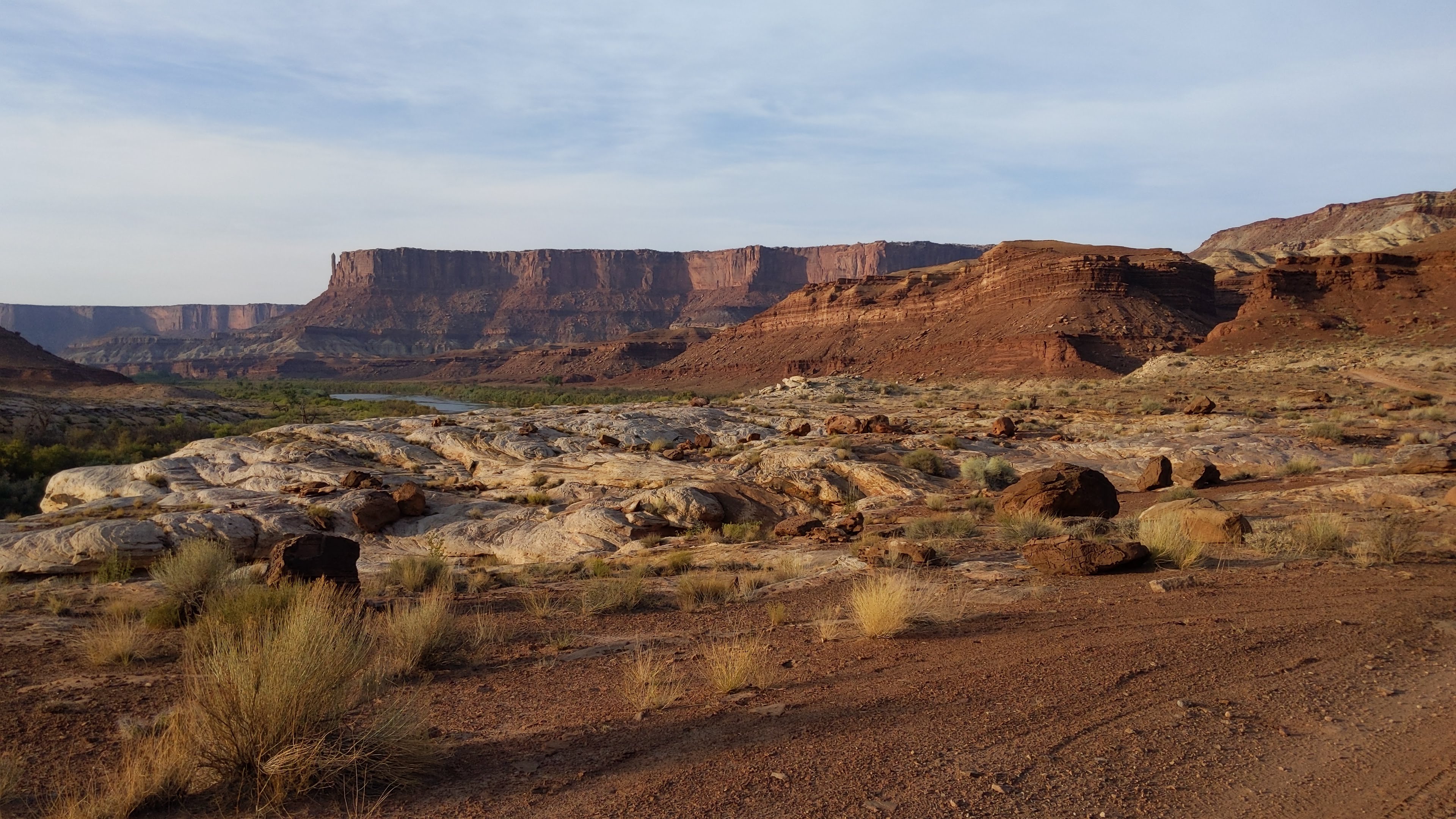
Looking up the road towards Canyonlands NP the next morning from camp. Not too shabby.
|
 |
Our campsite nestled below & among the rocks.
|
 |
Our second attempt to access the Green River was a success!! This would've been a cool place to camp if we could've found it in the dark.
|
 |
Loading up for the climb out of Mineral Bottom.
|
 |
Interesting colored striations. Photo by Jeff.
|
 |
This access trail was a bit too overgrown for bikes. Photo by Jeff.
|
 |
The original plan was to camp down near the boat ramp, but by stopping a few miles early, we saved ourselves some distance today.
|
 |
Starting up the Mineral Bottom climb. The top is on the far upper left.
|
 |
It was a grind, but rideable. Photo by Jeff.
|
 |
We spotted some oil slicks on the roadway which probably ruined someone's day, but not nearly as bad as this. Wonder what the backstory here is?
|
 |
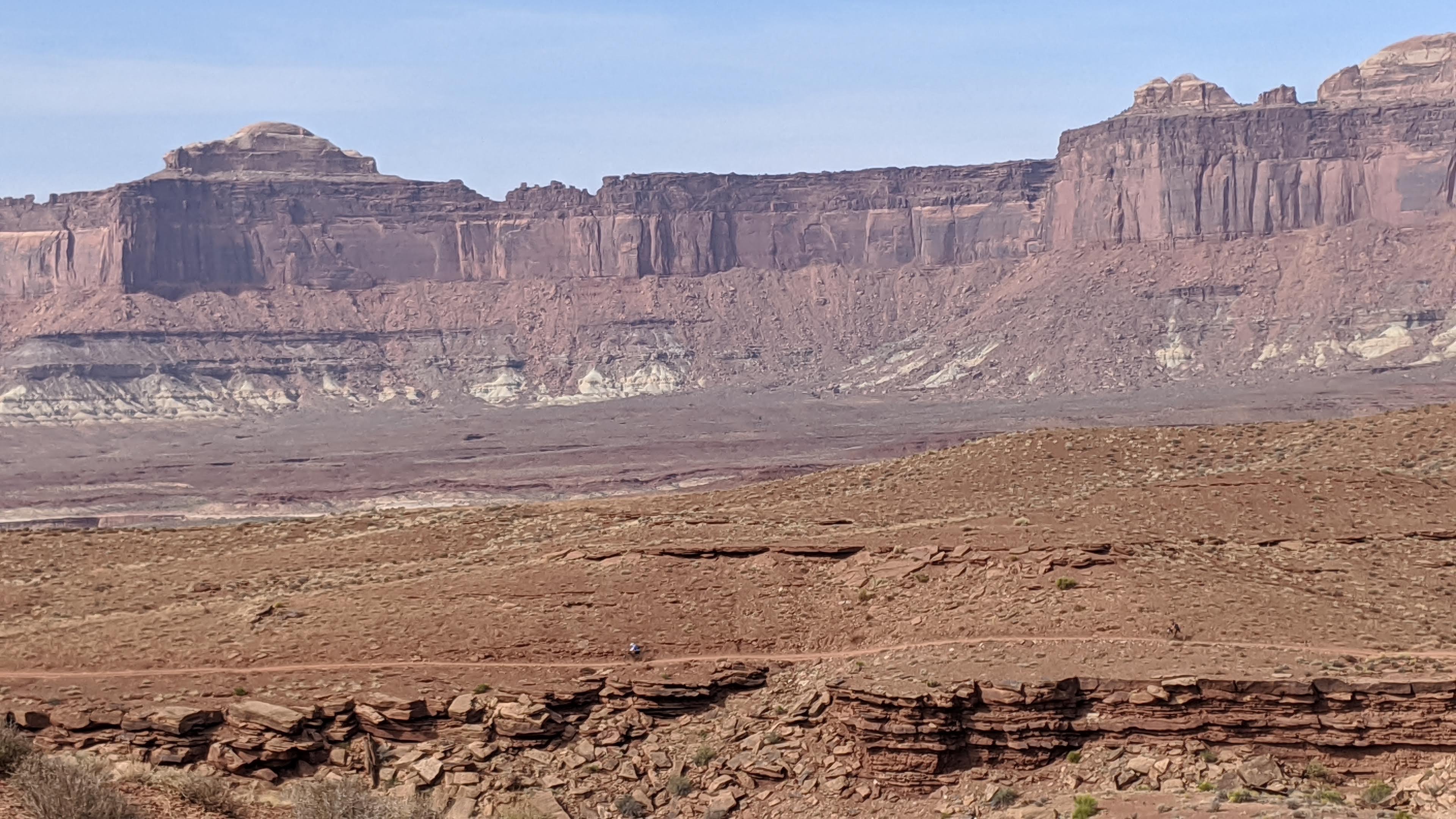
Somewhere near the halfway mark. Find the white pickup truck for scale.
|
 |
It was a bit of a relief to have most of the upper climb in the shade.
|
 |
I relented and walked one stretch between switchbacks not realizing I was so close to the top. Joe was caught in the sunlight cheering me on.
|
 |
Mineral Bottom climb: DONE.
|
 |
Now we grind out some mind numbing slightly uphill miles back to the park.
|
 |
In our route planning, I found this two-track that shaved off a bunch of miles. It worked out great.
|
 |
It was nice to see some vegetation again.
|
 |
A few fast downhill-ish miles on pavement brought us back.
|
 |
I had to grab some patches on the way out. Photo by Jeff.
|
 |
Joe hoisting his rig in victory!!
|
 |
Same spot as a day earlier, but a little more clear.
|
 |
Time for cold beverages, lunch and a shower!! Photo by Jeff.
|
White Rim complete and lived up to the hype, just wished I would've felt better. I'll be back, targeting cooler temps. Perhaps a birthday bash ride next spring with support vehicles?? Hmmm, sounds good to me.
Route:
We grabbed some cold drinks at the Chevron down on US191, then beelined to town for lunch. The
Quesadilla Mobilla has been a staple and did not disappoint. We cleaned up with showers at Canyonlands RV on the south end of town then did a bit of grocery shopping. Our original plan was to then head out for a Capt. Ahab loop & play on the Slickrock trail in the late afternoon, but we were all pretty whooped, so off to camp we went at Dead Horse Point. It was beer-thirty anyway.
Nancy was feeling ambitious, so she rode out to Dead Horse Pt. and snapped some photos.
 |
Looking down on the Green River and White Rim Rd. Photo by Nancy.
|
 |
| Photo by Nancy. |
 |
| La Sal Mtns. in the distance, our destination for the next day. The bright blue looking bodies of water on the left are actually Potash Ponds from TexasGulf as seen on Google satellite. Photo by Nancy. |
 |
Meanwhile, back at camp.... Photo by Nancy.
|
 |
Found this guy infiltrating our camp.
|
It was so windy that night, even the protection of a tent wasn't enough to keep the fine sand out!! I don't think I managed more than an hour of actual sleep, instead just lying there with my eyes closed listening to the tent flapping in the wind.
The alarm sounded at 5a and yet, I felt rested. We packed up under the cover of darkness and made our way down the hill into town with plenty of time to spare for our 7:30a shuttle. Slowly the cars trickled in and the vans were loaded. Much to our surprise, another Phoenix friend, Stefan, was also booked on our shuttle!! We hadn't seen him in a few years, but I keep in touch via social media. We've been talking about arranging a ride, so what were the odds we'd meet up here by chance? He booked this shuttle by mistake too. Haha.
 |
Kind of obvious what ride you're going to do.
|
 |
This is a t-shirt logo of mine from last time using Chile Pepper's shuttle. I'd recommend either shuttle complany. We'd be swapping out the couple miles of dirt road on Kokopelli for the Jimmy Keen singletrack which adds about 5 miles and a little bit of climbing.
|
 |
First bikes on, last off. It takes about an hour to get to the drop off zone for Burro Pass.
|
 |
Burro Pass drop zone, apparently Joe didn't get the orange jacket memo. Photo by Stefan.
|
 |
Here we go!!! It was chilly, but not too bad considering the start is at 10,500'.
|
 |
Joe cruising some alpine singletrack.
|
 |
Stefan!! Really cool to run into him and have him join us on the way down.
|
 |
Ride train!!
|
 |
The puffy was needed early on, but it would come off soon. Photo by Jeff.
|
 |
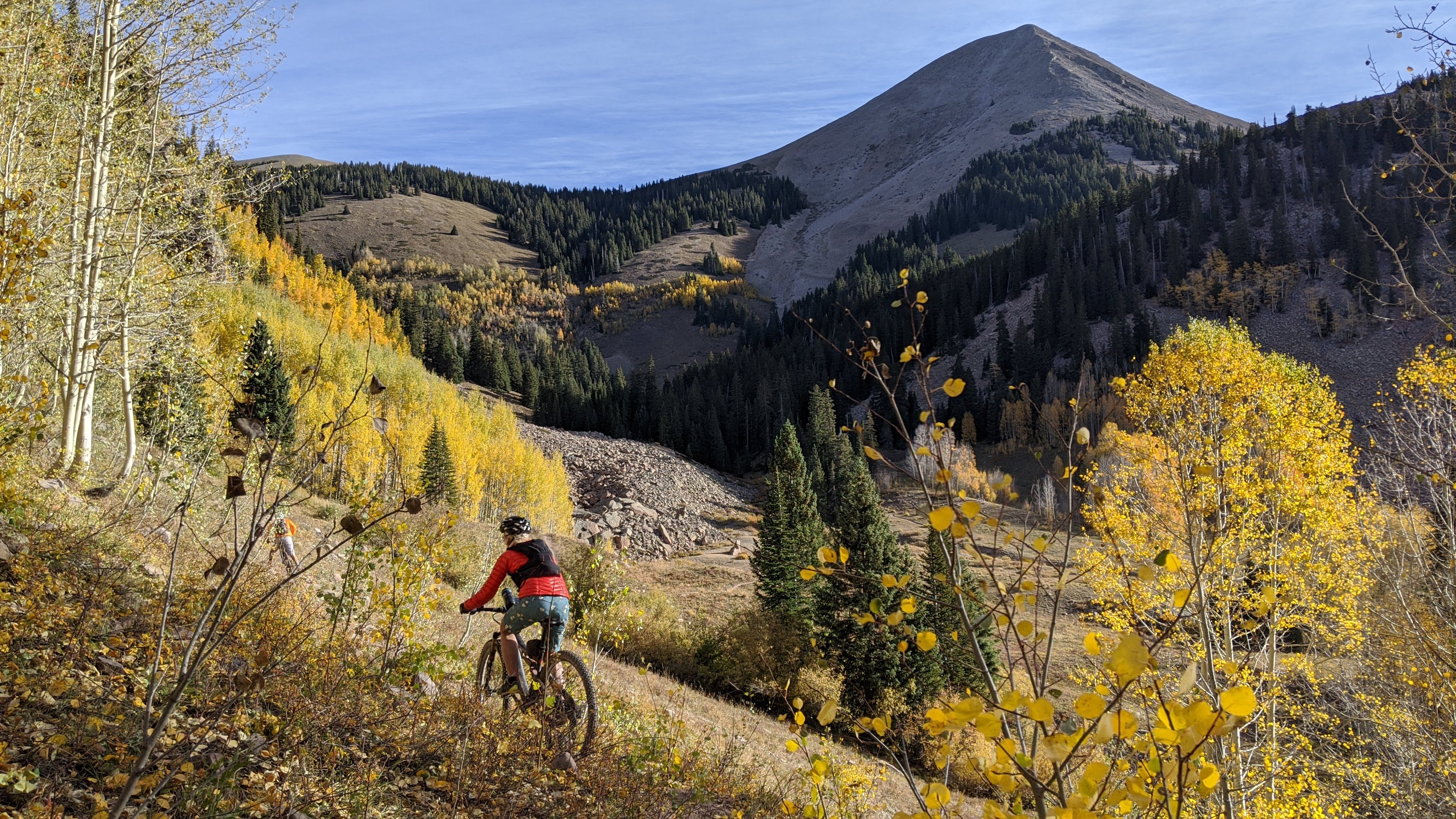
It's an autumn picture frame. Our suspicions regarding fall colors up high was on point.
|
 |
Coming around the backside of the La Sals.
|
 |
| At least there's a little bit of flow and warm-up before the main climb. |
 |
Up we go, ride some, walk some. Photo by Jeff.
|
 |
Near 11,000' it's more of a walk zone.
|
 |
Joe up ahead and yes, that's the top: Burro Pass!!
|
 |
Made it!! 11,200'. Oof. Now for my next stunt, a 7,000'+ descent!! (There's a couple small climbs in there)
|
 |
Jeff joins the party at Burro Pass.
|
 |
The upper reaches of the trail had thick moon dust, it's so dry everywhere!! The trail is steep enough that I was on my brakes...a lot, so this picture provided a stop to rest my hands/wrist.
|
 |
| Joe crossing the Wet Fork of Mill Creek. I was surprised it actually had water. |
 |
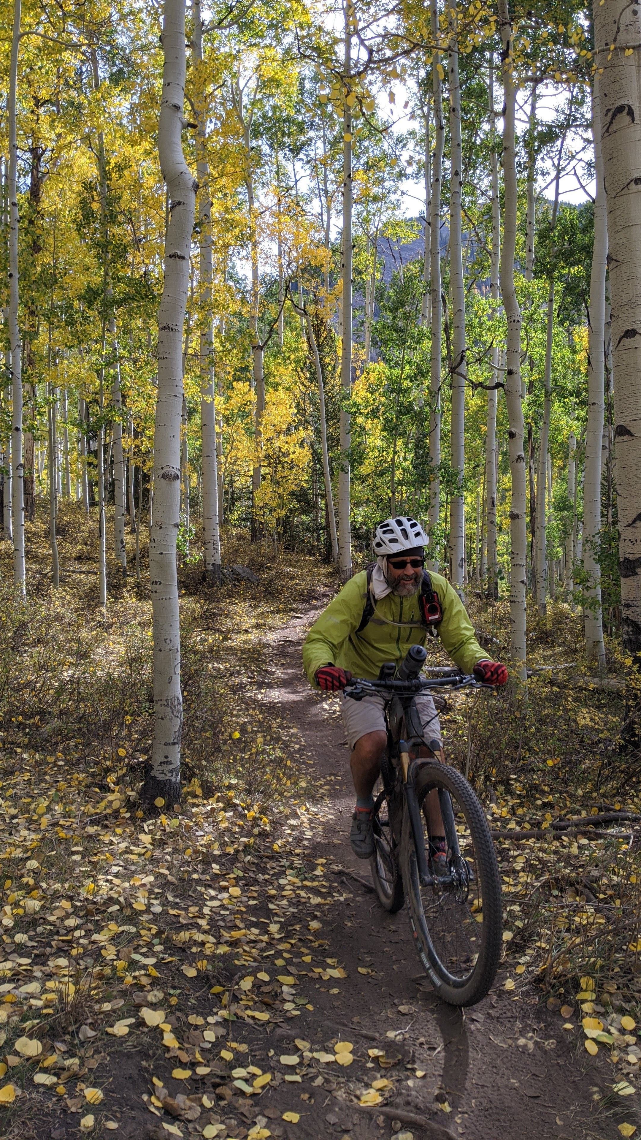
My turn!! Photo by Stefan.
|
 |
Topping out on the Hazard County climb and the end of the aspens. Photo by Stefan.
|
 |
Popping out onto Kokopelli. Photo by Stefan.
|
 |
Looks like a good snack opportunity. Photo by Stefan.
|
 |
Joe!! Photo by Stefan.
|
 |
| John!! Photo by Stefan. |
 |
| Nancy!! Photo by Stefan. |
 |
| Jeff!! Photo by Stefan. |
The singletrack eventually ends as you peel away from Porcupine Rim. A fast, but chunky jeep road follows. Ups, downs, some tech moves and a lot of speed are had here. Jeff & I were bringing up the rear when I stopped for a quick break. I heard Jeff ride away, but when I turned around a minute later he was trying to pick himself up after getting tangled in his bike. He wasn't sure what happened, but we guess it was a pedal strike on a large rock since the trail was otherwise clear. He took a good shot, but shook it off.
I rolled in, slowly, and didn't quite have a solid stance on the bike. I checked myself, stopping after the first rock roll, leaning against the large boulder in the pic below. Take two. Jeff made sure I really wanted to do it, I did. Then another rider came up and asked if I was going to ride it. I said 'yes', and he too grabbed his camera. He's standing up on the right on pics 2 & 3. Haha. Of course the pics don't really do it justice, there is a bit of penalty for failure just after the turn. Jeff snapped a set of 4 pics:
 |
Dropping in.
|
 |
Ready to make the turn.
|
 |
Exiting the turn.
|
 |
Rolling it out!!
|
I was stoked for not only pulling it off smooth, but actually having the nerve to do it. I didn't realize there was a whole lower section until after the 4th pic, I cleaned that too. Nothing like a good adrenaline rush at the end of a solid ride. There was barely half a mile left to the trailhead.
 |
Jeff enters the wormhole exit.
|
 |
That's one stoked crew!!
|
 |
A few miles of bikepath along the Colorado River is a good way to cool down after the ride.
|
Route:
Our long weekend had come to a close. The White Rim & Porcupine Rim of the Whole Enchilada made up our two rides totaling some 140 miles. That's a solid return on investment. It was now time to head back to the desert. We picked up Nancy's melted wheel, grabbed a bite to eat at the Moab Brewery and began the trek home.
 |
One last shot, camera perched on the dashboard in Night Sight mode.
|
Until we meet again, Moab. Ride on.