December 29, 2022

Papago Park: The 'ol Stomping Ground

 Papago Park was the very first place I rode a mountain bike. It was back in '94, my buddy, Adam, had gone on a few rides there from his apartment next door. We both worked at the Motorola across the street. He said I should come join him sometime and I could borrow his sister's bike. Ok. I'll give it a try. I thought perhaps Adam was trying to get me back for introducing him to alpine skiing the season before. Either way I had a blast that day in spite of taking a header into a bush!! The following day I drove over to Landis Cyclery in Tempe and purchased a Trek 930 hardtail. For more on my biking backstory go here: Rad Roots.

Papago Park would continue in the regular ride routine. Why? It's just a city park in the middle of the urban sprawl of Phoenix. It's near the airport, the Phoenix Zoo is adjacent the park as is the Desert Botanical Garden. Rolling Hills Golf Course is also next door. There are major roads bisecting the park. No chance of getting away from it all, right? Wrong.

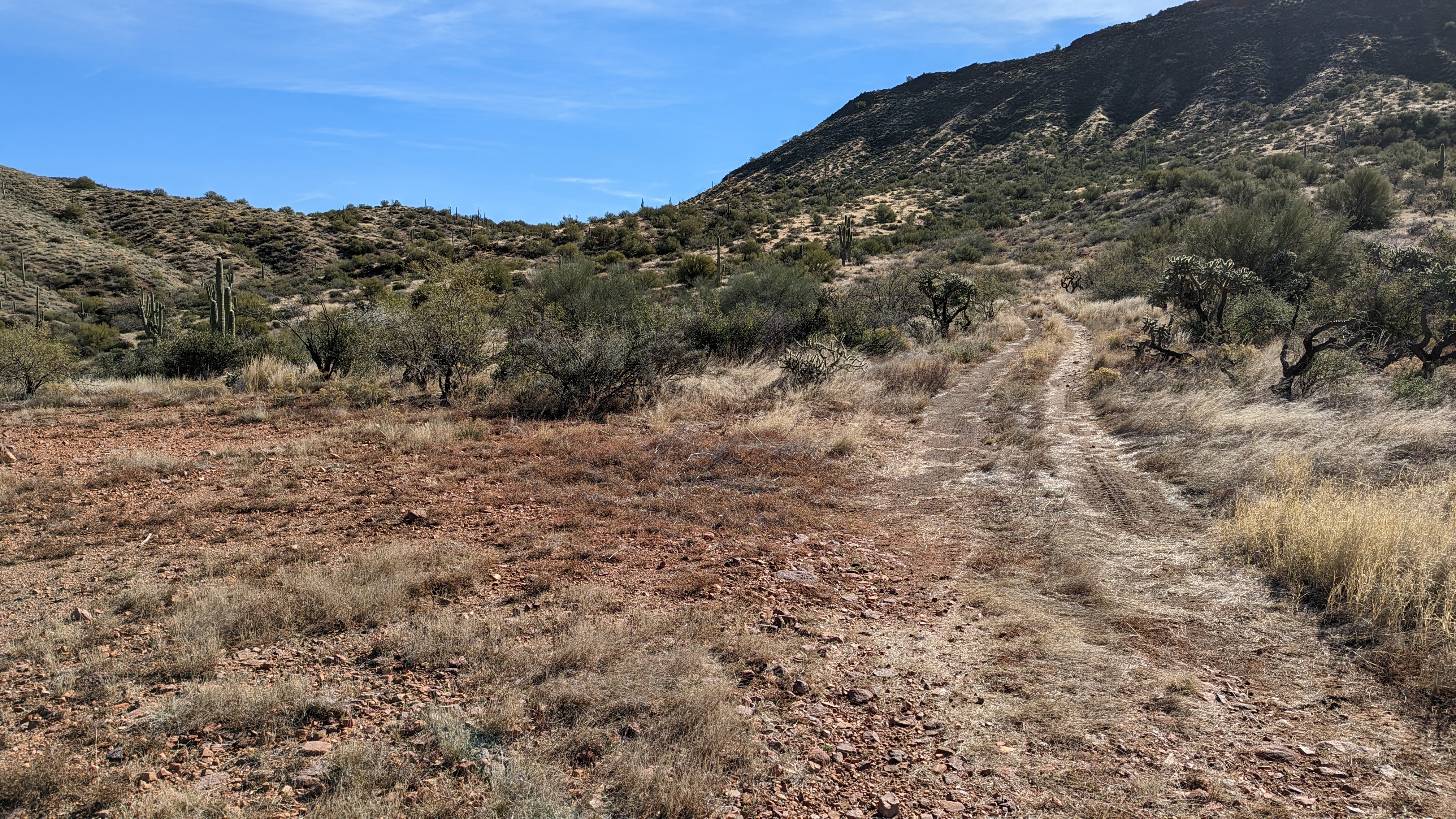
The park is bigger than it looks. Part of that is the topography. It's not flat like most of the city. There are hills, rock outcroppings, an access tunnel under a main roadway and interconnectivity to the surrounding communities of Tempe, Scottsdale & Phoenix. Oh, and there are dirt jumps. Lots of them.

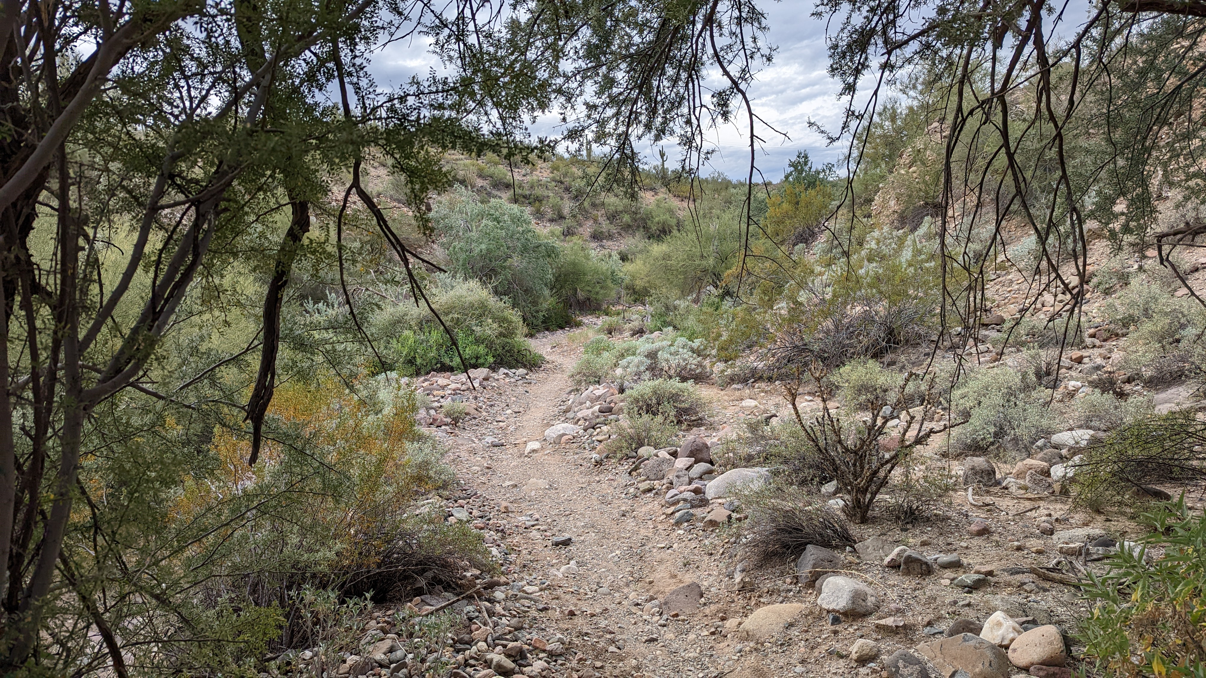
Over the years I grew to know every nook and cranny of the place. Learning how to actually ride my mountain bike, gaining the skills I needed to tackle more intimidating places like South Mountain. Papago Park may not look like much on the surface, but dig deeper, keep your eyes peeled, many trail surprises await.

On a recent ride there I decided to take a spin down memory lane, trying to recall some of the fun hidden gems or trails I used to up my riding game at the time.

For years I used to park near the south end of Papago at College & Curry Rd. These days I prefer to stage from the parking lot off Galvin Pkwy across from the Phoenix Zoo. It gives you a nice few miles to warm up going CW around the golf course.

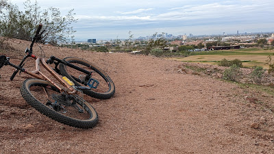
Literally right next to the Rolling Hills Golf Course.
This was the first time in almost 1 1/2 years that my bike has been nekked - no framebag or feedbags. Looks clean, but where am I supposed to put all my crap?? It felt snappy, but oddly weird.

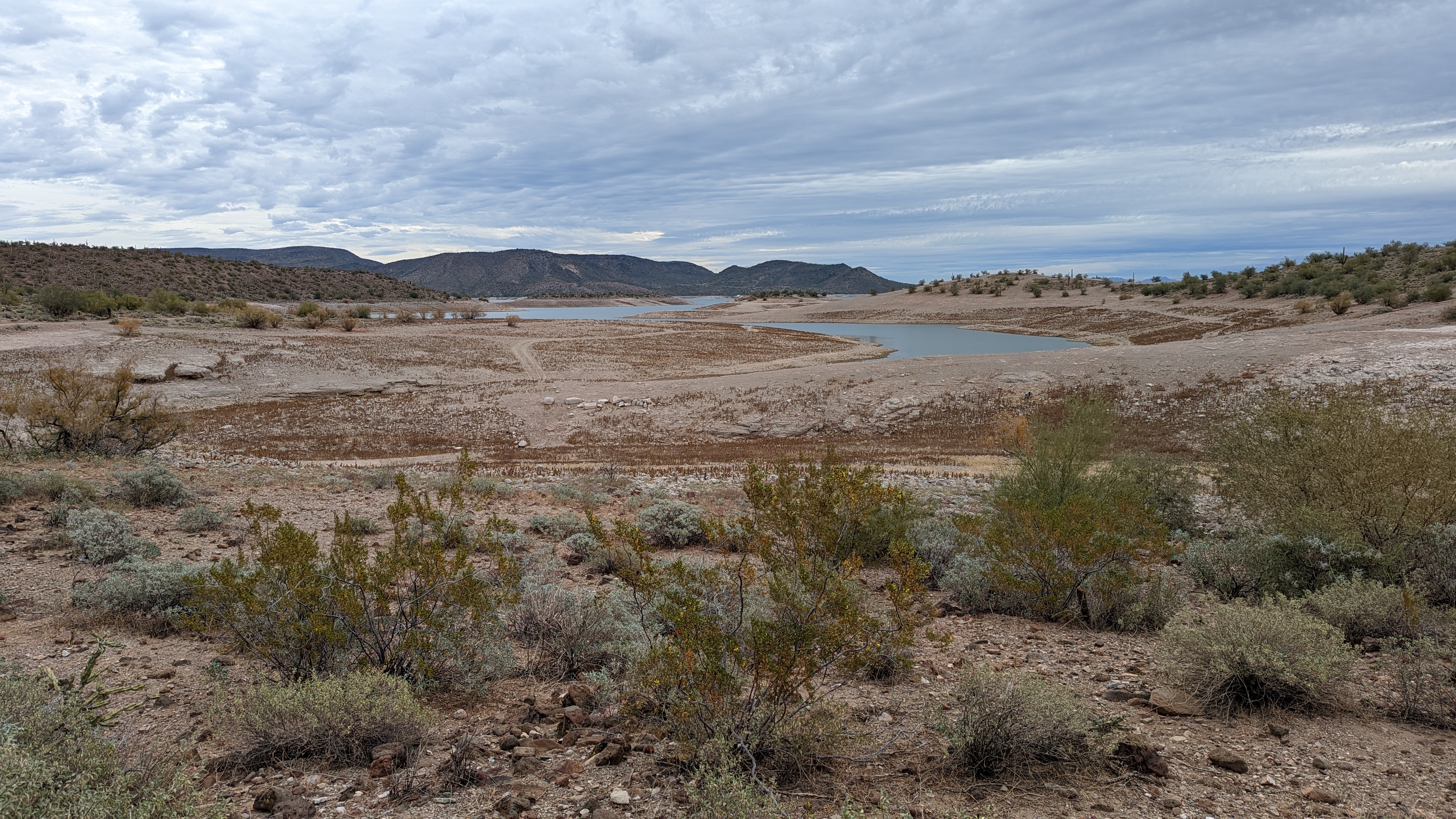
Taking the extra high road climb by the immensely popular Hole-in-the-Rock. Place is always packed on cooler days.

Same shot as above, but more of a city view.

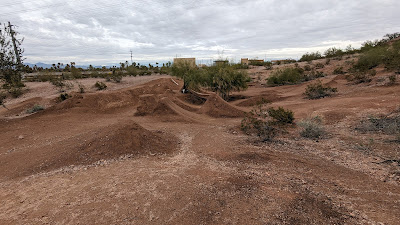
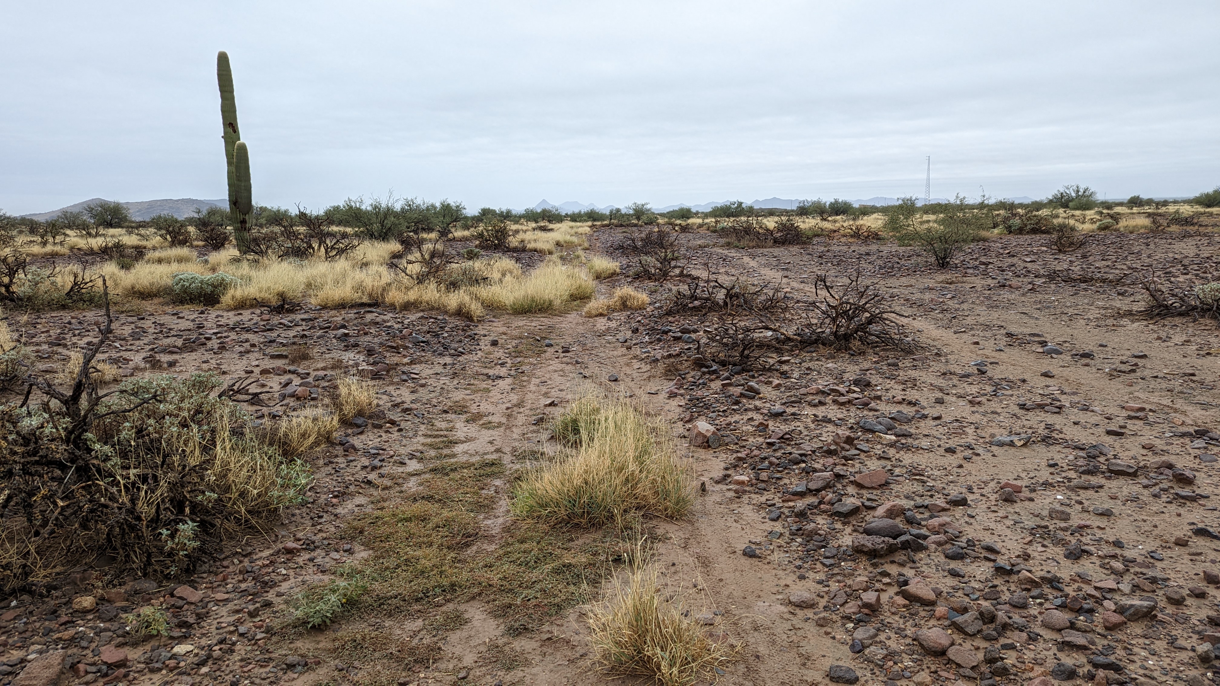
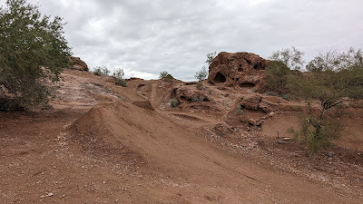
Near the back entry of the Zoo resides a playground of dirt.

It's morphed and advanced over the decades.
I've been coming here since '91 on my GT Pro Freestyle Tour BMX bike. I used to do 360's off one of the far jumps, no gaps back then.

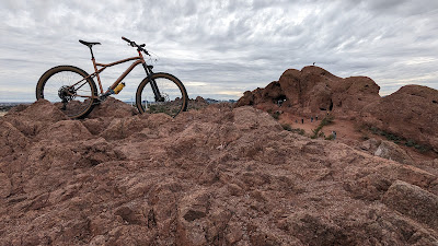
That rock face behind the jump is what I was after.
That face was one of my earliest technical challenges on a mountain bike. It's really steep and has a bit of an awkward step halfway up. I remember it taking many, upon many tries to finally get it. Cruised right up today and it felt good to visit an old friend.

Up top there's a water tank with some fencing around it. There's just enough clearance around the fence to fit a narrow trail that often gets hidden behind some Palo Verde trees. It's still there, but I almost tumbled down the hillside when I clipped the fencing with my handlebars!! Oops. I didn't have 800mm bars back in the 90's!!

From there it's a fun mostly downhill rip to a tunnel under Curry Rd. This leads to the hilly area between Curry and the Loop 202 Fwy. Unfortunately, it's also now home to quite a few transients. I didn't hang around long, making my way past a few tents and up to the areas high point.

Nice view of Tempe Town Lake and skyline. It's crazy now how you can barely see Sun Devil Stadium, once a dominant feature on the horizon.
I crossed over Curry and rejoined the trails looking for one climb that used to give my problems as a new rider. I found it and made quick work of it, but recalled how difficult it used to be. It's a bit steep, fairly short, but littered with loose rock. It was a perfect training hill to learn where my weight needed to be.
Looks like a newer trail cut in just below the ridgeline.
I had to check it out, it was a hoot and very well built. It was much longer than it first appeared too. Pretty cool to find new trails at a place that's been around forever.

Starting my way back towards the jumping area.

Hunt's Tomb.

It also provides a great view of downtown while overlooking the Zoo.

Southerly view from Hunt's Tomb, South Mountain in the background.

Near the Hole-in-the-Rock parking area and all the tourists.
Even after all these years, Papago is still a really fun place to ride. There's something for everyone. Go check it out sometime and keep your eyes peeled for the hidden gems. You may just like it enough to add it to the regular rotation.

Route:


December 26, 2022

Picketpost: Half-Hearted Loop

 I've love scouring topographic maps for potential biking routes. I've been trying on & off over the years to find a suitable shortcut out near Superior to add more miles of the Arizona Trail, AZT, to some bikepacking routes. During a recent map scour of the area I spotted something, a piece of singletrack connecting two otherwise deadend jeep roads. Would this go? Rideable? One way to find out.

This was the planned route, a heart-shaped clockwise loop. The top of the heart would all be new-to-me terrain with the right side of the route being the AZT through Whitford Canyon.
I had a couple of questions I needed to answer about this route: Is the new stuff rideable? Can the singletrack actually be linked together? Is it any good? How steep is the grade beginning at the dip in the heart? Rideable? I was about to find out. How exciting!!
Satellite view of the first section of jeep road that deadends at a ravine and what appears to be a clear singletrack trail continuing south.

The end of the singletrack bit ends at this cattle tank in the trees. Looks easy enough to find a way through to the next 2-track and more visible jeep road. This is the dip in the heart.

Leaving the north end of Picketpost trailhead.

Two miles of AZT: 4 gates, 1 culvert under US60 and crossing Queen Creek.

Saguaro forest.

FS172, time to head north.

The road cuts through Hewitt Canyon, Roblas Butte on the right.

Saguaro covered landscape back here.

Satellite view of the area off FS172, looks like the 2-track follows a wash for a bit...

...the reality on the ground. It was easier to walk through.

The 2-track became more what I hoped for after leaving the wash area.
However, each subsequent uphill was littered with loose rubble and just steep enough to be a hassle. Lots of on/off hike-a-bike. So far this route wasn't winning me over, wasn't totally off limits...yet.

I was now in the thick of nowhere. I rounded a corner and was totally caught off guard by a lady out hiking with her dog!! I startled her too and we simultaneously asked each other where we came from. She was camped somewhere along FS172 and had mentioned one of the dirt roads deadended up ahead. I knew this based on my satellite scanning, see the earlier pic above. Before reaching the deadend, the road dropped down to an old windmill.

Preston Well.
The jeep road continued around the hill then came to an end at a steep embankment above a gulch. I started down the slope, made it about 2-3 steps before my feet slid out from under me on the pea gravel. Thankfully, I held on to the bike as we both slid down about 20 feet. No harm done. I was now looking for that white line of singletrack I saw on my computer. It didn't take long as it was plenty wide at first. It seemed like it could have been an old moto trail at some point?? It was now reduced to a narrow gulley filled with loose rock and somewhat overgrown, not that this surprised me.

Looking back along the singletrack. This was probably the 100' of trail I could actually ride.

Picketpost Mtn. comes into view. Neat. The trail wasn't any more rideable, pretty much all hike-a-bike.

I pushed through the vegetation at the end of the trail, crossed a dry cattle tank and found the 2-track on the opposite hillside. Overall, getting to this point of the route was much more work and hike-a-bike than I had hoped for. I was now at the base of the main climb and one look up the hillside told me I wasn't going to be riding much of it. The grade was rather stout. It was about 2 1/2 miles up to the top, fairly sustained pitch. I knew at this point the route would link to the AZT, but I really didn't feel the need to push my bike there just to prove a point on a route I wouldn't be using. So, I bailed, halfway through the heart and road mostly downhill back to Hewitt Station Rd.

I bumped into a couple of guys in a SXS on their way up. They were surprised to see a mountain biker out in this area. They asked where I came from and got some puzzled looks when I pointed towards the canyon I came through via singletrack. I think they wanted to try to go that way, but it's impassable in a vehicle. I watched as they began to climb the ridgeline, stopping for a couple of minutes at the road I popped out on. I'm sure they were considering it, but eventually they moved on up the climb.

That's the intended route going sharply up the ridgeline.

My route back crossed this flowing slickrock area. The lower pool looked deep enough to soak in.

It was definitely a fun exploration ride, too bad it didn't work out as well as I hoped, as it would have been a cool way to add about 10 miles of AZT to a couple of routes. On to the next one....

Route:

December 3, 2022

AES: Unpleasantville

 The final event on the Arizona Endurance Series, AES, calendar was upon us: Pleasantville. A big, 61 mile, clockwise loop around Lake Pleasant. I was looking for a bit of redemption from last year's DNF due to tire issues early on. The initial forecast looked good, but the night before it had changed to a 30% chance of afternoon showers. Good thing I checked as I hadn't planned to take rain gear!! I didn't think too much of it since by afternoon I'd be getting close to the finish anyway.

Kirsten offered to host us again which is just about the coolest thing ever. It also makes it very convenient to access the Maricopa Trail as it's only a few blocks away.

The morning was cool, but not cold, although my hands would still be complaining for the first few miles. I was a few minutes late off the start because I forgot to load the track on the GPS and it was taking longer than normal. Oh well, I'd be near the back anyway.

The hot air balloons were out early on this overcast morning.

A less than spectacular section of the BCT.

I caught up to Nancy while she Macgyver'd a water nozzle hack for her pack. She and Jeff would opt to cut the ride short when Jeff wasn't into the long day ahead. This turned out to be a very fortuitous decision.

This area is seeing more dispersed camping and along with it some unfortunate scenes. I wonder what the story here was. This was literally crossing the trail.

The route drops off the ridge into this fun canyon area as it nears Lake Pleasant.

The New Waddell Dam which creates Lake Pleasant.

Rude awakening to the trails!! I've never seen this much water here. The footbridge to cross this area is still 25' away. I managed to keep my feet/shoes dry as I crossed.

A very receded waterline of Lake Pleasant, somewhere near 60% capacity.

With the low lake levels we could simply ride across the old site of the floating bridge which is scattered about.

Lake view from the trail.

Clouds building as we begin to circle the north end of the lake.

Now looking south towards Lake Pleasant.

The SXS crowd had the dust flying, but not for long.

Some chunky, but fast dirt roads around the north end.

Bottoming out in another dry finger of the lake.

Hard to believe this area fills with water on occasion.

Steven and I made the short detour to Solo Spring to filter some water and get the advertised time bonus. It's a cool sight. Clear, cold water tucked under this overhang.

Back on route, we near the mesa as light rain begins to fall sometime around 12:30p.

It's enough to wet the ground and break out the rain gear, but the riding is good.

Ouch. A relatively new Subaru Forester well over it's head. I wonder what the story here is as it's been reported to have been here a while, yet to everyone's surprise it isn't riddled with bullet holes or has much missing. That's how remote this section is. There is a flat camping spot on top of the hill to the right of the photo, that's my guess on its destination. The road deteriorates further after the hill. I'm shocked it made it this far back to begin with.

Friendly reminder that this route is CLOSED between Dec. 15 - June 15.

Steven takes the plunge to the next obstacle: the giant field of cockleburs!!

At first we could follow the path of the faster riders, then it closed. Every rider for themself!!

This fella just stood there staring at us, laughing inside I'm sure at our stupidity.

Revenge of the cockleburs!! They attach to everything and were 7' tall in some areas. Apparently they spawned the invention of VELCRO. Seems logical.

We finally made it to a real path through the burs.
The rain continued, but was light and steady. The riding was fine as we crossed a dry Agua Fria River and began a short stint on Table Mesa Rd. The ground was now well saturated as we began the Black Canyon Trail, BCT. We stopped for a snack, which included a semi-soggy slice of Chicago style pizza thank you very much.

I joked beforehand that any rider would receive a one minute time bonus for each cocklebur still on their bike or person at the finish. Steven is looking to trim an hour off his time!! Hahaha.

I took off a little ahead of Steven and crossed the one dirt road on this section to begin the meat of the climb away from Table Mesa Rd. It was the last time I'd see Steven as he opted to bail from the route and get picked up since he didn't have any rain gear. I found this out after the ride.

I kept climbing, slowly. I was about 2/3 of the way to the saddle when the dirt began accumulating on my tires. Eventually it was too much and my chain came off as the sticky mud clung to everything. Ugh.
My poor bike not exactly rideable at the moment.
I topped out on the saddle, bike loaded with mud. I knew a good downhill was coming, so I didn't need to bother with my chain at the moment, hoping a good bit of mud would fall off. It didn't. At the next 2-track crossing I tried to get the chain cleaned enough to put back on but to no avail. I opted to coast the downhills, Fred Flintstone the flat sections and walk the uphills all while stopping every so often to try and get the chain to stay. I doused it with water from my bladder, scraped it, nothing worked.

Finally, about the 5th try it didn't fall off!! I slowly soft pedaled for a bit until I knew it would stay on. Relieved, I could now cover ground at a reasonable pace.

Saguaro Alley.

Gavilan Peak near New River through the rain.
For the most part the trail rode fine the next few miles. I was about a mile or so from the Emery Henderson TH when my phone rang, it was Igor. He, along with a few others, managed to finish the route and were back at Kirsten's place soaking in the hot tub. Where are you? He asked. I said about 8 miles from the finish. He insisted I skip the dirt road connecting the BCT to the Maricopa Trail as it was all death mud. I asked how the BCT rode south of Emery Henderson and he said it was fine. So, my plan was to stay on the BCT until I linked up with the Maricopa Trail, then ride it in reverse of what we did in the morning back to Kirsten's place.

A few minutes later I cruised through the trailhead intent on knocking out the final 6 1/2 miles relatively quick. That didn't last long as I was almost instantly bogged down in gooey muck after crossing New River Rd. The mud was piling up quickly on my bike & shoes, then the chain came off again. Shit. This was truly horrible stuff, heinous. I had barely gone 1/4 mile from the trailhead. No way I was pushing my bike through this crap to the finish. Plus, it was already 4p and only a little over an hour of daylight remained.

I called Igor back asking for the odds of him picking me up. Zero. He didn't have his truck. Bob was there and overheard my plea and offered to come get me from the trailhead. Hooray!! Bob also rescued me from my AZT300 DNF in 2017 in style. What a guy!!
My Pleasantville ejection wasn't quite as glamorous!! Ha!

It may look innocent...

...but it's pure evil!!! Gah!!
It took everything I had to lift the bike high enough to clear the horse gate back at New River Rd. I bet the bike weighed over 150lbs easily. Back at the trailhead I walked the bike through a series of puddles on the pavement to attempt a little bit of cleaning.

Pretty sure my bike hated me after this ride.

Somehow I managed to find one more section of the BCT to avoid when wet.
I have to admit, it was a gratifying DNF, calling it after 55 miles of a 61 mile loop. Most of the DNFs on this day were after 50 miles due to mud. At least we all were able to ride the best part of the loop!! Thanks again to Bob for bailing me out. Back at Kirsten's place it was great to hang out for a bit, soak in the hot tub and share the tales from the day. Thanks also to Kirsten for once again hosting this silly route and being the awesome host everyone loves!!

The Battlewagon the following day, still not completely dried out. Took about 30 minutes to get all the muck off.

Would you look at that!?! It's a nekked SSP. I've had this bike for almost 1 1/2 years and I had never seen it without bags. Haha. It went straight to the bike shop for a major overhaul.

Route: