The Maricopa Trail, MT, is a mixed surface multi-use trail/route that encircles the entire Phoenix metropolitan area, aka The Valley of the Sun. It links most of the Regional Parks and South Mountain Park using a main loop, there are a series of spur routes that lead off the main loop to some of the Regional Parks. Here is an interactive map of the trail system.
The trail was officially completed in 2018 and a few of us set out to ride it early in 2019. I had an unfortunate mishap with a slick sidewalk corner, cutting my ride short barely 20 miles into it. I had unfinished business.
Fast forward to 2021. The MLK weekend was approaching and the 10-day forecast was looking divine: sunny & low 70's during the day & low 40's at night. That's cowboy camping conditions!! I live down on the SE corner of the map in Queen Creek only one mile from the MT along Queen Creek Wash. I'd be doing the main route in a clockwise direction starting with the San Tan spur. I'd be bikepacking this route solo, not racing, but intending to ride long hours into the wee hours of the night. I love night riding. I'd be carrying a SPOT tracker showing my location online so family & friends could follow my progress and meet me on route to ride bits, give me treats or a high five for encouragement. Any or all was highly encouraged!!
As a side note, each year the Maricopa County Parks & Recreation puts on a 100 Miles in 100 Days Challenge. (200 miles if done via mountain bike). You have to log miles in the Regional Parks or Maricopa Trail to get credit. I did it last year and received a cool t-shirt. I wanted another one and this ride alone would get it done.
One section of the route was a bit in limbo, down in the SW corner was a new spur out to the Buckeye Hills had been marked with a dotted 'future' line for a while on the map. I had been out in the area recently and noticed a bunch of MT signs, so I knew part of the route could be followed, but how far west would it go? I'd play it by ear when I arrived.
 |
| My ride: Motobecane Ti 29er hardtail. *I'd also be wearing a 25L Osprey Escapist backpack |
 |
| Cockpit view: One bottle for electrolytes, yellow feedbag for electronics, center feedbag for snacks, Garmin Edge705 GPS, REV Grips to help dampen the bumps, K-Lite Bikepacker Ultra light wired directly to the dynamo hub for endless illumination. |
I thought if all went well I may be able to finish late on Sunday, but I also had Monday available so I wasn't too stressed about it. I had everything ready to go by Wednesday night as I had to work a few hours on Thursday morning before heading out.
I left home right at 11:30a making my way down Sossaman Rd. towards San Tan Regional Park. I'm not too wild about riding along Sossaman Rd. as it doesn't have a shoulder, but traffic was light on a midday Thursday.
 |
| The first of many farms along the route. |
 |
| Very short off-route spur to this historic site. |
 |
| Had to reach through the fencing to get a clear shot. Right in the middle of suburbia now. |
 |
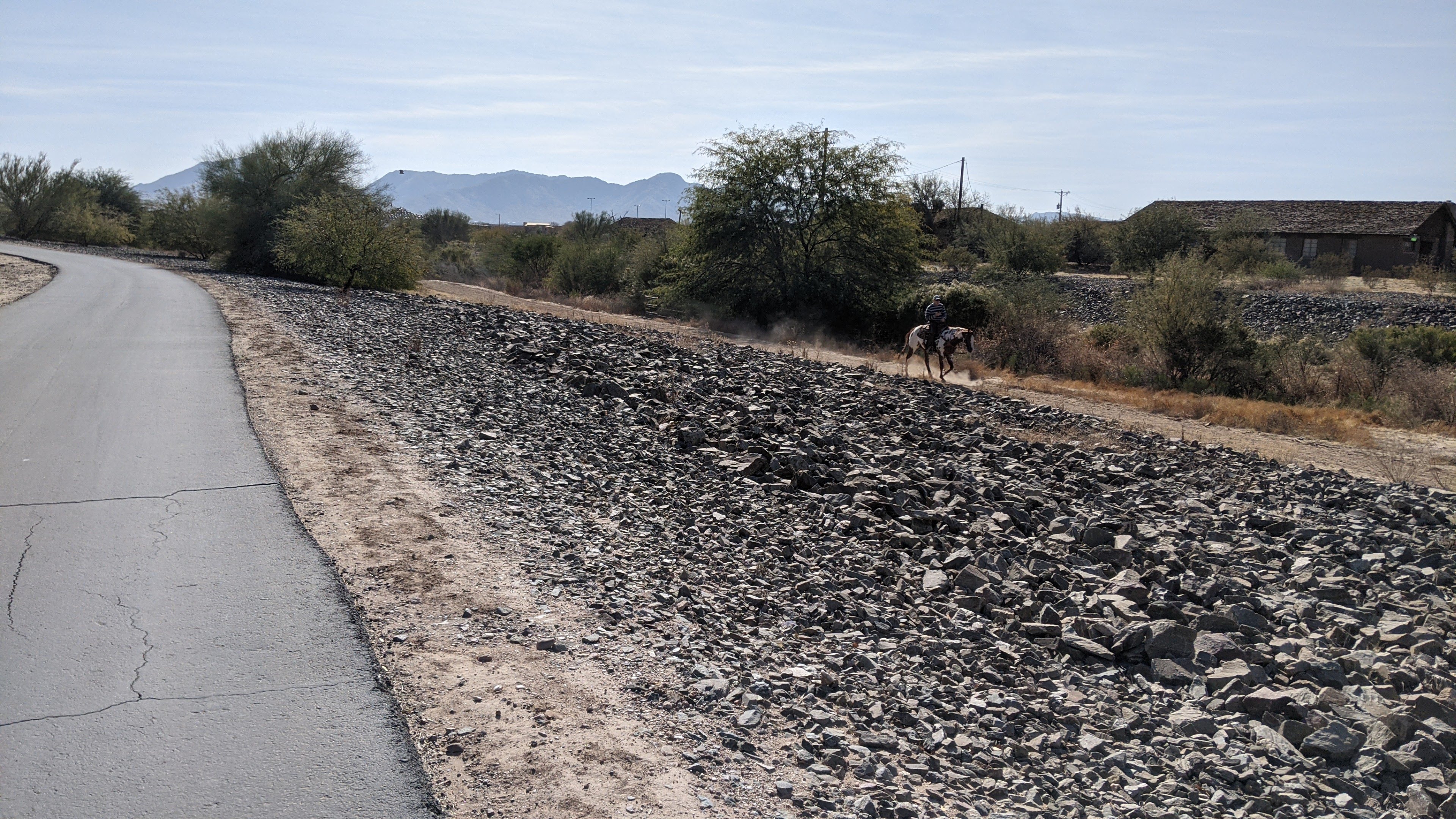
| Paved multi-use path next to an equestrian path, no matter what you ride, get outside!! |
I was about 3 miles into the ride, heading south on Hawes Rd. when my GPS track disappeared from my Garmin. WTF?? It reappeared a half mile later only to disappear again. I had checked the track on the unit the night before, it had been reduced to 10k points too. I rounded a turn and the track appeared, but the map locked, stuck on the same image as I rode along. Timer & mileage were still ticking. Great. At least I knew the route for the next 20 miles or so, but what a PITA!!
 |
| Next to San Tan Regional Park, I've always wanted to see the inside of these. |
 |
| I would see many of these Maricopa Trail signs along the way. You are here: San Tan Regional Park. At least I was getting my monies worth out of my annual hike/bike pass!! |
 |
| Climbing Dynamite trail. |
 |
| Dynamite trail is by far my favorite in the park, too bad I wouldn't be descending it. |
 |
| Inside the center of the park on Moonlight trail. |
 |
| Near the southernmost portion of the entire MT, looking north to the steep scar I'd be hiking up shortly. |
 |
| Starting up the steep, rugged Goldmine trail. |
 |
| Singing: 'I love hike-a-bike'... |
 |
| At the summit. |
 |
| Slow, careful descent through the chunky stuff. |
 |
| Took a slight detour to two graves inside the park. |
 |
| Fast downhill exiting the park. |
I veered off the Maricopa trail to avoid Sossaman Rd again, instead staying on Hawes Rd. since it has a wide shoulder and I could rejoin the multi-use path along Queen Creek wash which would return me to the route near home. But first, I had to exorcize some demons...
 |
| A Sour Patch Kids offering at the now dry slick sidewalk turn that took me out two years ago. |
 |
| What the??? Maricopa trail CLOSED for maintenance?!? The closest mile to my house and I had to skip it. The crews were doing some seal & patch work along the path. I could always ride it at the end. |
 |
| I was now a few hours into the ride, might as well load up on calories!! |
South Mountain was the next trail destination, lots of road & canal miles to get there, so the riding was fast.
 |
| At least there were bike lanes on the road. |
 |
| The trail was marked very well, showing arrows for turns in spite of the rogue sticker!! |
 |
| Another place I drive by frequently that I'd love to see inside. |
 |
| A rider passed by me going the other direction & yelled my name, it was my buddy, Noel. He was also sporting an AES jersey like me. |
We rejoined the main MT loop at the Western Canal and my GPS seemed to sort itself out. No more disappearing track or locked up map screen. I have no idea what caused that. In over 10 years of using this model of GPS, it's never done that.
 |
| Downtown Gilbert. |
 |
| New railroad overpass being built. It'll be a great addition as the tracks are a bit wonky to cross. |
 |
| Screen covering to guard against wayward golf balls. |
 |
| Noel showed me this MT bypass, super cool and it cut out a couple miles of busy road riding. Hopefully the MT adopts this section in the future now that a connection to it has been built. |
 |
| Passing through the tiny community of Guadalupe. |
 |
| I-10 overpass. |
 |
| Made it to the entrance of South Mountain before sunset. |
 |
| I took a short break here, getting ready for the technical gauntlet of National trail - mostly in the dark too. I love night riding and was kinda glad I was starting up right at sunset, that meant I wouldn't have to worry about much oncoming trail traffic. I bid adios to Noel and continued west. |
 |
| The first feature on National: Gatekeeper sets the tone immediately. I decided to just walk the entire climb. |
 |
| Elevation piling up quick. |
 |
| Dusk sets in at the top of the first major pitch. I did ride a few bits here and there. |
 |
| The infamous Waterfall. |
 |
| I think the views up here are better after dark. |
 |
| Getting super close to the TV towers, a Phoenix landmark for reference. |
 |
| Beyond Telegraph Pass, the downhill slope drops off into the abyss. This section of National is highly underrated IMO. |
I reached the far west end of the mountain and began the steep, loose descent. I rode what I could, but was taking no chances so I began walking down earlier than usual. A few minutes into the always enjoyable downhill hike-a-bike, HAB, my left IT band began to make itself known. It wasn't happy. The discomfort intensified with each step. Hmmm, this isn't good. I knew I didn't have much walking left, but opted to pop a couple of Advil anyway. Back on the bike, it wasn't an issue. I eventually crested the small west saddle and descended towards the Bajada junction. It was now 9:45p or so and I thought this would be a good place to crash out for a few hours. It didn't take long to find a relatively clear flat spot to lay my sleeping bag down. Day 1 in the books and I met my goal of completing National trail, 65 miles down. I was ready for a big day on Day 2, so I set my alarm for 5:45a.
The alarm seemed to come quickly the next morning. I turned it off and noted how chilly it was. That's when I opted to stay in my sleeping bag until the sun came up. Zzzzz. Again, I wasn't racing, this was my ride, I'll do it my way.
 |
| Early morning light on the Sierra Estrella Mtns. |
I packed up camp, ate a small breakfast and was rolling around 8a. This would become a theme for the entire ride, breaking camp around 8 - 8:30a.
 |
| I quickly left National trail and exited the park after a couple miles of riding. |
 |
| About to cross under the Loop 202 Fwy. |
 |
| The next few miles follows a powerline corridor along the boundary with the Gila River Indian Community. I wasn't too keen about camping anywhere along this stretch. |
 |
| The pavement soon gave way to nicely graded dirt. |
 |
| A reminder of your proximity to the rez. |
 |
| This was an odd sight, not sure what they are. |
 |
| The miles were stacking up quickly, making my way to the Tres Rios Wetlands. |
 |
| Cotton fields. |
 |
| New meets old. |
 |
| It's pretty sad to see all the crap people dump in the desert, but a boat? Out here?? |
 |
| Of course, it too was filled with trash. |
 |
| The Sun Circle trail is a smaller interior loop of the MT, but parts overlap. |
 |
| Turning west, still good riding even if the desert looked kinda bleh. |
 |
| Entering the Tres Rios Wetland area. |
This area was a bit odd to me, I had seen on some maps that it was off limits this time of year or a permit was required for entry. I saw a few cars parked at the trailhead and some workers just beyond. I didn't see any signs indicating it was closed, but there were a bunch of No Trespassing signs all around, then a MT sign and another telling visitors to enjoy their time at the wetland. It was all very strange. Should I be here or not? One of the workers began coming my way, so I rode over to him to inquire about the status of the area. He said it was open, but to watch out for some construction project up the way. The No Trespassing signs were for a fenced off area, not the actual wetland.
 |
| Lots of interpretive signage along the way. |
 |
| Wide open, smooth dirt. |
 |
| Finally!! Some water. |
 |
| Now it resembles a wetland. |
 |
| It was a really cool area to ride through, glad the timing worked out that I caught it in daylight. |
 |
| Now I knew I was getting to the far west valley, Phoenix International Raceway. |
 |
| The only time I've ever been inside the track was for a Faith No More/Metallica/Guns 'n Roses concert probably back in '92. I wouldn't mind checking out a race someday. |
 |
| It's an impressive sight and miles upon miles of available parking!! |
 |
| I entered Estrella Mountain Regional Park, almost all new-to-me trails. I've only ever ridden here once over the years. |
 |
| It was a nice climb to get into the park. |
 |
| Equally good payoff too. |
When I was planning my route it was very difficult to find any information about the Buckeye Hills spur inside of Estrella Mountain Regional Park. I asked my buddy, Rhino, if he knew what the route would be and we both took a guess and came up with the same routing leading through the park. Now, after the fact, a more recent map was just published and of course we chose the wrong trail!! Oh well, I still like the route I took along Gadsen trail. I took note of the route mile, 84, and the time of day, 10a, when I left the main route to begin the Buckeye Hills spur.
This spur would take me through Estrella Mountain Park, Pirate trails, F.I.N.S. and then there was a question if any of the trail beyond was constructed yet. I was kinda hoping it wasn't, then I could continue north towards the White Tank Mountains & Lake Pleasant.
 |
| Quartz outcropping. |
 |
| A slice of fast slightly downhill singletrack in the Pirate trails. |
 |
| Not sure what the story is here, but these have been lying around for a while. |
 |
| Maricopa Trail stickers have been added to the area trails. |
 |
| This was another area of question as a new housing development was going in, but the trail around it was intact. |
 |
| Entering the always fun, F.I.N.S. system. |
 |
| Great signage & maps throughout this area. |
 |
| The MT follows this trail, Kimurel's Hurl, but it's a one-way downhill flow trail and I was coming up. So, I went up a different trail to get here, Harv's Howl. |
 |
| Down Spent Spade... |
 |
| ...and into the Enchanted Forest!! |
 |
| I reached the end of F.I.N.S. and wouldn't you know, the trail continued. Ride on. |
 |
| It was soft in spots, but very rideable as it followed the banks of a wash. |
 |
| The MT is a non-motorized trail, tell that to the two pickup trucks who drove past me on the trail. |
 |
| Sadly, more desert dumping. |
 |
| Considering I hand drew most of the Buckeye Hills spur route, my GPS track was dead on. But the GPS wonkiness from early on day 1 returned. Freezing map, disappearing track. So weird. |
 |
| Trail continuing west. |
 |
| The singletrack ended near this massive sand trap wash crossing. |
 |
| MT signage continued along a series of dirt roads. |
As I neared the Buckeye Hills, the track would split and head to two different trailheads. I'd take the shorter southern leg first, then backtrack to the northern spur.
 |
| End of the line. My track was showing a 'trail' straight ahead here, but clearly nothing was on the ground. I guess there is still a bit of trail construction needed in this area. The Dogbone trail system is right here as well, hopefully the MT uses some of those singletrack trails. |
 |
| Now on the north spur on the west side of SR85. |
 |
| I didn't see any MT signs on the west side of SR85, just followed my GPS track when it decided to update. |
 |
| End of the line at the Buckeye Hills Regional Park. Sign here said the park was closed. I took a short snack break before turning around. I was already around 30 miles since breaking off the main route in the Estrellas. |
 |
| I couldn't believe how far west I had ridden, looking north, those are now the backside of the White Tank Mountains!! I was in the 285th Ave. range. Dang. |
In order to speed things up, I chose to take the roads back to Estrella Mountain Ranch where I could resupply at Safeway, then rejoin the spur route at the Pirate trails and back down to the main loop in the Estrella Mountains. I was getting low on water and while it wasn't hot out, it was warm. A quick Google map check showed old town Buckeye not too far away and a convenience store almost on the route I planned to take.
 |
| Crossing the Gila River and it actually has some water in it. |
 |
| If you know the Phoenix area, you know how far out this is. |
 |
| Turning back east, those are the Estrella Mountains in the distance. I need to get back there to rejoin the main loop. |
 |
| Howdy partner, welcome to Buckeye. |
I loaded up on drinks and slammed a large chocolate milk. Nectar of the gods, I tell ya. That would hold me over until I got to Safeway.
At Safeway, I grabbed a large sandwich for dinner and stocked up on food for the next push. I had a huge reserve bag full of bars, nuts, Payday bars, etc. in case I didn't have real food to eat.
 |
| Leaving Safeway the sun was already setting, seemed to time it well here. |
 |
| Arriving back at Estrella Mountain Regional Park at dusk. |
 |
| I knew I had a few miles of gentle climbing before a downhill brought me back to the main loop I left this morning. |
When I finally arrived at the loop, it was 7p and route mile 144. The Buckeye Hills spur ended up being 60 miles and took me 9 hours to ride, most of the day. I now set my sights on getting as close to White Tank Regional Park as I could tonight. That was still a ways away.
 |
| Ghostly looking parked planes at Goodyear airport. |
I forgot how the overall routing went through this area. It had me going east, then north before heading west again for a bunch of miles of road riding. I stopped for dinner along the way, checked in with K back home and told her my plans for the evening. I found a Circle K on route and loaded up with cold drinks and another chocolate milk for camp.
 |
| I-10 culvert. |
The route zigzagged through some canal drainage areas after crossing under the freeway, then it was on to a paved multi-use path near Verrado. It was fast riding and the miles were ticking by rapidly. I left the neighborhood area and resumed desert riding. It was approaching 11p so I started scanning for a camp location. Barely 5 minutes later I spotted a clear flat spot off the trail. Perfect. I ended up with 108 miles on the day in 15 hours.
 |
| Day 3 greeted me with this sunrise view from my sleeping bag. |
 |
| Early morning glow on the White Tank Mountains. |
 |
| A smooth spot tucked among the rocks. |
I got rolling and found I had camped about 100 yards or so before the rollover gate leading into the White Tank Regional Park. I hadn't realized I was so close to the park the night before. This worked out perfectly, as the next spur route was about to begin, was very short, and had restrooms. There were a few hikers out early on this Saturday morning, but it wasn't super busy. Before long I was back on route heading north.
 |
| Another friend!! Sara tracked me down to ride some miles together. |
 |
| Another reminder of the horrendous 2020 burn season. |
 |
| It was turning into another beautiful bluebird day. |
 |
| Then there were three, Rhino joined the fun. |
I owe Rhino a huge thanks for helping me through some logistics for this ride. He rode the entire main loop a couple years ago, I think he was the first to do it. He pointed out a couple tricky spots along the way and helped me verify the track I had. He put a ton of time & effort into doing resupply research and I was able to compare what I had to his master list. After comparing his notes & mine, I was very confident in my plan. Beers are on me next time we ride.
 |
| Leaving the White Tank area - the track is fast & smooth. |
 |
| One of the more scenic spots on the entire loop!! ;p |
 |
| Crossing a busy Grand Ave. Sara peeled off here, thanks for coming out!! |
 |
| Rhino & I continued on generally following the powerlines. |
 |
| More bikepath riding somewhere in the NW part of the route. |
 |
| We picked up another rider, Ed, who was also riding the MT towards Lake Pleasant. Here, Rhino leads us along N. Lake Pleasant Pkwy. |
 |
| We heard a truck honking its horn, next thing we knew, Mike & Karen were handing me bacon!!!! |
 |
| Thanks a ton for the bacon handup!! |
 |
| This section along the Waddell Canal rode like a powerline corridor. It was a bit rubbly, but not too bad. |
 |
| Cruising one of the less rocky sections. Photo by Rhino. |
 |
| Lots of fall-line grades as we approach the Waddell Dam and Lake Pleasant. |
 |
| On to the next spur, up to the lake. |
 |
| We still need to crest that hill above me. Photo by Rhino. |
 |
| I really enjoy the Lake Pleasant trails. Photo by Rhino. |
 |
| Rhino's singlespeed steed. Photo by Rhino. |
 |
| The Roadrunner trail offered great views of the lake while leading us to the visitor center. |
 |
| Cool petroglyphs at the visitor center. |
 |
| Top of the hill. I could see this tower for miles. |
 |
| Lake Pleasant panorama from the visitor center. |
 |
| Rhino leading the charge back down the spur route. |
 |
| Sometimes there's actually water in here. Photo by Rhino. |
 |
| Adios dude, thanks for coming out!! Photo by Rhino. |
I should note here that I'm running a dynamo hub with a switch that diverts power from my light to a USB converter. During the day I switch over to the USB and power my cache battery, at night I switch to 100% light and use the cache to recharge my GPS & Phone. Well, some time ago, I had an extension added to my switch, but one of the connections isn't working. Need to rework the extension. Not a big deal, as I can simply unplug the light and swap that cable with the USB converter cable. So, on this day I swapped everything out, plugged in my cache battery to charge it during the day. Only thing is, I realized at the end of the day I hit the toggle switch, which diverted power to the side that isn't currently working. Dang it. An entire wasted day of charging. Now my battery was low, GPS was low, phone was low. The rest of the ride would become an electrical juggling act, but if done right all my devices would have enough juice to finish. This is another reason why, in spite of having a dynamo, I always top off using an electrical outlet when possible, even if it's only for 20 minutes at a time.
 |
| Kirsten's desert oasis. She offered to fire up the hot tub and have me stay the night, but I needed to be finished on Monday and had to keep rolling. One of these times, I'm taking her up on the offer!! |
 |
| Always great to see Kirsten's smile. This place is going to be so much fun when COVID is behind us. Thanks again for your hospitality & electricity even without the hugs!! |
 |
| This is how close her place is to the MT. Rad, huh? |
While out, I had received word that some rain, yeah rain, was on the Tuesday forecast. That made me push ahead since I didn't bring any rain gear. The Buckeye Hills spur added a bunch of miles & time to my route, so I was now going to need a full Monday to get it all done. I was about to enter the most difficult section of the entire route through the Seven Springs Recreation Area, the Cottonwood trail in particular. I was aiming to knock out some difficult bits tonight so I could do the brunt of the work early the next day.
 |
| Beautiful sunset over north Phoenix. |
The section of trail near New River is rugged, lots of on/off/on riding and I was glad to get through it tonight. I knew the spur route down to the Cave Creek Regional Park would ride fairly quick. I had hoped to get close to or through the Spur Cross area before camping.
 |
| Entering the Cave Creek area and the next spur. |
 |
| Can't stop now, sign says: Go!! |
The Cave Creek Regional Park spur was relatively short, but it's often loaded with hikers. By arriving after sundown, I had the entire park to myself. I also topped off my water here before linking back to the main loop.
 |
| We need some signs like this over at Hawes. |
 |
| By 10:30p I was beginning to slow down, I found this spot shortly before entering the Spur Cross area. |
 |
| Spur Cross Ranch Conservation Area. |
 |
| I was only a mile or two into my day when Mike appeared!! He had a few hours to ride part of the route. |
 |
| We then crossed paths with a bunch of total asses, ahem: ASSes - Arizona SingleSpeeders!! I know most of the guys pictured. |
 |
| Hey Dennis!! He's an ASS too!! |
 |
| Cool mural at the Spur Cross trailhead. |
This is where Mike twisted my arm to ride over to his car for breakfast burritos, Gatorades, cold Coke and any other food items I may want or need. Talk about a full SAG wagon!! Thanks man.
 |
| We motored on, linking north to the dreaded Cottonwood trail. |
 |
| Holy smokes, there's flowing water in Cave Creek!! It was bone dry farther downstream. |
 |
| Mike splashing down. |
 |
| Skull Mesa trailhead marks the beginning of the Cottonwood trail. |
 |
| Gaining elevation rapidly above Cave Creek. |
 |
| Whoa! A rideable portion. |
 |
| This entire area is best described as rugged beauty. Every view is hard earned. |
 |
| There were sections of trail that had seen some work in recent years. |
 |
| Other sections are still waiting for it. |
 |
| Obligatory Cottonwood trail sign. |
 |
| When I could ride, it was slow, chunky & loose. |
 |
| I felt like I had gone 10 miles, but the sign indicates only 2 1/2?!? 5 more until Bronco. |
 |
| I played leap frog with a family out hiking up Skull Mesa, they couldn't believe I had a bike on this trail. I couldn't either. |
 |
| Saguaro forest. |
 |
| Not sure if this was Cottonwood Spring, but there was some standing water nearby. |
 |
| The trail eventually drops down in/out of Cottonwood Wash for a bit. Sometimes rideable... |
 |
| ...sometimes not so much. |
 |
| Believe it or not, the trail on the right IS the new re-route. Imagine how bad the old trail must've been. |
 |
| This section of newer trail was really cool. |
 |
| I was about 2 miles from the Bronco trail junction and I was hoping for some rideable terrain to help speed up my progress. Ask and ye shall receive!! The final two miles of Cottonwood relented and I was able to pedal almost all of it. |
 |
| Bronco trail intersection, but don't rejoice too quickly. |
 |
| Still plenty of pushing to gain the main saddle. |
 |
| The harsh realities of life. |
 |
| I could finally taste the end and I saw the eastern mountains for the first time in a while. Four Peaks, Weaver's Needle and the mighty Superstition Mountains. |
 |
| The remainder of Bronco trail was pretty good, trending downhill to the trailhead. |
 |
| Humboldt Peak straight ahead with the golf ball on top. |
 |
| Two more friends: Adrienne & Scott came out with a van loaded with goodies. |
 |
| Cottonwood & Bronco trail: Done!! Huge hurdle completed. |
I visited with Adrienne & Scott for a bit, grabbing some cold drinks, pickles, etc. Thanks a bunch for coming out, especially after that brutal section of trail. However, I had one more giant hurdle to crest: Kentuck Mountain.
 |
| Now the third burn area I'd ride through, this one was fairly large last year, the Sears Kay fire. |
 |
| The first few miles are mostly downhill with some short climbs to break it up. |
 |
| The dust was flyin' on Seven Springs Rd., sure glad I wasn't over there. |
 |
| Beautiful bridge across this drainage. |
 |
| Another view of the Superstition Mountains as I begin the main climb. |
 |
| Golden Hour was upon me, could I reach the saddle in daylight?? |
 |
| Lots of familiar peaks here. PeakFinder app. |
 |
| The trail up had some cool routing, but was too steep to ride in a few sections. |
 |
| Nearing the top of Kentuck Mountain, daylight waning. |
 |
| I may have just missed sunset at the saddle, but I didn't miss the incredible view. Wowzers. |
 |
| Taking a snack break at the top of Kentuck Mountain watching darkness settle in. I realized here that I had been riding for 10 hours today and only covered 24 miles. Oof. I set a goal of at least 50 for the day to set myself up for a Monday night finish. Better get moving. |
The downhill off Kentuck Mountain was steep, but rideable. It wasn't nearly as loose as when I rode up it a couple years ago, but I also determined it was easier to get over Kentuck coming from the Bronco Trailhead. Not easy, just easier. Overall, the terrain vastly improved from the Seven Springs area and I knew there were a bunch of easy miles up ahead.
 |
| Some more MT info. |
 |
| Tonto NF boundary at the Brown's Ranch border. |
I made quick work getting through the Brown's Ranch singletrack. I entered McDowell Mountain Regional Park around 10:30p and was still feeling strong and wide awake. I decided then, I'd knock out a late night lap on Pemberton trail and find a place to camp either up off Windmill trail or down near Coachwhip.
 |
| So far, so good, Mr. Abbey. |
 |
| Peace, Happiness, Courage, Love, Tranquility & Wisdom. |
 |
| This fellow bikepacker had other aspirations, making camp at Jackass Junction. |
It was now after 1:30a and I needed to get horizontal. I passed by all the offshoot trails from Pemberton until Coachwhip was my next turn. I opted to find a spot here, knowing the ground was less likely to have rocks unlike the Windmill trail a few miles ahead.
 |
| I swear, I really tried to get going earlier in the morning, but the chill kept me in my sleeping bag until the sun's golden rays lit up the mountains. 8:30a start again. |
 |
| Back at the Coachwhip split, this time in daylight. |
 |
| On my way up into the mighty McDowells. |
 |
| Four days of dirt & sun and you too can look like a dirt bag. |
 |
| There it is, the last major hurdle of the route: Windgate Pass. |
There was a lot of pushing to get up there, but it wasn't too bad and really not long at all.
 |
| Feeling great, it wasn't quite 10a yet and the cruising canal miles weren't far away. I was beginning to think I'd finish at a reasonable time. I should know better by now. |
 |
| Looking back from where I came, Four Peaks on the horizon. |
 |
| An urban landscape waits to greet me. I hadn't seen much of that in a couple of days. |
It was a holiday Monday and I had only seen a hiker or two. Where was everyone? They were farther down the trail, that's where. Somewhere around Inspiration Point the trail traffic increased as did the hiker amazement at my deft riding skills!! Haha. All those rocks just make the riding look more difficult than it is.
 |
| Inspiration Point turn. |
 |
| The trail slowly becomes more tame down on Gateway. |
What's this? An MT sign pointing to the left, UP Gateway saddle?? I checked my GPS, my track was staying straight. Hmmm. Welp, gotta follow the signage, what's some more HAB?
 |
| Assume the position. People wonder why I ride in hiking shoes. |
 |
| Another summit attained, are we done? |
 |
| Gateway saddle was clearly marked as MT. It wasn't as obvious to link to the Paradise trail, but I knew that's where I needed to go. |
 |
| Paradise trail doesn't exactly live up to its namesake, it is fun though. |
 |
| The trail cuts between neighborhoods as it drops off the flank of the McDowell Mountains. |
I was so glad to be exiting the chunky McDowells, about to connect to some 20 fast flat miles, when I began to climb out of a wash and TING!! My titanium seatpost simply snapped in two. Gah!!
 |
| That's no good. Thankfully, after loosening the seatpost clamp I was able to easily remove the remaining post from the frame. |
 |
| Trail sniper. Things were going so well, other than my busted GPS mount. |
I looked at the post, there was still quite a bit remaining, so I reinserted it, smooshing my Jerrycan bag a bit. The seatbag still had decent clearance from the rear wheel, but I cinched it up some more. I hopped on for a test ride, considering how low the seat was it didn't ride all that bad. So, you're saying there's a chance I can still finish on this thing? You bet.
My buddy, Mike, who I rode with the day before lives right up the road and barely one mile off the MT. He said I should stop by if I needed anything. I thought he just might have a 27.2mm seatpost lying around and I could use a shot of electricity for my phone & GPS.
 |
| Back on smooth trail. |
 |
| Yeah, this is ritzy Scottsdale. |
 |
| It was cool to see these singletrack connectors tucked between the canal and major roadways. |
 |
| Dirt path along Cactus Rd. |
I detoured over to Mike's place after riding up the wrong road. Wouldn't you know it, he wasn't home. Out hiking with his kids on this glorious Monday. Oh well, the seatpost wasn't bothering me, time for lunch anyway.
 |
| The Scottsdale multi-use path is quite the sight. |
I found a local sandwich shop, Chompie's, slightly off-route and made my way over there. They had a couple of isolated tables next to an outlet. Perfect. I grabbed a huge tuna salad sandwich and went to town. For as hungry as I was I couldn't finish it. I wrapped it in foil and saved it for dinner. My electronics got a nice boost too.
 |
| Back on route, now this looks more like a greenbelt. |
 |
| Lots of people out & about, but this stretch was very relaxing. |
 |
| Almost refreshing too. |
 |
| Well done, Scottsdale. |
 |
| Back in the early 90's I used to inline skate along this path. |
 |
| It doesn't stay next to the main roads for long. |
 |
| My buddy, Brian, from Michigan, found this place recently while riding the AZ1000 route. |
 |
| The route turns east, staying on a similar multi-use path. |
 |
| After crossing Pima Rd. the route enters the Salt River Indian Community. |
 |
| Big views of Four Peaks, Red Mountain & the Superstition Mountains grab your attention. |
 |
| Superstition Mountains here. |
 |
| The Arizona Canal continues east towards Hawes and the final spur route into Usery Mountain Regional Park. |
 |
| Some of the famed wild horses near Granite Reef. |
 |
| Could be a painting: Lone Horse Flat. |

|
| Red Mountain, the famed backdrop of the Hawes trail system in NE Mesa. One of my home turf riding areas. I felt so close to home here, yet still 50 miles away from finishing. |
The Hawes\Usery spur is a deadend, so I created a loop out of it to bring me back to the canal. I was riding north along the Bush Hwy and made my way up Granite trail. When I arrived at the first trail split, the MT sign indicated I should've come from the left on Saguaro trail. Huh? I double-checked my GPS and it was on Granite. Maybe the MT changed? I backtracked down Granite, continued on the Bush Hwy to the next entrance and picked up Saguaro trail. Ten minutes later I was back at the sign, going the right direction.
 |
| Does this shot make my seat look low?? :) |
 |
| Climbing up to Twisted Sister. |
At the trail junction I ran into a couple from Colorado. We began chatting and they asked me about all the Maricopa trail signs. They mentioned their friend told them some dude was out riding the whole thing right now and they were a bit surprised to find out I was that dude. They couldn't wait to tell their friend they ran into me. Too funny.
 |
| Just up the hill I ran into Tiana & Jenn, who knew what I was up to!! These two are always having a good time and I'm glad our paths crossed out there. |
 |
| More from Twisted Sister. |
 |
| The next mile or so is a fun downhill rip. |
 |
| Well, if it isn't Shawn Gregory, the man behind the mini-dozer blazin' the new trails at Hawes. He's doing an amazing job with the new trail builds. He also makes some fantastic maps: Big Loop Maps Not only does he do all that, he's one heck of a rider too. |
 |
| Shawn directed me to his latest build: Maricopa Madness. He had just finished cutting the trail, it was soft, but rideable. Hopefully this trail will be adopted by the MT to eliminate some road riding along Usery Pass Rd. Maricopa Madness is now open and on Trailforks. |
 |
| The tool of the trade. |
 |
| What's this? Our very own 'Two thumbs up' Saguaro?? |
 |
| Fresh tread on Maricopa Madness. |
 |
| This trail has some character too. |
 |
| Sun setting on day 5 as I climb to Pass Mountain. |
 |
| I really like these giant MT signs showing the 'You are here' arrows. |
 |
| City lights from Pass Mountain. |
I knew Usery would ride fast, so I texted my friends, John & Jennifer to see if they were home. They were and told me to stop by. Be there shortly I replied. Again, I should know better by now.
I stopped by the Pass Mtn. trailhead to top off water since that fountain is chilled. Out of order. Rats. There were some teenage kids there checking out my ride and one asked me what kind of bike it was and if it was an eBike. No, it's not.
I began riding Blevins trail and things began to get weird. My GPS had me going up Chainfruit trail, but there was no signage at that split. I followed my GPS, but when I arrived at the next junction with Lost Sheep trail the MT was pointing left & right, like I should've come up Lost Sheep. Drat. I turned around, continued on Blevins trail to the next trail, Moon Rock. There was an MT sign on the post, but again, no indication to turn right or stay straight. I stayed straight to the next junction where there weren't any MT signs. Ugh. Back to Moon Rock, turn left, then meet up with Lost Sheep which was finally all signed correctly. I then passed by Chainfruit and popped out at the visitor center thus completing all my MT spur sections!! So much for arriving shortly.
 |
| Chainfruit Cholla in the dark are eerie looking. |
 |
| I had approached from the left, no turn indication here. |
 |
| Officially completing all the spur MT bits here. |
 |
| I need one of these for my garage wall...and some stickers!! |
 |
| Finally exiting Usery. |
 |
| Another buddy, Steve, doing some drive-by cheering. |
 |
| Beer me. Chilling at Jennifer & John's place. Joe, middle, stopped by to pick up a helmet. I was able to top off my electronics enough to get home without anything going dead. |
It was around 8:30p when I left their place. They offered to let me stay, but my bed was calling and I wanted to see K tonight. I was now near the top of Hawes, so only a few downhill-ish miles of trail then all canal miles back home. I could tell the skies were becoming more ominous, I needed to finish now.
 |
| Top of Hawes trail. I checked in with K and told her what I had left. |
I thought I could finish before midnight, but I really wasn't sure exactly how many miles I had remaining.
Barely five minutes after getting off the phone, I was descending Magic Mountain, rounded a righthand corner and the bike disappeared from my hands. OTB (Over the bars). It happened so fast, I still don't know what occurred. All I know is I landed on my feet and looked to my right to see my bike almost upside down, rear wheel spinning away. Not a scratch. Whew. Let's get off these trails and on to the flat stuff, mmmkay?
 |
| Thanks Hawes, it was fun. Gotta go. |
 |
| The fast smooth canal was welcomed. |
 |
| It too revolted with a few miles of pesky washboard. Meh. |
 |
| Loop 202 underpass. |
 |
| Turn left here, cross the bridge. However, no signage. None. |
This was a strange one. I knew a lefthand turn was coming as I rolled along the South Canal. The bridge pictured above is part of the Consolidated Canal. GPS had me going left. I walked around a bit looking for a sign or sticker, nothing. I crossed the bridge and found a MT sticker about 100 yards up the path. That would be the last MT marking I'd see for a bunch of miles along the Consolidated Canal.
 |
| The instant I snapped this picture, some dude came whizzing by me on a bike. Startled the crap out of me!! Never heard him coming. |
 |
| I began to wonder if the MT was marked on the opposite side of the canal. I checked at the Southern Rd. crossing and only saw a faded Sun Circle blaze. |
 |
| Down in Gilbert the MT is part of a vast network of canal trails. |
 |
| Right here. This officially closed my giant loop when I reached the Western Canal. Now it was just a ride home. It was already pushing midnight. |
I turned off the Western Canal on to the Roosevelt Canal. There was some construction near Warner Rd. that had me detour a short bit. That's about the time the wind began to really pick up. Great. Less than 10 miles to go and now I get to battle a headwind near 1am in the morning.
Route on Garmin Connect:
The Maricopa Trail is the ultimate urban bikepacking experience. You're never too far from services if needed, yet feel 'out there' on much of the loop. Overall, the riding is fairly fast and non-technical with the exceptions of: Goldmine trail at San Tan, National trail at South Mountain, a bit of trail near the Anthem trailhead, Spur Cross, Cottonwood/Bronco trails at Seven Springs, the steep grades on Kentuck Mountain and Windgate/Gateway passes in the McDowell Mountains.
I really lucked out with the weather, I don't think I'd want to do the full loop if temperatures were above 80º. Water was easily accessible, but there are a few stretches without food options. Do your research.
My five days on the route were 65, 108, 76, 67 & 100 mile days. Not sure how many others want that kind of ride experience. It included about 6 hours of night riding each night. Maybe a 7-10 day pace would be preferred for less night riding.
I want to thank the folks at Maricopa County Parks & Recreation for seeing this idea through, putting up all the signs, re-routing difficult sections where possible and generally maintaining the trail corridor. Well done!
I'd also like to thank all my friends who supported me out there, be it by offering food/drinks, riding companionship, a high-five or a shoutout!! You all rock!!