A few months ago
Jeff & Nancy tossed around the idea of doing the
Breck Epic. They ponied up and it was set. As a side bonus, they had an extra room in their condo and extended an invitation to K & I to join them for a bit. How could we say no? Escape the oppressive August heat in Phoenix for a few days in Breckenridge, CO - yes, please.
Of course my wheels began to turn almost immediately. How can I squeeze in a few 'bucket list' trail rides not only in Breck, but along the way AND keep the peace with K? I poked around a bit, but it didn't really take long to figure out what I wanted to ride. Our route to Breck would take us through the mtb meccas of both Moab & Fruita. Then on the way home I thought I could swing a ride up on the Monarch Crest. Throw in some hiking and National Park tourista-ing and it was set. Let's GO!
I have to admit, but after 20+ years K & I finally had an efficient departure for a vacation!! We were on schedule!! Our goal for the day was to reach Moab not too late and camp there. A noon departure had us out of the metro area and up to Flagstaff before any traffic situations developed. Good call. A quick spin through the Navajo reservation landed us at our first photo op of the trip: Monument Valley. Love this place, even if only passing through.
 |
| Such an incredible place. |
 |
| State No. 2 of our 4 corners tour. |
 |
| Recognize this spot? |
 |
| Sure enough. Sign is a bit hard to spot going 70mph!! It's on the west side of the road. |
 |
| Mexican Hat rock. |
Eventually we made it up to Moab, UT around 9:30p. Set up our tent and crashed out for the night.
The next morning we arose fairly early and had a nice breakfast at the Jailhouse Cafe. A quick stop by Chili Pepper Bike Shop for a
Latitude 40º map and it was ride time! I decided I want to start collecting a good set of waterproof mtb maps. I love riding with GPS, but there's still nothing like a good overview map in hand.
My ride for the morning was a short loop up the HyMasa trail to Capt. Ahab, roughly 8 miles. K was willing to wait by the car reading while I sampled some of Moab's finest.
 |
| Ready to go!! |
 |
| The routing of these trails is truly remarkable. |
 |
| Follow the blue dots. |
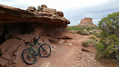 |
| Nice spot to dodge the rain or sun. |
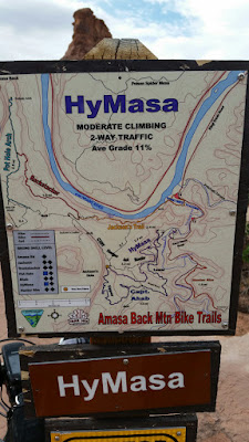 |
| Great maps along the trail too. |
I was really looking forward to riding Capt. Ahab trail. I had heard so much about it from friends and watching a few videos. I was curious to see how much I'd actually be able to ride.
 |
| Almost immediately I was presented with a jaw dropping vista. Whoa. |
 |
| More slickroack swoopiness. |
 |
| A rare stretch of dirt! |
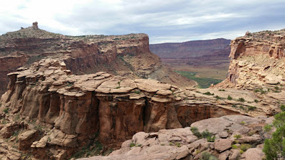 |
| That spine is begging for a trail. |
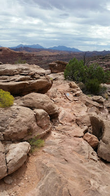 |
| A few good tech spots thrown in. |
 |
| The final descent along the canyon wall. |
It still amazes me how the trail builders in Moab can route a fun, technical, yet flowy line through the surrounding topography. Trail wizards indeed. Why it took me 16 years for a return visit is beyond me. I'll be back soon, too much goodness all around.
We were on schedule for the day, so after a few quick stops in town we made our way over to
Arches National Park for a quick visit. Now that I have an annual pass for the parks I don't feel so bad about going through them on a pass through trip. Plus, we had been to Arches before and knew where we wanted to go. Such a wonderful display on geological anomalies.
 |
| Cars help provide a sense of scale. |
 |
| Balanced Rock. |
 |
| Two arches visible from here. |
 |
| A light rain began to fall on our way to the Delicate Arch viewpoint. |
 |
| Arches everywhere!! |
 |
| Not even a steady rain could keep Segway dude from enjoying the park. |
We exited the park and pointed the car north. Our next stop would be Fruita, CO for lunch and more riding. Fruita was only 1 1/2 hours away, but by the time we arrived it was almost 4pm. A little later than I wanted, but we needed to eat first. A couple of bike shop employees pointed us to the
Hot Tomato Cafe for pizza. We ordered their famous special: Peach pizza!! (Peaches, Gorgonzola, Canadian bacon, rosemary) Not a combination we would have thought of for pizza, but dang, it was incredible. It was just the fuel I needed for my ride.
 |
| I thought AZ was fast! Go Utah! |
I did a fair amount of research on the area trails. I knew my time was limited, but I wanted something super fun and fast. I was looking for a compliment to the techy Moab riding. Enter the 18rd trails north of town. I happened to find this fantastic mapping resource online for all the Grand Junction/Fruita trails:
COPMOBA
My orignal idea was to do two loops, both coming back through the trailhead. I told K that since we were running a bit late, I'd do one loop and see where we were on time. I bolted from the parking area under cloudy skies and 75º!! So much for the mid-90's forecast - sweet!
 |
| The Prime Cut trail climbs gently towards the Book Cliffs. |
 |
| Top of Prime Cut. |
 |
| Perfect bench-cut trail. |
 |
| Frontside trail. |
 |
| This was the trail I wanted to ride: Zippity Do Da. |
 |
| The trail follows this ridgeline for a few miles, mostly downhill sans a couple steep grunt climbs. |
 |
| Follow the trail way off into the distance as it regains a lower ridgeline. |
 |
| It was like riding your bike on a rollercoaster. A big rollercoaster!! |
I spent about an hour on my 7 mile loop and decided to call off my second loop even though I wanted to do six more!! We needed to get moving as Breckenridge was calling and still about three hours away.
 |
| Fruita's claim to fame: Mountain bikers & Dinosaurs. |
We finally arrived in Breck sometime before 10p. We crashed out soon after as we were going to hit the trails at 8a with Jeff's brother, Glen and his buddy, Garrett, who made the drive down from Oregon.
Saturday morning's ride was supposed to be a acclimation kind of ride. Nothing killer, just some spinning at elevation. We opted for a short OnB ride on the Burro trail. Almost immediately I felt my legs & lungs screaming at me!! Breckenridge sits at 9600' and we were climbing past 10k, no wonder I thought I was going to pass out. By the time we reached our turnaround point, only 3 1/2 miles in, I was just about done. At that moment I was glad I wasn't doing the Breck Epic the following day. Jeff had a look of concern about him. That's one thing we can't really train for in Arizona - high alpine elevation. Sure, Flagstaff is nice and high, compared to Phoenix, but most of the trails sit between 7-8k with some spikes to 9 and beyond. By comparison, all the trails here are between 9500-12k, that's a huge difference.
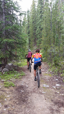 |
| Jeff representing AZ well. |
 |
| Nancy cruising over a stream crossing. |
 |
| About to be epic or get epic'd?? |
K was surprised to see us back at the condo so early. With our extra time we walked around downtown taking in the small town vibe.
 |
| Make no mistake, Breckenridge is a ski town. |
 |
| Plenty of good uses for those old planks. |
 |
| Sure there were plenty of tourists, us included, but it's a cool town. |
Nancy received some feedback from her cousin on a few local hikes, so K and I went south of town for what we thought would be a nice alpine stroll.
 |
| This was our starting trailhead. |
What we didn't realize, the hike went up, up, up from a start of 11,000' to near 12,000'. To our left we had a watchful eye on Quandary Peak towering over us at 14,265'. There were tons of people milling about that trailhead as we drove by.
 |
| Beginning our ascent up the gulch. |
 |
| Fantastic views all around. |
 |
| A Pika makes an appearance as we crossed a boulder field. |
 |
| Watch you step! |
 |
| Twin Falls. |
 |
| Mountain goat sighting. |
 |
| Runoff from an alpine lake. |
 |
| Quandary Peak. |
 |
| Back near the bottom, mission accomplished!! |
Needless to say, our little hike was pretty taxing. We slept well that night!
That evening we all met up at the
Breckenridge Brewery. I noticed on Facebook that a digital friend of mine, Rolf, happened to be in town for the race as well. I invited him to join us for a brew. It was good to meet him in person, cool dude. He trekked north from Houston solo for the event!
The next morning was the start of the Breck Epic for the others, for me it was a 1/2 day of exploring the trails not occupied by the race - there are plenty!
 |
| A flurry of activity and nerves about 10 minutes prior to the start. |
 |
| Here's the start, Jeff & Nancy are at the end of the clip. Why? Jeff forgot his water bottle at the condo and made a mad dash back to get it before the start. Nothing like a few more anxious moments on race day morning!! |
 |
| And they're gone on the neutral roll towards singletrack. |
Time for me to get busy. I only had two goals on the day: ride the Peaks trail and hit some of the Colorado Trail. Oh, and be back to the condo by 1pm to meet K for lunch.
I climbed up the paved Ski Hill rd to the Peaks trailhead. The sign read: 10 miles to Frisco. Here we go.
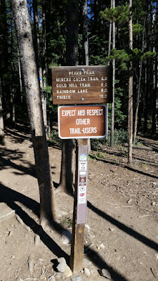 |
| 10 miles, right? |
 |
| A few bridges and planked sections were cool. |
 |
| Landspeeding through the forest was fun. |
 |
| Followed this waterway for a bit. If flowed seemingly uphill at times. |
 |
| The views opened up while crossing a clearing. |
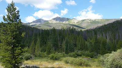 |
| Tenmile Range. |
 |
| I started to encounter more hikers as I approached Frisco. |
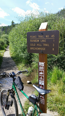 |
| Hmmm, the opposite trailhead in Frisco says Breck is only 8 miles away, not 10?!? GPS was closer to 8. |
My original thought was to do an OnB on the Peaks trail back to the CT junction, but with all the hikers I opted to take the paved bike path around and rejoin the CT at Gold Hill. Sure glad I picked up a detailed map of the area. (
Sky Terrain maps)
 |
| Tenmile Range from the serene bike path. |
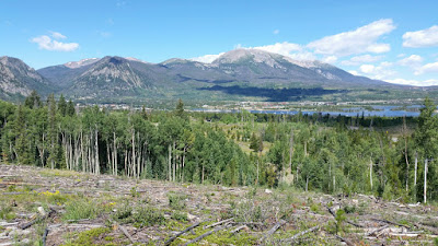 |
| Frisco and the Dillon Reservoir. |
 |
| The bike path was top notch and part of the Tour Divide route. |
 |
| Gold Hill trailhead. |
 |
| Daunting CT switchbacks. |
A fella came up to me in the parking lot asking if I knew how to access the CT across rte9. Nope, but my map does! He had been on the trail years earlier, but couldn't recall how to get over there. Turns out the bikepath leads to an underpass linking up a short paved road to some fine singletrack. The trail crosses a rural road and tightly hugs what appears to be a community lake while squeezing behind some homes. A family thought it would be a great place for a picnic, and it was, just not on a 3' wide bridge that happens to be the trail!! Really?
 |
| Am I in dreamland? |
 |
| The switchbacks themselves were tough, tight. The climbing grade: perfect. The trail can be seen on the far side of the lake to the left of the island. Ski trails of Breckenridge in the distance. |
 |
| After the switchback climb things became more undulating. |
 |
| Exiting the CT. |
 |
| I started making my way back towards town. |
 |
| Views in all directions for this homeowner. |
 |
| Climbing Discovery Ridge, part of the race route for day 2 of the Breck Epic. |
 |
| Discovery Ridge. |
I was starting to get a little pressed for time and didn't want to be late since this wasn't only a mountain biking vacation. Discovery Ridge dropped me onto a gravel road and I could see the trailhead I needed to be at only a short distance away...opposite a steep drainage and creek! Gotta get across that one way or another, but the road was taking me up and away from my intended direction. I kept pedaling hoping I'd find a crossing. Roughly a half mile later it came and with it a seldom used trail by the looks of it.
 |
| My saving connector! Freshly cut?? |
 |
| A rider in the parking area pointed me up here, top of Tom's Baby. A short grunt that led to some stellar singletrack back into town. |
 |
| Aspen tunnel on Middle Flume trail. |
 |
| Cutting it tight on time, but the end was in sight. |
 |
| Back on the paved bike path near the condo. Only 15 minutes late. :) |
I met up with K just as Jeff & Nancy were arriving after their raceday. We made quick work in finding a lunch spot while the others rested up. After lunch we jumped on the gondola for a ride up to the mid-mountain area. We were a bit surprised by all the activities going on up there: alpine slide, lift served mtn. biking, mini-golf, bungee jumping, etc.
 |
| FREE ride to the top. |
 |
| Nice 6-pack!! (The chairlift anyway) |
 |
| Plenty to do up here. |
 |
| View from the gondola. Our condo was in the sea of roofs to the right. |
 |
| More old ski uses. |
 |
| The Voodoo had a nice place to park each night. |
Just like that our weekend in Breck was done, but our fun still had another full day. I knew it would be a late arrival back home. We were looking at a 13+ hour drive home. Toss in another ride and a National Park stop along the way and who knows when I'll get to bed.
We left Breck at 5am on Monday and rolled towards Hoosier Pass - it was 37º!!
 |
| Brrr, it was chilly, but felt really good. |
 |
| Thanks to an online tip we stopped for a fantastic breakfast in Salida right next to Absolute Bikes at the River's Edge. We arrived right at 7am as the doors were being open. Perfect. |
I made a quick stop in the bike shop for yet another area map, my 4th of the trip. We made our way up to Monarch Pass and by 8:30am I was on my way across the Monarch Crest trail. Typically, people shuttle up from Poncha Springs, get dropped off at the pass and ride the Crest trail over to Marshall Pass, then pick up the Rainbow trail heading down to Poncha. I didn't have time for that. Originally I was going to ride out to the Agate Creek trail split and take that down to a location farther west on US50, but after some consideration re: remoteness for both myself & K, I opted to stay up on the Crest for an OnB ride. Wise choice.
 |
| K hung out here while I sampled the goods. |
 |
| She also took the scenic skyride up to 12k, here looking at Monarch Ski area. |
 |
| Right on the divide. |
 |
| The Crest trail IS the CDT. A short dirt road climb gets you here, the start of the singletrack. |
 |
| It begins in thick forest. |
The trail takes a hard right as it meets a jeep road and begins to climb. This was the only section that was on the crappy side. The jeep road was rutted in spots, some loose sections and it kicked up here and there. I did run across a guy out doing some maintenance on it though. I was able to keep it spinning in granny gear. Before I knew it the singletrack returned and with it the postcard views found on the Monarch Crest brochure. Enjoy!! I sure did.
 |
| Greetings from singletrack heaven. |
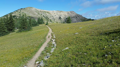 |
| The trail contoured nicely, flirting with the treeline. Imagine your bike here. |
 |
| Most of the singletrack was like this, buffed out and fast. |
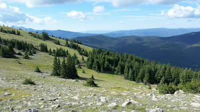 |
| Temps hovered around 50º and only a light breeze. Trail making a cameo in the upper left. |
 |
| At times it felt like you were riding over the curvature of the Earth. |
 |
| Double-dipping once again: CDT & CT. |
 |
| The infamous Fooses Creek drop-in. Yep, it's as steep and gnarly as the reports. |
There was a bikepacking rig lying near the sign, but no rider in sight. I figured it was a CT through rider taking care of morning 'chores'. A few minutes later he caught up to me at the Green's Creek junction. Sure enough he was riding the full CT, on day9 out of Durango. The CT is on my short list on long distance trails to ride. This trip only further sparked my interest.
 |
| Again, on an online recommendation I stayed on the Crest trail until the singletrack turned back to gravel. I was now 9.25 miles in and a little over my time estimate. |
So far the only person I saw was the CT through rider. A few people left the parking area before me. I anticipated seeing some shuttle riders on the return. I was also not looking forward to what I thought would be an extended HAB after flying down a moondust layered steep descent to Green's Creek trail. The return started with a 1 1/2 mile climb back up to the Agate Creek trail split.
 |
| This Pika came out to say 'hi' only a few feet from me. K was very pleased with this picture!! |
 |
| The tailend of a shuttle train of 12 riders approaching. I am happy to say I cleaned this climb going the other way. My legs & lungs had come around from that first ride in Breck. Amazing what 24 hours spent at elevation will do for you. |
 |
| To my surprise, I rode most of the potential HAB section. Again, stoked to do so. |
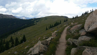 |
| I didn't want it to end. |
 |
| Clouds were building, getting darker by the minute, but no thunder. |
I was very surprised to see a steady flow of riders coming at me as the clouds darkened. This isn't exactly a safe place to be if/when the weather turns.
YOU are the lightning rod above treeline!!
 |
| Chalk another one off the list!! |
It was now 11:30am, gotta get moving. We stopped for a nice lunch in Gunnison and I couldn't help but think of all the incredible trails nearby in Crested Butte and Hartman Rocks. Some other time.
Our next stop would be the
Black Canyon of the Gunnison National Park. Quite a mouthful, but it's a relatively small National Park that probably doesn't get a ton of visitation due to its remote location. Once again the park pass came in handy as we were going to do a quick Griswoldesque driveby.
 |
| Blue Mesa reservoir goes on for miles. |
 |
| Make the detour if you're nearby. |
 |
| Gunnison River slicing through the rock. |
 |
| Painted Wall and the Dragon. |
 |
| NE view along Painted Wall. |
 |
| This rock has eyes!! |
 |
| Twisting in the wind. |
Gassed up in Montrose we were finally set for the big push home taking the Telluride route since it only has one mountain pass. The San Juans are a stunning mountain range. Littered with 14ers, they stab at the sky. I eagerly yearn for more time here.
 |
| Near Ridgway, CO. |
 |
| Coming into the Telluride turnoff. |
 |
| This was only my second time through here outside of winter. |
 |
| The final pass in CO before exiting to the high desert around Cortez. |
 |
| Lizared Head. |
We made it to the New Mexico line as the final rays of light dissipated. A quick food/gas stop in Gallup, NM and our Four Corners tour was almost complete. We eventually arrived home at 2:30am, some 22 1/2 hours after we left Breck. I'd gladly trade a few hours of sleep for our detours today.
Thanks again to Jeff & Nancy for the invite, it was a great getaway. Here's
Jeff's recap of racing the Breck Epic. Nancy ended up on the podium with a 4th place SS finish too - awesome!! Rolf took a nasty fall during the week, but a race photographer happened to catch him at the finish. The resulting photo is now circulating the published writeups and he's quickly becoming
'the face' of the 2015 Breck Epic!!
This trip has given me the confidence going forward that I can successfully ride long distances above 11k. Well done ColoRADo, well done.
Guess what? There's more pics!! See them all here:


No comments:
Post a Comment