I was introduced to Robert back in February at
Singlespeed AZ in Bisbee. A few friends had asked if I knew him since he liked to ride big routes & wasn't afraid of some hike-a-bike. Off the beaten path kind of stuff. We chatted for a bit that night and a few weeks later Robert joined in the fun on my
Queen's Ransom Bikepack. Good times were had.
Fast forward a couple of months and I was copied on a group email for a route over in the White Mountains of eastern Arizona. I was very intrigued, I had only really been to the area to go skiing at Sunrise Park Resort. The route, dubbed the Many River Alpine Loop, would be a bit farther east and north, all new-to-me terrain. I love filling in my mental atlas. I secured the necessary green light from K and we began hatching a plan for awesomeness.
 |
| The Many River Alpine Loop. A huge clockwise loop in the White Mountains. |
Three other fellas would also join in the fun: Gerrit, Mike & Andy. I had a sneaking suspicion I was going to be the trail sweeper in this group.
The track was dialed in, meeting point discussed, car camp logistics worked out and car/bike loaded for the high country. I should also mention it was forecast to be 114-117º in the Valley of the Sun the same weekend, talk about picking the right time to head north!! Let's go!!
First stop: Alfonso's in Payson for lunch and a couple of ride burritos.
 |
| Our first critter encounter: Micro Praying Mantis. Photo by Mike. |
We made another stop in Pinetop to grab subs for dinner at camp, then rolled up to our spot in the high country at 9400'. The final 1/4 mile is a rugged jeep road that the Juke was able to crawl up. Safely at camp, the relaxation kicked in.
 |
| Plenty of room to spread out here. |
 |
| Looking off the small rise to the west. |
 |
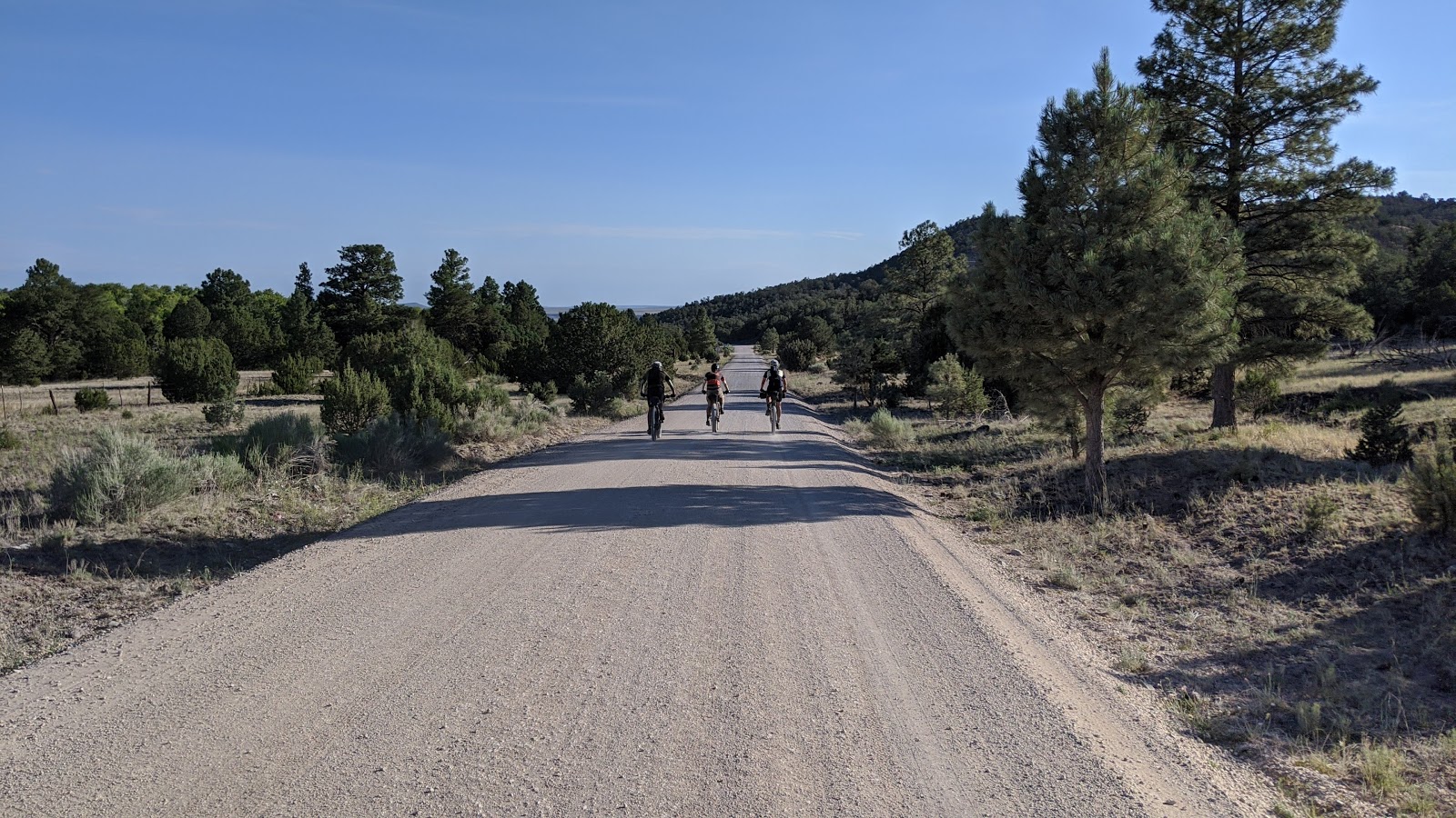
| Next morning, the crew is ready: R-L: Andy, Robert, Gerrit (riding Uncle Fateous) & Mike. |
 |
| We instantly popped on a faint 2-track leading away from camp. |
We couldn't have been more than 10 minutes into the ride, maybe a mile+ or so when it happened. I looked up ahead and saw Andy, Gerrit & Robert stopped and all of a sudden a huge herd of elk rumbled by, easily over a hundred head!! It was absolutely amazing to witness, but I was bouncing down a rocky section of trail and couldn't fire the camera quick enough. The herd split as the guys rode ahead, some 40 more hanging behind. What a cool experience and just like that I saw more wildlife on this loop than my
20 days on the Divide last summer!! Crazy. (And I saw quite a bit)
 |
| A bit difficult to see, but there are a bunch of elk tucked in those trees. |
 |
| A few more stragglers. |
The route morphed into a more pronounced dusty jeep road, a bit rocky, but nothing silly. We then joined a nice forest road section leading to our first singletrack of the loop on Indian Spring trail.
 |
| I was starting to get Montana flashbacks without the threat of Grizzlies!! |
 |
| I was a bit surprised at the high quality of trail here. |
 |
| Somewhere around this sign I had lost sight of Gerrit and my track was showing a hard righthand turn, but nothing was there. I looked around, couldn't really see tire tracks, and rode back & forth a bit trying to figure out what was up. I decided to simply keep going and met Robert, who was riding back to check on me. |
Come to find out, when he put the track together, a bunch of the forest trails were drawn in using the topo map designation. Armed with that tidbit of info, I knew the track wouldn't be exact, but it would get us in the right direction. Going forward, we all realized the slight deviation and paid more attention at junctions so we all stayed together.
 |
| Robert warned us of the potential for down trees, but his buddy, Pete, had been doing some trail clearing lately. |
 |
| More good looking singletrack. |
 |
| Thick ferns!! |
Our next wildlife sighting came moments later when a family of wild turkeys were spotted on the trail. Looked to be 9 little feathered friends running around. They were too quick for the camera.
 |
| The Grand Master, Robert, ripping some fine singletrack. |
 |
| I swear that bike weighed 70+ lbs, didn't slow Gerrit down one bit. |
 |
| Stamp of approval!! Photo by Robert. |
 |
| Making our way into a burn area from the 2011 Wallow fire, the largest wildfire in the history of AZ. |
 |
| What is this?? A second elk herd?? Count up another 30+ head. |
 |
| Scouring the landscape for more elk. Photo by Mike. |
 |
| Almost 10 years later and still a stark landscape. |
 |
| We joined an old railroad grade for some nice pedaling through the toothpicks. |
 |
| The railroad grade cleaned up nicely in the unburned portion of the forest. We regrouped here, at a faint turn onto singletrack, the less obvious start to the West Fork trail. Photo by Robert. |
 |
| The post is the dead giveaway. Trail? Not so much. |
 |
| The vague bit led us here, a legit trailhead and a better tread. |
 |
| That sign is eye candy to any mountain biker. |
 |
| Yeah, it was kinda like that. |
 |
| Andy navigating an awkward down tree. |
 |
| Mountain biking train through the ferns & burns. |
 |
| A rare rocky bit of trail, for the most part the trails weren't too bumpy. |
 |
| The rockslide climb challenge. Robert had prepped us it was coming, could any of us clean it? |
 |
| Gerrit gave it a good run on attempt No. 1. |
Here are a few videos of our attempts, the best part is Robert's commentary!! Enjoy.
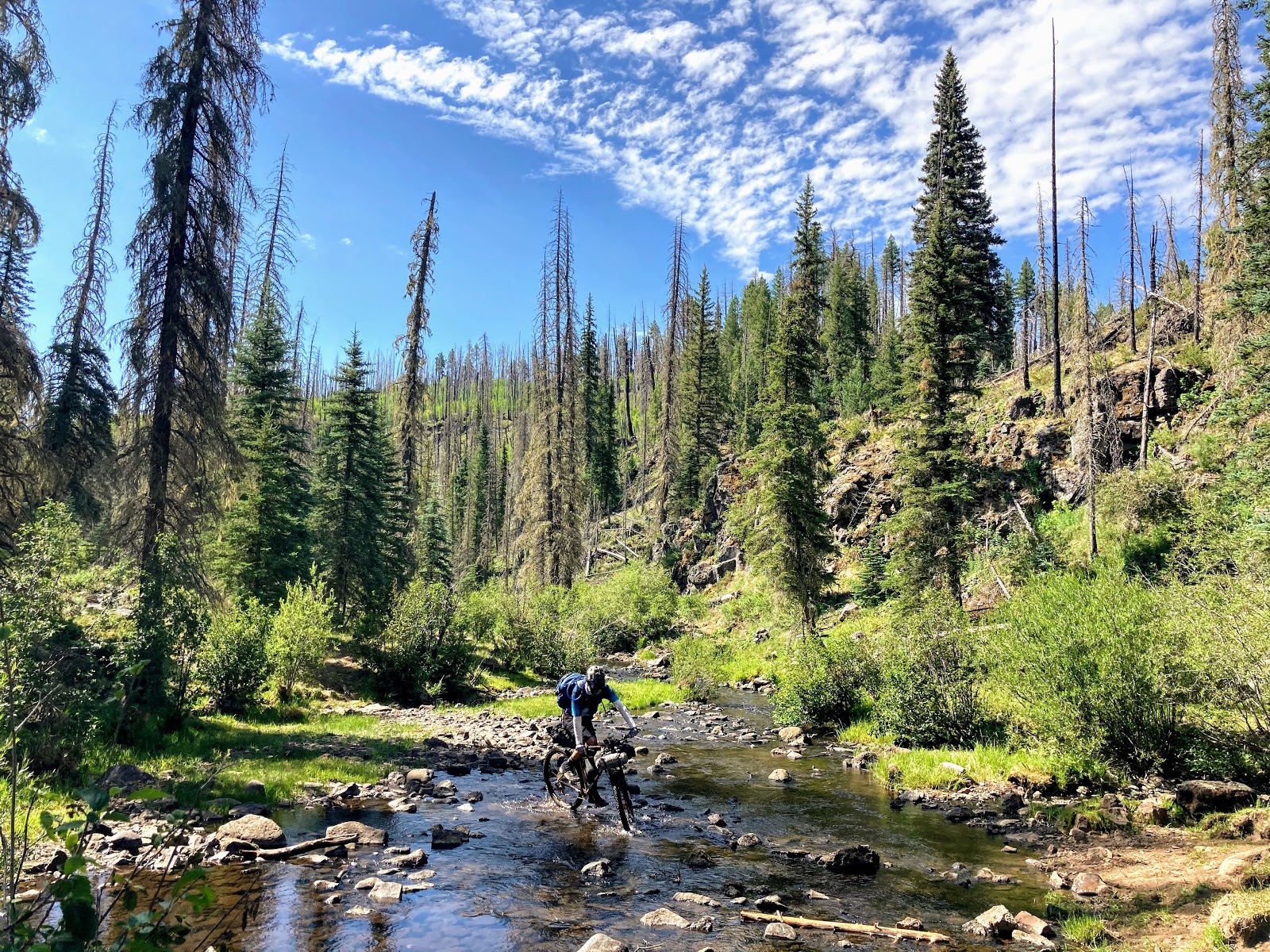
As you can see, Gerrit himself, was the only one to clean the rockslide climb challenge. Uncle Fateous FTW!! The trail wound down a fun series of switchbacks to the West Fork of the Black River where a couple unsuccessful attempts to ride across were made.
 |
| We didn't mind the wet feet. |
 |
| Serene setting down here. |
 |
| An instant before my feet were soaked!! Photo by Andy. |
 |
| Getting set to hop over more trees. Photo by Robert. |
We could see the trail below, it looked fantastic, but no clear way to drop down to it. I continued to hop trees with Gerrit & Mike. A bit later I noticed Robert & Andy had found a way down and were hootin' & hollerin' at their good fortune.
 |
| The Black River's West Fork snaking through an alpine valley. |
 |
| Robert & Andy made the correct choice. |
 |
| Although, we weren't doing too bad up high now that the trees has cleared. |
 |
| We managed to find a shortcut down to the trail at this trout dam. |
 |
| The dam was built to protect the native Apache trout (official state fish BTW), one of two native trout to Arizona. |
 |
| Fishing is prohibited in these waters to protect the Apache trout. |
 |
| Butterflies were out in force too. Photo by Mike. |
 |
| Gerrit & Andy hamming it up. Photo by Robert. |
 |
| The trail was by far a better riding experience. |
 |
| I was too slow to match Gerrit's coolness. Photo by Robert. |
 |
| We rolled through the trailhead and began a steady climb towards the high point of the route at 9800'. Photo by Robert. |
 |
| Vast wide open valleys up here. |
 |
| Then we climb the feared Col de Blanc!! |
This would start a trend for me. I'd fall off the back of the group watching them pull away. Somewhere about halfway up this particular climb, my legs/lungs had enough, time to push.
 |
| Gerrit & Robert nearing the top. Photo by Andy. |
 |
| Well, at least they look tired!! Photo by Gerrit. |
 |
| My first time seeing Big Lake. |
 |
| The PeakFinder app was super helpful on this ride. Lots of new peaks to discover. Yes, the White Mountains also have a South Mountain!! Too bad the one in Phoenix isn't that high. |
 |
| Our route would take us around the far side of Escudilla Mtn. the next day. |
 |
| Mike was always easy to spot in that bright helmet. Photo by Robert. |
 |
| Eventually, I made it to the top!! Photo by Robert. |
 |
| Nice view from the top looking east. |
 |
| Beginning the East Fork trail. |
 |
| I believe we detoured to this 2-track off East Fork due to down tree reports, but we'd rejoin East Fork up the line a bit. |
 |
| Not too many gates on the route. |
 |
| Sunrise Ski resort looks much different from this angle. That's Sunrise Peak on the far right, the lodge on top of Apache Peak is visible to the left of center. |
 |
| Wide angle view of Sunrise Ski resort with Baldy Peak. |
 |
| This 2-track doesn't get used much, but was easy enough to follow. |
 |
| I swear, there's a trail in there somewhere!! Photo by Robert. |
 |
| Trail was a bit easier to follow here. |
 |
| Uncle Fateous enjoying the downhill through a burn area. |
 |
| Andy exiting the downhill through the pine gatekeeper. |
We popped out on another dirt road for a bit then came to a barbed wire fence covered in red ribbons to catch your attention. Why??...
 |
| Hmmm, who's going first?? |
 |
| Andy spotted an on/off switch opposite the sign warning. No threat of shock, we crossed easily, then turned it back on. |
 |
| A third elk herd? Yes, indeed. Probably another 20-30 head. |
 |
| Back on the East Fork trail, getting set for a downhill into Greer for a much needed lunch stop. Photo by Robert. |
 |
| The Aspens are making a comeback after the Wallow fire. |
 |
| The descent off Amberon Point down to the West Fork of the Little Colorado River was a blast. I only stopped here because my hands/wrists needed a break. |
 |
| As luck would have it, I happened to stop next to a raspberry bush. Score. |
 |
| Making my way across the mightly WF Little Colorado River. Photo by Robert. |
 |
| Returning to civilization in Greer. |
 |
| We ended up here, the Rendezvous Diner. Took a while to place our order, we were not being seated, just wanted food to eat outside. |
 |
| Nice collection of license plates. |
 |
| Seemed like our kind of place. |
 |
| After a bit of a wait in the warm temps, the bacon cheeseburgers were delivered. Photo by Gerrit. |
 |
| Sorry, burger, you don't stand a chance. Photo by Gerrit. |
 |
| That's the look of lunch determination!! Photo by Gerrit. |
 |
| After lunch we left the pavement and circled around River Reservoir. |
 |
| While the burger was mighty tasty, it sat heavy. I was constantly falling behind the group. |
 |
| The 2-track ended and once again morphed back into vague singletrack. Photo by Robert. |
 |
| Lots of water tanks dot the landscape up here. |
 |
| There really is a trail beneath my tires, look closely!! Photo by Mike. |
 |
| Up & over a small rise... |
 |
| ...into a chunky, rowdy downhill. |
 |
| We joined the South Fork trail at the bottom. Our night 1 camp location would be a few miles beyond Mexican Hay Lake. |
 |
| It was still quite warm, so we filtered water from the South Fork of the Little Colorado River. Unfortunately, that water was a bit on the warm side too. |
Robert had warned me of an upcoming hike-a-bike, so I got a head start up the hill. I didn't have much power in the 'ol legs and was reduced to walking even some rideable grades.
 |
| The skies were looking ominous all around, but nary a drop. |
 |
| The terrain relented a bit as Mike rode on. |
 |
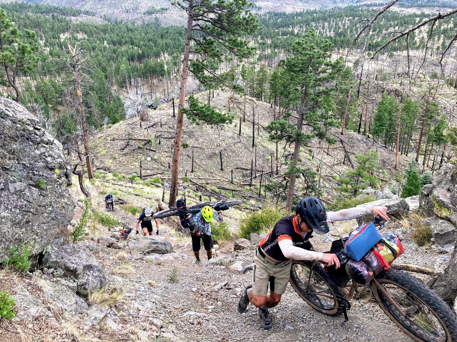
| Ahh, here we go. Hike-a-bike train. This would only be the beginning... |
 |
| This is the upper pitch, ridiculously sloped & covered in loose nickel sized gravel. That's Andy already at the top. |
 |
| Mike going full enduro!! So pro. Photo by Robert. |
 |
| Great sequence of shots by Andy showing how each of us got it done. |
 |
| As much as I wanted to try Mike's approach, I had zero confidence in my shoes holding traction. Five Ten's aren't made for hike-a-bike at all. Photo by Andy. |
 |
| Robert keeping his center of gravity low for the final hurdle. Photo by Andy. |
 |
| One foot in front of the other and heave!! This was one of the most difficult hike-a-bikes I've done, albeit short. It was a combo of the tenuous footing, steep grade, lifting the loaded bike and not having energy to complete the task at hand. Photo by Robert. |
 |
| The look of exhaustion after pushing Uncle Fateous up a heinous grade. It was a little dusty too, nice legs!! Photo by Mike. |
 |
| We took a nice long break before continuing our push to Mexican Hay Lake. Photo by Robert. |
 |
| A few other notable peaks in the area. |
 |
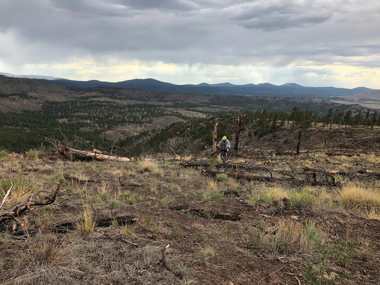
| More climbing ensued, the burn area made the trail a little tricky to follow. |
 |
| Mike picking his way up the hillside through the fire debris. Photo by Robert. |
 |
| How can this guy power that machine over everything!! Photo by Robert. |
 |
| Andy rounding a corner, moments from slicing a tire!! Gah!! Photo by Robert. |
 |
| Every so often, a tube still comes in handy. Photo by Mike. |
 |
| Typical trail condition through here. |
At the top the trail gave way to more 2-track for a bit. We used it more as a shortcut before doing a short stint of overland riding to regain the trail. Once back on singletrack it was mostly downhill until we dropped on a well established dirt road. It felt good to do some easy pedaling.
 |
| Mexican Hay Lake isn't much of a lake after all. |
 |
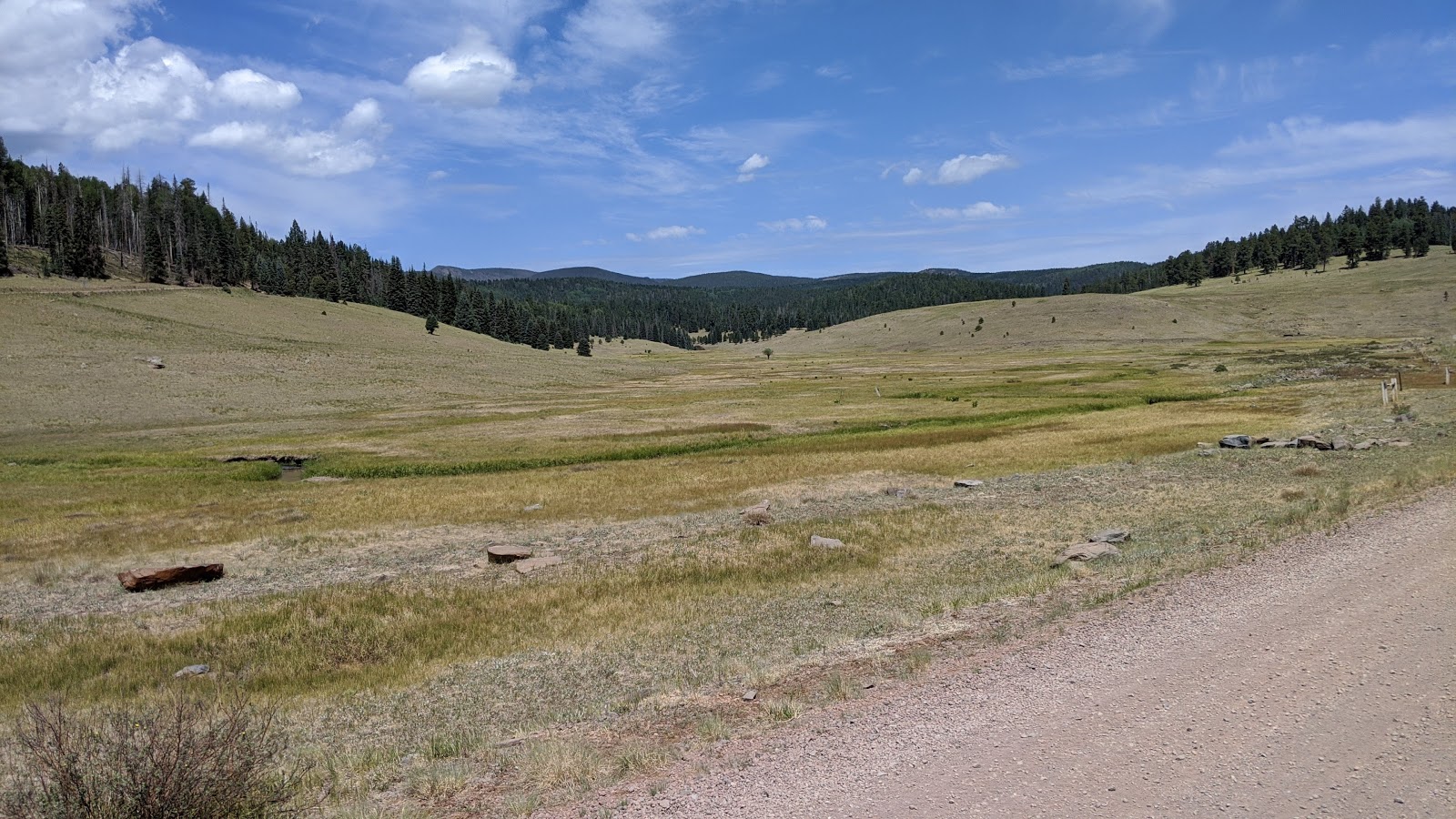
| FS8070B Rolling over the rocky grasslands. |
 |
| The brooding skies met us on our fast rip down AZ261. |
 |
| Home for night one. |
 |
| Right next to Point of the Mountain Spring, clear & cold. Perfect ending to a 47 mile day. |
Camp was set up quickly and out came my Alfonso's bean & cheese burrito...and a thermos of cold margaritas for everyone. Not a bad way to end an eventful first day in the White Mountains. It didn't take me long to fall asleep under the dizzying amount of stars. The others weren't as fortunate, as it was a tad warm for our liking.
There was no rush to break camp in the morning, but we were all up at first light. Even with the relaxed morning we were packed and breaking camp by 6:45a. The only real goal for the day was to reach Alpine for dinner and see how we were doing time-wise at that point.
 |
| We blasted out 5 fast miles right from camp. |
 |
| Before we knew it, we were on another non-motorized trail system: Murray Basin. |
 |
| The vegetation and topography had a Phil's World feel to it, trails no so much, but they were still good. |
 |
| Backtracking to the above picture as we overshot a turn. |
 |
| Some more overland riding as we missed another turn on to faint 2-track. |
 |
| Easy enough to miss at first. |
 |
| The wide open grasslands didn't offer much relief from the morning sun. Photo by Andy. |
 |
| Shade spot!! Morning snack break. Photo by Robert. |
 |
| "Gonna end up a big ole pile a them bones" |
 |
| Making fast ground here, Escudilla Mtn. straight ahead!! |
 |
| Miles & miles of fast pedaling, even a bunch of downhill. This section of the route had Tour Divide written all over it. Photo by Robert. |
 |
| I think we surprised her, but she was quick to tell us all about the history of the place. Photo by Gerrit. |
 |
| The hummingbird feeders were very active as well. Photo by Gerrit. |
 |
| Protecting more AZ native species. |
 |
| Early lunch break. Tuna & avocado tortilla wrap for me. Photo by Robert. |
 |
| This place is a true oasis in the middle of nowhere. We all joked about making this our camp spot for the night!! |
 |
| Sense of scale. |
 |
| The fast miles kept piling up. |
 |
| This was a cool change of pace, descent through a small canyon. |
 |
| Those dudes are strong & fast. |
 |
| Escudilla Mtn. finally getting close, but the heat was really kicking in without shade. |
 |
| Pete to the rescue!! Roadside ice cold Kiltlifters for everyone!! Hooray, beer. Photo by Gerrit. |
 |
| Horned Lizard, aka Horny Toad. Photo by Robert. |
 |
| We quickly returned to the pines on the Col de Blanc #2 or was it #3?? I was losing count of the climbs. |
We regrouped at the top for a snack break then began a series of undulating forest roads before reaching a sustained downhill. The miles were ticking off fast now and I spotted Robert up ahead stopped, looking up at the adjacent cliff band. A bobcat had crossed the road in front of him and he was trying to find it. Dang it!! I still have never seen one in the wild and missed a golden opportunity by 30 seconds. Drat. Add it to the groups wildlife encounters though.
 |
| Long steady downhill. Some cattle on this stretch of road. |
As I cruised along I noticed my front wheel feeling squishy. Sure enough, the tire was getting low. I hadn't recalled running over anything in particular since the past few miles were on friendly dirt roads. I gave it a shot of air to see how fast/slow the leak really was. I caught up to Robert at the bottom the hill at Thomas Creek and needed to add a bottle of sealant.
 |
| Trailside pitstop. One bottle of sealant and a CO2 cartridge make quick work. Back in business. Photo by Robert. |
 |
| On the ensuing Col de Blanc, sensing a theme here?, we were finally treated to some rain. I light shower, enough to soak the roads and justify bringing rain gear. It felt really nice!! Unfortunately, for me, the grade got to me and I ended up walking the upper half of the climb. Thankfully, it wasn't too long, but I was feeling bad for making the guys wait. |
 |
| Mike finding some shelter at the top of the climb. Photo by Andy. |
 |
| The view from the top. Photo by Andy. |
 |
| Andy made the side trip up to the towers. |
 |
| We begin the long, mostly downhill jaunt to the East Fork of the Black River. |
 |
| I couldn't quite place the mountain range I was seeing, until I viewed it through the PeakFinder app. Baldy Peak put things in perspective for me. That's not too far from the start of the loop. |
 |
| Robert bombing the downhill. |
 |
| A rare uphill bit on this section. Photo by Robert. |
 |
| We dropped into the East Fork canyon at Diamond Rock. Lots of formal campgrounds along this road. |
 |
| Crossing the river and our spot for the night. |
 |
| East Fork Black River. |
 |
| A few of the guys opted for baptism by Black River. Photo by Andy. |
It was another stellar camp site. Our wildlife logbook added a few more entries: Blue Heron, Osprey and a Bald Eagle soared through the river valley and perched in a tree near our camp, such a cool sight. We were all glad to have made the extra push to get here well before sunset, capping a 62 mile day.
It took me a while to nod off for some reason that night, but I felt rested by morning. Robert was up early snapping pics of us snoozing.
 |
| My setup is quite cozy for cowboy camping. |
 |
| This morning was actually a little on the chilly side. |
 |
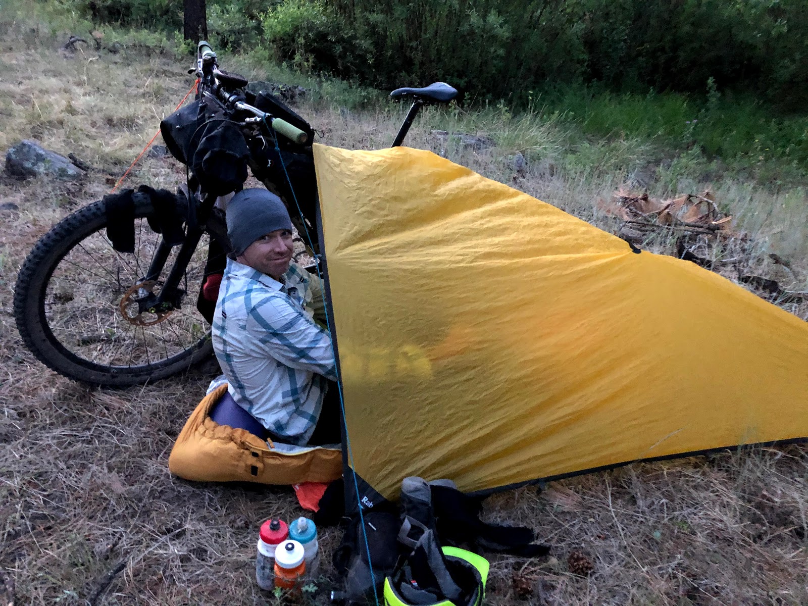
| Mike with his bike / tarp combo. Pretty sweet setup as long as it's not raining sideways. |
 |
| An ideal spot for the night. |
 |
| The other side of Mike's setup. |
 |
| Interesting rock foundation near camp. Photo by Andy. |
 |
| Leaving camp, we still had 6 more gradual downhill miles to ride next to the river. |
 |
| It was a perfect start to the day. |
 |
| You'd almost think this was part of the Rocky Mountains finest. |
 |
| A few early morning fishers were out waving us on. |
 |
| Huge beaver dam, that looks like a lot of work!! |
 |
| Another fishing spot, she hadn't caught anything yet... |
 |
| The base of the final Col de Blanc of the trip, what was this 5...6?? :) |
 |
| This climb had a much friendlier grade over its 10 miles. |
 |
| I still got dropped, but at least I wasn't walking!! I actually felt good climbing, those fellas are just much stronger. |
 |
| Pulling in to the regrouping location, shade & a snack break before the final climb to Big Lake Knoll. Photo by Robert. |
 |
| This part of the route was unknown to everyone, looks like we found a winner. |
 |
| Making my way to the end of the road at Big Lake Knoll. Photo by Andy. |
 |
| Panoramic view from the summit at 9,415'. Photo by Andy. |
 |
| All praise Uncle Fateous!! Photo by Andy. |
 |
| Geological marker for Big Lake from 1958. Photo by Andy. |
 |
| Andy on top of the Knoll. Photo by Robert. |
 |
| Mike flexing while Gerrit shields his eyes from the bright white!! Photo by Robert. |
 |
| Calm, Stoic, conqueror of the Col de Blancs. Photo by Robert's phone. |
 |
| I wasn't quite worthy of Mike's double flex, so a single arm will have to do. Photo by Robert. |
 |
| Baldy Peak dominating the horizon. |
 |
| View to the south. |
 |
| Northwest view. |
 |
| Amazing how you can see all the way to Mt. Graham from here, it was barely visible, but visible nontheless. |
 |
| View of Big Lake without obstruction. |
 |
| We were back on Indian Spring trail from Day 1 as it begins just off the dirt cul-de-sac of Big Lake Knoll. Mike gets things going. Photo by Robert. |
 |
| Andy finds some smooth trail up top. |
 |
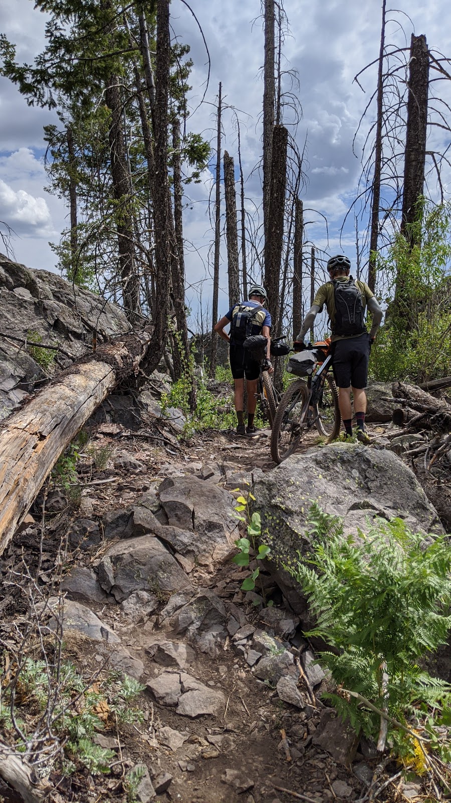
| There were a couple of short mega chunk sections to deal with, but otherwise a great trail. |
I'm not sure I recall where Mike was perched, but the following sequence of shots are fantastic. Really cool angle.
 |
| Gerrit, aka Uncle Fateous. |
 |
| Andy. |
 |
| Robert. |
 |
| Myself. |
 |
| Four stoked riders on a fun trail. Photo by Mike. |
 |
| Sorry, Mike, my shot isn't nearly as cool as yours, but you do get some graffiti trees!! |
 |
| We were now back on the same section of Indian Spring trail we rode the first day, in the opposite direction. |
 |
| The trail rides great in either direction. |
 |
| Dare I say 'Hero dirt?' |
 |
| This was a perfect singletrack ending to the route, but still a few more miles to go. |
We debated for a minute about continuing on Indian Spring trail to complete the full loop, but that was going to add about 2 hours. While it was still early in the day, we all had a 4+ hour drive home which could be longer based on Sunday traffic leaving the high country. We opted to stick with the original plan and hop on the dirt roads to wrap things up.
 |
| Posing in front of Big Lake. Photo by Robert. |
 |
| Slightly wider view of Big Lake. |
 |
| The final miles were mostly level-ish. Photo by Andy. |
 |
| Andy blowing by me in a big gear. |
 |
| Look closely, you'll see a train of riders cutting across the open landscape. |
 |
| One final downhill into a headwind of course!! |
 |
| The smooth section of FS249C. The Juke made it in crawl mode over the chunky bits. |
 |
| Rolling into the finish. Photo by Mike. |
 |
| The benefit of an auxiliary powered fridge, cold beers at the finish!! Thanks Robert!! Photo by Mike. |
We were back at the car by 10:30a, a mere 22 miles from last night's camp. Time to relax and enjoy a cold one. By the time we packed up to leave it was around noon and hovering at 88º all the way up at 9,400'!! We weren't too excited about returning to Phoenix.
What can I say, that was an amazing route. It had a little bit of everything. Huge thanks to Robert for not only putting it together, but inviting me to join in the fun. Wish my legs would've cooperated a bit more, but I still had a wonderful time enjoying new-to-me terrain with a bunch of great guys. Already looking forward to the next adventure.
I'm sure if you've read this far, you're dying to know exactly how many river crossings there were? By our count, we tallied six.
 |
| Sunrise Park Ski resort sans snow. |
It did begin to rain as we drove past Sunrise Ski resort, I noted to Mike how the outside temperature had dropped all the way down to 52º!! That would've been great to ride in. It didn't last too long though...
 |
| Welcome home!! |
I took our final .gpx track and cleaned up some of the overland riding pieces where we overshot turns, etc. There may be one or two vague areas still in the track, so trust the line on your GPS, it'll get you where you need to go.
Route:


That was awesome! Thanks for sharing. You have to do the Iditarod (less beer involved though).
ReplyDelete...but...the COLD!!!!
DeleteNice Ride.... Maybe one of these days we will meet-up and do a ride
ReplyDeleteThat would be great!!
DeleteWhat a great adventure write up!
ReplyDelete