I've love scouring topographic maps for potential biking routes. I've been trying on & off over the years to find a suitable shortcut out near Superior to add more miles of the Arizona Trail, AZT, to some bikepacking routes. During a recent map scour of the area I spotted something, a piece of singletrack connecting two otherwise deadend jeep roads. Would this go? Rideable? One way to find out.
 |
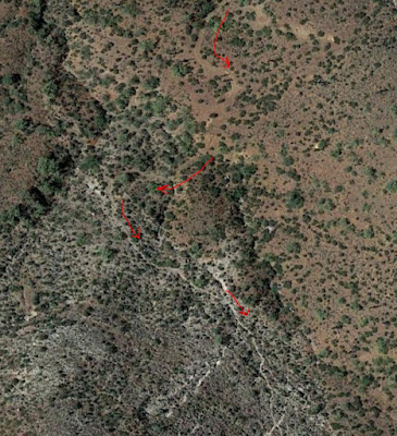
| This was the planned route, a heart-shaped clockwise loop. The top of the heart would all be new-to-me terrain with the right side of the route being the AZT through Whitford Canyon. |
I had a couple of questions I needed to answer about this route: Is the new stuff rideable? Can the singletrack actually be linked together? Is it any good? How steep is the grade beginning at the dip in the heart? Rideable? I was about to find out. How exciting!!
 |
| Satellite view of the first section of jeep road that deadends at a ravine and what appears to be a clear singletrack trail continuing south. |
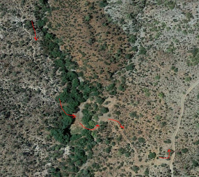 |
| The end of the singletrack bit ends at this cattle tank in the trees. Looks easy enough to find a way through to the next 2-track and more visible jeep road. This is the dip in the heart. |
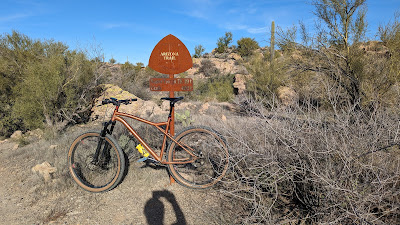 |
| Leaving the north end of Picketpost trailhead. |
 |
| Two miles of AZT: 4 gates, 1 culvert under US60 and crossing Queen Creek. |
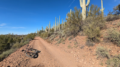 |
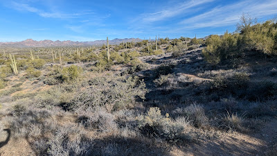
| Saguaro forest. |
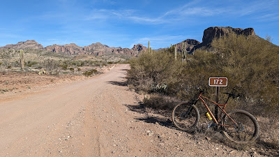 |
| FS172, time to head north. |
 |
| The road cuts through Hewitt Canyon, Roblas Butte on the right. |
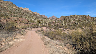 |
| Saguaro covered landscape back here. |
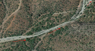 |
| Satellite view of the area off FS172, looks like the 2-track follows a wash for a bit... |
 |
| ...the reality on the ground. It was easier to walk through. |
 |
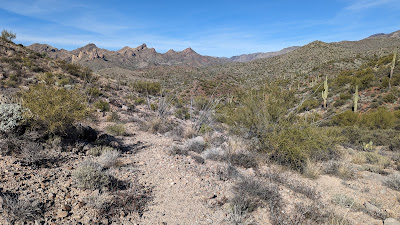
| The 2-track became more what I hoped for after leaving the wash area. |
However, each subsequent uphill was littered with loose rubble and just steep enough to be a hassle. Lots of on/off hike-a-bike. So far this route wasn't winning me over, wasn't totally off limits...yet.
I was now in the thick of nowhere. I rounded a corner and was totally caught off guard by a lady out hiking with her dog!! I startled her too and we simultaneously asked each other where we came from. She was camped somewhere along FS172 and had mentioned one of the dirt roads deadended up ahead. I knew this based on my satellite scanning, see the earlier pic above. Before reaching the deadend, the road dropped down to an old windmill.
 |
| Preston Well. |
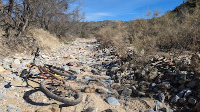
The jeep road continued around the hill then came to an end at a steep embankment above a gulch. I started down the slope, made it about 2-3 steps before my feet slid out from under me on the pea gravel. Thankfully, I held on to the bike as we both slid down about 20 feet. No harm done. I was now looking for that white line of singletrack I saw on my computer. It didn't take long as it was plenty wide at first. It seemed like it could have been an old moto trail at some point?? It was now reduced to a narrow gulley filled with loose rock and somewhat overgrown, not that this surprised me.
 |
| Looking back along the singletrack. This was probably the 100' of trail I could actually ride. |
 |
| Picketpost Mtn. comes into view. Neat. The trail wasn't any more rideable, pretty much all hike-a-bike. |
I pushed through the vegetation at the end of the trail, crossed a dry cattle tank and found the 2-track on the opposite hillside. Overall, getting to this point of the route was much more work and hike-a-bike than I had hoped for. I was now at the base of the main climb and one look up the hillside told me I wasn't going to be riding much of it. The grade was rather stout. It was about 2 1/2 miles up to the top, fairly sustained pitch. I knew at this point the route would link to the AZT, but I really didn't feel the need to push my bike there just to prove a point on a route I wouldn't be using. So, I bailed, halfway through the heart and road mostly downhill back to Hewitt Station Rd.
I bumped into a couple of guys in a SXS on their way up. They were surprised to see a mountain biker out in this area. They asked where I came from and got some puzzled looks when I pointed towards the canyon I came through via singletrack. I think they wanted to try to go that way, but it's impassable in a vehicle. I watched as they began to climb the ridgeline, stopping for a couple of minutes at the road I popped out on. I'm sure they were considering it, but eventually they moved on up the climb.
 |
| That's the intended route going sharply up the ridgeline. |
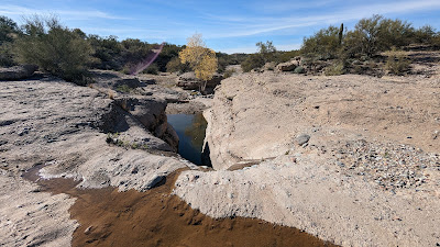 |
| My route back crossed this flowing slickrock area. The lower pool looked deep enough to soak in. |
It was definitely a fun exploration ride, too bad it didn't work out as well as I hoped, as it would have been a cool way to add about 10 miles of AZT to a couple of routes. On to the next one....
Route:


No comments:
Post a Comment