My buddy, Rich, had asked me last year if I wanted to join his White Rim supported ride. My schedule didn't allow it, but he was doing it again this year and the stars aligned. He also mentioned he had space for a couple more, if I knew anyone. Of course. My longtime friend, Travis, from my early years of BMX freestyle riding back in PA had been wanting to ride the White Rim. This would be perfect, as Rich had already secured two nights camping inside Canyonlands Nat'l Park, one at Airport Mesa and the other at Hardscrabble. He also had someone to drive his Jeep, so we didn't have to carry bikepacking gear, extra food or water!! Bike glamping!!
I also asked my friend, Karin, if she wanted to join since she now resides in Moab. I asked her if Trav and I could crash at her place before and after and all was cool. It looked like we'd have a group of 9 for the ride. We'd team up for sharing meal responsibilities, which was something new to me as I've always fended for myself. We opted to cover the lunches with cold cut sandwiches.
The plan was to roll out around 11a on Friday since it was a relatively short riding day and a fair amount of downhill. We staged off Mineral Bottom Rd., the same road we'd be finishing the loop. So this set the stage for a 30 mile first day.
Once I finally met up with Karin and Trav after my ride with Scott, Karin mentioned she wouldn't be joining us, but rather heading out on a more ambitious ride over the weekend+. In the end, that worked out fine, as you'll see how packed Rich's Jeep became. We took care of our grocery shopping then made our way to meet the rest of the group.
 |
| The pile of gear kept growing. |
 |
| Still not sure how, but it all 'fit'. |
 |
| My 30x20 singlespeed gearing was no match for the fast geared guys on pavement, or anywhere else actually. |
 |
| The rider gang: L->R: Rich, Bob, Todd, John, David, Travis and Mark. Not pictured: Todd2 the driver. |
We made a short detour, OnB, to the visitor center. I opted to chug some water fountain water since I was only carrying my hip pack, 1.5L capacity. I did have a few bottles of electrolytes on the bike as well. The clear advantage of having vehicle support for this ride, no water concerns.
 |
| Almost GO time. Nice overlook across the way from the Visitor Center. Soon, we'd be way down in that canyon behind me. |
 |
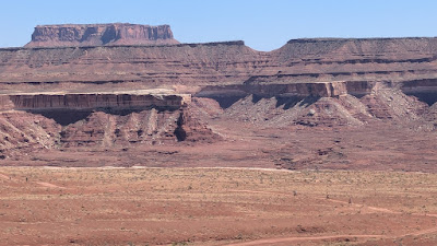
| And I mean way down there in the Permian layer. Image courtesy of Canyonlands NP. |
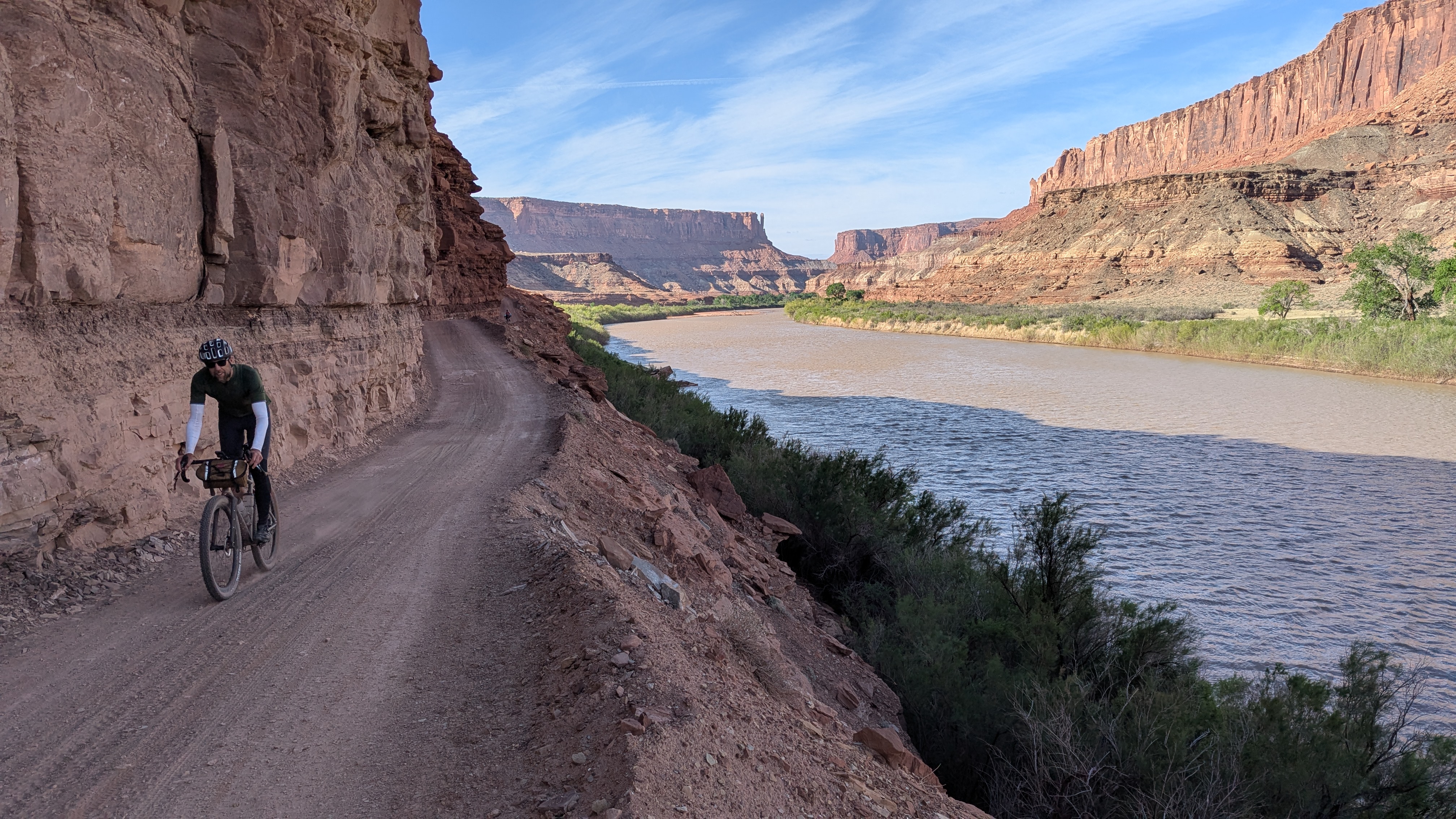
We made our way back to the dirt road turnoff with the help of a tailwind. The winds were definitely going to be reckoned with on this ride.
 |
| Shafer Trail, or road as it is, winds just below the rim before taking a huge plummet into the canyon. Photo by Travis. |
 |
| Stoke was high, ready to roll. Would the singlespeed 30x20 be a smart move?? Time will tell. Photo by Travis. |
 |
| Boom!! Our route, far below. One of many spectacular vistas on route. |
 |
| Todd2 taking it all is as well as he navigates the Jeep along. |
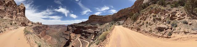 |
| Good place for a panorama. Photo by David. |
 |
| The famed switchbacks of Shafer Trail approach. |
 |
| The fast guys, Bob & David, are already bombing down it!! |
 |
| My turn!! Photo by Travis. |
We took turns riding a few switchbacks at a time so we could get some cool photos. We passed a few riders grinding up the grade, nearing the finish of their CCW loop.
 |
| Travis taking it all in. |
 |
| It's almost dizzying looking straight down. Rich cruising along. |
 |
| Pan out and the riders look like ants on the landscape. |
 |
| Easily overtaking the vehicles on the way down. |
 |
| Classic shot. |
 |
| Hard not to smile on this downhill. Photo by Travis. |
 |
| The grade begins to mellow out a bit, but speed is still high. |
 |
| A quick regroup, then off we go, already halfway to camp. |
 |
| For the most part, it was gentle ups and downs most of the day. Photo by Travis. |
 |
| Travis on a smooth section of road. |
 |
| Anytime a side canyon crept up to the roadway, the views were jaw dropping. Snow capped La Sal Mtns. were the backdrop most of the day. |
 |
| I applaud the people involved who decided 'We should build a road down there'. |
 |
| First glimpse of the Colorado River. |
 |
| Stand and mash. Photo by Mark. |
Since today was a short riding day at 30 miles, we had plenty of time for a few side excursions. When you see a sign that reads: Scenic overlook, you go.
 |
| Not bad, not bad at all. |
 |
| Hitchin' posts. Must be lunch time. Photo by David. |
 |
| Have I mentioned how great it was to have vehicle support? Table, lunch fixin's, chairs and cold drinks. Yes. Photo by Travis. |
 |
| Off-shoot to another boring overlook... |
 |
| Colorado River. |
 |
| Rich demonstrates how to approach the edge. |
 |
| Todd2 sighting out of the Jeep!! Photo by Rich. |
 |
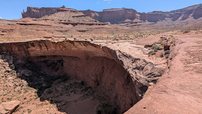
| Next stop: Musselman Arch. |
 |
| It's a little hard to see in the photo, but it's a huge, wide, flat arch. |
 |
| The gang's all here!! Photo by Rich. |
 |
| Met a fella there on quite the roadtrip!! |
 |
| Grand Canyon-esque scenery. |
 |
| Would be cool to see one of these during a storm. |
 |
| The road turns to slickrock. Makes for a bumpy ride and slow going in the fully loaded Jeep. |
 |
| So. Many. Layers. |
 |
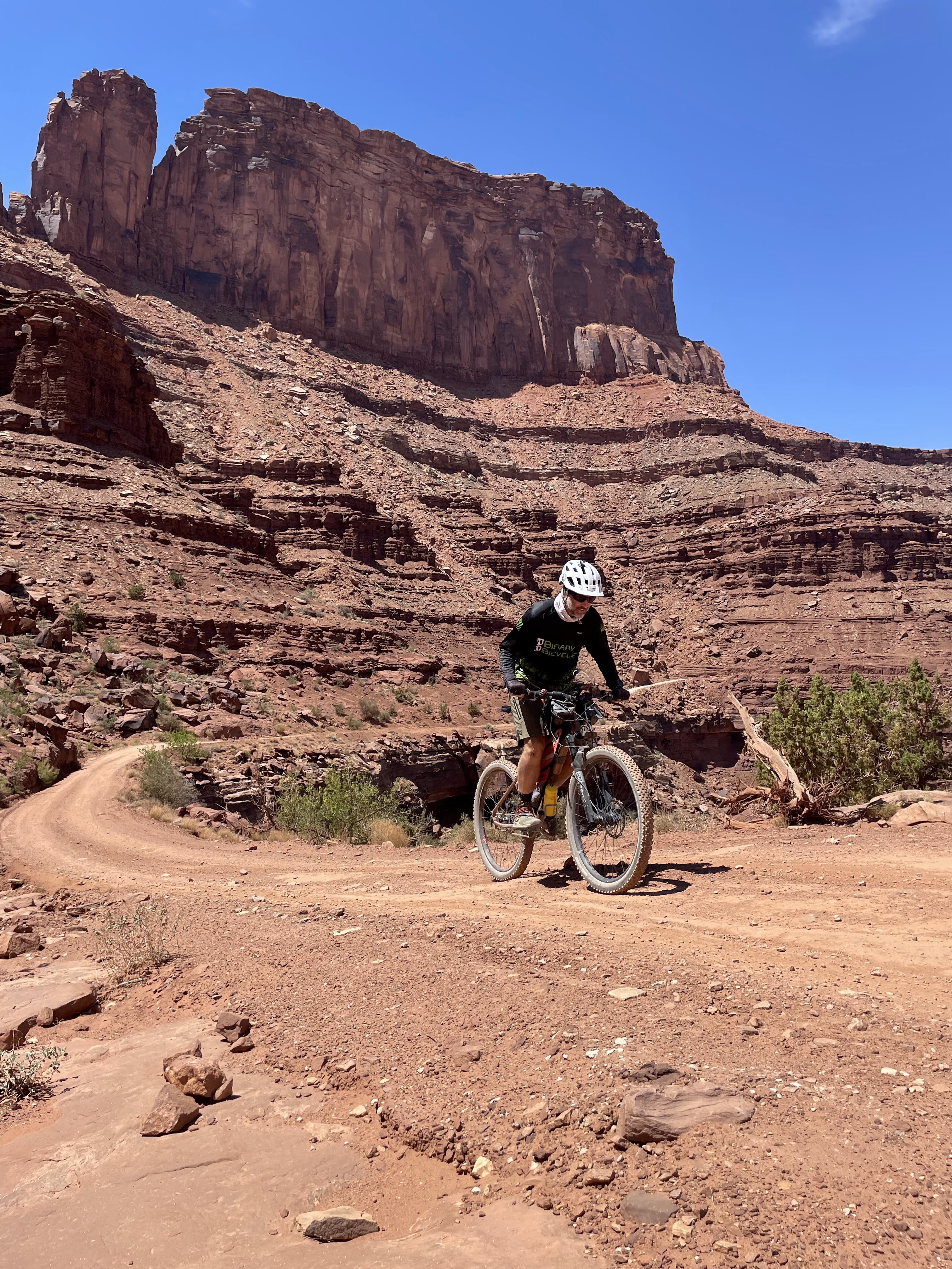
| There was a short, steep pitch to reach this notch in the saddle. My first of a few dismounts. Todd blasts off towards the downhill reward. |
 |
| Off we go!! |
 |
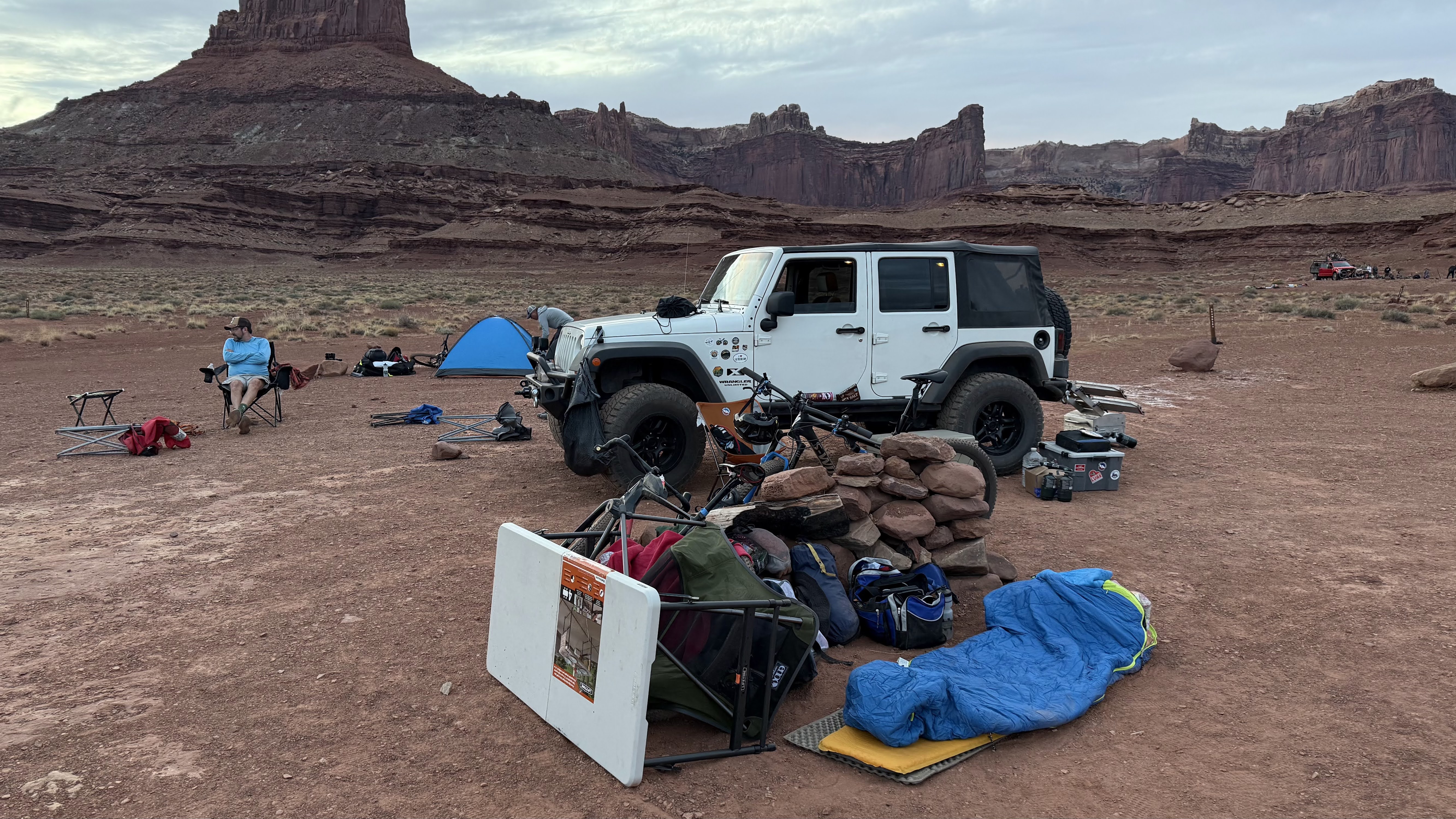
| Our campsite for the night, Airport B. |
 |
| The occasional color of plant things could be found. Photo by David. |
We settled in, mostly waiting for the wind to die down before setting up camp. It would be a while as we reached camp sometime around 3p. Beer me.
Meanwhile, a second group had arrived to the other campsite above us. It was a commercial outfit and we noted how all their camp chairs were perfectly set out in a row.
 |
| Dude Wipes to the rescue!! Photo by David. |
 |
| The wind finally settled down around sunset. Nice night for some star gazing. |
 |
| This was across the road from camp. |
We woke to clear skies and light winds, how long would that last?? Today would be our big mileage day at a bit over 50 miles to reach camp at Hardscrabble. There were two bumps on the elevation profile, of which, I knew I'd be walking both.
 |
| Travis and Rich leading the way for the back-of-the-pack crew. |
 |
| Spires, buttes and cliffs, oh my!! |
 |
| Bighorn Sheep!! So bummed I missed seeing this group, but glad Mark snapped this photo. Cool!! |
 |
| The scenery and side canyons are relentless!! |
 |
| Fuzzy Prickly Pear. |
 |
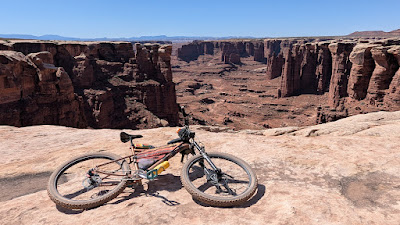
| One of the few wide open expanses along the route that isn't near a cliff edge. |
 |
| The La Sal Mtns. getting farther and farther away. |
 |
| So stoked to share this ride with Travis. From our early days riding BMX freestyle, almost 40 years ago, to still riding bikes in rad places. It's official: bikes are cool AF. |
 |
| A second viewpoint eerily similar to the one above. |
 |
| Totem poles and arches. |
 |
| A weakness of the singlespeed? Long, flat stretches as I watch the other guys easily ride away. |
 |
| Rich silhouetted on the horizon. |
 |
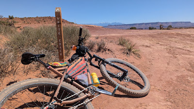
| I caught up to the fellas atop a small rise as we neared the split for the White Crack CG. |
Last time I was here I wanted to check out the CG, as it's a short out-n-back off the southern tip of the loop, but I didn't have the time. Today, I did, but the others wanted to press on so I went south solo.
 |
| It would be slightly uphill going south, so the return would be quick. |
 |
| Cool looking boulder shaped like a desert tortoise. |
 |
| End of the line. |
 |
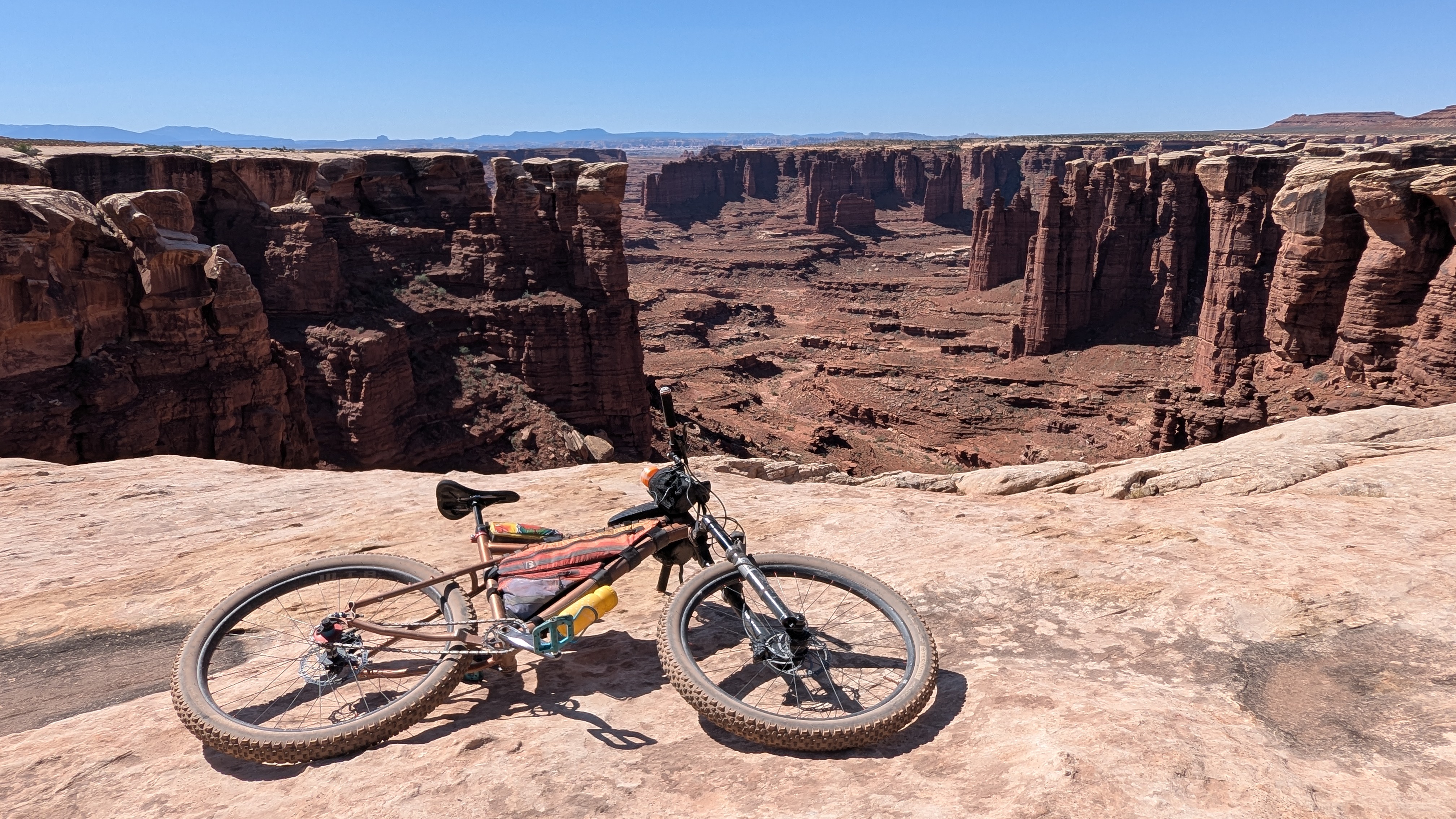
| Spectacular views into the Needles District of Canyonlands. |
 |
| Short hiking trail in the White Rim layer of rock. |
 |
| Back on the main loop, the views make you feel like you're in an airplane. |
 |
| Sheer cliffs around every turn. |
 |
| Cresting a large, sweeping switchback. |
Off in the distance, I spotted Todd2 driving the Jeep. Could I catch him? I was definitely gaining, but running out of time as the steep Murphy's Hogback climb was approaching.
 |
| The ultra steep grade comes into view. |
 |
| I think I'll walk the rest of the way. |
 |
| Meanwhile, probably 45 minutes earlier, Bob, Mark and Todd grind up the monster. Photo by David. |
 |
| Top of Murphy's Hogback, ready to tackle the rest of the day after a well earned lunch break. |
 |
| The ensuing downhill was a blast to ride. |
 |
| The route sprawled out below. |
 |
| A sliver of the Green River can be seen in the upper left. |
 |
| A Monument Valley wannabe stands guard. |
 |
| Green River slices through the topography. |
 |
| Travis getting his hike-a-bike practice in. |
 |
| The cavalry approaches. We had passed another tour group a little ways back. |
 |
| Bob making it look easy. |
 |
| Mark rocking the 'Sun's out, guns out' vibe. |
 |
| Travis back in pedal mode!! |
 |
| Bob and Mark blast off down the valley. |
 |
| A sandy stretch of 2-track. |
 |
| The occasional splash of color could be found. |
 |
| How slot canyons are formed. |
 |
| Rich and Travis popping out on the banks of the Green River. |
 |
| Potato Bottom CG, ours is next...after a good upward push. |
 |
| Travis begins the climb up and around Bighorn Mesa. |
 |
| It didn't come without some quality hike-a-bike. |
 |
| We can almost see our camp location, on the right bank by the island. |
 |
| The road leveled out as we cut across the cliff layer. |
 |
| The long, loose, downhill comes into view. Can you spot our camp location? (Left at the road split, then off to the right) |
 |
| Short hiking trail led to the shore of the Green River. |
 |
| The Jeep and camp supplies arrive!! |
 |
| Can you spot the tree growing at the base of the elevated cliff?? |
 |
| Nature finds a way. |
 |
| Cool looking driftwood near camp. |
 |
| We tried setting up the food next to the Jeep as a wind break. It sort of worked. |
 |
| Patented wind/bug sleep setup?? Photo by David. |
 |
| Astral time lapse around the North Star. Photo by Rich. |
The wind initially died down, but sometime during the night, it began gusting wildly. Most of us got interrupted sleep at best. From what I could tell, if it held up, we'd be getting a tailwind up the final climb. Wouldn't complain about that!!
 |
| Jeep packed for the final time as the dust whips across the valley. |
 |
| Here comes the Sun, time to roll. |
 |
| We had a few mellow miles to get the legs warmed up before reaching the Mineral Bottom climb. |
 |
| Just like the previous days, the views were spectacular. |
 |
| It's a Travis postcard!! |
 |
| Rich and Travis enjoy one of the few downhill sections. |
 |
| Being so close to the river, the greenery comes out. |
 |
| White Rim info board for those traveling the opposite direction. |
 |
| Reaching the park border. |
A couple miles later the big climb out loomed. Would I be able to ride it? I didn't recall the grade being too horrendous, but being on the singlespeed would definitely be a challenge.
 |
| There would be a lot of this!! Stand and mash, all the way up. Photo by Travis. |
 |
| I made it to here before needing my first break. |
So far, the grade wasn't too bad, but it sure spiked my heart rate!! I figured I could pedal the entire climb, but I'd stop on occasion to keep everything in check.
 |
| Rich grinds along and passes by me. |
 |
| Bob nearing the top. Photo by Mark. |
 |
| Up, up, up. |
 |
| Classic view of Mineral Bottom. Not far from the top now. |
I rounded the final turn to find Todd2, Rich and Travis giving me a cheer!! I was stoked to have pedaled all of it. I stopped about 6 times to keep the HR in check, but otherwise it was a solid test.
Route:


Long live #OrangeShirtGuy!
ReplyDeleteFantastic write-up, and an even better adventure! Thanks for the amazing summary of an epic few days riding some of the most spectacular trails in the world. It was great to ride with you!
ReplyDeleteSo fun to read this several weeks later to relive the good time we all had! Some of this route was definitely easier to ride than drive, glad I could join and learn to drive that nice Jeep since I was on injured reserve. Todd2
ReplyDelete