Barely a week had gone by and I was still wanting more of the Highline trail. I reached out to Mike and he was game for a ride as it was all new terrain for him. We decided to make it a loop knowing full well we'd be in for some pro-level hike-a-bike gaining the rim after the Highline trail. We were not deterred.
We would be doing a clockwise loop starting up on the rim, descending the Military Sinkhole trail, ride Highline from the Two Sixty trailhead over to the fish hatchery, then push our bikes up the Babe Haught trail where we'd cruise back to the car via FR300.
There were only a couple of cars parked at the trailhead when we arrived. Right out of the gate I led us the wrong direction for about 1/2 mile!! Oops. What's a little bonus rim riding anyway?
 |
| The misdirection at the start led us here. |
Back on route, we dropped down the Military Sinkhole trail. The lower you get, the more rowdy the experience!! Hard to believe but this trail is probably the easiest way to not only drop off the rim, but climb up to it as well. It's a good test of forearm pump and picking good lines. Near the bottom, the trail levels out to a more contoured wooded trail with a few technical bits scattered about.
 |
| I got this. Photo by Mike. |
 |
| Umm, perhaps not. Photo by Mike. |
The Military Sinkhole trail dumps into the Two Sixty trailhead where the Highline begins its westward push. We were both glad to be done with the rugged descent and equally glad we changed our starting point so this trail would be done first, not last. Sometimes we have smarts. Sometimes.
 |
| A tad bit smoother here. |
 |
| Nifty rock ledge. |
 |
| Mmmm, tasty. |
 |
| Somebody is enjoying it. |
 |
| Super fun lush rip towards See Canyon. |
 |
| Beautiful country up here. |
 |
| Christopher Creek. |
 |
| The trail steadily climbs a series of switchbacks to here. |
 |
| Nice slice of Sedona here. |
 |
| Reminds me of the Great Smoky Mountains. |
 |
| Even the dead trees are cool looking. Photo by Mike. |
 |
| Some solid power moves along the way too. |
 |
| Switchback attack!! Photo by Mike. |
 |
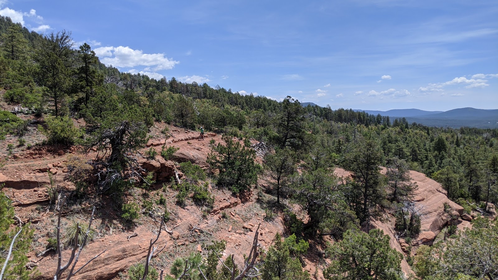
| So much of this trail is prime riding. |
We reached the Derrick trail split. Riders have a choice to make here, either drop down Derrick trail and climb up Horton Springs trail to rejoin the Highline near the spring or stay on the Highline over to Horton Spring. Last time I rode this section of Highline, there was a bunch of hike-a-bike. Mike and I opted to stay on the Highline, since it was a few miles shorter even if we had to push a bunch.
 |
| The first climb seemed to have work done on it, then the power moves became more frequent. |
 |
| It was amazing to see such a nice trail wind through the rugged landscape, but soon the pushing began. |
The hike-a-bike ended up only being a few minutes. I was really surprised and we were both glad we stayed true to the Highline.
 |
| The descent to the spring was steep in sections and almost felt like riding through a tunnel. |
 |
| Watch your step crossing Horton Creek. Photo by Mike. |
 |
| Horton Spring is quite the sight. Waterfall pouring out of the mountainside. |
 |
| It also makes a great place for a snack break!! |
 |
| 3 1/2 miles to Tonto Creek, then the pushing really begins. |
 |
| It's a relatively fast track to the hatchery along Tonto Creek. |
 |
| Mike makes his way across Tonto Creek. |
 |
| Nice map of the full Highline trail. |
 |
| 'ol Sasquatch needs a bike on his shoulders. |
 |
| Hatchery was closed, but if you ever get the chance it's a cool place to check out. |
 |
| 3 miles until good gravel. Maybe 1 to 1 1/2 miles straight up the rim. We hoped to reach FR300 in an hour, gotta have goals. |
 |
| It didn't take long to go full enduro. |
 |
| Rapidly rising above the Tonto Fish Hatchery. |
 |
| No real let up in sight. |
 |
| This was a good section of trail. |
 |
| This was not. However, the top was near and Mike had dropped me like a bad habit. |
 |
| Mike's view from the top while he waited for my arrival. |
 |
| Slowly, but surely I got there. Photo by Mike. |
 |
| Pro-tip: Close the water bottles else you get wet. Photo by Mike. |
 |
| One final oomph from Babe Haught. Photo by Mike. |
 |
| Soaking in the final rays high above SR260. Photo by Mike. |
We finished before sunset!! What a day. There's some amazing riding along the Mogollon Rim. Most people won't ever do the push up the Babe Haught trail and I don't blame them. Most riders opt to shuttle the Highline trail, either getting picked up at Christopher Creek after the See Canyon downhill or at the bottom of Derrick & Horton Springs trails. Riders could also get there by dropping down the paved road at the Tonto Fish Hatchery. Whatever you choose, go ride it!!
Route:


No comments:
Post a Comment