In southern Arizona, down near Patagonia, the Arizona Trail Association recently completed a multi-year project constructing new singletrack. Big deal, right? What this project, Temporal Gulch, did was remove the AZT from a busy paved road, remove some old difficult tread, remove the route from miles of dirt road and bypass a small slice of the Mount Wrightson Wilderness. In short, the new singletrack is all open to mountain bikes!! Yay!!
The majority of the construction was completed earlier in the year, with final hand finishing happening this fall. I had hoped to ride the newest portion, from Gardner Canyon to SR82 a few months ago, but life had other plans. Fast forward to this October and it was fine time for a #locorides board meeting. I should mention that with this new construction, the ATA formerly changed the name of Passage 4 from Temporal Gulch to Casa Blanca Canyons. It's quite fitting.
Our plan for the day was to meet in Patagonia where we'd drop a vehicle, then carpool north to begin our ride back to town, from Gardner Canyon. We'd use the AZT and the Train Track trail.
 |
| Patagonia is a fantastic hub for any biking adventure. |
 |
| Beto's secret hideaway along Gardner Canyon road. Perfect place to begin our ride. |
 |
We started with a few gentle dirt road miles to start. Oops, sorry kids, I mean 'gravel'.
|
We reached the Apache Springs trailhead after 5 miles or so and hopped on the AZT here. We would ride the full length of
Passage 4 going southbound, which 'trends' downhill. I was really glad we got on the trail here, since it meant we'd be riding the Flume trail, AZT, to Gardner Canyon.
 |
| It's not the AZT without a bit of hike-a-bike. |
 |
| New rollover gate since my last visit. Photo by Shannon. |
 |
| Although we're surrounded by hills, the Flume trail is mostly flat for a couple of miles. Photo by Shannon. |
 |
| Beto takes in the sights of Mt. Wrightson from the Flume trail. |
 |
| Nearing the end of the Flume trail by an old aqueduct. |
 |
| The new tread on the south side of Gardner Canyon Rd. This would begin 11 miles of new terrain for both Beto & Shannon. Some new stuff for me after the first 3 miles or so. |
 |
| I love the terrain down here. Photo by Shannon. |
 |
| It's forested grasslands. |
 |
| Power couple!! |
 |
| This is one of those rides where you want to stop for pictures every five minutes. |
 |
| There's no flat ground here, yet the trail slices through it seemlessly. |
 |
| Shannon approved. |
 |
| Beto: AZT gate concierge!! Photo by Shannon. |
 |
| This small clearing marks the beginning of the next new section. My first time on it. |
 |
| Down we go!! |
 |
| We descended for a while, so I knew a climb was coming... |
 |
| Oof!! It was steep too. Couldn't quite make it. Photo by Shannon. |
 |
| Most of the climb was rideable after the initial kick. |
 |
| Nearing one of the few false summits. |
 |
| Looks like a good bit of payoff for our climbing legs. |
 |
| Patagonia Mtns. in the distance. |
 |
| Beto blasts off. |
 |
| The entire corridor was clear of vegetation, it was glorious. |
 |
| I'm in favor of these metal AZT signs at trail crossings over the flimsy carsonite signs of yore. Photo by Shannon. |
 |
| We are merely blips on this landscape. |
 |
| Ocotillo forest. I'd like to see this in full bloom. |
 |
| Down, up, down, up...repeat. Photo by Shannon. |
 |
| Shade breaks throughout. Bonus!! |
 |
| Shannon tops out on the final, lengthy climb. Photo by Beto. |
 |
| Ran into some familiar faces to Shannon & Beto. |
 |
| The final 8-9 miles to SR82 are mostly downhill, dotted with a handful of short uphill bits. |
 |
| We were now back on familiar terrain as this portion had been completed almost two years ago, but hadn't been connected through except for a loop over to the Temporal Gulch trailhead along the old AZT alignment. |
 |
| The gpx of this area looks like a bunch of squiggles, reality is on another plane. |
 |
| It just goes and goes and goes.... |
 |
| Still haven't heard the story on this thing. |
 |
| Mt. Wrightson topping out 9,456' is higher than the nearby popular Mt. Lemmon at 9,171'. They are part of southern Arizona's Sky Islands. |
 |
| Nearing the bottom of our downhill contouring. |
 |
| Mesquite forest. |
 |
| Reaching the SR82 underpass. |
 |
| This is a mellow 4 mile singletrack trail linking the AZT to Patagonia without having to ride on the busy SR82 shoulder. Win. |
 |
| Going south, it's slightly downhill, fast riding. |
 |
| Good signage at the few dirt road crossings. |
 |
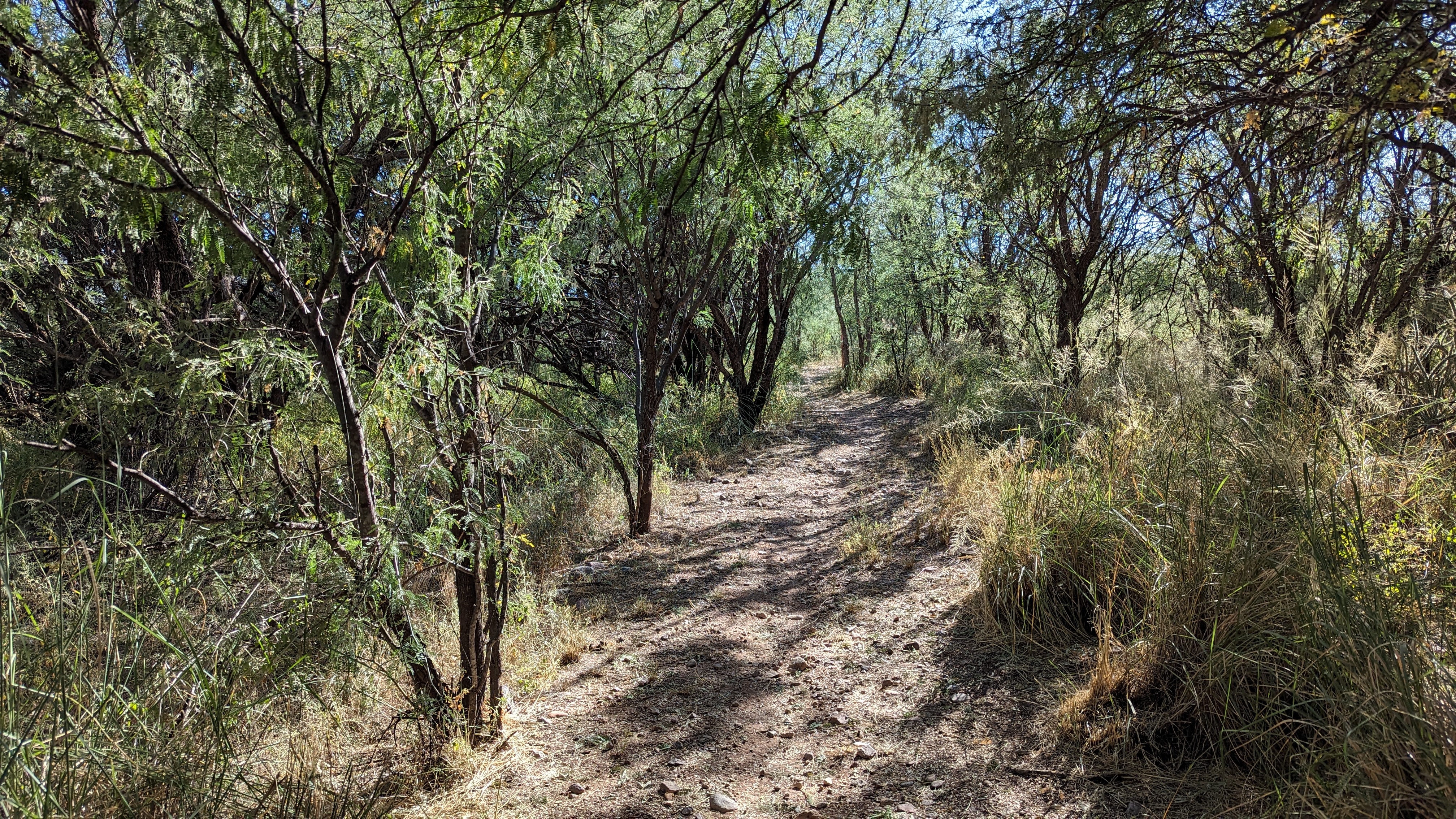
| Lots of shade near town. |
We arrived in Patagonia ready for lunch, but the sandwich shop we had planned to eat at was closed. Gah! Shannon recalled a good place in Sonoita to grab ice cream, the Corner Scoop on the NW corner of SR82/SR83. They had more than ice cream!! Giant soft pretzels, malts, real food too. It's going on my list of post ride eats in the area.
 |
| Yum!! |
 |
| Another successful #locorides board meeting and with minimal hike-a-bike!! What the... |
This was such a great ride and not overly taxing on the legs. The shuttle was really easy to set up and didn't add much time at all. This ride will probably be an annual thing, similar to Picketpost to Kelvin near Superior, it's that good. Do yourself a favor and make the drive south for this one.
Route:


No comments:
Post a Comment