We made our way back up to camp after lunch and wouldn't you know, the skies were clearing and we began tossing around another ride option for the afternoon. Scott mentioned a seldom used trail near camp leading back to town, then we could check out one of the new additions to the Colorado Trail Race on our way back. Sounded good to me.
We took off on a long steep downhill knowing full well our ride would end climbing back to camp. I guess that's the price of admission around here.
 |
| Part of the abandoned aerial tramway of the Mayflower Mine. |
 |
| Singletrack leading to now dry beaver ponds. |
 |
| Beaver dam turned berm. |
 |
| And just like that, the weather turns again. Photo by Scott. |
 |
| Into a thick aspen grove. |
 |
| Lackawanna Mill overlooking Silverton. |
 |
| Scott giving the stamp of approval. |
 |
| Crossing Swansea Gulch. |
 |
| Zoom!! Photo by Scott. |
 |
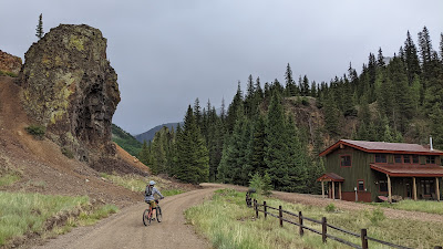
| Dropping down to Kendall Mtn. Ski resort as the rain begins to fall. |
We took cover on the porch of the lodge as the rain picked up. We could tell it was going to be short lived. Next up was to ride through town and link up with the newly modified CTR route heading towards Stony Pass.
 |
| Silverton dried out quickly. |
 |
| Silverton Town Hall, constructed in 1908. |
 |
| San Juan County Courthouse. |
 |
| Crossing over Cement Creek as we head out of town going north. |
 |
| Continuing on CR2. |
 |
| Now on the other side of Lackawanna Mill. |
 |
| Very marshy in this part of the valley. |
 |
| CR2 gives way to dirt. |
 |
| Overlooking the Animas River, which we will be following shortly. |
 |
| Now on the CTR re-route. This cabin found a perfect location. |
 |
| This option was much more pleasant, great scenery and only one or two vehicles. |
 |
| Plus, this route cuts out a short hill by the Mayflower Mill. |
 |
| Looking back towards the cabin we passed. |
 |
| Since this road is slightly below grade of CR2, you couldn't hear it at all. |
 |
| Not sure what this is for below the Mayflower Mill. |
 |
| A few of the buckets remain on the tramway. |
 |
| This is why we didn't see much traffic, not a through road for vehicles!! |
 |
| Great riverside camp site nearby. |
 |
| Continuing north towards Howardsville. |
 |
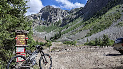
| This is where the re-route ends and rejoins CR2 before crossing the Animas River and then begins to ascend to Stony Pass. View is looking back south towards Silverton. |
 |
| View to the north at our turnaround spot. |
 |
| Heading back, slightly downhill, the sun came out. |
 |
| Simply stunning views along the Animas River. |
 |
| This grotto made for a perfect photo op. |
 |
| I somehow managed to not fall on the slippery rocks and Scott was shocked the bike didn't topple over!! |
 |
| Crossing over the Animas and making our way back to camp. |
 |
| Starting up the aptly named 'Climb of Doom'. |
 |
| It was steep, but I kept turning the cranks over. |
As I neared camp I noticed I was almost at 10 miles for the ride, might as well log at least 10, so I kept going. Then I saw I was nearing the 10,000' barrier, might as well notch that too.
 |
| Found this great vista a bit above our camp turnoff. |
 |
| The San Juan mountains are spectacular, every way you look. |
 |
| Only half a mile until the end? Might as well check that out while I'm at it. |
 |
| Good choice. End of the line and over 10,000' too. |
 |
| Arrastra Basin. |
 |
| Chowing down at Thee Pitts Again BBQ. |
I'm not sure what's harder to believe, the fact that we did two back-to-back rides today that were relatively easy or the fact that we did two rides with virtually no hike-a-bike?? Usually when Scott and I team up for a ride there's some level of insanity involved. I have to admit, it was kinda nice!! I'm sure we'll make up for it tomorrow...
Route:


No comments:
Post a Comment